Posts Tagged ‘hiking’
Trail and tribulation in Powell River
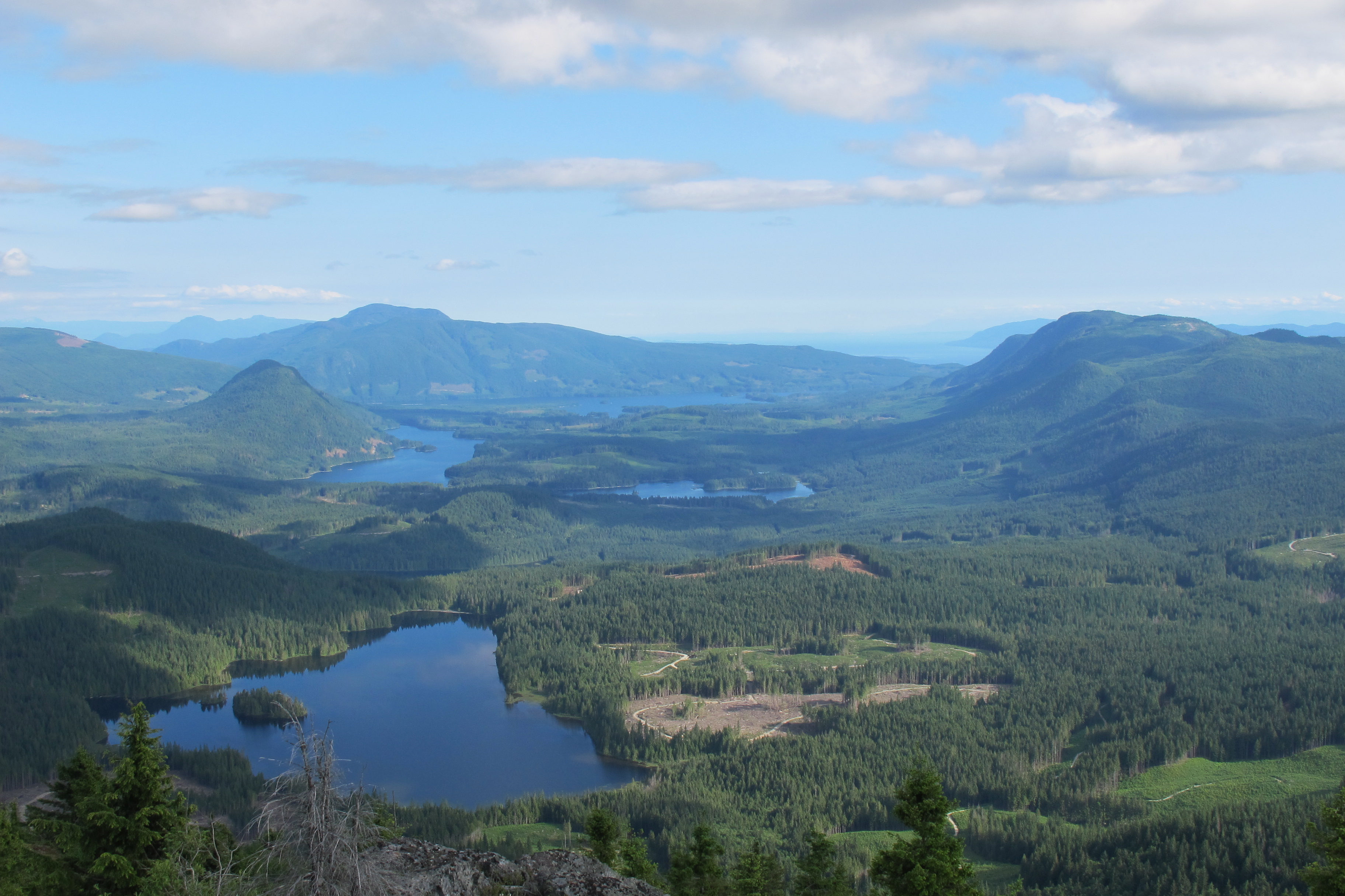
Make it to the top of Tin Hat Mountain and you will be rewarded with 360-degree views of more than two-dozen lakes. Plus you’re half way to finishing the trail! Photos courtesy Eagle Walz
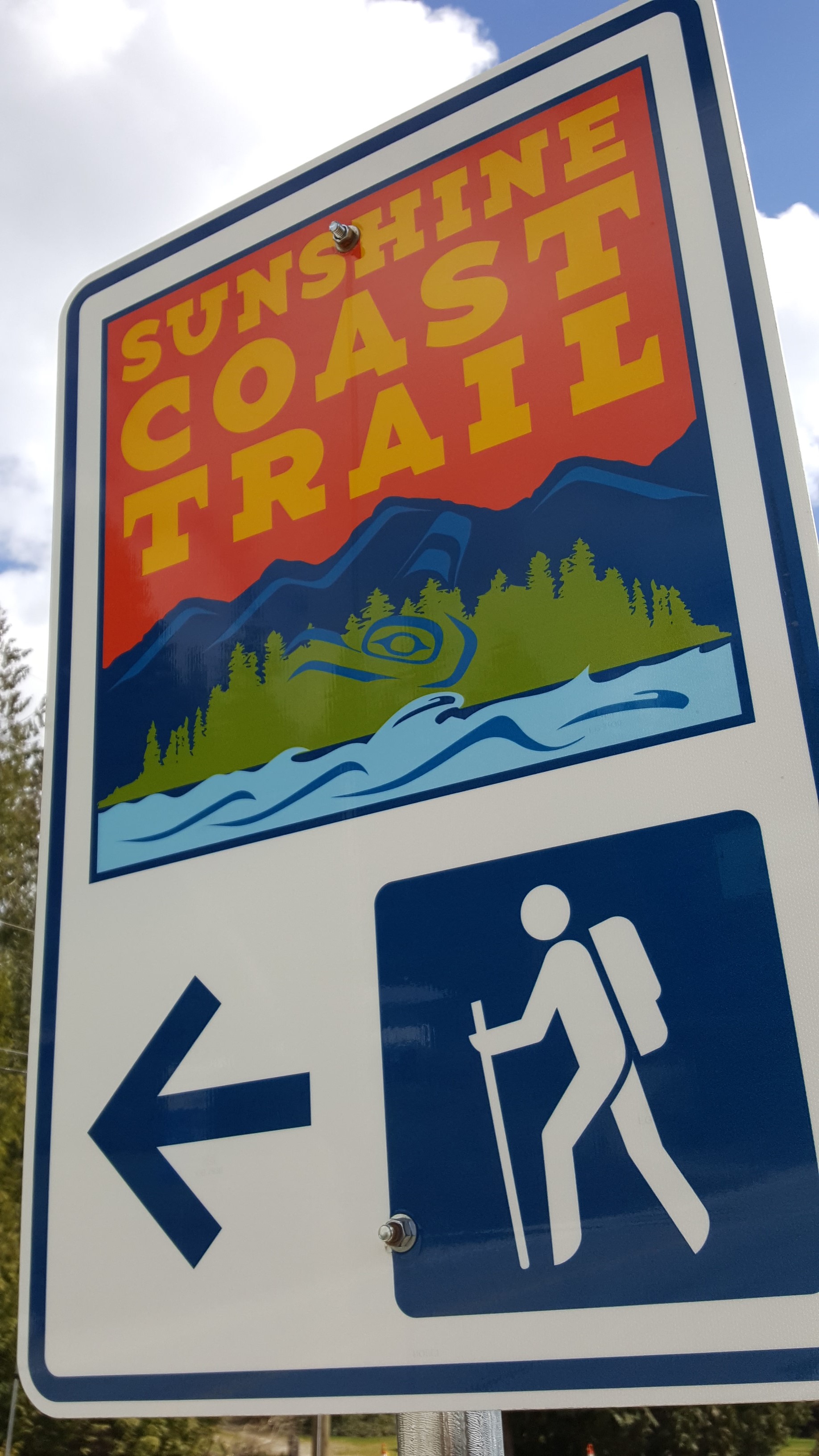
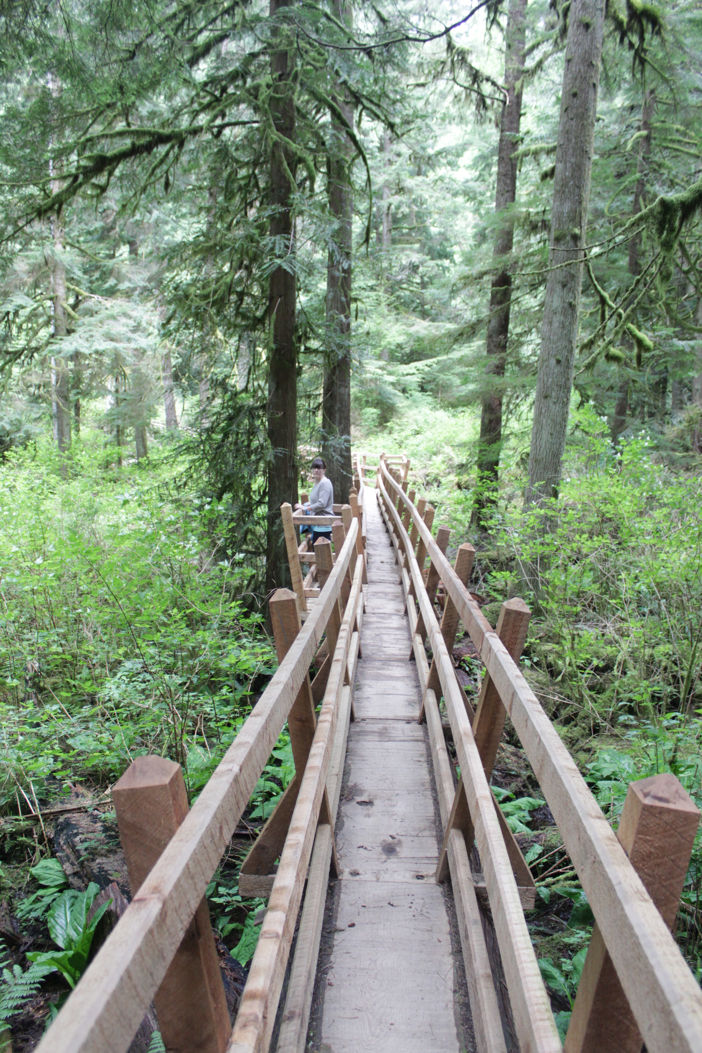
Connecting Sarah Point, near Lund, to the ferry terminal at Saltery Bay, the 180-kilometre Sunshine Coast Trail now ranks among the greatest hiking trails in the world, according to Explore Magazine’s Top-50 list. Not only is it more than twice the length of the West Coast Trail on Vancouver Island, it’s Canada’s longest hut-to-hut hiking trail, and it’s free!
The trail’s mix of old growth forest, mountain peaks and sandy shoreline, attract thousands of visitors from around the world each year. Fifteen beautifully constructed huts en route provide overnight accommodation on a first-come, first-serve basis.
“It’s beginning to be seen as an economic driver in Powell River,” says Eagle Walz. “It’s the biggest recreational tourism resource we have.”
Walz is a trailblazer, one of a handful of outdoor enthusiasts who in 1992 realized that accessible old growth on the Upper Sunshine Coast was fast disappearing. They formed the Powell River Parks and Wilderness Society (PRPAWS), a non-profit committed to setting aside protected areas on a trail sufficiently unique to lure locals and tourists alike.
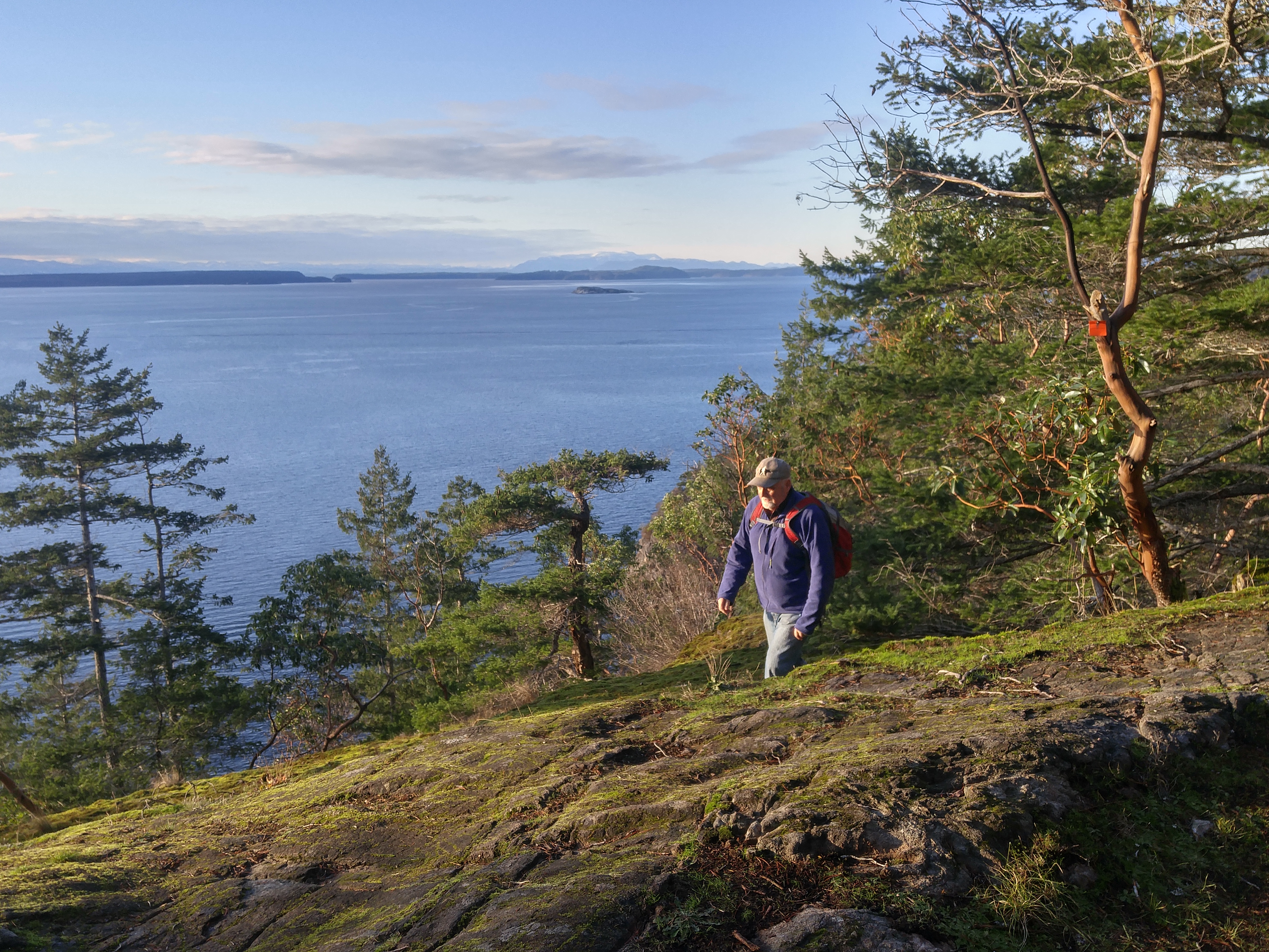
Eagle Walz in his element, hiking the Sunshine Coast Trail. Walz is a co-founder of the Powell River Parks and Wilderness Society, the non-profit behind the trail’s creation and upkeep.
PRPAWS mobilized volunteer work parties and began connecting the bushwhacked paths, deactivated roads, and disused railway grades left behind by a century of logging. In some places that meant constructing bridges – some 120 feet long – to ford creeks and rivers. They found enduring allies in a group of bloody old men, otherwise known as the BOMB (Bloody Old Men’s Brigade) squad. Comprising mostly retirees, many of whom practiced their trades at Powell River’s paper mill, the BOMB squad helped build bridges and huts, and are still counted upon for help in the trail’s never-ending maintenance.
The first time I interviewed Eagle for a story back in 2000, he was fending off criticism from a variety of sources over liability issues and the environmental concerns about sensitive wildlife areas. Walz and his cohorts had run into a host of jurisdictional challenges, too. Crown forest land, private land owned by logging companies, and Tla’amin Nation land are among the eight jurisdictions through which the trail crosses.
Seventeen years ago, he addressed those questions with a question of his own: “Would the trail have been built if we’d settled all these issues first?”
When I caught up with Eagle earlier this year, that question at least, appeared to have been answered. “You couldn’t start this trail now and try and make this happen,” says Eagle. “But that doesn’t mean the logging companies won’t stop logging. Western Forest Products, with their tree farm licence, they are the biggest interest. We manage to work together and eke out considerations. I only wish it would be a bigger buffer along the trail than we get most of the time.”
That buffer can be from 10 to 30 metres, sometimes more. Occasionally, the trail must be relocated in places. Overall, says Eagle, compromise and varying levels of protection ensure the trail’s viability.
“Our vision is that in 100 years, we’ll have no more logging near the trail,” he says. “It will be designated an old growth trail to be enjoyed by future generations. It needs someone to be the champion for it. We’re hopeful the younger generation will take over and certainly a lot of younger people are using it. People of all ages.”
Perhaps more challenging to PRPAWS is pressure on the trail from non-hikers.
“Mountain biking is very popular here, as it is everywhere else. The pressure is always to turn something into something else. But a multi-use trail wouldn’t have the same appeal as a single-use trail. We’re struggling to remain a hiking trail only because that’s what’s given us the edge in the market place. That’s what is bringing people by the thousands from all over the world to Powell River.”
In the meantime, trail maintenance keeps Eagle busier than ever. Ten years retired as a teacher, Eagle says he has time to enjoy the trail, but it’s usually when he’s part of a work party. The day I call him, he’s about to leave on just such a mission – a five-night trip to Confederation Lake, a steep section of the trail in Inland Lake Park, north of Powell River.

Eagle Walz takes in the view from the hut atop Tin Hat Mountain.
It’s a favourite spot, he says, before adding: “I think usually where I’m working, I like that part the best.” Eagle’s other cherished locations include Tin Hat Mountain with its 360-degree views of more than two-dozen lakes; and Mount Troubridge, popular for its magnificent stands of Douglas fir and yellow-cedar old growth.
When Eagle’s not on the trail, he’s writing about it – though not in the way he might have envisaged in 1972, when he moved to Powell River to write poetry: “I write hundreds and hundreds of emails,” he says in a deadpan voice. “That’s basically the extent of my writing.”
- Visit http://sunshinecoast-trail.com/ for everything you need to know about planning a trip, including the definitive guide to the trail, written by – who else? – Eagle Walz.
Desert delights in Tucson
The pigs attacked shortly after dawn.
The first indication was a dust cloud billowing from the bushes beyond the swimming pool, closely followed by deep, guttural belching.
Javelina pigs are native to the American southwest, extremely shortsighted, and smell like skunk. Perhaps for the last two reasons, they seem to be permanently agitated. Thankfully for us, they were attacking each other in what turned out to be a short-lived domestic dispute.
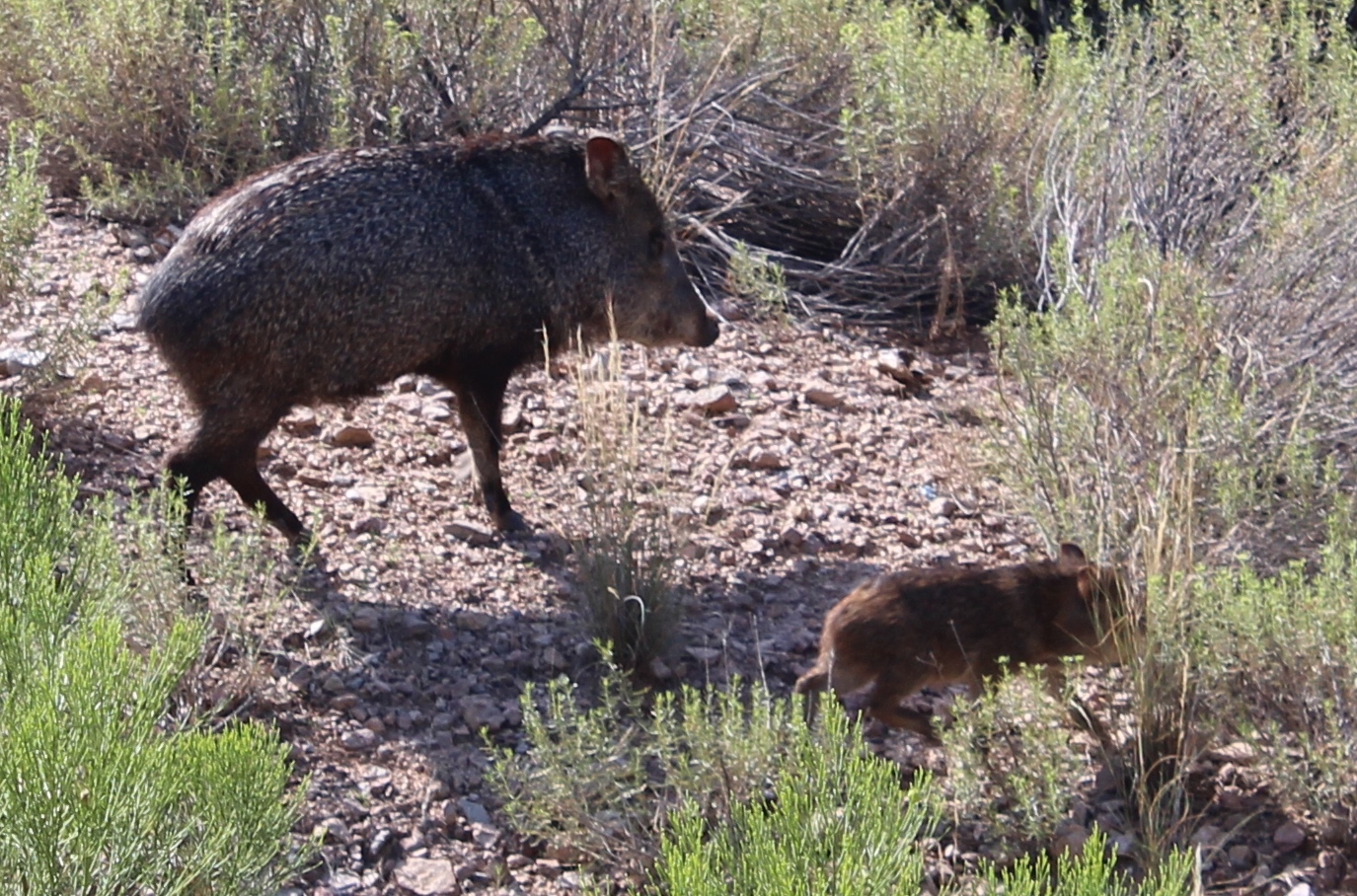
Short-sighted, smelly and agitated – Javelina pigs.
“If they approach you on a trail, they probably can’t see you,” said our guide, Koi. “Make some noise and they’ll go away.”
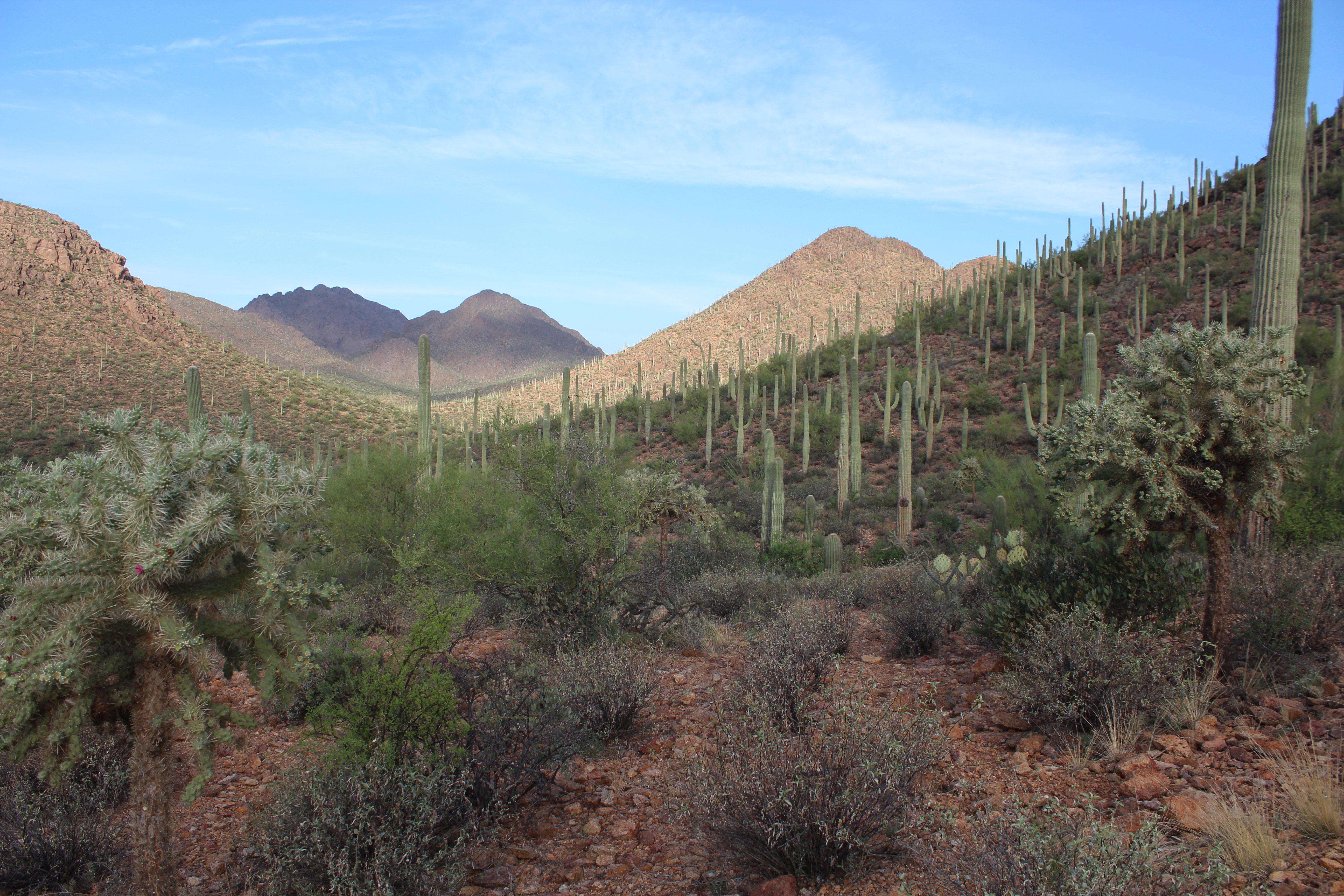
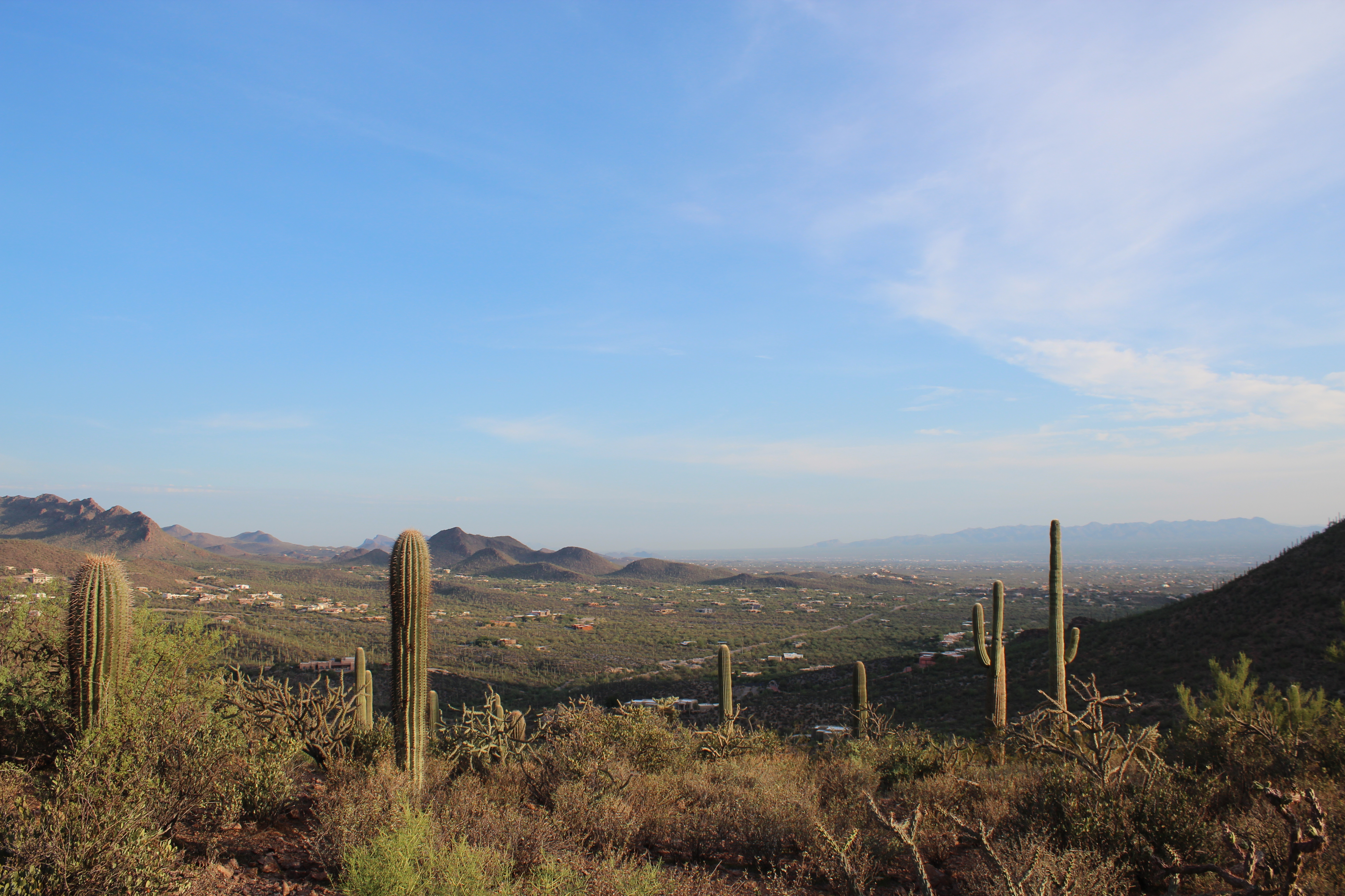
Koi works for Southwest Trekking, a professional guide service that offers guests of the J.W. Marriott Starr Pass Hotel free sunrise walks into Tucson Mountain Park. The 6 a.m. start might hurt a little on vacation, but the reward is a fascinating introduction to the unique landscape of the Sonoran Desert.
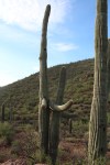
This is the only place where the saguaro cactus grows wild and many were blooming thanks to nightly thunderstorms during our late-August visit.
“They’re supposed to bloom in May but something’s going on,” said Koi, who showed us another cactus native to the Sonoran Desert, the so-called jumping cholla. The cholla’s stems are easily detached and love nothing more than to reattach to anyone or anything unlucky enough to be close by. The spines are barbed and extremely painful to remove.
Between Tucson and the Mexican border an hour south, the United States’ only population of jaguars roams. I was OK with not seeing one, but we did see several deer, including a buck.
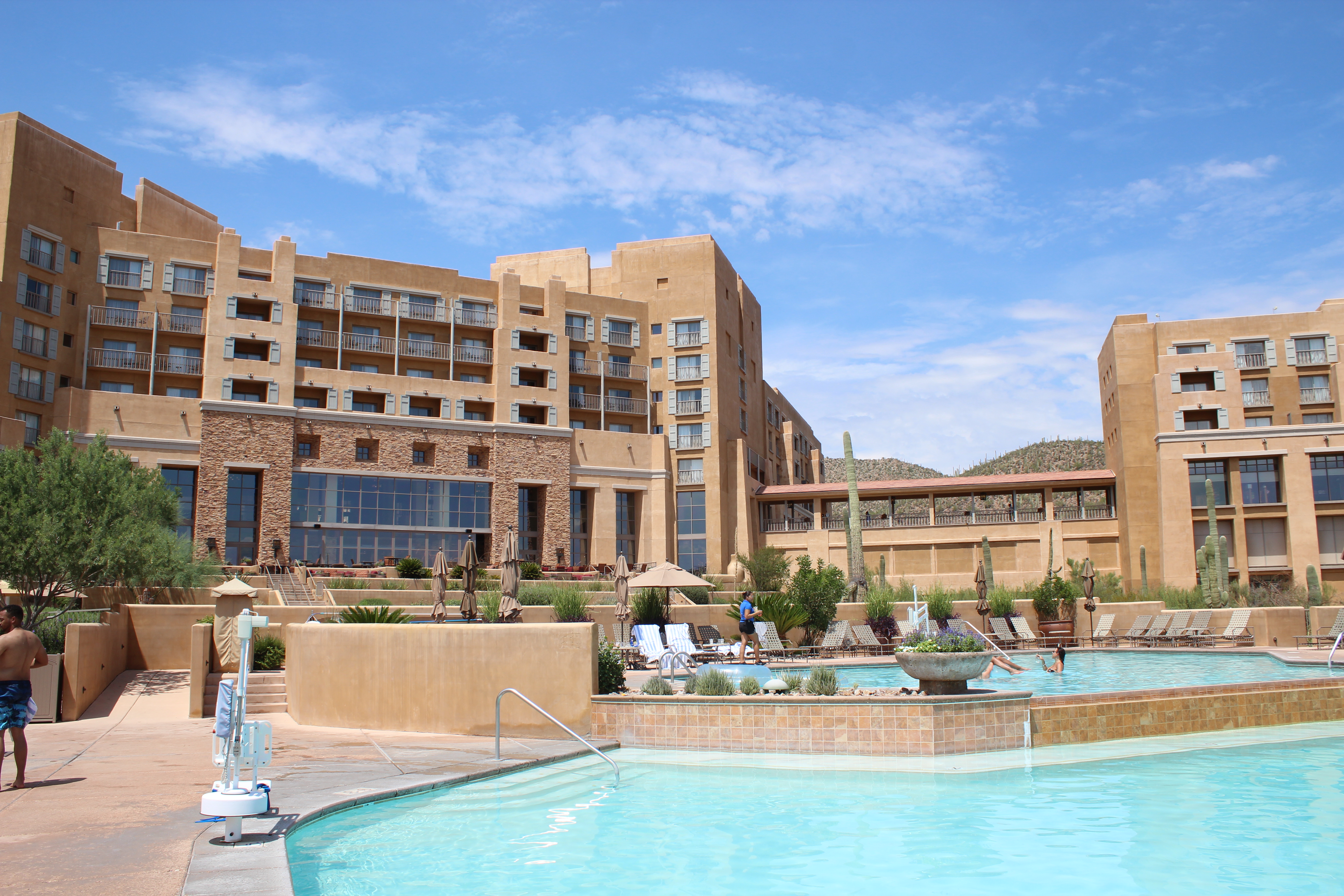
The Marriott Starr Pass: “Too nice,” according to Emma Judd.
Post-hike, we drank coffee on the Marriott terrace overlooking Tucson, a city I visit for business several times a year. This was the first time I’d been able to bring my family and I had a long list of favourite places to show them: Maybe too long.
The first problem was the Marriott Starr Pass. “It’s too nice,” explained my daughter, Emma, as we floated one more time around the hotel’s lazy river in an inflatable. “Why would I want to leave this?”
“There are wild pigs out there,” my wife, Leah, chimed in. My son, Ryan, conceded that he might be willing to get off his sunbed to play golf at Starr Pass Golf Club: in a few hours.
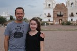
So it was with some coercion, the Judd family arrived at San Xavier del Bac, a Spanish Catholic mission 16 kilometres south of Tucson. When first glimpsed amid dusty farmland from Highway 19, San Xavier del Bac looks like an oasis. Gleaming white with two towers and a cupola, the church is as old as the United States itself and the quintessential example of Spanish colonial architecture.
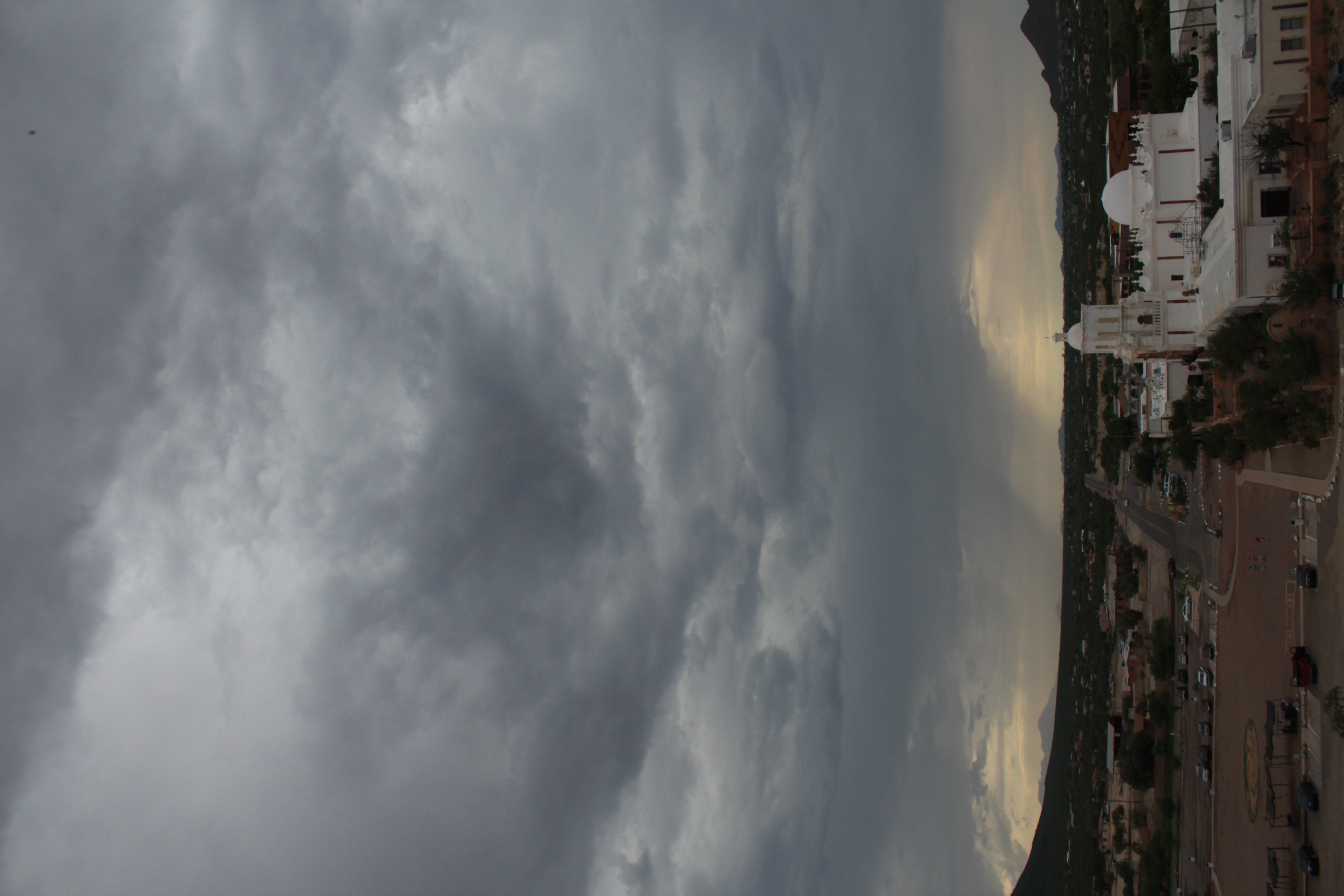
San Xavier del Bac, a Spanish Catholic mission 16 kilometres south of Tucson.
Enter through the impressive carved mesquite-wood doors and you’ll find the interior is just as dramatic. Candles flicker beneath an eclectic mix of religious devotion: paintings, carvings, statues and frescoes fill the church, which was built between 1783 and 1797 (replacing an earlier version built in 1700). It has since survived earthquakes, lightning strikes, and leaky walls, and continues to host daily mass.
We lingered in the pews before heading outside to buy sweet Indian fry bread from a vendor in the car park. We walked it off by climbing Grotto Hill, a short walk from the church and the best place to snap panoramic shots.
No one seemed in a rush to get back to the lazy river. We we’re on a roll, so we headed east to the Pima Air and Space Museum. You’d need several days to fully explore the museum’s 80 acres inside and out. And I needed several hours to sort through the 500 photos I took there. Center-stage in the museum’s main hangar is the Lockheed Blackbird, a plane that will evoke childhood memories for anyone who grew up in the 70s playing the card game, Top Trumps. In the aircraft issue of Top Trumps, Blackbird was a virtually unbeatable card. It flew from New York to London in less than two hours, and from Los Angeles to Washington DC in 64 minutes. Nothing could touch it for speed (2,193 mph) and cruising altitude (85,069 feet).
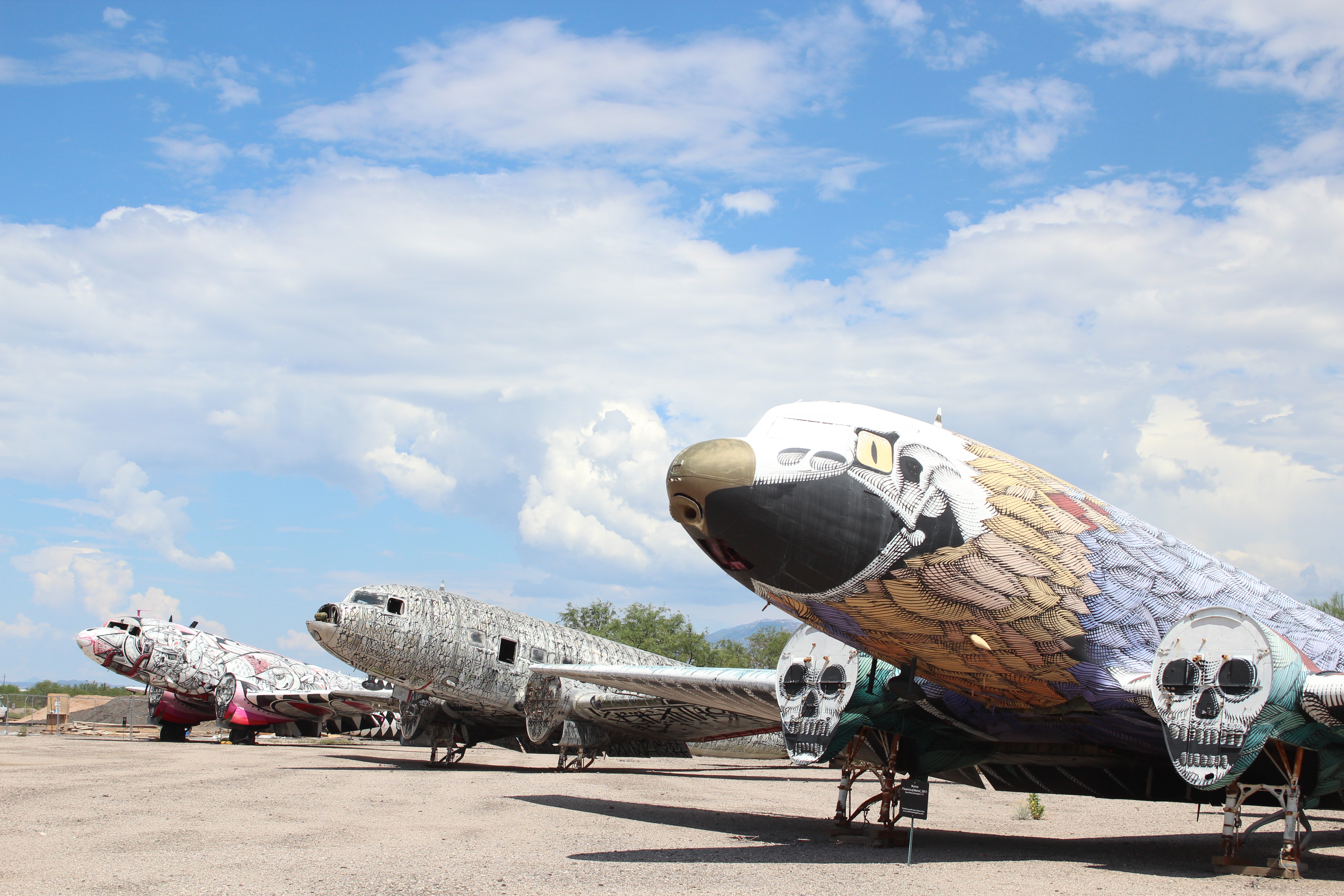
One of the 500 photos I took at the Pima Air and Space Museum.
Just a few feet from Blackbird is the Bede BD-5 Micro-Jet, which appeared in the 1983 James Bond film, Octopussy. Almost 13 feet long, the BD-5 was apparently sold in kit form but proved to be beyond the abilities of most homebuilders to complete. (Presumably it wasn’t flown much.)
There’s much to keep you indoors at the museum, and not just the air conditioning. Several exhibitions pay tribute to space travel and World War II, but the huge variety of planes outside on the tarmac were worth braving 40-degree heat to see. Besides behemoths like the Boeing B52 collection and oddities like Aero Spacelines’ Super Guppy (which looks like it should be in an aquarium or a cartoon), there are planes displaying from nose to tail the work of acclaimed street artists and mural designers.
I refused to allow the family back to the hotel until we’d visited my favourite place to eat in Tucson, the Guadalajara Grill on Prince Street. Hand-made tortillas, salsa prepared table-side, a roaming mariachi band, and fresh margaritas served in glasses the size of fish bowls – the Guadalajara Grill by itself is worth visiting Tucson for: Especially if you don’t have to go to work the next morning.
Good morning Tucson!
Back at the Marriott the next day, the male half of the family followed in the footsteps of Arnold Palmer and Phil Mickelson at the Starr Pass Golf Club. Golf is a huge lure for Tucson visitors, with the city boasting numerous award-winning courses. Many of them cut their prices on mid-summer afternoons for those willing to bear Arizona’s heat. (Tucson is drier and generally a few degrees cooler than Phoenix, 90 minutes’ drive north.)
Starr Pass is no exception. The club features 27 holes divided into three nines played in three different 18-hole combinations. We played the Roadrunner nine, the club’s shortest circuit, which was just as well, having lost all our original balls by Hole 8. The afternoon thunder clouds seemed to be beckoning us inside and at the first sign of forked lightning, we called it a day.
That evening we ventured downtown to Reilly, which combines pizza and craft beer in a century-old building that used to house a mortuary and funeral home. Any morbid thoughts were soon banished by parm truffle fries, roasted crimini mushroom pizza, and Brussel sprouts in sherry, hot sauce and pecan brittle crumbs. Reilly epitomizes the resurgence of Tucson’s downtown, which features numerous bars and restaurants with inventive menus in historic premises restored to former glory. Perhaps the classiest of them all is the Hotel Congress, built in 1919, and now a thriving music venue, as well as housing a restaurant and bar.

Hotel Congress, built in 1919, and now a thriving music venue, as well as housing a restaurant and bar.
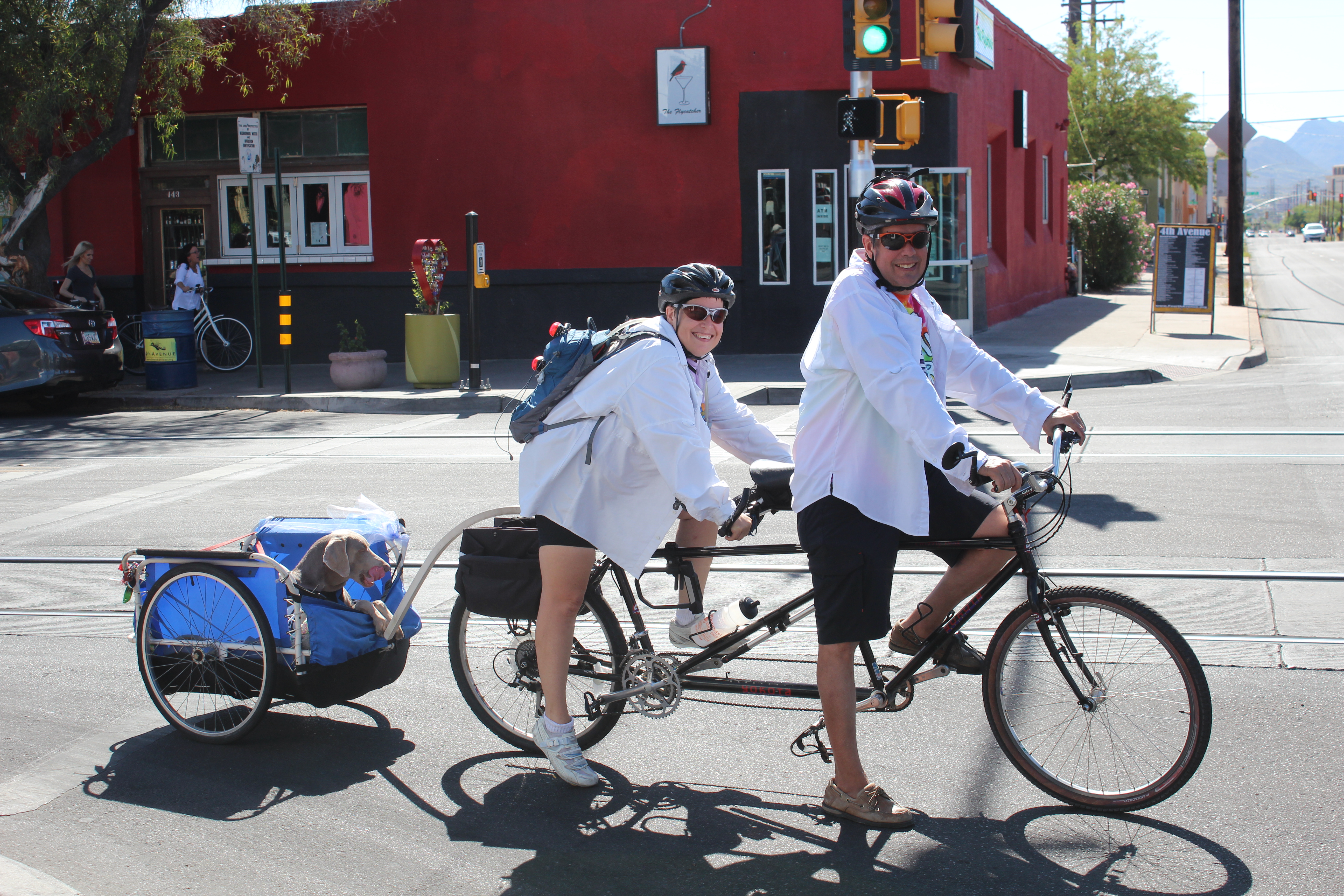
A great way to see downtown and learn some of its history is by bicycle with guide, Jimmy Bultman, who runs Tucson Bike Tours. Dive bars, food trucks, a pinball arcade and downtown’s historic neighbourhoods feature in the sunset tour, which I did in April. I enjoyed it so much I rented a bike and covered much of the same ground by myself the very next day.
Jimmy turns kayak guide elsewhere during Tucson’s summer months, but he’s back now. The city is home to a growing bicycle network, including The Loop – more than 100 miles of trail shared with skaters, joggers and horse riders. In the foothills and mountains beyond the city is an extensive network of mountain bike trails.
And for the ultimate in relaxation, there’s always the lazy river at the Marriott Starr Pass. Just give the pigs a wide berth.
If you go:
- Marriott Starr Pass offers deals starting at $129 a night. Visit marriott.com/hotels or call +1-520-792-3500.
- For more on the Pima Air and Space Museum, visit pimaair.org
- Details of Jimmy Bultman’s bicycle tours are at tucsonbiketours.com
- Desert hiking and biking tours are available through Southwest Trekking at swtrekking.com
- visittucson.org is a good resource for anyone planning a visit to the city.
-
-


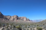
Las Vegas: The beaten track and the single track
For a city synonymous with late nights, Late Night Trailhead just outside of Las Vegas is decidedly different. There are no buildings besides an outhouse, no meandering pedestrians or neon, and certainly no noise. Instead you’ll find about 200,000 acres of desert known as Red Rock Canyon, home to tarantulas, rattlesnakes, burros, bunnies and wild vegetation that can either harm or cure you.
More than 80 miles of trails lure another desert creature, namely the mountain biker – about 2,000 of them locally, according to Brandon Brizzolara. Brizzolara is a guide and mountain bike specialist for Escape Adventures and Las Vegas Cyclery. He grew up in Vegas and fondly remembers when even The Strip had its own biking scene.
“From Tropicana to Fremont we’d have BMX sessions on The Strip like it was a skate park in the 90s,” he says. “Vegas is a pretty active community, it’s just The Strip that’s a little out of shape.”
Brandon Brizzolara, guide and mountain bike specialist for Escape Adventures and Las Vegas Cyclery.
We’re here for The Strip and the desert – the beaten track and the single track: Neville and Leah and their teenagers, Ryan and Emma, all of us with contrasting wishes and expectations for our three-night stay in Las Vegas.
Shopping had been my kids’ idea. For hours we’d lost ourselves in high-octane consumerism at Miracle Mile Shops at Planet Hollywood Resort and Casino, a consumers’ paradise with 170 stores, 15 restaurants and several entertainment venues. Britney Spears has her own store here where Britney merchandise exhorts shoppers to “Work it, Bitch”.
It’s a legitimate vice in Sin City, but shopping – and Britney Spears – make me uncomfortable so I stood with a crowd and watched a guy get his belly tattooed at Club Tattoo. Leah got a manicure at Original Diva and had nails “to die for” long after returning home. Ryan and Emma blew their entire budget.
On all of our wish-lists was a Vegas show. Britney had taken March off so we chose Cirque du Soleil’s Zarkana, a celebration of circus traditions set in an abandoned theatre (but in reality at the Aria Resort and Casino). The show blends anarchic humour with the precision and grace of aerialists, acrobats, jugglers, high-wire and trapeze artists. The clowns made Ryan uncomfortable but he’s only 16; otherwise we left well entertained.
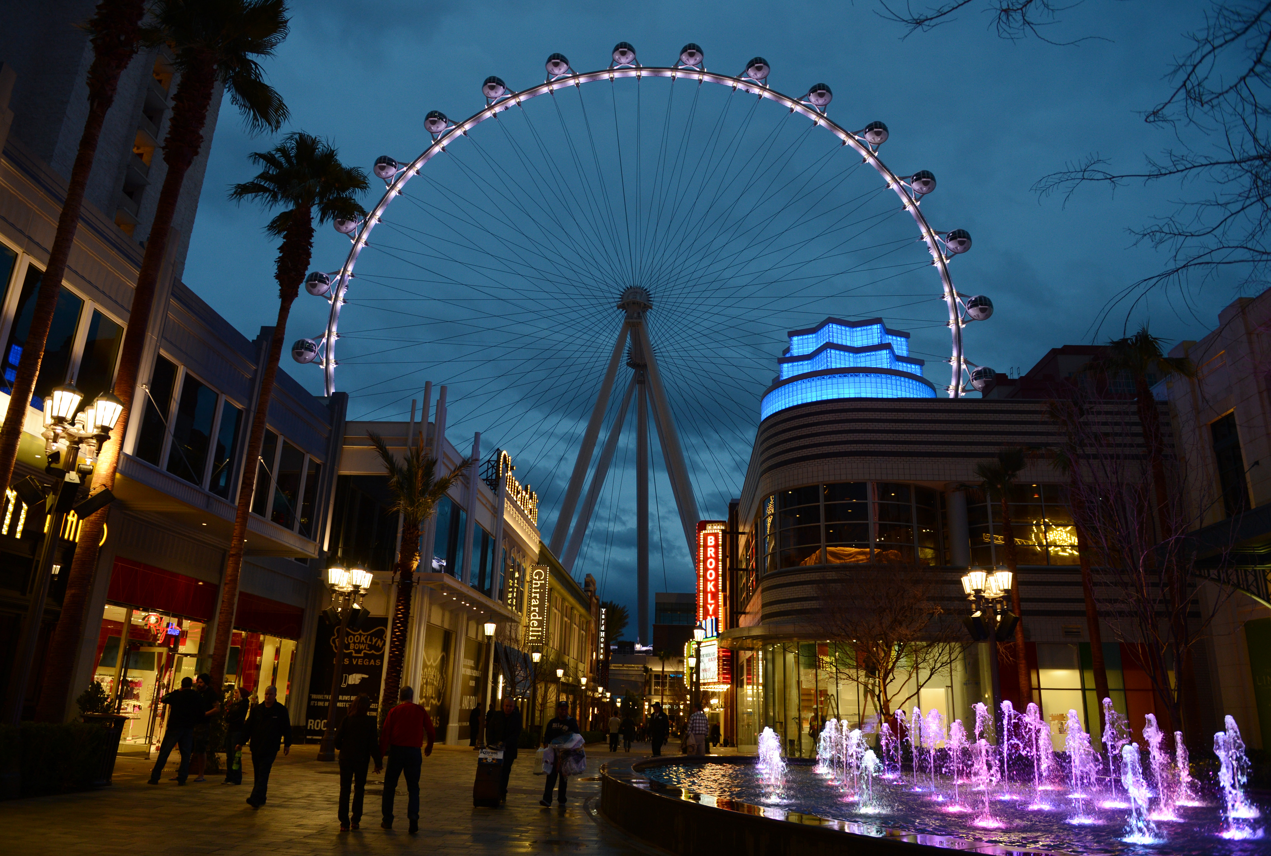
At 550 feet tall, the High Roller is the crown jewel in Caesars Entertainment Corporation’s LINQ development, a pedestrian-friendly neighbourhood on The Strip. The High Roller opened March 31. Denise Truscello photo
The spa treatment was Leah’s idea, but I was happy to tag along. For the Vegas rookie it can be tricky finding places on foot and ESPA at the Vdara Hotel was no exception. We could see it set back off The Strip, but The Strip has a way of keeping pedestrians on The Strip. We eventually got there by walking through another hotel, The Cosmopolitan. Any stress I might have felt at being late for a spa treatment soon melted away under the sensuous heat of volcanic stones, body brushing, exfoliation and a scalp massage. Beats shopping any day of the week!
Great food was on everyone’s list and the following three restaurants more than delivered. The Yard House enjoys an enviable location just a few feet from the High Roller, the world’s biggest observation wheel. At 550 feet tall, the High Roller is the crown jewel in Caesars Entertainment Corporation’s LINQ development, a pedestrian-friendly (hallelujah!) retail, dining and entertainment neighbourhood on The Strip. The High Roller opened March 31, two weeks after our visit, but we were content to admire it illuminated in green for St. Patrick’s Day from the deck of the Yard House. The beer list alone would entice me back to the Yard House, but the St. Louis-style ribs and truffle fries had me at hello.
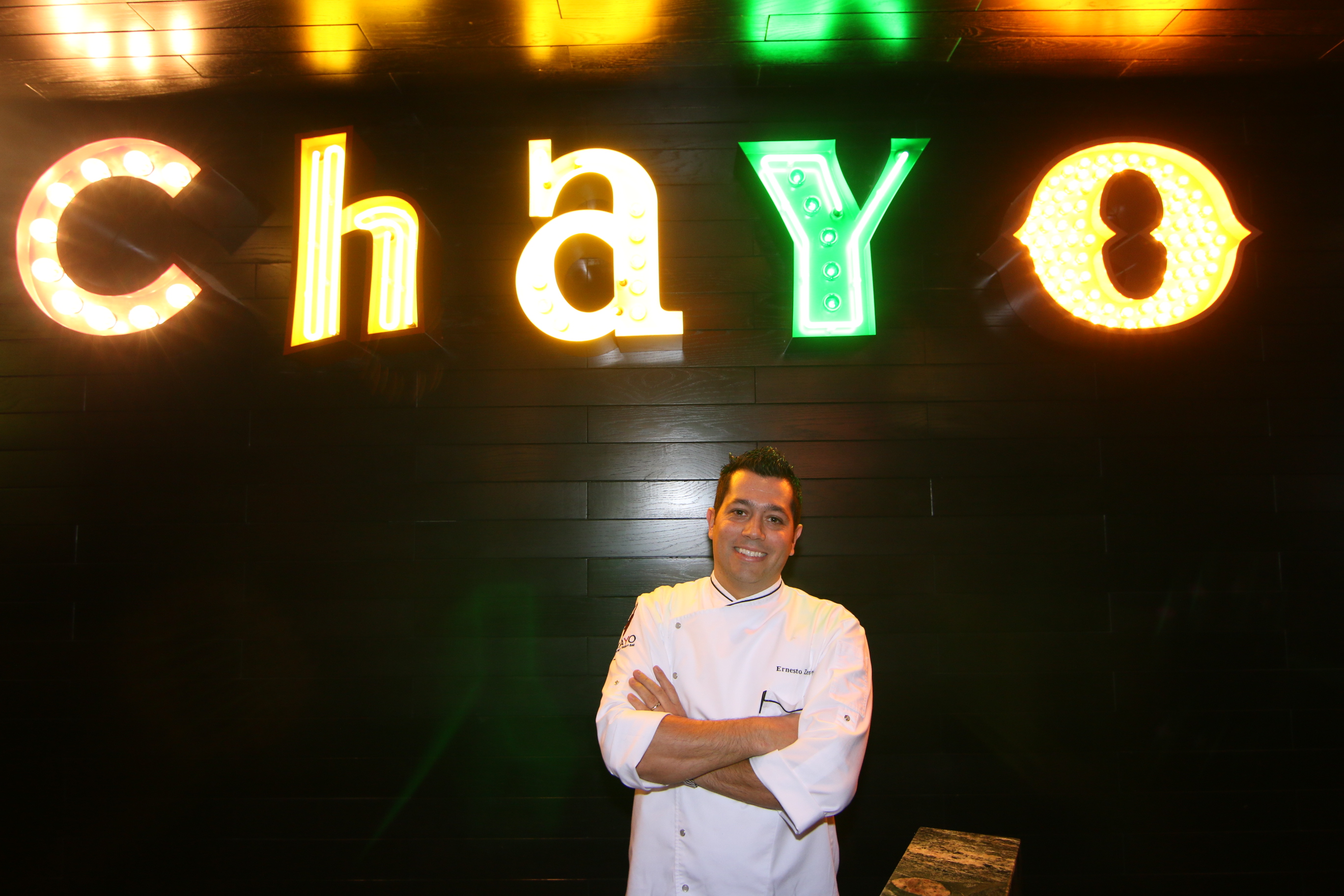
Chayo chef, Ernesto Zendejas.
Just a short stroll through the LINQ brings you to Chayo Mexican Kitchen and Tequila Bar, a two-storey fiesta in the making, anchored by a mechanical bull. Mexico City-born chef, Ernesto Zendejas, draws upon classical training in France to present an exquisite mix of flavours: Lobster tacos, bass ceviche, cilantro cream soup, shrimp fajitas – it’s tough to pick a favourite, but none of us were lining up to ride the bull afterwards. (Portions are decidedly North American – not French!)
Plates are meant to be shared at Crush, one of many dining options at the MGM Grand, but our family came close to making a scene over the sea scallop benny, comprising sunny-side quail egg, chorizo and chipotle hollandaise. Some meals are too good to be shared. The shrimp risotto and lamb sirloin with bacon brussels sprouts also didn’t last long.
Between the shopping, the show, the spa and the dining, we savoured afternoon pool time. In downtown Las Vegas, we mingled with celebrity lookalikes and body-painted models at the Fremont Street Experience, five city blocks of high-tech wizardry featuring a 550,000-watt sound system and a music and light show broadcast from an LED canopy 90 feet above the ground.

Sea scallop benny at Crush, MGM Grand. Don’t even think about sharing.
And we ventured a little off downtown’s beaten track. Further down Fremont Street, past El Cortez, the city’s first casino, we found The Beat Coffeehouse and Records, the hippest little joint for breakfast and heaven to a 16-year-old who’s just discovered vinyl.
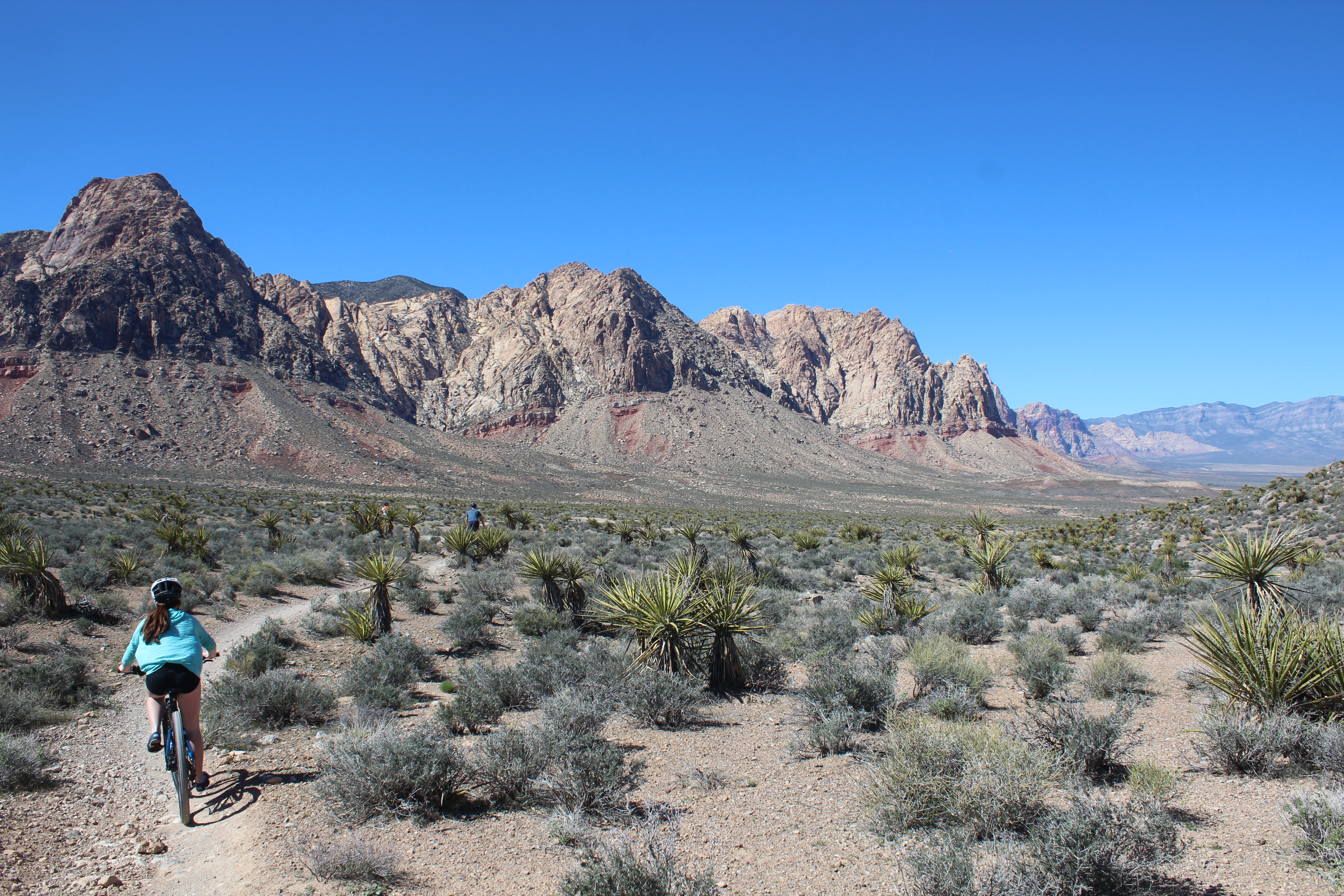
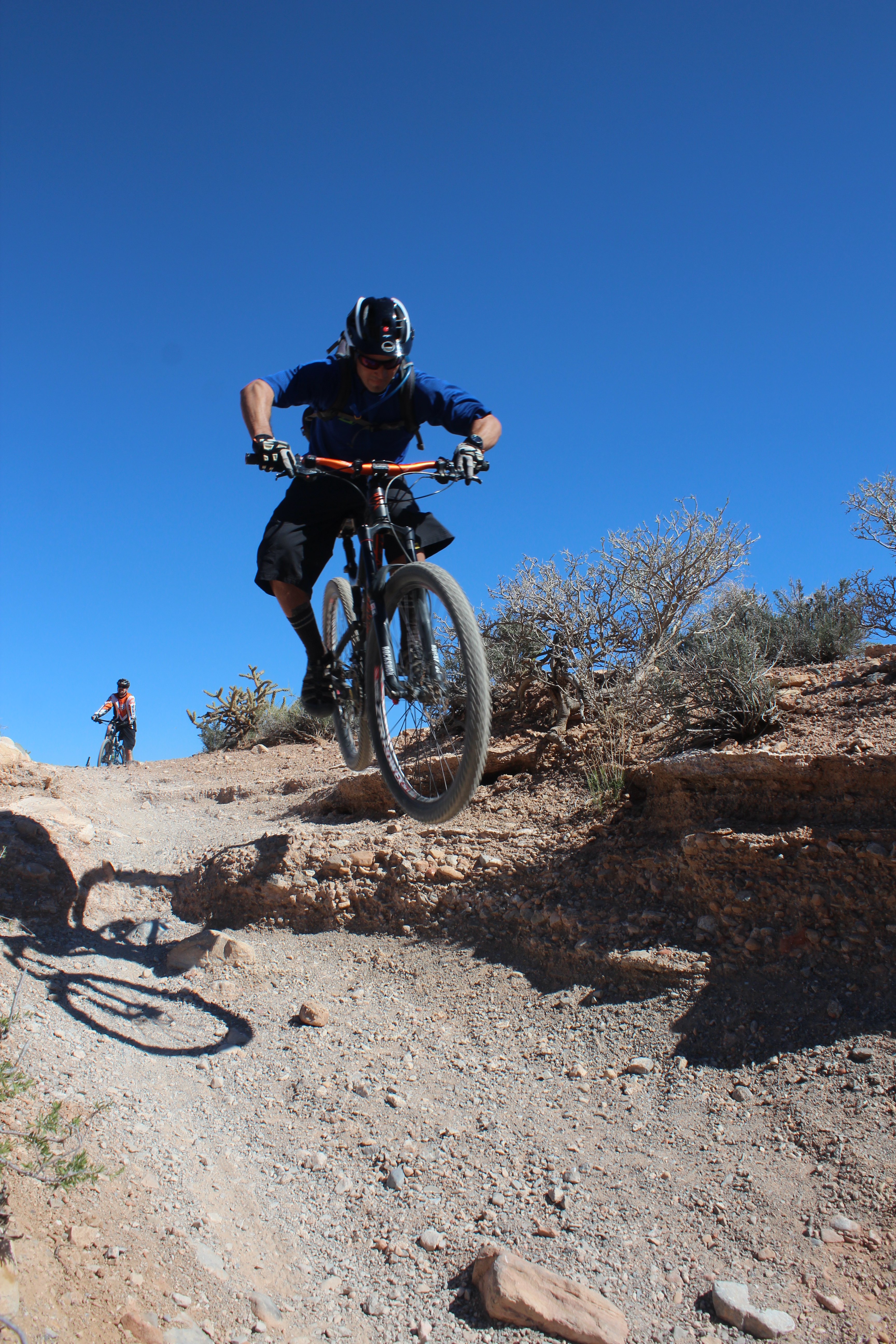
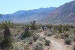
Nowhere though seems quite so off the beaten track as the Mojave Desert and the single track of Red Rock Canyon. The mountain biking had been my idea. Only 17 miles west of Las Vegas Boulevard, Red Rock’s Mustang Trails might have been on another planet, such is the contrast with The Strip.
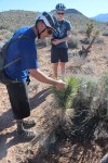
For two hours we mostly coast on easy trails, stopping occasionally for impromptu descriptions of the vegetation. Brizzolara says he hasn’t taken a pill in more than 10 years, and why would he with nature’s pharmacy on his doorstep? There are seemingly cures for all ailments in the numerous sage bushes and plants like Mormon’s Tea, a species of Ephedra, which is traditionally used to treat asthma, hay fever and the common cold.

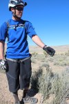
Ryan Judd in his element at Red Rock Canyon.
If inducement to remain on the bike were needed, there are no shortage of plants that could make for a painful landing: cacti, whose barbs expand after piercing skin, and the Joshua Tree, whose bayonet-shaped leaves feature serrated edges – handy for cutting barbecue wieners, according to Brizzolara. We stay on our bikes. My daughter, Emma, who’s never mountain biked, struggles gamely and mostly ignores her dad telling her to relax.
It’s the same advice she gave me at the Britney Spears store.
If you go:
- Las Vegas Cyclery (lasvegascyclery.com) and Escape Adventures (escapeadventures.com) offer year-round tours (half day and full day) for mountain bikers and road cyclists, as well as hiking tours. If mountain biking, you’ll ride full suspension Santa Cruz 29ers and tours start at $129. Call 1 800-596-2953
 1 800-596-2953.
 - We divided our accommodation between the Downtown Grand Las Vegas (downtowngrand.com) and the MGM Grand (mgmgrand.com). Formerly the Lady Luck, the Grand recently reopened after a $100-million renovation. It’s steps away from the Fremont Street Experience and features PICNIC, a wonderful rooftop pool. The MGM Grand more than holds its own on the pool front with four to choose from and a lazy river. It also offers Stay Well rooms, which comprise more than a dozen health and wellness features, including aromatherapy, wake-up light therapy and Vitamin C-infused shower water.
- For more on ESPA at Vdara, visit Vdara Hotel and Spa.
- For more on Las Vegas, visit vegas.com
-
- Guide Brandon Brizzolara points out the good, bad and ugly of desert flora and fauna.
-
- The Las Vegas mountain bike community numbers 2,000-plus. Fortunately there’s lots of room for them all.
-

- Easy riders at Red Rock Canyon.
-
- All those trails with no rainforest in the way!
-

- High Roller at The LINQ. Denise Truscello photo
-

- Chayo cilantro cream soup.
-

- Chayo lobster tacos.
-

- Crush sliced sirloin.
-

- Sprinkles at The LINQ actually features a cup-cake ATM!
The Trail Collector

Creator of sunshine-coast-trails.com Becky Wayte is probably the Sunshine Coast’s most avid nature bather.
You might call Becky Wayte a wanderer. Almost every day for the last 20 years, Becky has hiked or biked a trail somewhere on the Sunshine Coast. It wasn’t until a couple of years ago though, that she became a collector.
Some people collect stamps; others baseball cards. Becky collects trails, maps them with a GPS, and documents them on sunshine-coast-trails.com, a website she created for outdoor enthusiasts. The site lists hundreds of trails, from Langdale to Earl’s Cove, with descriptions, maps, difficulty ratings and useful links. She has her favourites – three of which she describes in her own words in a sidebar to this story.
In 2011, hiking three to four hours a day, almost every day, Becky managed to map almost all of the Sunshine Coast’s trails in six months. She’s been updating her collection ever since. The Coast is home to some prolific trail builders, it seems.
“I actually thought it would take me a couple of years,” she tells me. “But I quickly realized that I’m a little obsessive. When I start something, I need to see it through to the end.”
But the truth is, collecting trails never ends. New trails are always springing up and some remain well-guarded secrets. In a recent interview with pinkbike.com, local mountain-bike phenom, Holly Feniak, describes the Coast’s trails as: “Dreamy. Loamy, mossy, bouncy, incredibly green, and in the secret spots … all that and steep.”
Cliff Gilker Park, Roberts Creek.
She might have added ‘never-ending’!
“For heaven’s sake, stop building trails,” Becky laughs, when I ask her about the Coast’s trail builders. “I actually love finding new trails and I admit, there might be the odd one I don’t know about. I’m always trying to keep up!”
For a moment, we think we may have found a new one. It’s an unusually hot day in May and we’re walking through a dusty trail off Field Road in Wilson Creek. We’re accompanied by Cody, a large, lovable dog from the nearby SPCA where Becky volunteers each week as a dog-walker. The path veers past someone’s back yard and into the forest.
“Let’s take a look,” says Becky, in her element. A few minutes later we come to a dead-end. Cody looks at us expectantly and we return the way we came. So what inspired Becky to take on this labour of love?
“I have three dogs and one has issues with other dogs, so I wanted to find new trails to hike where there weren’t so many people,” she says. “There were few websites, but they only featured the most popular hikes, places like Mount Daniel, so I decided I’d do it myself.”
Becky’s well qualified. Not only does she love the outdoors, but she learned to build websites through her work teaching computer courses in the Adult Basic Education Program at Capilano University in Sechelt. With the website established, Ryan Robertson, a Squamish-based app developer, who specializes in creating trail applications for iPhones and Androids, contacted Becky. Becky provided the GPS (Global Positioning System – the satellite navigation application) data and Ryan created the app. Trailmapps: Sunshine Coast costs $10 and is available at the Apple Store and Google Play.
For old-school trail lovers, she’s also created waterproof trail maps that are available in Gibsons at Spin Cycles, and in Sechelt at Source for Sports, the Sechelt Visitors’ Centre, and Off The Edge Adventure Sports.
Outdoors, technology couldn’t be further from Becky’s mind. While she’s always hiked to combat weight gain, she’s also convinced of nature’s therapeutic benefits. The Japanese have a name for it: shinrin-yoku, or forest bathing. Becky cites Japanese research, which points to the many benefits of simply being in nature – lower blood pressure, higher creative aptitude and boosted immune systems.
“I prefer the term ‘nature-bathing’ because I find just being out in nature makes me feel better. I always come home feeling better than when I left.”
Well, almost always.
Becky sheepishly recalls one particular hike that went awry, much to her husband’s despair. “I was hiking up Elphinstone and I’d let people know where I was going and what time I’d return. It took a lot longer than I’d expected though and my phone died.
“I got back around 7:45 p.m. – not the 5 p.m. I’d told my husband. He was pretty mad.”
The experience didn’t sour Becky’s love of Mount Elphinstone. In fact, the Mount Elphinstone Summit Trail ranks in her three favourite hikes and bikes. (See below.)

Kinnikinnick Park, West Sechelt.
Sidebar
My Three Favourite Hikes & Bikes, by Becky Wayte
Mount Elphinstone Summit Trail (hike only)
This is a long, fairly difficult climb, but the view at the very top is worth it. The trail to the top can be accessed from the top of Sprockids or via some feeder trails off B & K logging road in Roberts Creek. If you take your time and enjoy a picnic and rest at the top, this hike will likely take you five or six hours. Make lots of noise or wear a bell so the bears hear you coming.
Ruby Klein Traverse – Suncoaster Trail (hike or bike)
Beautiful views of Ruby Lake and a hand carved bench greet you at the highest point along the trail. Easy to make a whole day trip out of this even though the hike itself will probably only take you a couple of hours. You can visit the Iris Griffiths Centre, take a swim in Klein Lake and there is even a feeder trail down to the Ruby Lake restaurant (Trattoria Italiano).
McNeill Lake Circle Route (hike or bike)
This is one of my favourite destinations in the summer months because I always combine a bike ride with a swim. The lake itself is not that well known so often no one else is there, especially on weekdays. There are several trails that connect to create a loop around the lake, with access to the lake from a couple of spots. I park on Middlepoint Forest Service Road and take Copper Head, Dry Feet, a logging road, Old Pole Road and back to Copper Head. There is a short trail off the logging road just north of Dry Feet that takes you into the lake. This is an excellent place to ride your mountain bike if you have pre-teen kids or you just want a fairly flat ride (we don’t have many flat rides on the Coast). Hiking it probably takes about 1.5 hours and by bike about an hour, unless you stop to enjoy a swim.
For the definitive web guide to the Sunshine Coast’s trails, visit http://www.sunshine-coast-trails.com.
