Archive for the ‘Hiking’ Category
Cold play
The Tetrahedron Outdoor Club ensures a warm welcome for visitors
Reached by ferry or floatplane, the Sunshine Coast, north by northwest from Vancouver on Canada’s west coast, is the kind of place people visit to get away from it all. The Tetrahedron is the kind of place Sunshine Coasters go to get away from it all.
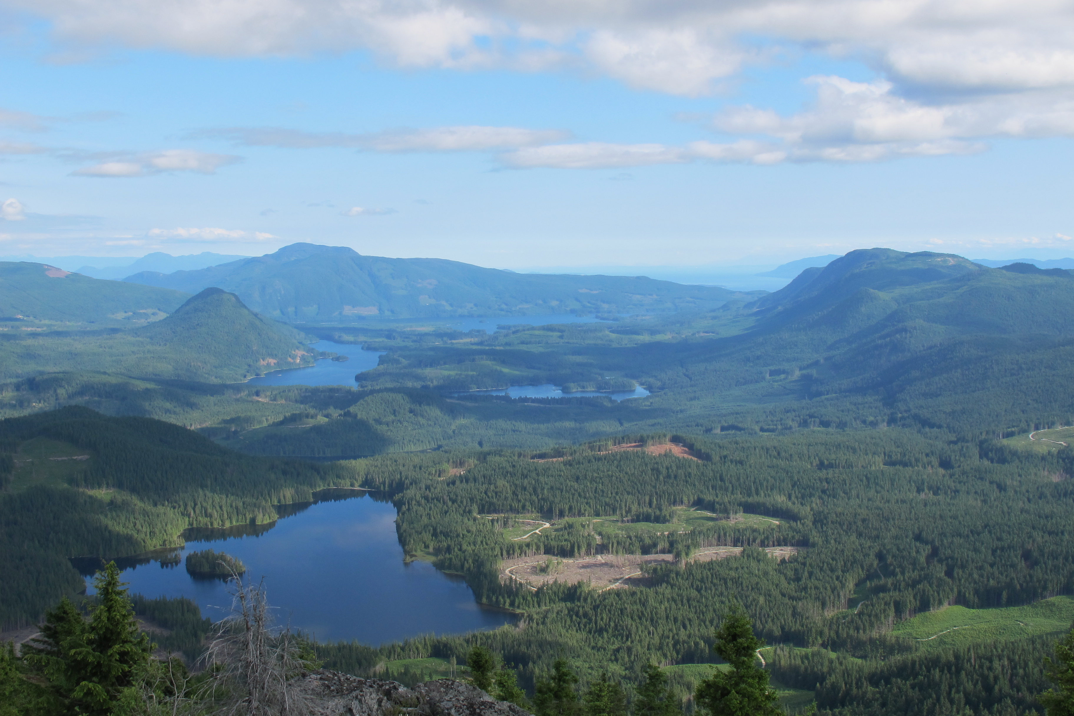
As backyards go, the Tetrahedron tends to be on the large side. Six thousand hectares of mountains, lakes, streams, wetlands and forest make this Class A provincial park the perfect place for backcountry enthusiasts to explore.
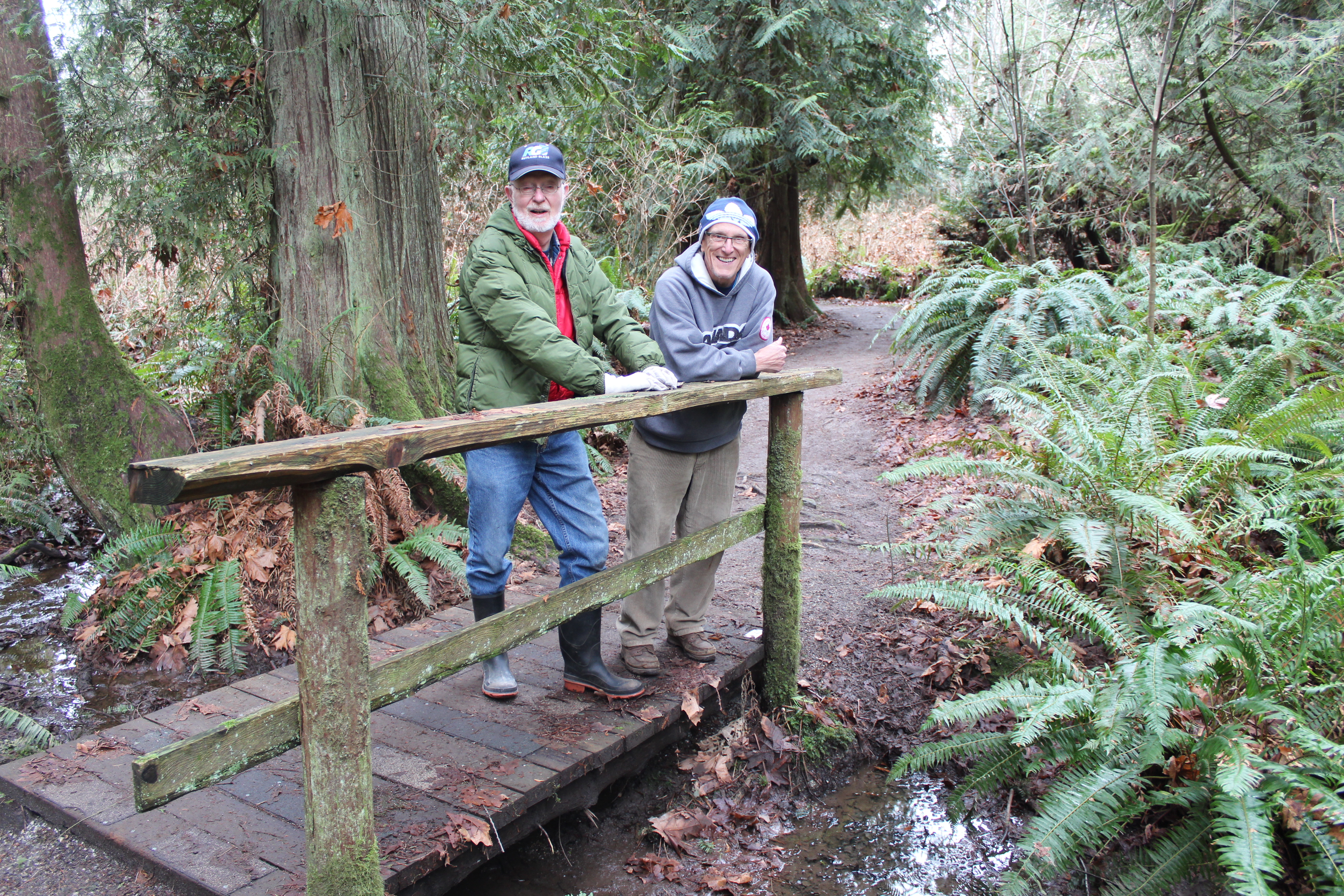
It also makes the Tet, as it’s fondly known, an immensely challenging place to maintain for visitors. Charged with that formidable task is the Tetrahedron Outdoor Club, a hugely dedicated volunteer organization committed to maintaining the park’s four rustic cabins and the 25-kilometre trail network connecting those cabins.
“B.C. Parks owns the cabins and it’s their provincial park,” explains club president, Gerry Marcotte. “We are the stewards of the park and a have great working relationship with B.C. Parks, which goes a long way to keeping these cabins and trails up to date.”
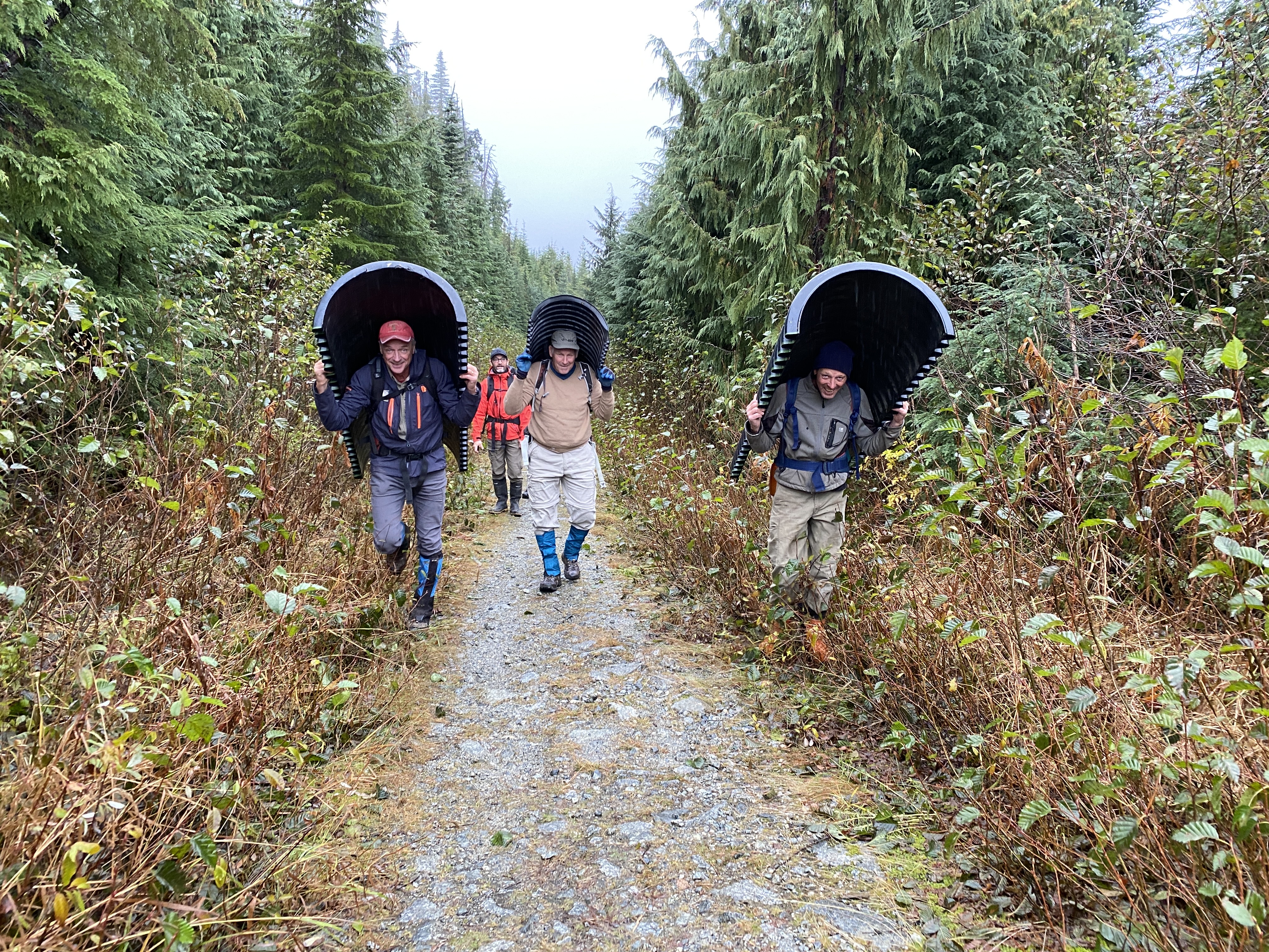
The latest major project keeping the club’s volunteers busy has been the installation of a three-ton bridge spanning Steele Creek. Lowered by helicopter and installed by club members last month, the bridge cost about $20,000 – $12,000 of which was partially funded by a grant from the Sunshine Coast Community Forest Legacy Fund.
It would have cost more but for the donations of businesses – structural engineering, welders and lumber milling. The mix of grants, donations, partnerships and resourceful volunteers continues from a blueprint established more than 35 years ago.
In the mid-1980s, amid an economic depression, a group of backcountry enthusiasts united to mobilize more than 200 volunteers, 45 businesses, schools, community groups and several levels of government: their goal, to build cabins linked by a trail network.
The Tetrahedron Ski Club, as it was then known, secured more than $150,000 in federal funding and another $20,000 from the province, to build the cabins at Sechelt airport. The cabins would then be disassembled and flown by helicopter to be reassembled on site.
Forestry company, Canfor, and the Sunshine Coast Regional District donated timber, Sechelt Creek Contracting provided logging service, Airspan donated some airtime, Gibsons Building Supplies provided crane trucks and the Outdoor Recreation Council pitched in with chainsaws.
An army of volunteers mobilized to clear trails while 18 people worked on the cabins, gaining valuable carpentry skills and learning about surveying and wilderness first aid. By the time the cabins opened to the public in 1987, the club had raised more than $300,000 for the project. Perhaps more remarkably, a single great idea had united governments, businesses and local volunteers.
So, what motivated such efforts back then and what continues to drive the club’s volunteers now?
“There are a lot of people in the Tet for pure recreation,” says long-time club member, Melissa Rayfield. “I think the difference with volunteering is that it becomes purposeful recreation. I think any volunteer would feel the same way, it’s part of their social life, part of pleasure and the fulfilment of getting something done.”
Melissa’s husband, Danny Fleischhacker, agrees, adding that the solitude and the elements amid the Tet’s wide-open spaces are hard to resist, especially in winter.
“Getting out into the backyard, being out in nature there’s a sense of throttling back, tapping the brakes and going slow, but looking around,” says Danny, who admits that he also likes to go fast. “I really love skinning in a blizzard with the wind blowing at me. (Skinning is the practice of sticking synthetic skins to skis, climbing a trail, then skiing down. Danny and fellow club-member, Sam Preston, are particularly fond of exploring ski terrain deep in the park and immortalizing perfect runs with names like “Heaven is a Halfpipe”.)
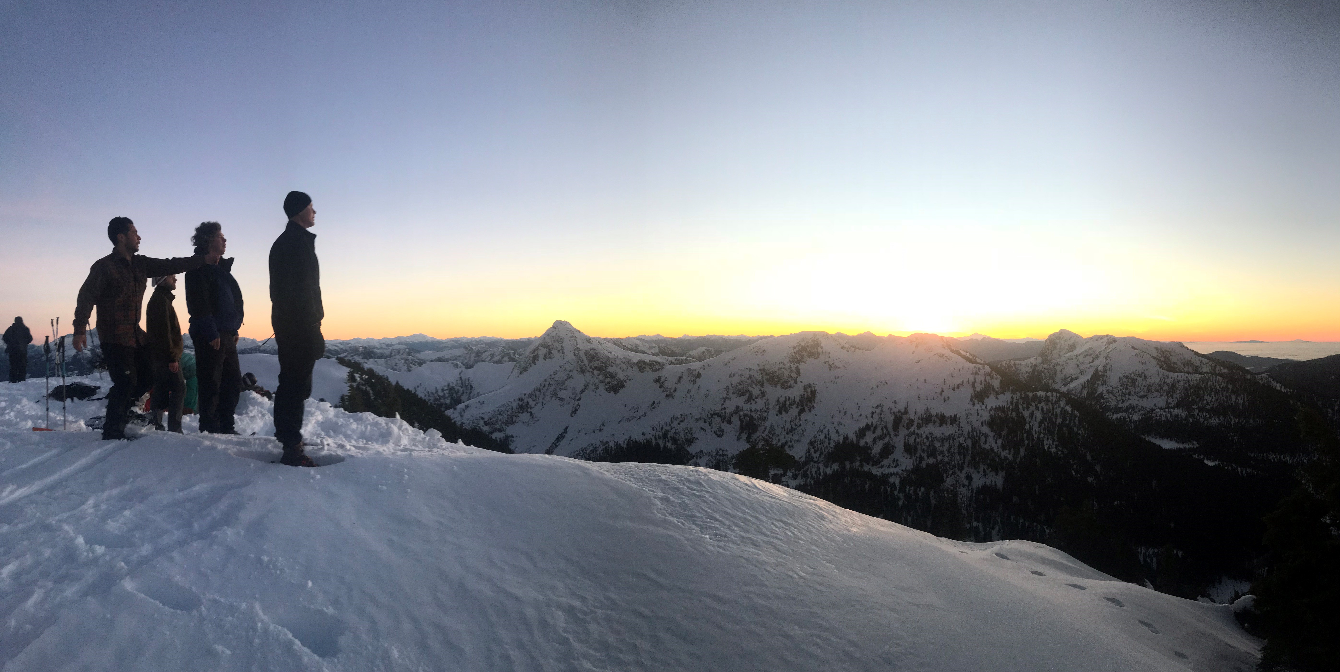
Melissa and Danny are stewards of McNair cabin, visiting about once a month for maintenance and monitoring. (Visitors are asked to clean up after themselves but that doesn’t always mean that they do.) Gerry and his wife Ellen steward Bachelor cabin. In between are Edwards and Steele cabins, each with their own stewards and the latter cabin being the highest, situated at the base of 5,114-foot Mount Steele.
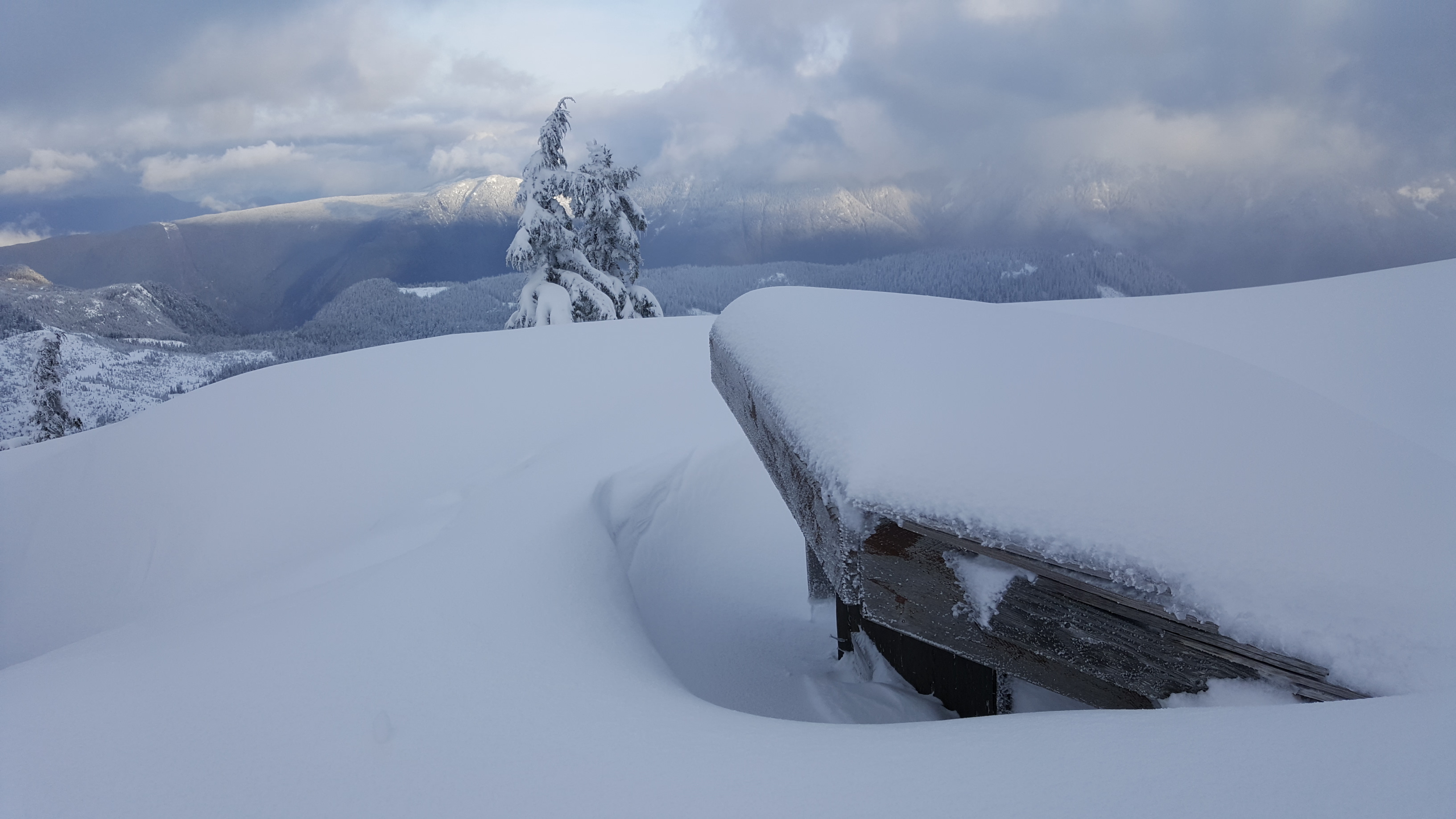

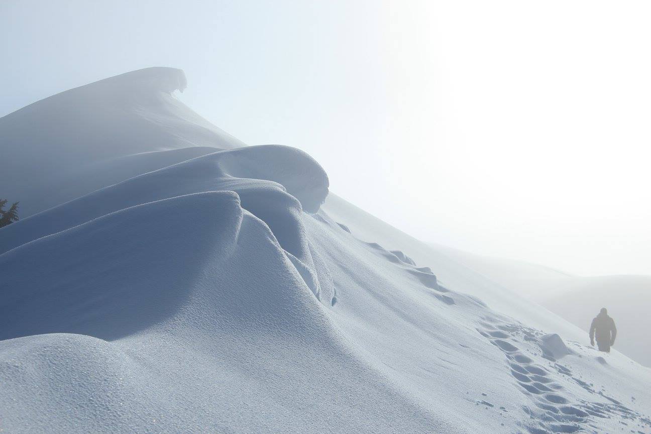
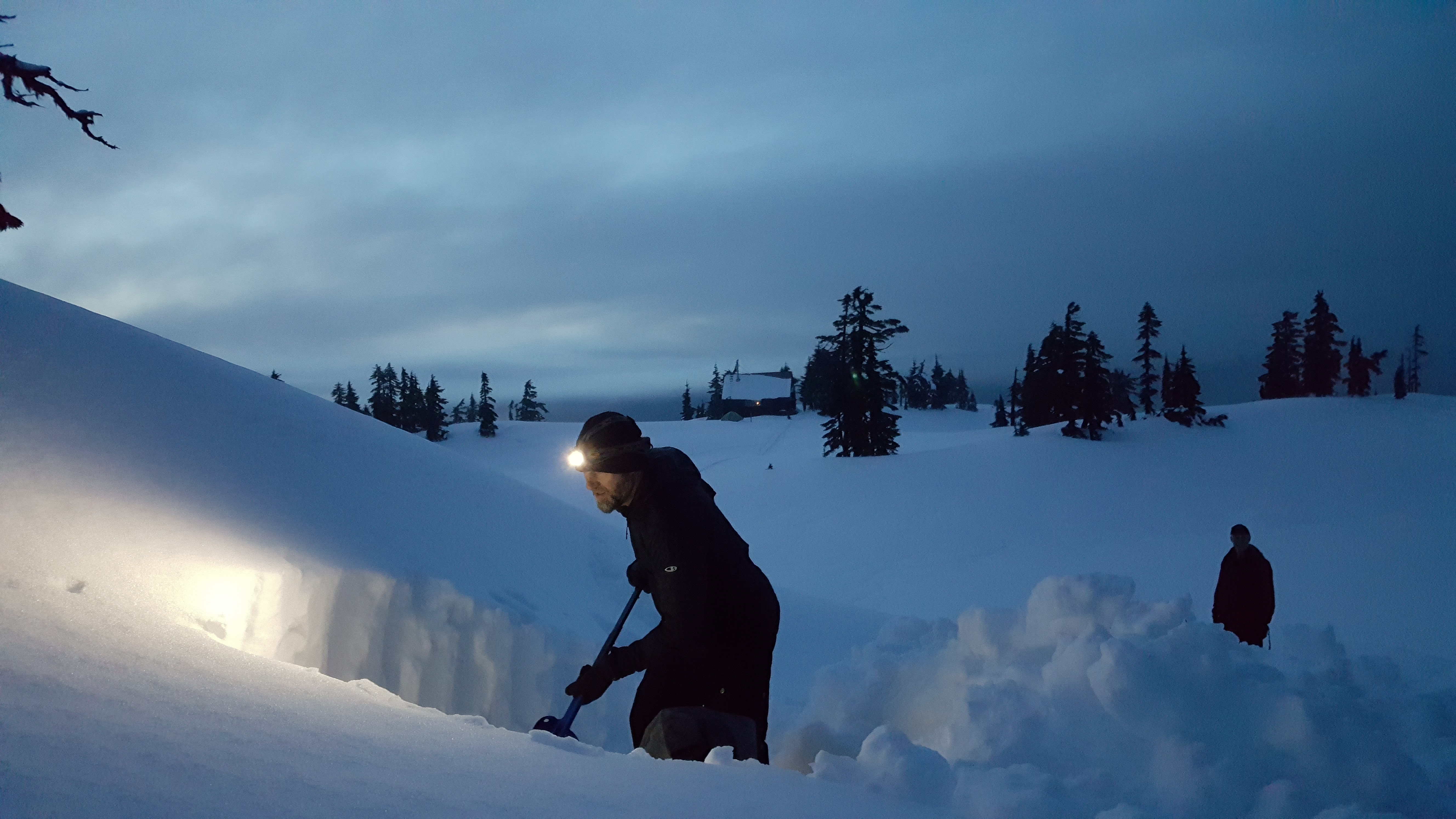
It’s not uncommon to have to dig your way into the Tetrahedron’s cabins and outhouses, especially on Mt. Steele.
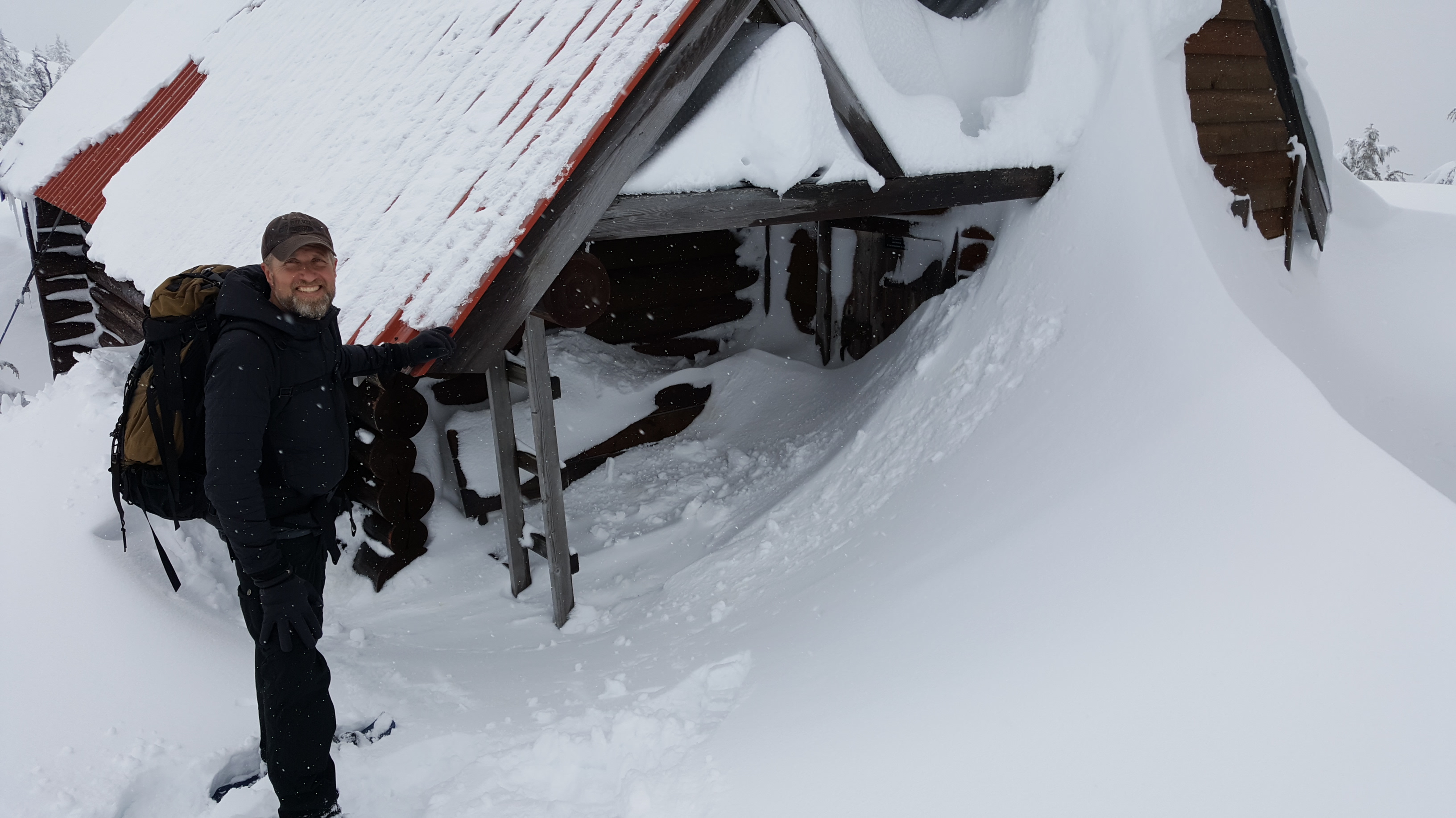
The cabins accommodate 12 to 16 people, are first come, first serve, and are well equipped with mattresses in the attic, firewood in the basement, a kitchen counter and a sink. The wood stove usually has the place toasty warm within an hour.
Panther, Steele and Tetrahedron peaks loom over the park’s 10 lakes and some of the oldest trees in the country. Amabilis fir, mountain and western hemlock, yellow cedar and white pine can all be found here.
For Melissa and Danny, winter in the Tet means fun; summer means work. “It can take a herculean effort by a small number of people to accomplish some of the projects,” says Melissa. “Trail-clearing is never ending.”
(Veteran club member, George Smith, recently spearheaded a new trail to provide day-trippers with a beautiful new winter-touring option past Mayne Lake.)
Nor are the volunteers getting any younger.

“When you look at the group photos from the Steele Creek bridge project, you realize the average age of the volunteers is low-60s,” says Danny. “We need to bring down that average age, not that our volunteers aren’t uniquely capable – there are some extremely hard-working 70+ people. We all love the Tet and are very supportive of each other. There’s never a shortage of camaraderie.”
Funding is also a perennial concern for the club. Snow removal costs between $6,000 and $12,000 a year. Firewood is airlifted to the cabins at a cost of $18,000. Community members donate the wood, which is cut and split by club volunteers. (Visitors building winter bonfires outside of the cabins are a particular source of frustration for the club.) Then there’s cabin maintenance and major projects like the Steele Creek bridge. A bridge will soon be needed across Chapman Creek.

Cabin revenues of $10 to $15 a night help but the club’s major source of income is from the annual Banff Mountain Film Festival held at Elphinstone Secondary School in Gibsons. Tickets are on sale for the February 3 event, (see below for details) which is also a good opportunity to learn more about the club and consider volunteering. Otherwise, the best way to join is online at tetoutdoor.ca.
“We welcome everyone with open arms,” says Gerry. “We moved here in 2016 and were warmly welcomed and encouraged by the club and it still holds true today. The people we have come to know, the friends we’ve made – it’s absolutely awesome!”
Visiting the Tetrahedron
- Four-wheel drive and chains are essential for visiting the Tetrahedron during winter. For more information about conditions, visit the club’s Facebook page.
- For information about the park, visit bcparks.ca/explore/parkpgs/tetrahedron/
- There can be a significant avalanche risk in the park. Before heading out, visit www.avalanche.ca
Banff Mountain Film Festival tickets
Tickets for the Banff Mountain Film Festival, (February 3, 2023 at Elphinstone Secondary School) are available at:
- Alpha Adventures, Wilson Creek
- Elphi Cycles Gibsons and Sechelt outlets
- High Beam Dreams, Gibsons
- Trail Bay Source for Sports, Sechelt
Related stories: Men of Steele and Cabin Fever


Trail and tribulation in Powell River
Make it to the top of Tin Hat Mountain and you will be rewarded with 360-degree views of more than two-dozen lakes. Plus you’re half way to finishing the trail! Photos courtesy Eagle Walz
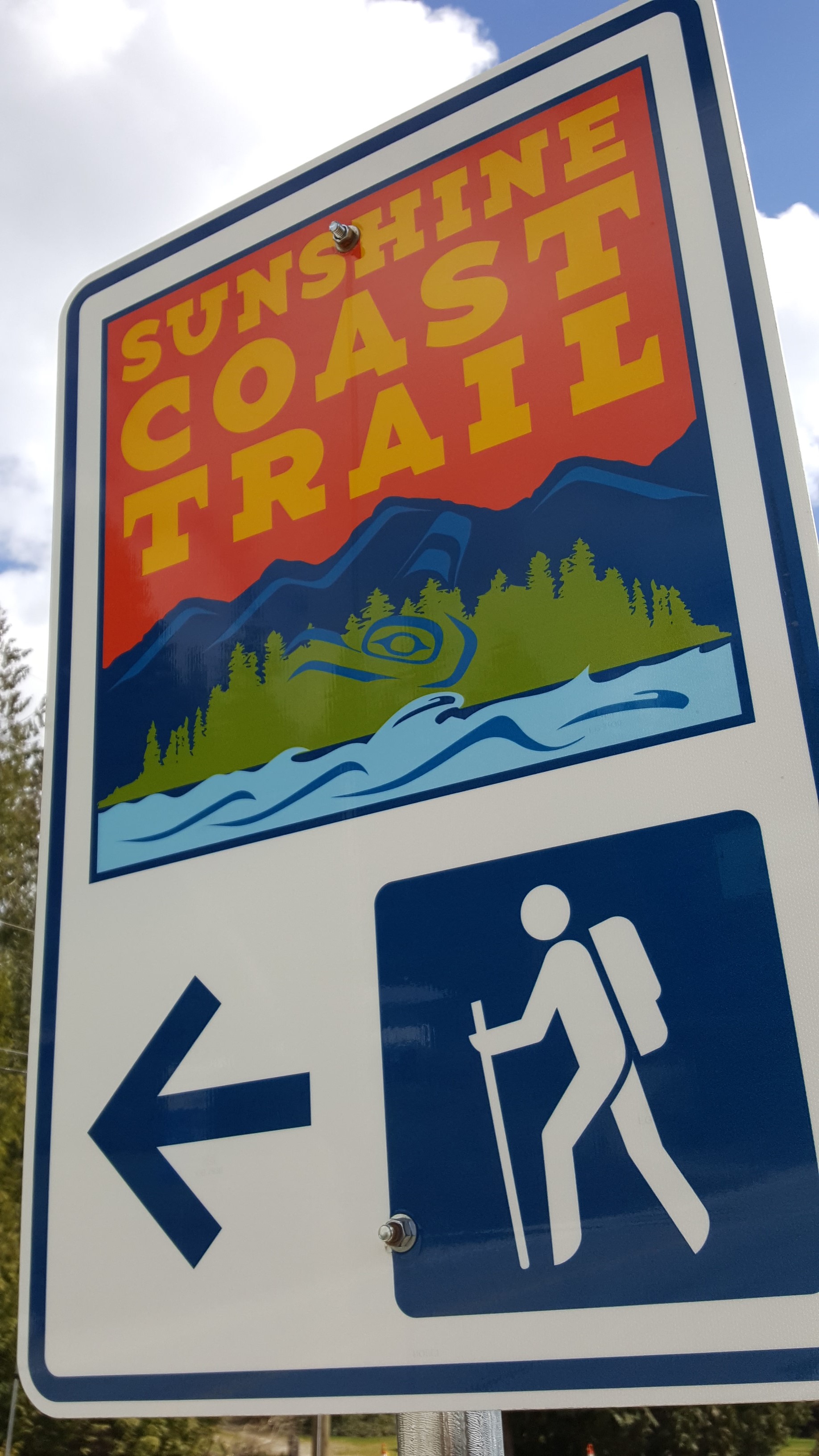
Connecting Sarah Point, near Lund, to the ferry terminal at Saltery Bay, the 180-kilometre Sunshine Coast Trail now ranks among the greatest hiking trails in the world, according to Explore Magazine’s Top-50 list. Not only is it more than twice the length of the West Coast Trail on Vancouver Island, it’s Canada’s longest hut-to-hut hiking trail, and it’s free!
The trail’s mix of old growth forest, mountain peaks and sandy shoreline, attract thousands of visitors from around the world each year. Fifteen beautifully constructed huts en route provide overnight accommodation on a first-come, first-serve basis.
“It’s beginning to be seen as an economic driver in Powell River,” says Eagle Walz. “It’s the biggest recreational tourism resource we have.”
Walz is a trailblazer, one of a handful of outdoor enthusiasts who in 1992 realized that accessible old growth on the Upper Sunshine Coast was fast disappearing. They formed the Powell River Parks and Wilderness Society (PRPAWS), a non-profit committed to setting aside protected areas on a trail sufficiently unique to lure locals and tourists alike.
Eagle Walz in his element, hiking the Sunshine Coast Trail. Walz is a co-founder of the Powell River Parks and Wilderness Society, the non-profit behind the trail’s creation and upkeep.
PRPAWS mobilized volunteer work parties and began connecting the bushwhacked paths, deactivated roads, and disused railway grades left behind by a century of logging. In some places that meant constructing bridges – some 120 feet long – to ford creeks and rivers. They found enduring allies in a group of bloody old men, otherwise known as the BOMB (Bloody Old Men’s Brigade) squad. Comprising mostly retirees, many of whom practiced their trades at Powell River’s paper mill, the BOMB squad helped build bridges and huts, and are still counted upon for help in the trail’s never-ending maintenance.
The first time I interviewed Eagle for a story back in 2000, he was fending off criticism from a variety of sources over liability issues and the environmental concerns about sensitive wildlife areas. Walz and his cohorts had run into a host of jurisdictional challenges, too. Crown forest land, private land owned by logging companies, and Tla’amin Nation land are among the eight jurisdictions through which the trail crosses.
Seventeen years ago, he addressed those questions with a question of his own: “Would the trail have been built if we’d settled all these issues first?”
When I caught up with Eagle earlier this year, that question at least, appeared to have been answered. “You couldn’t start this trail now and try and make this happen,” says Eagle. “But that doesn’t mean the logging companies won’t stop logging. Western Forest Products, with their tree farm licence, they are the biggest interest. We manage to work together and eke out considerations. I only wish it would be a bigger buffer along the trail than we get most of the time.”
That buffer can be from 10 to 30 metres, sometimes more. Occasionally, the trail must be relocated in places. Overall, says Eagle, compromise and varying levels of protection ensure the trail’s viability.
“Our vision is that in 100 years, we’ll have no more logging near the trail,” he says. “It will be designated an old growth trail to be enjoyed by future generations. It needs someone to be the champion for it. We’re hopeful the younger generation will take over and certainly a lot of younger people are using it. People of all ages.”
Perhaps more challenging to PRPAWS is pressure on the trail from non-hikers.
“Mountain biking is very popular here, as it is everywhere else. The pressure is always to turn something into something else. But a multi-use trail wouldn’t have the same appeal as a single-use trail. We’re struggling to remain a hiking trail only because that’s what’s given us the edge in the market place. That’s what is bringing people by the thousands from all over the world to Powell River.”
In the meantime, trail maintenance keeps Eagle busier than ever. Ten years retired as a teacher, Eagle says he has time to enjoy the trail, but it’s usually when he’s part of a work party. The day I call him, he’s about to leave on just such a mission – a five-night trip to Confederation Lake, a steep section of the trail in Inland Lake Park, north of Powell River.

Eagle Walz takes in the view from the hut atop Tin Hat Mountain.
It’s a favourite spot, he says, before adding: “I think usually where I’m working, I like that part the best.” Eagle’s other cherished locations include Tin Hat Mountain with its 360-degree views of more than two-dozen lakes; and Mount Troubridge, popular for its magnificent stands of Douglas fir and yellow-cedar old growth.
When Eagle’s not on the trail, he’s writing about it – though not in the way he might have envisaged in 1972, when he moved to Powell River to write poetry: “I write hundreds and hundreds of emails,” he says in a deadpan voice. “That’s basically the extent of my writing.”
- Visit http://sunshinecoast-trail.com/ for everything you need to know about planning a trip, including the definitive guide to the trail, written by – who else? – Eagle Walz.
Desert delights in Tucson
The pigs attacked shortly after dawn.
The first indication was a dust cloud billowing from the bushes beyond the swimming pool, closely followed by deep, guttural belching.
Javelina pigs are native to the American southwest, extremely shortsighted, and smell like skunk. Perhaps for the last two reasons, they seem to be permanently agitated. Thankfully for us, they were attacking each other in what turned out to be a short-lived domestic dispute.
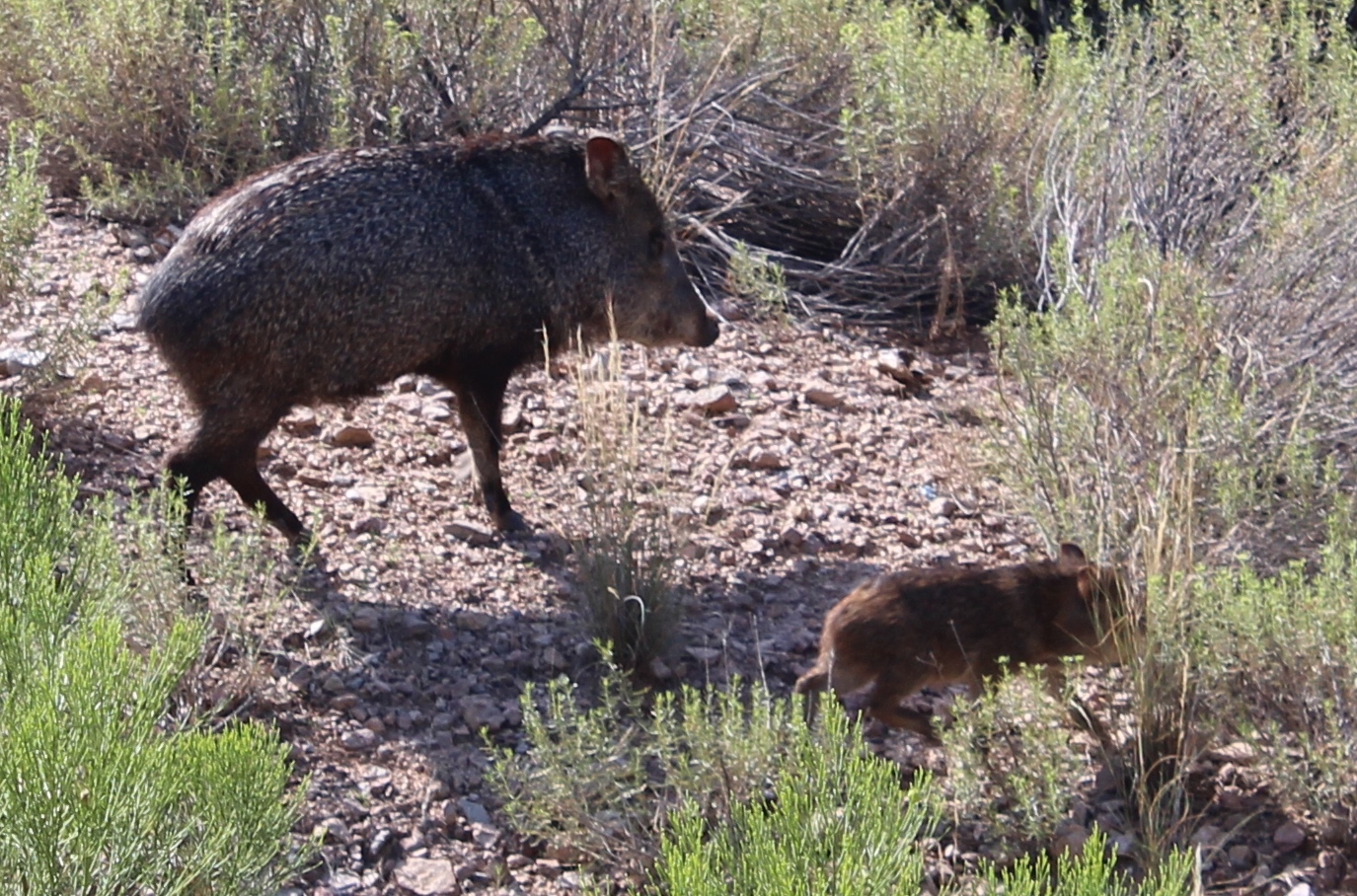
Short-sighted, smelly and agitated – Javelina pigs.
“If they approach you on a trail, they probably can’t see you,” said our guide, Koi. “Make some noise and they’ll go away.”
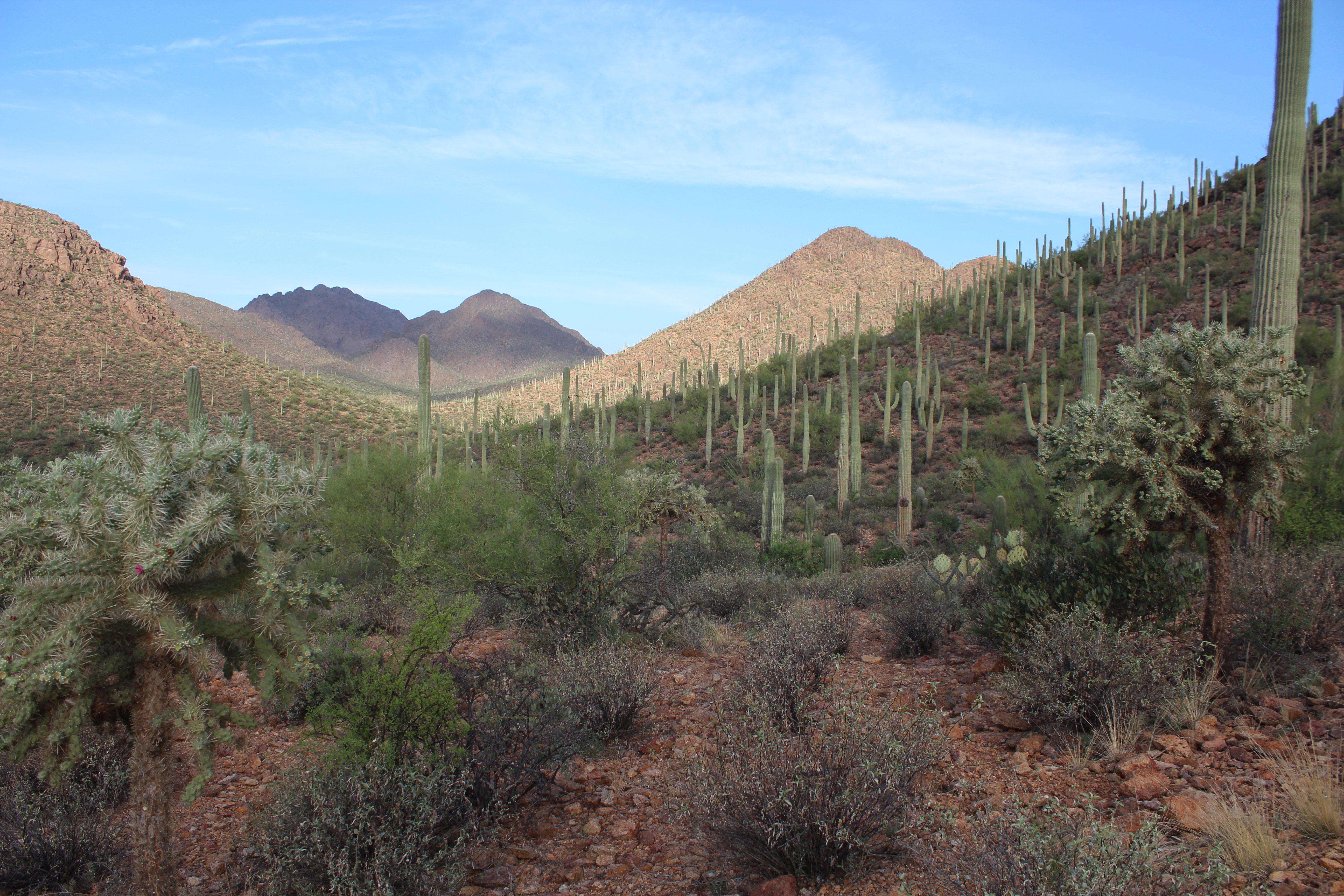
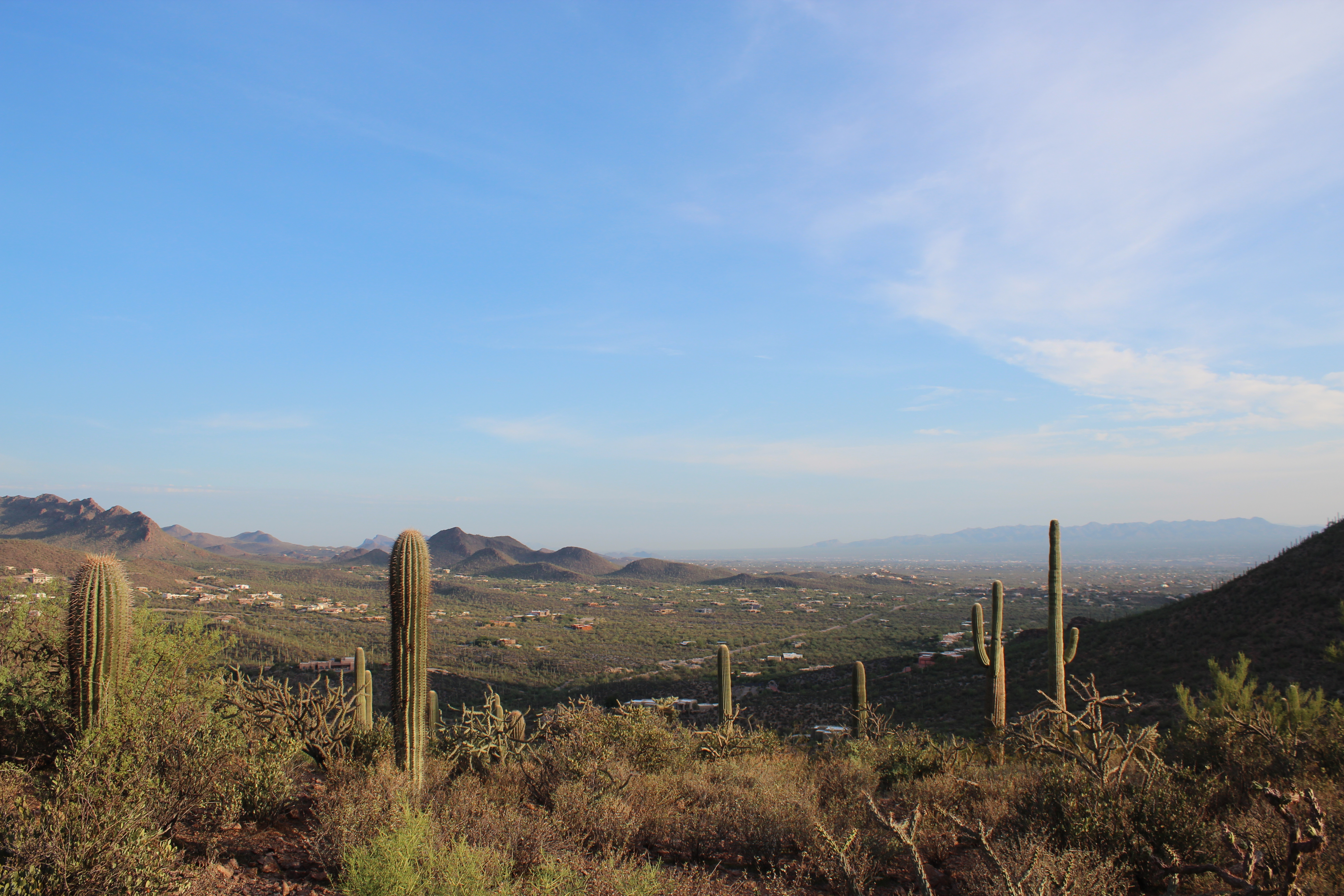
Koi works for Southwest Trekking, a professional guide service that offers guests of the J.W. Marriott Starr Pass Hotel free sunrise walks into Tucson Mountain Park. The 6 a.m. start might hurt a little on vacation, but the reward is a fascinating introduction to the unique landscape of the Sonoran Desert.
This is the only place where the saguaro cactus grows wild and many were blooming thanks to nightly thunderstorms during our late-August visit.
“They’re supposed to bloom in May but something’s going on,” said Koi, who showed us another cactus native to the Sonoran Desert, the so-called jumping cholla. The cholla’s stems are easily detached and love nothing more than to reattach to anyone or anything unlucky enough to be close by. The spines are barbed and extremely painful to remove.
Between Tucson and the Mexican border an hour south, the United States’ only population of jaguars roams. I was OK with not seeing one, but we did see several deer, including a buck.
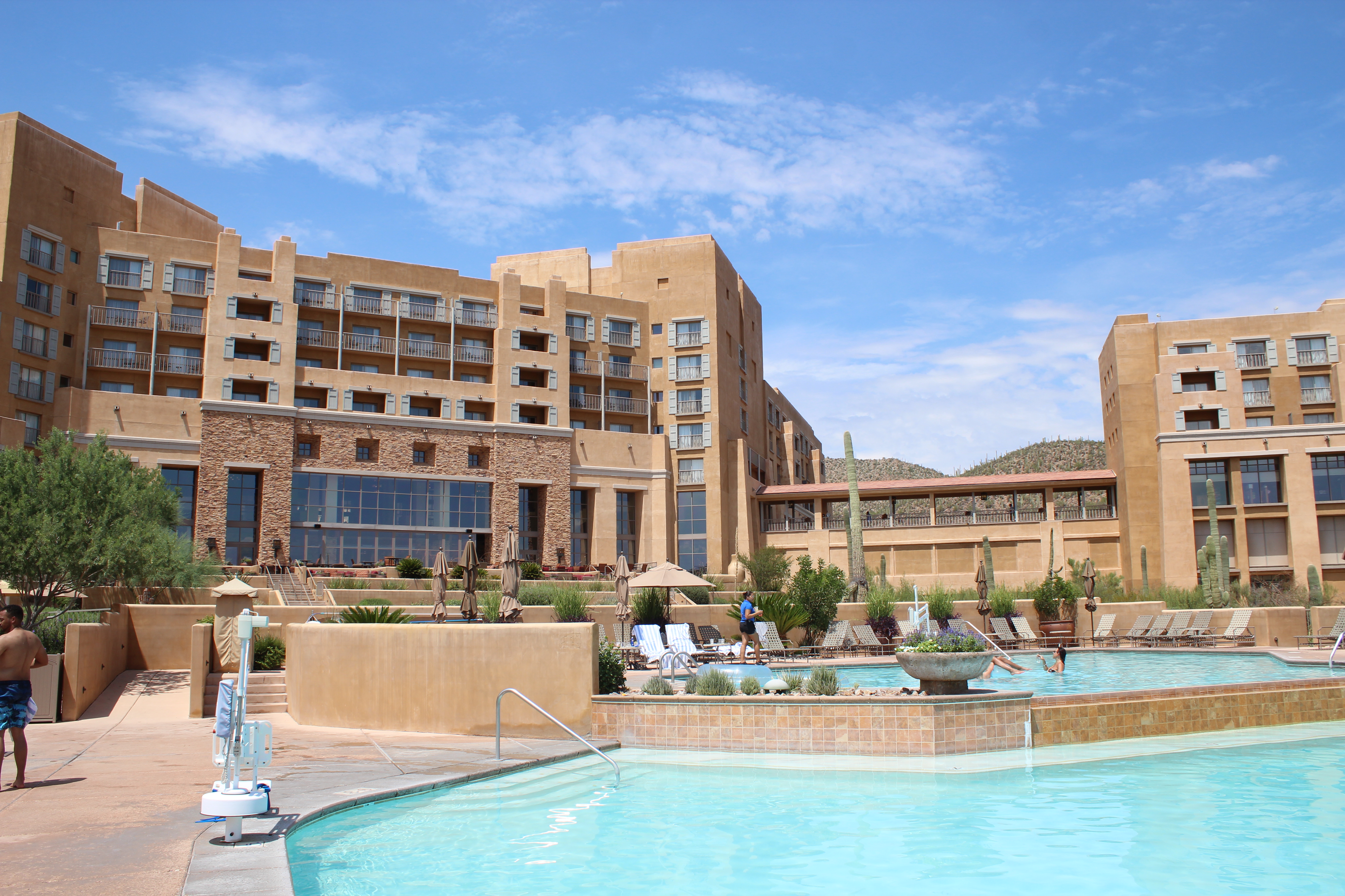
The Marriott Starr Pass: “Too nice,” according to Emma Judd.
Post-hike, we drank coffee on the Marriott terrace overlooking Tucson, a city I visit for business several times a year. This was the first time I’d been able to bring my family and I had a long list of favourite places to show them: Maybe too long.
The first problem was the Marriott Starr Pass. “It’s too nice,” explained my daughter, Emma, as we floated one more time around the hotel’s lazy river in an inflatable. “Why would I want to leave this?”
“There are wild pigs out there,” my wife, Leah, chimed in. My son, Ryan, conceded that he might be willing to get off his sunbed to play golf at Starr Pass Golf Club: in a few hours.
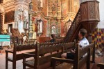
So it was with some coercion, the Judd family arrived at San Xavier del Bac, a Spanish Catholic mission 16 kilometres south of Tucson. When first glimpsed amid dusty farmland from Highway 19, San Xavier del Bac looks like an oasis. Gleaming white with two towers and a cupola, the church is as old as the United States itself and the quintessential example of Spanish colonial architecture.
San Xavier del Bac, a Spanish Catholic mission 16 kilometres south of Tucson.
Enter through the impressive carved mesquite-wood doors and you’ll find the interior is just as dramatic. Candles flicker beneath an eclectic mix of religious devotion: paintings, carvings, statues and frescoes fill the church, which was built between 1783 and 1797 (replacing an earlier version built in 1700). It has since survived earthquakes, lightning strikes, and leaky walls, and continues to host daily mass.
We lingered in the pews before heading outside to buy sweet Indian fry bread from a vendor in the car park. We walked it off by climbing Grotto Hill, a short walk from the church and the best place to snap panoramic shots.
No one seemed in a rush to get back to the lazy river. We we’re on a roll, so we headed east to the Pima Air and Space Museum. You’d need several days to fully explore the museum’s 80 acres inside and out. And I needed several hours to sort through the 500 photos I took there. Center-stage in the museum’s main hangar is the Lockheed Blackbird, a plane that will evoke childhood memories for anyone who grew up in the 70s playing the card game, Top Trumps. In the aircraft issue of Top Trumps, Blackbird was a virtually unbeatable card. It flew from New York to London in less than two hours, and from Los Angeles to Washington DC in 64 minutes. Nothing could touch it for speed (2,193 mph) and cruising altitude (85,069 feet).
One of the 500 photos I took at the Pima Air and Space Museum.
Just a few feet from Blackbird is the Bede BD-5 Micro-Jet, which appeared in the 1983 James Bond film, Octopussy. Almost 13 feet long, the BD-5 was apparently sold in kit form but proved to be beyond the abilities of most homebuilders to complete. (Presumably it wasn’t flown much.)
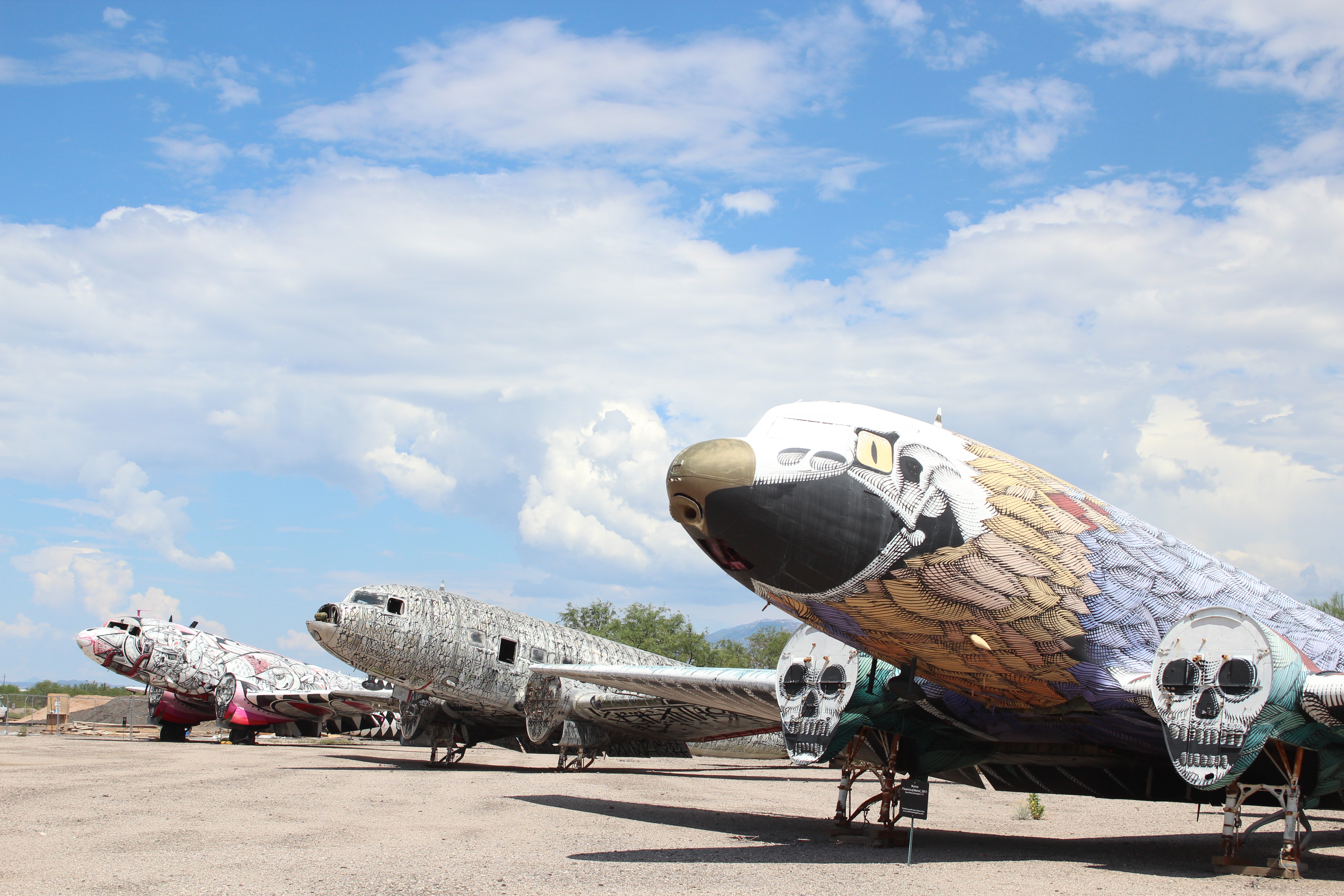
There’s much to keep you indoors at the museum, and not just the air conditioning. Several exhibitions pay tribute to space travel and World War II, but the huge variety of planes outside on the tarmac were worth braving 40-degree heat to see. Besides behemoths like the Boeing B52 collection and oddities like Aero Spacelines’ Super Guppy (which looks like it should be in an aquarium or a cartoon), there are planes displaying from nose to tail the work of acclaimed street artists and mural designers.
I refused to allow the family back to the hotel until we’d visited my favourite place to eat in Tucson, the Guadalajara Grill on Prince Street. Hand-made tortillas, salsa prepared table-side, a roaming mariachi band, and fresh margaritas served in glasses the size of fish bowls – the Guadalajara Grill by itself is worth visiting Tucson for: Especially if you don’t have to go to work the next morning.
Good morning Tucson!
Back at the Marriott the next day, the male half of the family followed in the footsteps of Arnold Palmer and Phil Mickelson at the Starr Pass Golf Club. Golf is a huge lure for Tucson visitors, with the city boasting numerous award-winning courses. Many of them cut their prices on mid-summer afternoons for those willing to bear Arizona’s heat. (Tucson is drier and generally a few degrees cooler than Phoenix, 90 minutes’ drive north.)
Starr Pass is no exception. The club features 27 holes divided into three nines played in three different 18-hole combinations. We played the Roadrunner nine, the club’s shortest circuit, which was just as well, having lost all our original balls by Hole 8. The afternoon thunder clouds seemed to be beckoning us inside and at the first sign of forked lightning, we called it a day.
That evening we ventured downtown to Reilly, which combines pizza and craft beer in a century-old building that used to house a mortuary and funeral home. Any morbid thoughts were soon banished by parm truffle fries, roasted crimini mushroom pizza, and Brussel sprouts in sherry, hot sauce and pecan brittle crumbs. Reilly epitomizes the resurgence of Tucson’s downtown, which features numerous bars and restaurants with inventive menus in historic premises restored to former glory. Perhaps the classiest of them all is the Hotel Congress, built in 1919, and now a thriving music venue, as well as housing a restaurant and bar.

Hotel Congress, built in 1919, and now a thriving music venue, as well as housing a restaurant and bar.
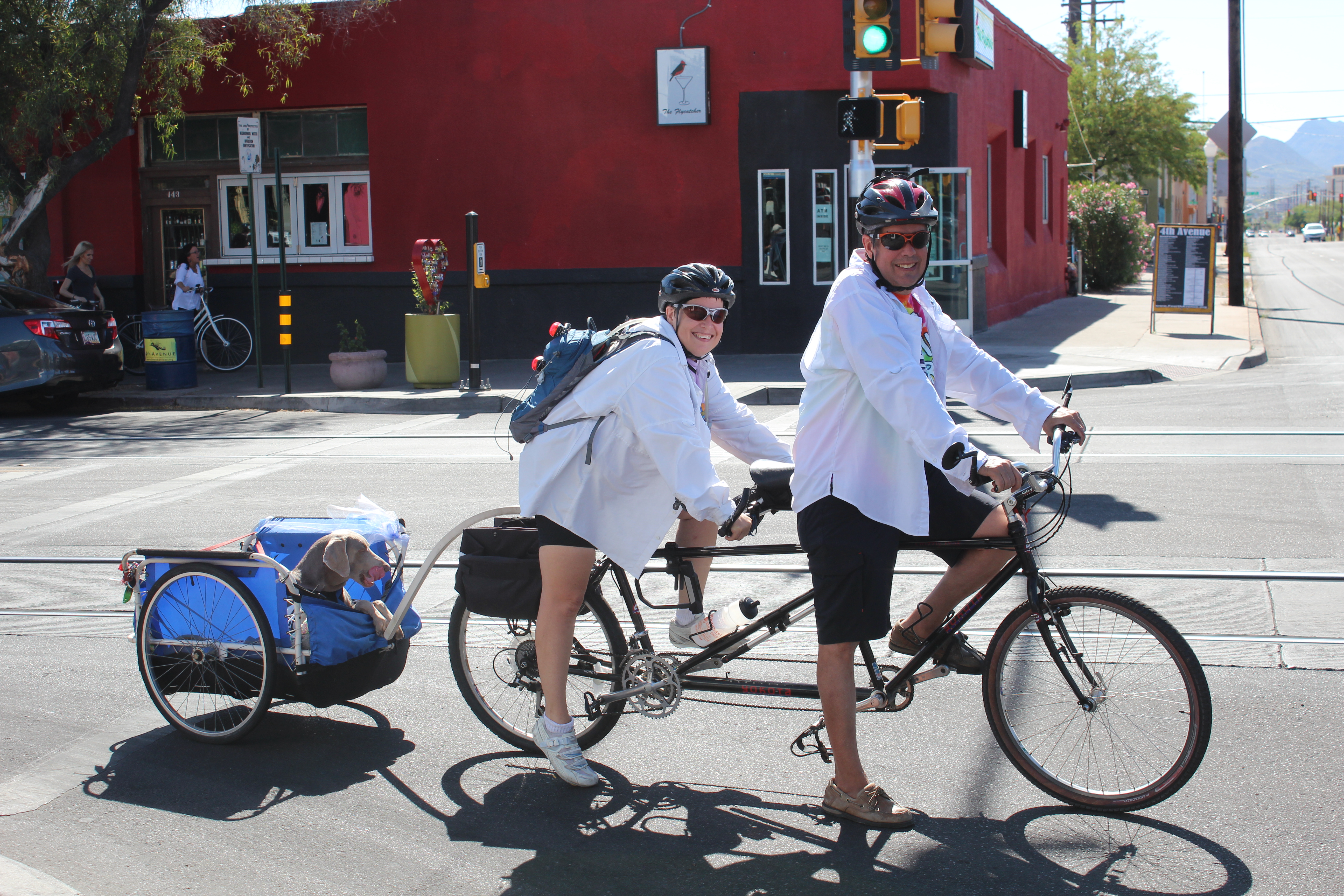
A great way to see downtown and learn some of its history is by bicycle with guide, Jimmy Bultman, who runs Tucson Bike Tours. Dive bars, food trucks, a pinball arcade and downtown’s historic neighbourhoods feature in the sunset tour, which I did in April. I enjoyed it so much I rented a bike and covered much of the same ground by myself the very next day.
Jimmy turns kayak guide elsewhere during Tucson’s summer months, but he’s back now. The city is home to a growing bicycle network, including The Loop – more than 100 miles of trail shared with skaters, joggers and horse riders. In the foothills and mountains beyond the city is an extensive network of mountain bike trails.
And for the ultimate in relaxation, there’s always the lazy river at the Marriott Starr Pass. Just give the pigs a wide berth.
If you go:
- Marriott Starr Pass offers deals starting at $129 a night. Visit marriott.com/hotels or call +1-520-792-3500.
- For more on the Pima Air and Space Museum, visit pimaair.org
- Details of Jimmy Bultman’s bicycle tours are at tucsonbiketours.com
- Desert hiking and biking tours are available through Southwest Trekking at swtrekking.com
- visittucson.org is a good resource for anyone planning a visit to the city.
-
-


It was already late December
When I found the time to write
I was going to do it in November
But ‘going to’ became ‘might’

Too busy staging cat selfies to write … until now!
Now the pressure’s on
Another deadline, I fear
The hours have all but gone
And 2016 is drawing near
The graduates
2015 was fast
It didn’t walk, it ran
But one memory that will last
Our boy became a man

A fart joke never gets old.
Ryan finished school
With a vision to refine
And ever since the Fall
He’s been studying design

Ferring’s travelling A-Team.
He got to share 18
With guests from far away
Ferring’s travelling A-Team
Nan and Grandad came to stay

Birthday boys. 102 candles between them! You do the math.
He still can’t get a beer
19’s the age to be
But that’s another year
So he bought a fake ID!
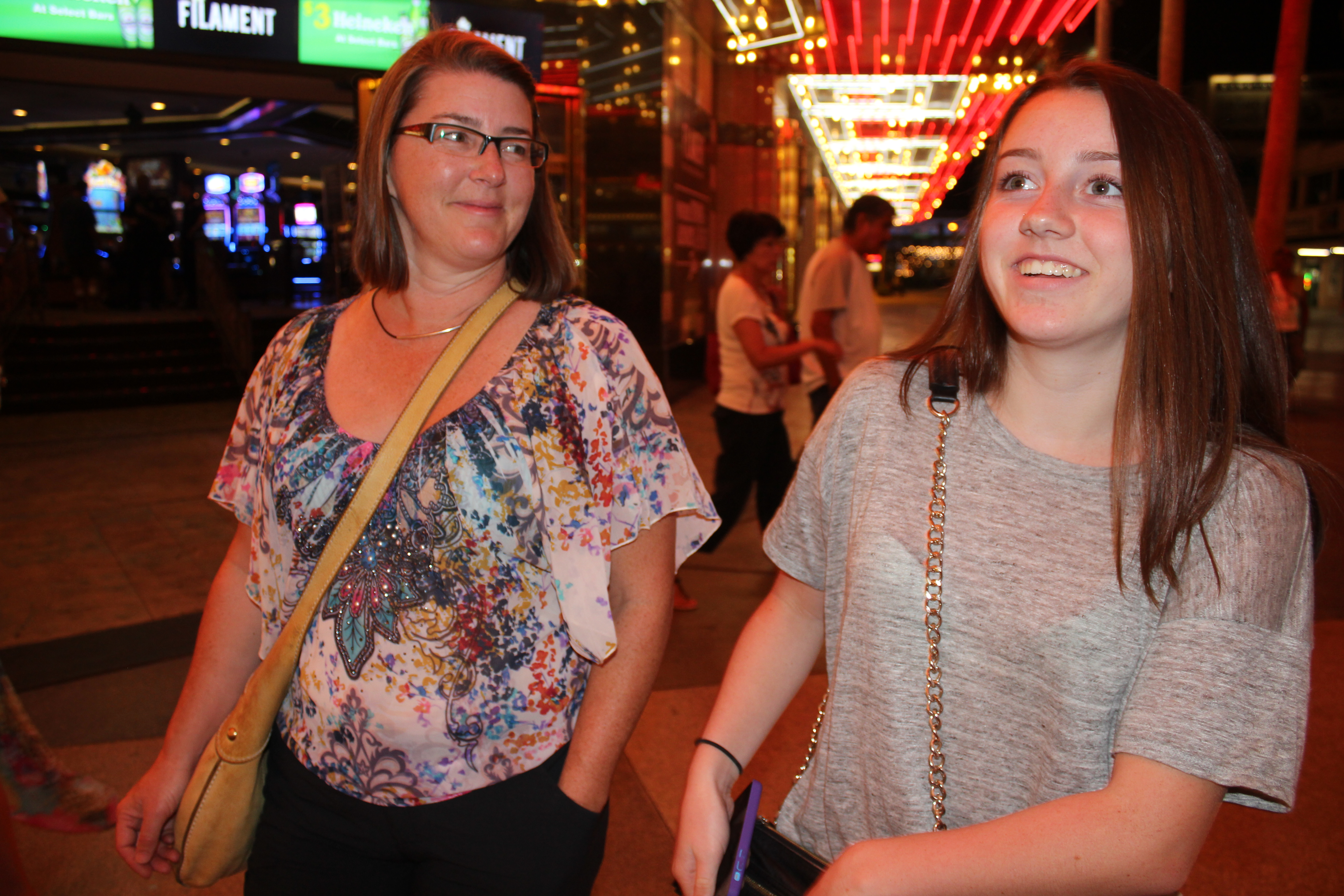
Our summer was so hot, we went to … Las Vegas.
We sweltered in summer heat
And here the forests burned
The grass died beneath our feet
But the rains have since returned

Taking no chances with Emma’s first driving lesson.
Emma learned to drive
Now she wants a car
But her savings took a dive
When she travelled to afar
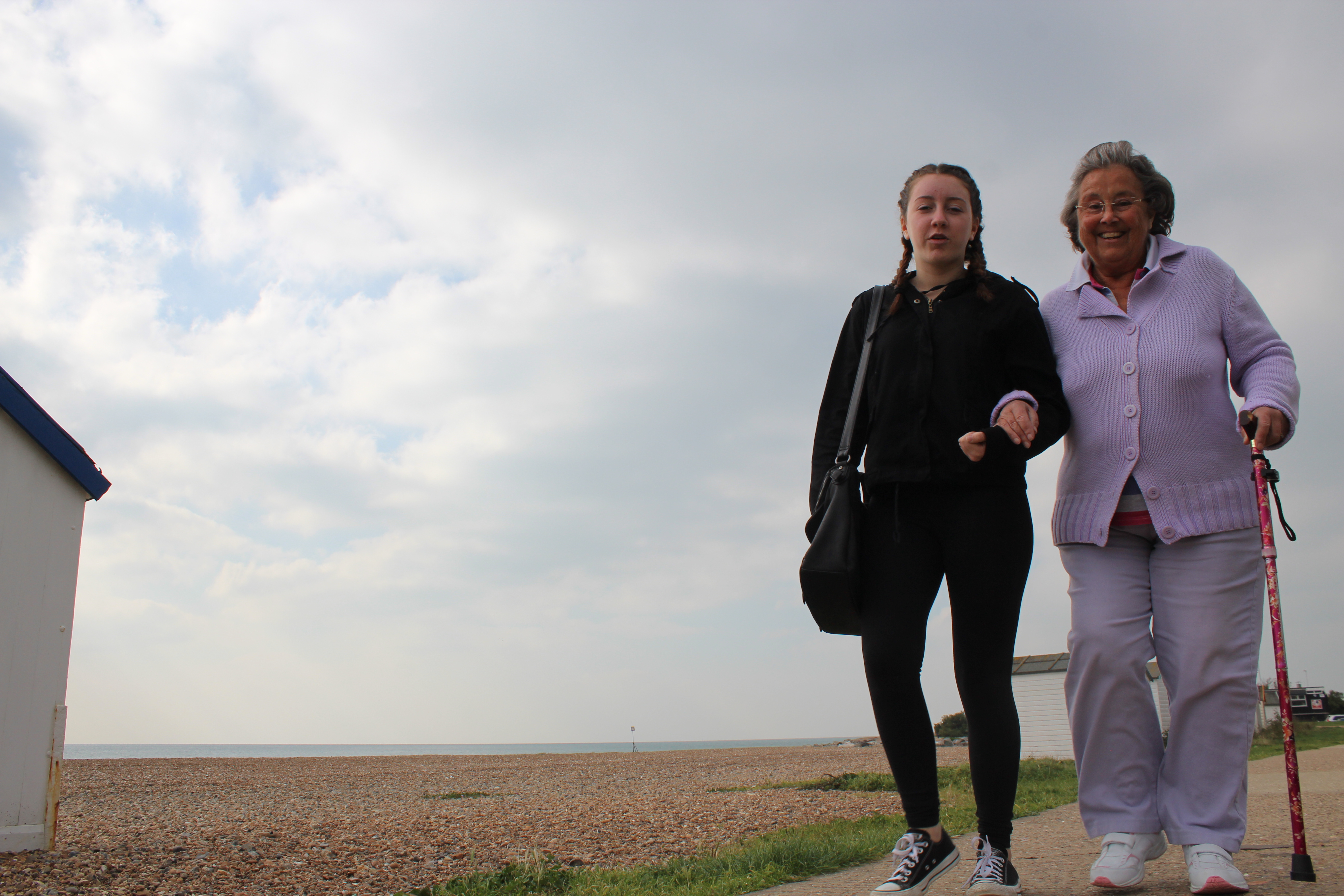
Walkies with Nanny.
Two weeks in the UK
Emma got spoiled rotten
So much packed into each day
Will not soon be forgotten

Just push a little harder!
London shopping, up the Shard
The Thames and fun upon the river
The set of Harry Potter starred
Butter Beer and no damage to her liver
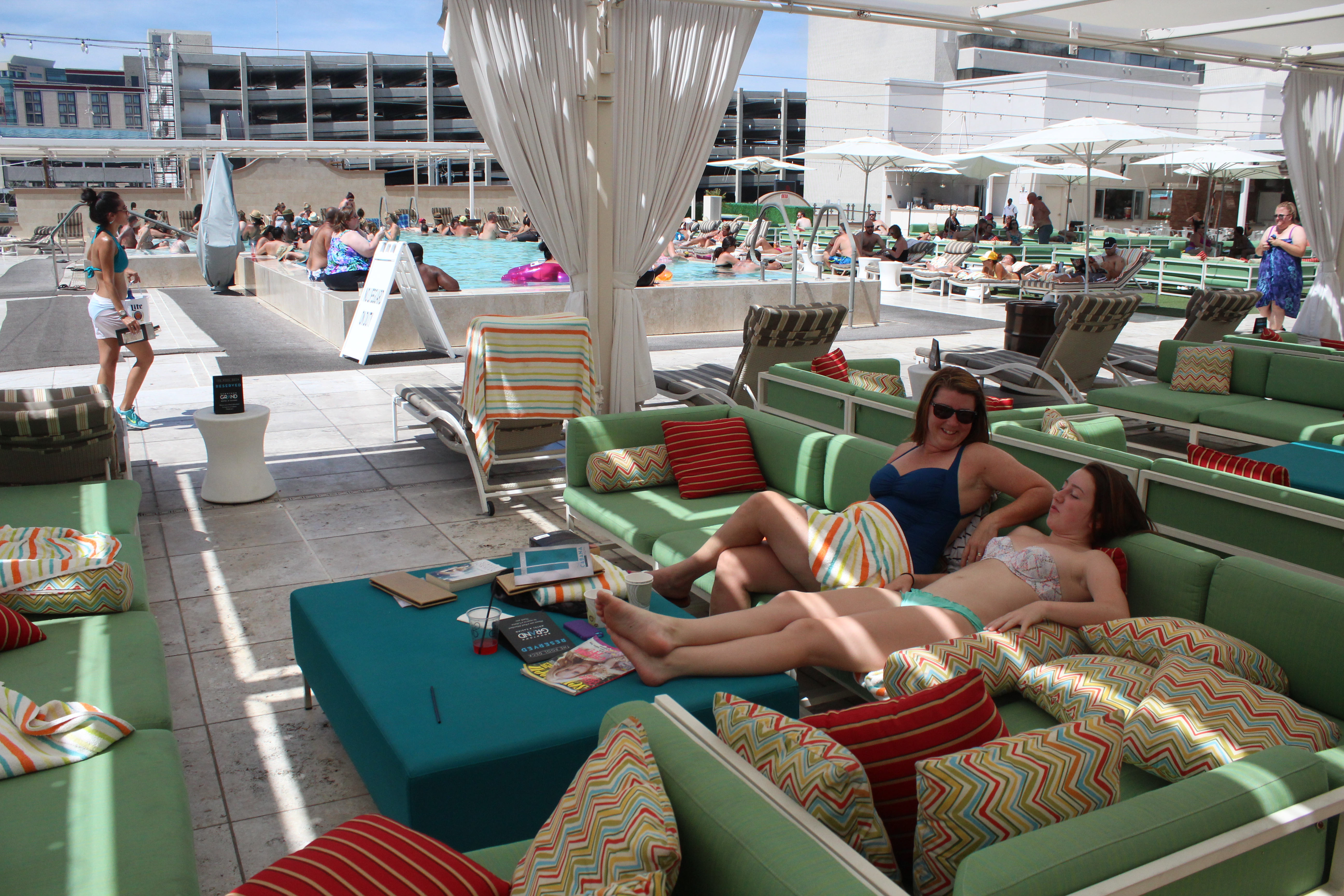
Up on the roof of the Downtown Grand in a cabana by the infinity pool. Like bosses.
We visited the U.S.
Despite our dollar in a slump
We like it in the U.S.
Despite that tosser Trump

Can’t even go to my bedroom without Donald Trump showing up … tosser.
There’s other stuff we did
But I’m running out of time
It’s best goodbyes are bid
And I post this up online
-
- Don’t try this at home.
-

- Cheers!
-
- “I’m warning you, Neville.”
-
- #Ferda
-

- Young guns/old gits.
-
- Worth a one hour drive.
-
- Ryan and Sylvester overcome by the emotion of Emma’s first day back at school.
-
- Judds on tour.
-

- Kids these days.
-
- The hills are alive.
-
- One-hour uphill to see the rare pink dolphins of the South China Sea.
-

- Wookie!
-

- Lovely ladies
-

- You probably had to be there.
So be well this joyful season
It’s time for me to go
If for joy you need a reason
Here’s a picture of J. Trudeau.

You’re welcome ladies.
Summer in Whistler begins at the lake
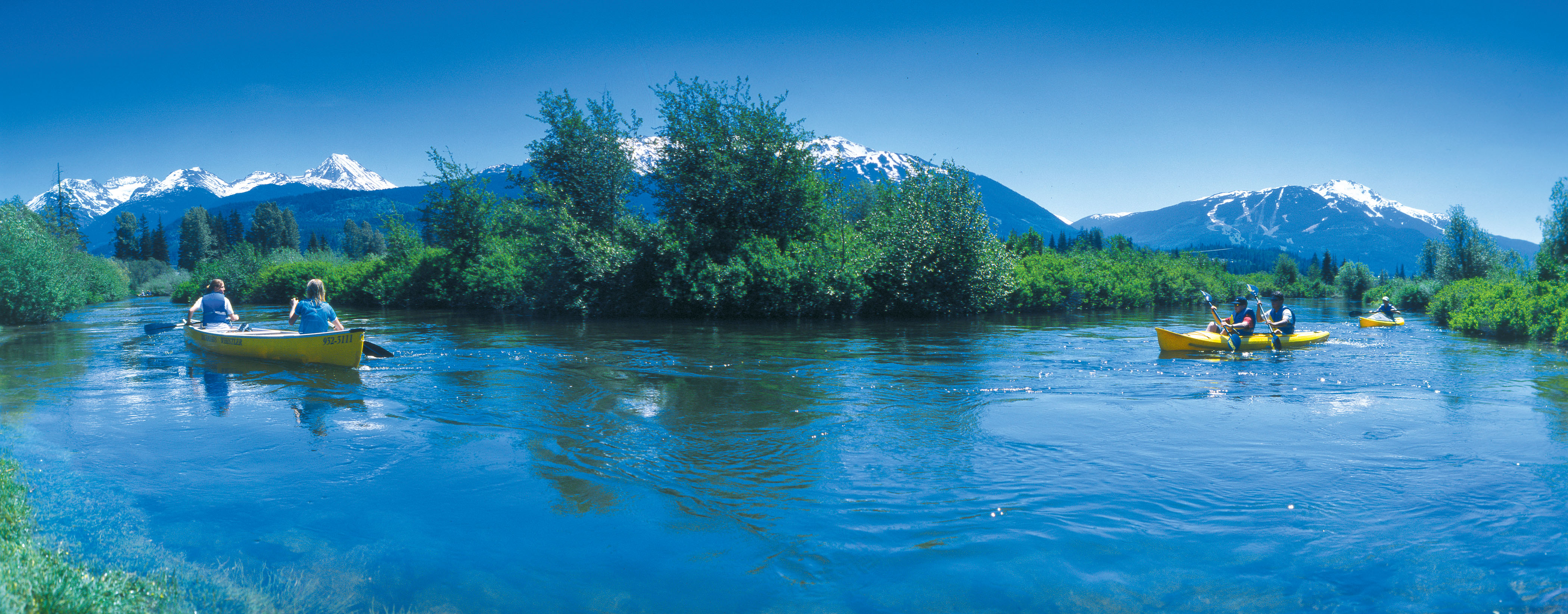
The River of Golden Dreams is an idyllic waterway for a quiet paddle … unless you find yourself in the middle of Whistler’s annual Go Fest and the Great Snow-Earth-Water Race. riverofgoldendreams.com photo
A quiet meander down the River of Golden Dreams, I’d promised my wife. After 36 hours of skiing, cycling, trail running, stand-up paddle boarding, dancing, eating and drinking, this would be a relaxing canoe cruise in the sunshine, a chance to mellow ourselves from weekend warriors to weekend wanderers.
It didn’t work out that way.
We’d come for Whistler’s Great Outdoors Festival, aka GO Fest. Held on the Victoria Day long weekend, GO Fest was the chance to cram an entire Whistler summer of activities into four days. A packed schedule had offered everything from fly-fishing to disc golf, river rafting to yoga, and much in between that involved wearing a silly costume.
By Sunday, my legs were aching from Saturday-night’s AlpenGlow Fun Run, a six-kilometre jog around Lost Lake, while wearing glow sticks. Or they might have ached from skiing Blackcomb’s Seventh Heaven all day; or from jumping up and down to The Sheepdogs during Friday night’s concert in the village.

The River of Golden Dreams connects Alta Lake and Green Lake. riverofgoldendreams.com photo
Cycling Whistler’s Valley Trail on Sunday morning, we stopped at Lakeside Park where we met Eric White of Backroads Whistler. When he told us about paddling the River of Golden Dreams, the timing seemed perfect: No pressure to perform; tranquility now. Backroads Whistler even picks you up at the end of the two- to three-hour paddle.
“People were coming here for the lakes long before the skiing,” Eric pointed out. “I think you’ll really enjoy it.”
To get our sea legs we warmed up with a stand-up paddle boarding session. Stand-up paddle boarding, or SUP, has taken off in recent years and it’s easy to see why. Not unlike snowshoeing, SUP offers a short learning curve and gets you closer to the elements. It can be as relaxing or as strenuous as you want. Eric gave us a quick tutorial on the dock and we were off.

Pasty Englishman attempts balance feat on stand-up paddle board!
The Kahuna boards designed by Whistler local, Steve Legge, were exceptionally stable, despite my initial fears of falling. (The lake ice broke just a month before!) It only took a couple of lengths between Lakeside’s docks for it to begin to feel like a core workout.
Now acclimatized to the occasional gusts picking up on Alta Lake, we paddled to shore for a new vessel.
Backroads offers kayaks and double kayaks but we opted for a two-person canoe. The canoe requires smooth communication between paddlers to navigate the notoriously tight corners of the River of Golden Dreams.
It’s also known as “The Divorce Boat,” according to Eric.
“We’ve only been married 23 years, what could possibly go wrong?” I asked my wife.
The River of Golden Dreams connects Alta Lake with Green Lake about three kilometres north. Because of its stubborn refusal to follow a straight line, the river’s full length is closer to five kilometres. In places, the river is barely wider than a canoe and portaging is sometimes necessary, depending on water levels, which can fluctuate rapidly depending on rain and snow melt.
After a quick paddling tutorial, we donned our lifejackets and set sail. Within 15 minutes we’d crossed Alta Lake and were nearing the mouth of the river. That’s when I noticed people waving at us from a bridge. Seconds later we heard a siren – the kind that’s normally accompanied by a loud voice shouting “release the hounds”.
“Why are those people waving at us?” asked my wife from the bow.

riverofgoldendreams.com photo
The answer appeared over our left shoulders: canoeists, two to a boat and wearing helmets and numbered pinnies, launching from a nearby beach and paddling straight for us. Unsure whether the people on the bridge were waving us in or away, we opted to paddle for the river, full steam ahead.
At the bridge we made two discoveries. The first was that we’d need to portage a few yards because we’d arrived at a weir. The second was that we’d unwittingly joined a pivotal leg in GO Fest’s Great Snow-Earth-Water Race – a grueling six-stage competition involving skiing, biking, running and canoeing.
“We’re expecting two dozen canoes through here,” a young man with a radio told us. “You might want to sit out and let them through.”
It occurred to me that on a narrow, winding river with few passing lanes and a head start, we could actually try and win the race. Then my wife reminded me that this was supposed to be a cruise. She also said something about ethics.
So for 20 minutes we perched at a picnic table and watched contestants portage their canoes around the weir and back into the river, cheered on by locals. When everyone had passed us, we re-launched and quickly learned to adapt to the river’s ever-changing moods: turn too tightly and fast eddies would pull us into the reeds; lose concentration and we’d find ourselves turning sideways to the current.
But the lush wetlands and snowy peaks beyond the banks made up for the occasional brushes with low branches. Better yet, during the course of our 90-minute paddle we became minor celebrities to those who had turned out to cheer on the racers. Everyone loves plucky losers and despite not wearing race pinnies, we were assumed by many to be the last-place finishers in the canoe stage of the Great Snow-Earth-Water Race.
I still think we probably could have won it!
The River of Golden of Golden Dreams (Backroads Whistler – riverofgoldendreams.com or 604 932-3111) is just one of a multitude of adventures awaiting visitors to Whistler this summer. Here are five more.

Several runs atop Blackcomb and the Horstman Glacier are open for skiing and boarding until late July.
Hit the Valley Trail: For a better perspective on Whistler’s surroundings get out of the village and onto the Whistler Valley Trail. More than 40 kilometres of paved trail and boardwalks connect Whistler’s lakes, parks and neighbourhoods. The trail is suitable for bikes, rollerbladers, joggers, walkers and well-behaved pets. Whistler.com offers more information on making the most of the Valley Trail, including a blog on the trail’s “six perfect spots”.
Shred the Park: Valley Trail offers a benign cycling experience and cross-country cyclists will find more than 500 kilometres miles of single track around Whistler. The Whistler Bike Park though condenses the best of Whistler’s downhill for all levels of mountain biker. Ride the lift up and take your pick of alpine view trails, banked cruisers through the forest, tight, winding single track and – for the experts – steep rock faces. Whistler Bike Park offers numerous ticket deals, including some with rentals, and accommodation packages. More information is at whistlerblackcomb.com.

Buckle up and ride the Elaho! Eric Beckstead photo
Ride the river(s): If paddling the River of Golden Dreams is too tame for you, consider whitewater rafting either of the Green, Lower Cheakamus, Elaho or Squamish rivers. A range of half-day and full-day tours are available from Whistler, (whistler.com/rafting) or from the Sunwolf Centre in Brackendale near Squamish (sunwolf.net/rafting).
Fly by the seat of your pants! The most exciting thing I’ve ever done in Whistler is ziplining at Cougar Mountain, just north of Whistler. Superfly Ziplines (superflyziplines.com) runs Canada’s longest, fastest, highest ziplines where speeds of more than 100 km/h are made possible by runs well over a kilometer long, 200 metres off the ground. Strap into a paragliding-style harness, attach to half an inch of galvanized steel with a trolley rig and prepare to fly! Ziptrek Ecotours (ziptrek.com) combines similar thrills above Fitzsimmons Creek with a strong environmental ethos.

Ziplining at Cougar Mountain, just north of Whistler.
Ski in a T-shirt: For all the great winter skiing at Whistler, the novelty of descending Horstman Glacier while wearing a T-shirt in July is hard to beat. Until late July, two or three runs, plus the terrain park remain open atop Blackcomb where lunch on the deck of the Horstman Hut is a must.
* For details of summer accommodation packages, visit fourseasonswhistler.com

Las Vegas: The beaten track and the single track
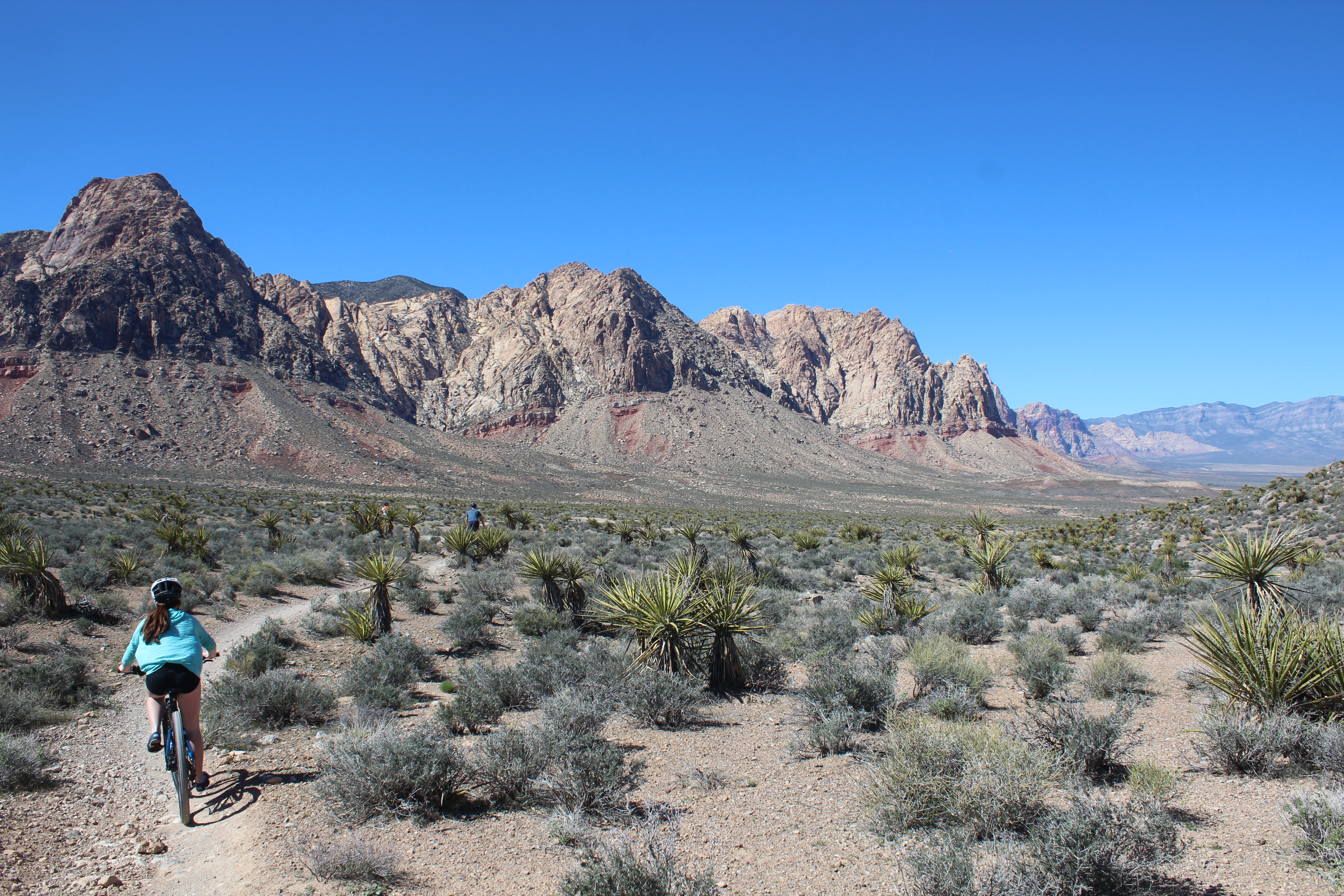
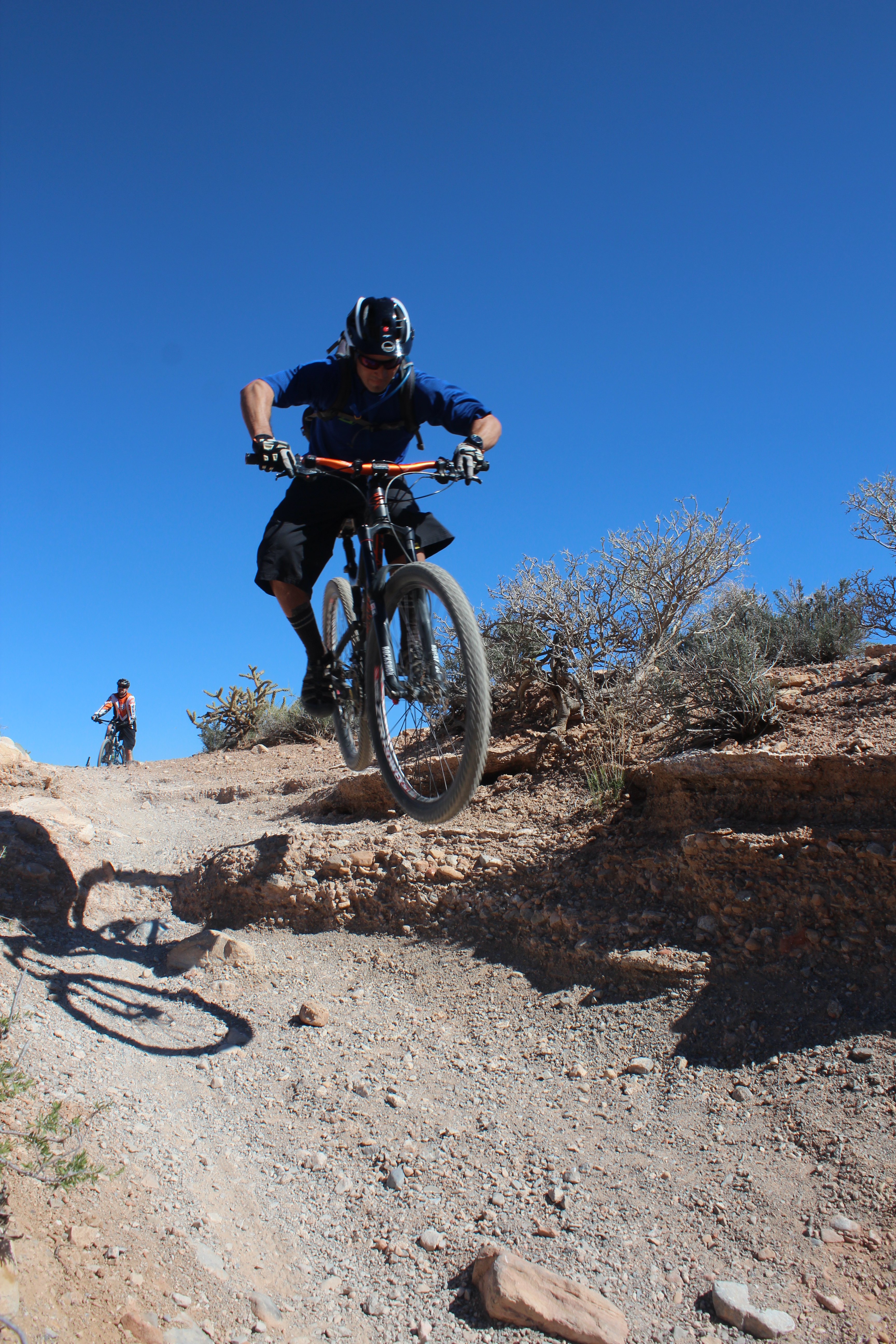
For a city synonymous with late nights, Late Night Trailhead just outside of Las Vegas is decidedly different. There are no buildings besides an outhouse, no meandering pedestrians or neon, and certainly no noise. Instead you’ll find about 200,000 acres of desert known as Red Rock Canyon, home to tarantulas, rattlesnakes, burros, bunnies and wild vegetation that can either harm or cure you.
More than 80 miles of trails lure another desert creature, namely the mountain biker – about 2,000 of them locally, according to Brandon Brizzolara. Brizzolara is a guide and mountain bike specialist for Escape Adventures and Las Vegas Cyclery. He grew up in Vegas and fondly remembers when even The Strip had its own biking scene.
“From Tropicana to Fremont we’d have BMX sessions on The Strip like it was a skate park in the 90s,” he says. “Vegas is a pretty active community, it’s just The Strip that’s a little out of shape.”
Brandon Brizzolara, guide and mountain bike specialist for Escape Adventures and Las Vegas Cyclery.
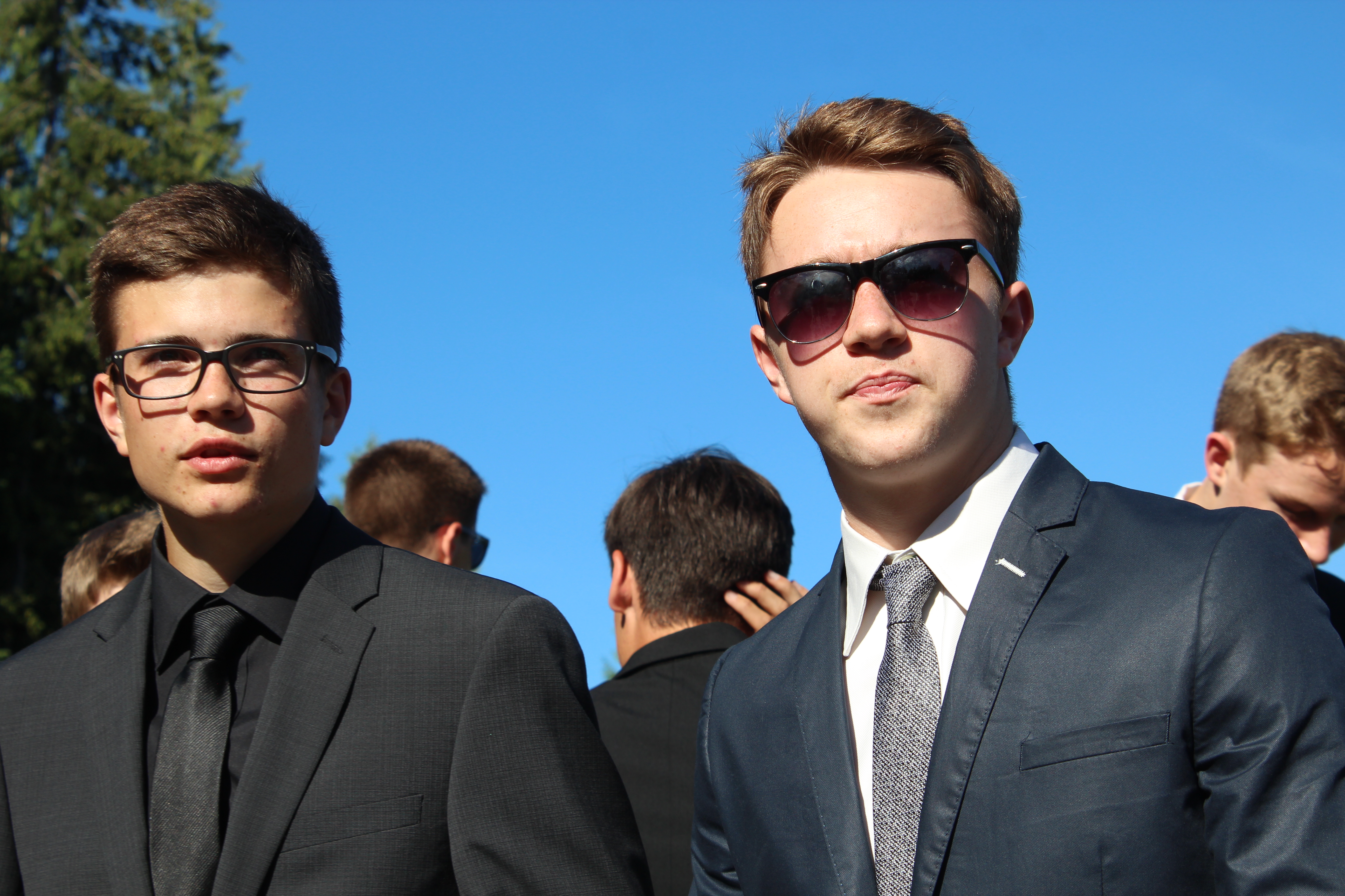
We’re here for The Strip and the desert – the beaten track and the single track: Neville and Leah and their teenagers, Ryan and Emma, all of us with contrasting wishes and expectations for our three-night stay in Las Vegas.
Shopping had been my kids’ idea. For hours we’d lost ourselves in high-octane consumerism at Miracle Mile Shops at Planet Hollywood Resort and Casino, a consumers’ paradise with 170 stores, 15 restaurants and several entertainment venues. Britney Spears has her own store here where Britney merchandise exhorts shoppers to “Work it, Bitch”.
It’s a legitimate vice in Sin City, but shopping – and Britney Spears – make me uncomfortable so I stood with a crowd and watched a guy get his belly tattooed at Club Tattoo. Leah got a manicure at Original Diva and had nails “to die for” long after returning home. Ryan and Emma blew their entire budget.
On all of our wish-lists was a Vegas show. Britney had taken March off so we chose Cirque du Soleil’s Zarkana, a celebration of circus traditions set in an abandoned theatre (but in reality at the Aria Resort and Casino). The show blends anarchic humour with the precision and grace of aerialists, acrobats, jugglers, high-wire and trapeze artists. The clowns made Ryan uncomfortable but he’s only 16; otherwise we left well entertained.
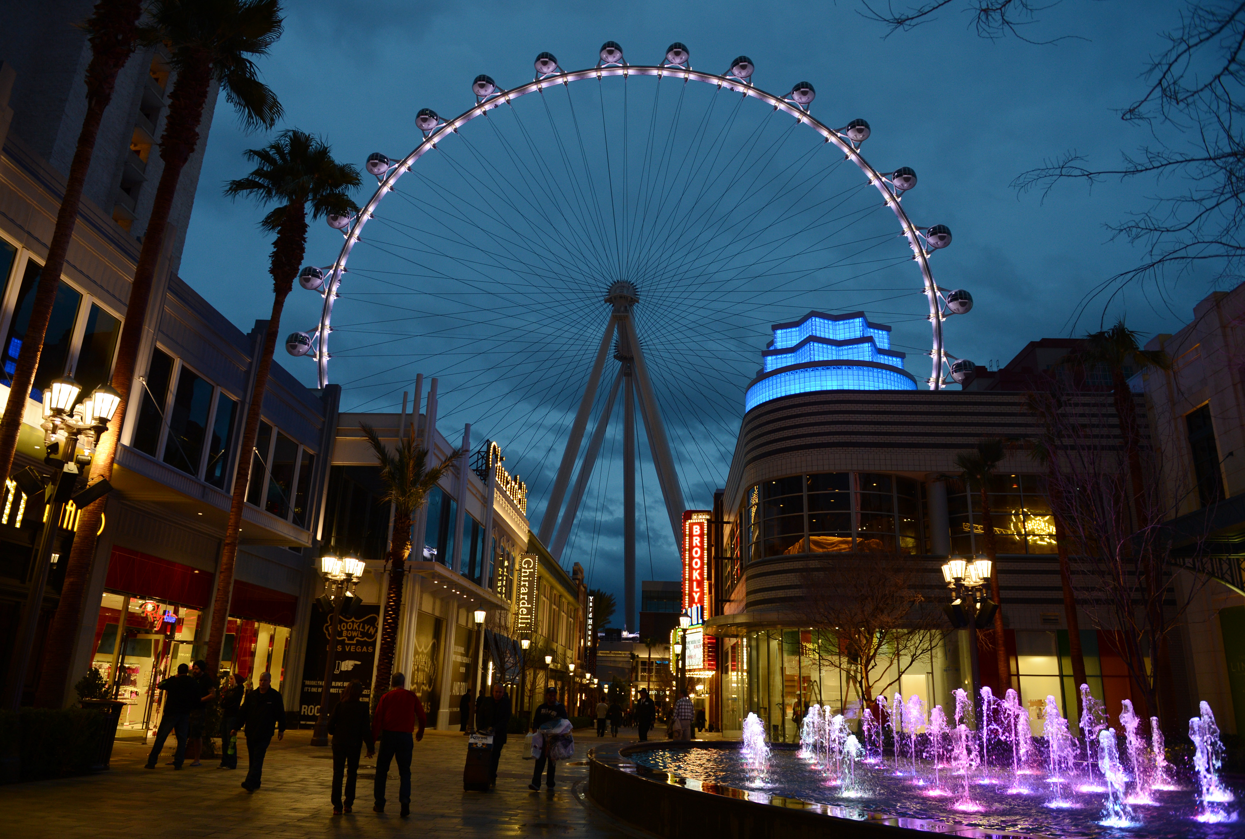
At 550 feet tall, the High Roller is the crown jewel in Caesars Entertainment Corporation’s LINQ development, a pedestrian-friendly neighbourhood on The Strip. The High Roller opened March 31. Denise Truscello photo
The spa treatment was Leah’s idea, but I was happy to tag along. For the Vegas rookie it can be tricky finding places on foot and ESPA at the Vdara Hotel was no exception. We could see it set back off The Strip, but The Strip has a way of keeping pedestrians on The Strip. We eventually got there by walking through another hotel, The Cosmopolitan. Any stress I might have felt at being late for a spa treatment soon melted away under the sensuous heat of volcanic stones, body brushing, exfoliation and a scalp massage. Beats shopping any day of the week!
Great food was on everyone’s list and the following three restaurants more than delivered. The Yard House enjoys an enviable location just a few feet from the High Roller, the world’s biggest observation wheel. At 550 feet tall, the High Roller is the crown jewel in Caesars Entertainment Corporation’s LINQ development, a pedestrian-friendly (hallelujah!) retail, dining and entertainment neighbourhood on The Strip. The High Roller opened March 31, two weeks after our visit, but we were content to admire it illuminated in green for St. Patrick’s Day from the deck of the Yard House. The beer list alone would entice me back to the Yard House, but the St. Louis-style ribs and truffle fries had me at hello.

Chayo chef, Ernesto Zendejas.
Just a short stroll through the LINQ brings you to Chayo Mexican Kitchen and Tequila Bar, a two-storey fiesta in the making, anchored by a mechanical bull. Mexico City-born chef, Ernesto Zendejas, draws upon classical training in France to present an exquisite mix of flavours: Lobster tacos, bass ceviche, cilantro cream soup, shrimp fajitas – it’s tough to pick a favourite, but none of us were lining up to ride the bull afterwards. (Portions are decidedly North American – not French!)
Plates are meant to be shared at Crush, one of many dining options at the MGM Grand, but our family came close to making a scene over the sea scallop benny, comprising sunny-side quail egg, chorizo and chipotle hollandaise. Some meals are too good to be shared. The shrimp risotto and lamb sirloin with bacon brussels sprouts also didn’t last long.
Between the shopping, the show, the spa and the dining, we savoured afternoon pool time. In downtown Las Vegas, we mingled with celebrity lookalikes and body-painted models at the Fremont Street Experience, five city blocks of high-tech wizardry featuring a 550,000-watt sound system and a music and light show broadcast from an LED canopy 90 feet above the ground.

Sea scallop benny at Crush, MGM Grand. Don’t even think about sharing.
And we ventured a little off downtown’s beaten track. Further down Fremont Street, past El Cortez, the city’s first casino, we found The Beat Coffeehouse and Records, the hippest little joint for breakfast and heaven to a 16-year-old who’s just discovered vinyl.
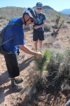
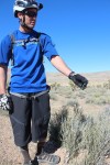
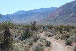
Nowhere though seems quite so off the beaten track as the Mojave Desert and the single track of Red Rock Canyon. The mountain biking had been my idea. Only 17 miles west of Las Vegas Boulevard, Red Rock’s Mustang Trails might have been on another planet, such is the contrast with The Strip.
For two hours we mostly coast on easy trails, stopping occasionally for impromptu descriptions of the vegetation. Brizzolara says he hasn’t taken a pill in more than 10 years, and why would he with nature’s pharmacy on his doorstep? There are seemingly cures for all ailments in the numerous sage bushes and plants like Mormon’s Tea, a species of Ephedra, which is traditionally used to treat asthma, hay fever and the common cold.

Ryan Judd in his element at Red Rock Canyon.
If inducement to remain on the bike were needed, there are no shortage of plants that could make for a painful landing: cacti, whose barbs expand after piercing skin, and the Joshua Tree, whose bayonet-shaped leaves feature serrated edges – handy for cutting barbecue wieners, according to Brizzolara. We stay on our bikes. My daughter, Emma, who’s never mountain biked, struggles gamely and mostly ignores her dad telling her to relax.
It’s the same advice she gave me at the Britney Spears store.
If you go:
- Las Vegas Cyclery (lasvegascyclery.com) and Escape Adventures (escapeadventures.com) offer year-round tours (half day and full day) for mountain bikers and road cyclists, as well as hiking tours. If mountain biking, you’ll ride full suspension Santa Cruz 29ers and tours start at $129. Call 1 800-596-2953
 1 800-596-2953.
 - We divided our accommodation between the Downtown Grand Las Vegas (downtowngrand.com) and the MGM Grand (mgmgrand.com). Formerly the Lady Luck, the Grand recently reopened after a $100-million renovation. It’s steps away from the Fremont Street Experience and features PICNIC, a wonderful rooftop pool. The MGM Grand more than holds its own on the pool front with four to choose from and a lazy river. It also offers Stay Well rooms, which comprise more than a dozen health and wellness features, including aromatherapy, wake-up light therapy and Vitamin C-infused shower water.
- For more on ESPA at Vdara, visit Vdara Hotel and Spa.
- For more on Las Vegas, visit vegas.com
-
- Guide Brandon Brizzolara points out the good, bad and ugly of desert flora and fauna.
-
- The Las Vegas mountain bike community numbers 2,000-plus. Fortunately there’s lots of room for them all.
-

- Easy riders at Red Rock Canyon.
-
- All those trails with no rainforest in the way!
-

- High Roller at The LINQ. Denise Truscello photo
-

- Chayo cilantro cream soup.
-

- Chayo lobster tacos.
-

- Crush sliced sirloin.
-

- Sprinkles at The LINQ actually features a cup-cake ATM!
Men of Steele

Next time we’ll bring snowboards and deckchairs.
My friend Tom and I had been planning a trip to the Tetrahedron for about 10 years. This weekend we finally did it. In hindsight, hiking to Mount Steele cabin would have been easier when I was 36, not 46.
At the base of 5,114-foot Mount Steele, the cabin is one of four two-storey cabins in Tetrahedron Provincial Park, each built to accommodate 16 people – first come, first serve. The others are at Bachelor Lake, above Edwards Lake, and between McNair and Chapman Lakes. The cabins are connected via a 25-kilometre trail network and are maintained by the Tetrahedron Outdoor Club.
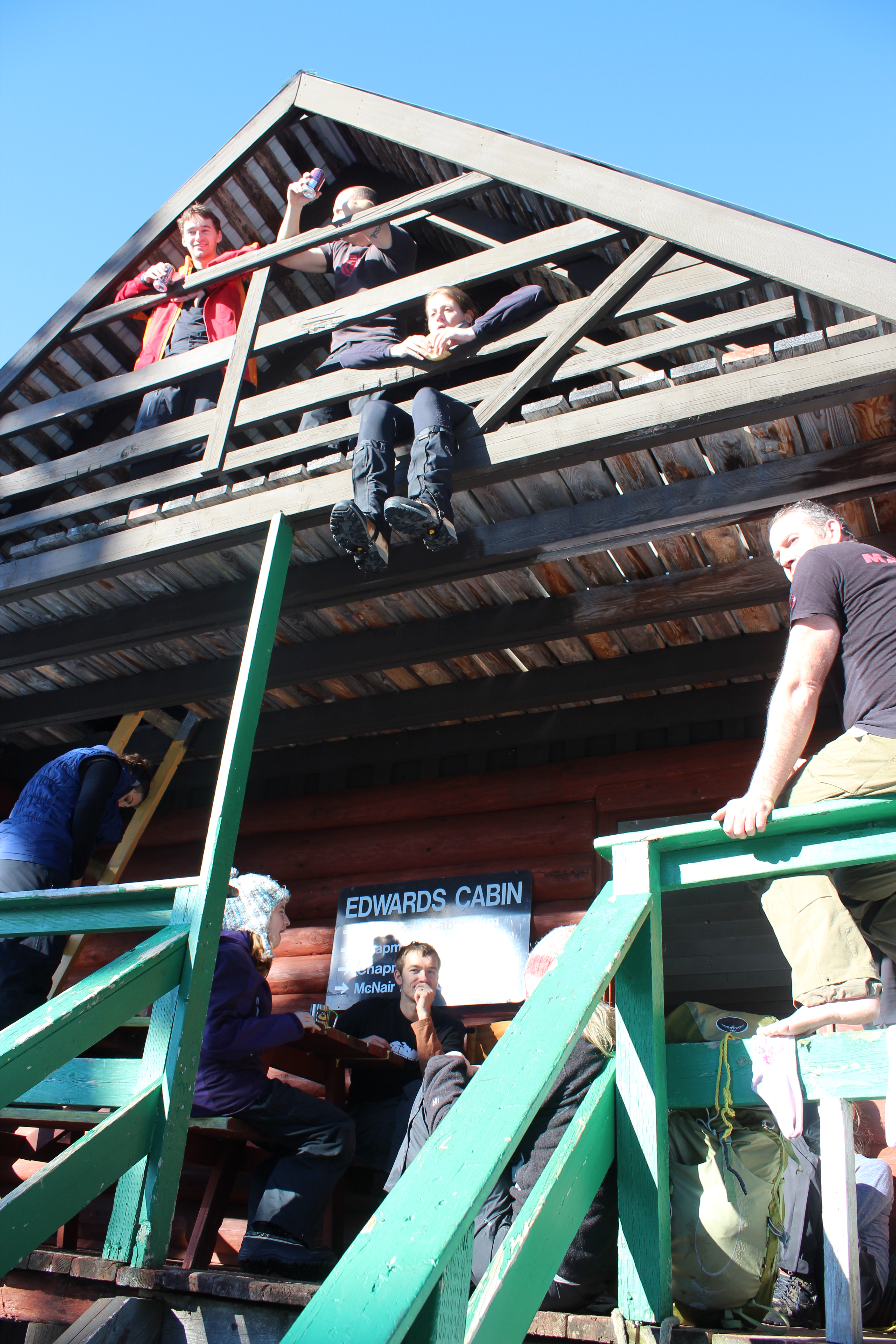
Lower Mainlanders enjoying lunch at Edwards Cabin.
We set off on snowshoes from the trailhead up Grey Creek Forest Service Road. In true Sunshine Coast fashion, the Tetrahedron is not signposted from the road, despite being a Class A provincial park. That might explain why there are only three other cars in the parking lot on a sunny January weekend.
Six thousand hectares of mountains, lakes, streams, wetlands and forest, the Tet, as it’s fondly known, has long been cherished by the backcountry enthusiasts who can actually find it. We finally meet some of those enthusiasts about two hours into our hike at Edwards Lake. They’re a group of 12 skiers and snowshoers from the Lower Mainland who are planning to stay at Edwards Cabin. We stop for lunch with them there before pushing on at 1 p.m.
So far we’ve been hiking for about two hours. There’s been no new snow for a week, temperatures are above freezing and the sun’s out. The sign at Edwards Cabin says it’s just three more kilometres to Mount Steele Cabin. It doesn’t mention the elevation gain of 1,300 feet, but that much is obvious from the contour lines on Tom’s map, which look like an intense low pressure system; that and our occasional glimpses of Mount Steele – white, jagged and way up there beneath the bright blue sky.

Downtime at Edwards Lake. We opted not to test the ice.
The climb begins almost immediately, as does the sweat, pouring off me and soaking me from head to toe. The steeper it gets the happier Tom becomes. He shouts encouragement and I try to ignore the chafing of 20-year-old longjohns and the borrowed 40-pound rucksack on my back. Following tree markers, we zig-zag our way through amabilis fir, mountain and western hemlock, yellow cedar and white pine while Tom yells to me about his merino wool base layers. “Not a drop of sweat,” he shouts. “This material wicks all the sweat away!”
I don’t say anything. I’ve stopped talking to Tom.
After an hour of this I’m resting every 10 steps. I’m eating snow to try and and conserve my water. We appear to have cleared the forested section but that brings its own problems. We can’t see any more tree markers. So Tom checks his map and his compass and we decide to climb one of Steele’s lower open slopes, figuring the cabin will surely become visible as we ascend. But with no more markers in sight, we get cold feet – actually, mine are soaking wet. (Tom’s aren’t. He has merino wool socks … or something.)
So we descend, covering the same distance in 10 minutes that took us 30 minutes to climb. It’s 3:30 p.m. and for the first time all day, I have one eye on the time. The sweat is freezing on my back and it will be dark in 90 minutes. After some searching though, Tom spots a marker and we’re off again, climbing in a different direction toward a ridge that he swears will take us to the cabin. From the ridge we’re treated to views of the Tantalus Range and the markers continue to guide our way.

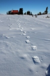
Mount Steele cabin, as seen from the top of Mount Steele.
Just before 4, I hear Tom from up ahead. “I can see the cabin!”
Thank God he’s not lying, I think as I catch up a few minutes later.
There it is, its red roof standing out against so much white. We savour the last few steps. I don’t think I’ve ever seen a location quite so beautiful. We have the place to ourselves. According to the guest book, we’re only the second visitors this year. An hour later at the metal kitchen table, we’re eating curry and naam bread cooked on the wood stove, washed down with a couple of beers. The cabin is well equipped, with mattresses in the attic, firewood in the basement, a kitchen counter with utensils and a couple of sinks. We melt snow for water and turn the stove down to a slow burn. Pretty soon the entire cabin is toasty warm.
It would seem impossible to put a price on such an amazing place, but the Tetrahedron Outdoor Club came up with $10 a night, which seems more than reasonable. More than a quarter of a century ago, the club used to be known as the Tetrahedron Ski Club. Back in 1987, the club mobilized more than 200 volunteers, 45 businesses, schools, community groups and several levels of government to build the Tetrahedron’s cabins and trail network.

Beer, curry, mates – just another Saturday night.
The cabins were built at Sechelt airport before being disassembled and flown by helicopter to be reassembled on site. Forestry company, Canfor, and the Sunshine Coast Regional District donated timber, Sechelt Creek Contracting provided logging service, Airspan donated some air time, Gibsons Building Supplies provided crane trucks and the Outdoor Recreation Council pitched in with chainsaws. For one of the few times in Sunshine Coast history, one great idea united governments, businesses, and local volunteers – in the midst of a recession, no less.
For all the day’s exertions, I can’t sleep. After midnight I set up my tripod outside and try and capture Mount Steele by moonlight with varying results. Fog covers Georgia Strait but I can see lights twinkling on Vancouver Island. There’s no bite to the breeze blowing and I feel like the last person on Earth. I may be delusional. I go back to bed.

The moon over Mount Steele. Sometimes not sleeping isn’t so bad.
In the morning under clear skies we hike to the top of Mount Steele. It’s difficult to reconcile this rugged terrain and such epic landscapes with the place I call home. For me, the Sunshine Coast typically conjures images of rainforest and beaches, not jagged peaks and frozen lakes. But then visiting this place would surely alter anyone’s perceptions.
Tom vows to bring his snowboard next time. I’m thinking a deck chair. We pack up, sweep up, and head out for the descent to civilization. Yesterday, it took us six hours to get here. Today we’re back at the car in just over two hours.
I relish every step of our tracks with a smile.
- For more information about the Tetrahedron Outdoor Club, visit www.tetoutdoor.ca
- Four-wheel drive and chains are essential for visiting the Tetrahedron. For more information about the park, visit www.env.gov.bc.ca/bcparks
- There can be a significant avalanche risk on Mount Steele. Before heading out, check with www.avalanche.ca/cac/bulletins/latest
- For more on the history of the Tetrahedron Outdoor Club, visit my earlier blog post here.
- If your fitness is kind of sketchy and you’re inexperienced in the backcountry, consider taking Tom with you. I couldn’t have done it without him.


The Trail Collector

Creator of sunshine-coast-trails.com Becky Wayte is probably the Sunshine Coast’s most avid nature bather.
You might call Becky Wayte a wanderer. Almost every day for the last 20 years, Becky has hiked or biked a trail somewhere on the Sunshine Coast. It wasn’t until a couple of years ago though, that she became a collector.
Some people collect stamps; others baseball cards. Becky collects trails, maps them with a GPS, and documents them on sunshine-coast-trails.com, a website she created for outdoor enthusiasts. The site lists hundreds of trails, from Langdale to Earl’s Cove, with descriptions, maps, difficulty ratings and useful links. She has her favourites – three of which she describes in her own words in a sidebar to this story.
In 2011, hiking three to four hours a day, almost every day, Becky managed to map almost all of the Sunshine Coast’s trails in six months. She’s been updating her collection ever since. The Coast is home to some prolific trail builders, it seems.
“I actually thought it would take me a couple of years,” she tells me. “But I quickly realized that I’m a little obsessive. When I start something, I need to see it through to the end.”
But the truth is, collecting trails never ends. New trails are always springing up and some remain well-guarded secrets. In a recent interview with pinkbike.com, local mountain-bike phenom, Holly Feniak, describes the Coast’s trails as: “Dreamy. Loamy, mossy, bouncy, incredibly green, and in the secret spots … all that and steep.”
Cliff Gilker Park, Roberts Creek.
She might have added ‘never-ending’!
“For heaven’s sake, stop building trails,” Becky laughs, when I ask her about the Coast’s trail builders. “I actually love finding new trails and I admit, there might be the odd one I don’t know about. I’m always trying to keep up!”
For a moment, we think we may have found a new one. It’s an unusually hot day in May and we’re walking through a dusty trail off Field Road in Wilson Creek. We’re accompanied by Cody, a large, lovable dog from the nearby SPCA where Becky volunteers each week as a dog-walker. The path veers past someone’s back yard and into the forest.
“Let’s take a look,” says Becky, in her element. A few minutes later we come to a dead-end. Cody looks at us expectantly and we return the way we came. So what inspired Becky to take on this labour of love?
“I have three dogs and one has issues with other dogs, so I wanted to find new trails to hike where there weren’t so many people,” she says. “There were few websites, but they only featured the most popular hikes, places like Mount Daniel, so I decided I’d do it myself.”
Becky’s well qualified. Not only does she love the outdoors, but she learned to build websites through her work teaching computer courses in the Adult Basic Education Program at Capilano University in Sechelt. With the website established, Ryan Robertson, a Squamish-based app developer, who specializes in creating trail applications for iPhones and Androids, contacted Becky. Becky provided the GPS (Global Positioning System – the satellite navigation application) data and Ryan created the app. Trailmapps: Sunshine Coast costs $10 and is available at the Apple Store and Google Play.
For old-school trail lovers, she’s also created waterproof trail maps that are available in Gibsons at Spin Cycles, and in Sechelt at Source for Sports, the Sechelt Visitors’ Centre, and Off The Edge Adventure Sports.
Outdoors, technology couldn’t be further from Becky’s mind. While she’s always hiked to combat weight gain, she’s also convinced of nature’s therapeutic benefits. The Japanese have a name for it: shinrin-yoku, or forest bathing. Becky cites Japanese research, which points to the many benefits of simply being in nature – lower blood pressure, higher creative aptitude and boosted immune systems.
“I prefer the term ‘nature-bathing’ because I find just being out in nature makes me feel better. I always come home feeling better than when I left.”
Well, almost always.
Becky sheepishly recalls one particular hike that went awry, much to her husband’s despair. “I was hiking up Elphinstone and I’d let people know where I was going and what time I’d return. It took a lot longer than I’d expected though and my phone died.
“I got back around 7:45 p.m. – not the 5 p.m. I’d told my husband. He was pretty mad.”
The experience didn’t sour Becky’s love of Mount Elphinstone. In fact, the Mount Elphinstone Summit Trail ranks in her three favourite hikes and bikes. (See below.)

Kinnikinnick Park, West Sechelt.
Sidebar
My Three Favourite Hikes & Bikes, by Becky Wayte
Mount Elphinstone Summit Trail (hike only)
This is a long, fairly difficult climb, but the view at the very top is worth it. The trail to the top can be accessed from the top of Sprockids or via some feeder trails off B & K logging road in Roberts Creek. If you take your time and enjoy a picnic and rest at the top, this hike will likely take you five or six hours. Make lots of noise or wear a bell so the bears hear you coming.
Ruby Klein Traverse – Suncoaster Trail (hike or bike)
Beautiful views of Ruby Lake and a hand carved bench greet you at the highest point along the trail. Easy to make a whole day trip out of this even though the hike itself will probably only take you a couple of hours. You can visit the Iris Griffiths Centre, take a swim in Klein Lake and there is even a feeder trail down to the Ruby Lake restaurant (Trattoria Italiano).
McNeill Lake Circle Route (hike or bike)
This is one of my favourite destinations in the summer months because I always combine a bike ride with a swim. The lake itself is not that well known so often no one else is there, especially on weekdays. There are several trails that connect to create a loop around the lake, with access to the lake from a couple of spots. I park on Middlepoint Forest Service Road and take Copper Head, Dry Feet, a logging road, Old Pole Road and back to Copper Head. There is a short trail off the logging road just north of Dry Feet that takes you into the lake. This is an excellent place to ride your mountain bike if you have pre-teen kids or you just want a fairly flat ride (we don’t have many flat rides on the Coast). Hiking it probably takes about 1.5 hours and by bike about an hour, unless you stop to enjoy a swim.
For the definitive web guide to the Sunshine Coast’s trails, visit http://www.sunshine-coast-trails.com.
Heart of green
Sechelt Rotarians, Tom Pinfold (right) and Mick van Zandt on the trails of Kinnikinnick.
Shirley Macey didn’t have time to waste. When she wasn’t coaching kids, she was raising a family, working as a Gibsons RCMP dispatcher, and lobbying local government for more recreational space.
Somehow she found time every week to climb Soames Hill with a garbage bag to pick up other people’s litter.
“She was pretty amazing,” remembers her son Darin. “I didn’t think much of it growing up; now I don’t know how she did it.”
At the southern end of the Coast, 14 hectares of Soames Hill Regional Park are named after Shirley Macey. No doubt she would be proud of the soccer fields, the wheelchair-accessible playground and Frisbee golf course. Shirley – or Sam (an acronym of her full name, Shirley Amelia Macey) to her friends – was a dedicated volunteer whose legacy is by no means unique.
Shirley Macey, Maryanne West, Ted Dixon, Cliff Gilker and Hackett are – to name a few – venues so familiar to most of us that it’s easy to forget that they were also people. Ted Dixon, for example, worked tirelessly for self-government for the Sechelt Indian Band before dying in a car crash in 1981. Maryanne West was the backbone of community TV and so many volunteer projects before dying at age 90 in 2008.
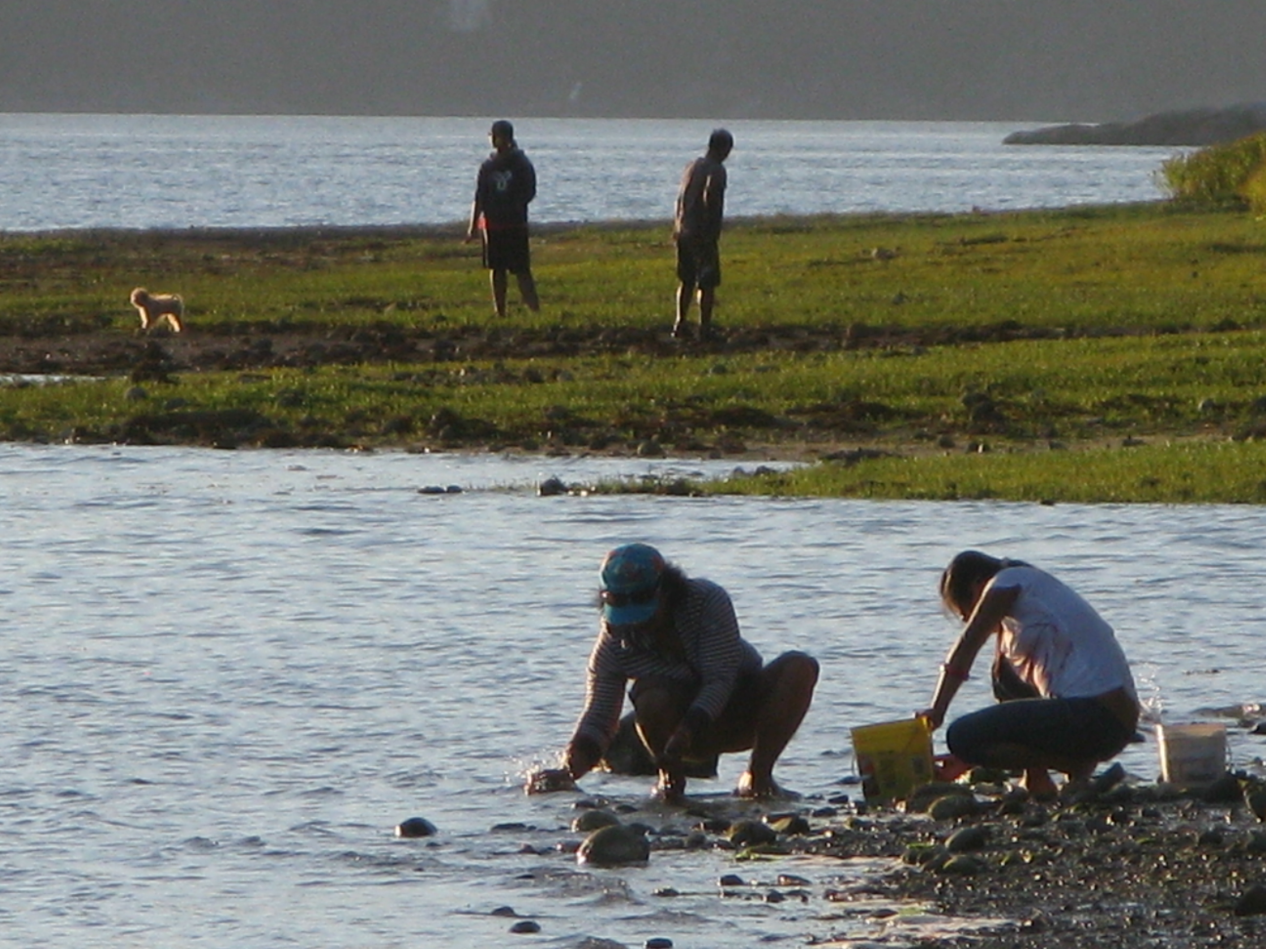
Scavenging the shoreline at Porpoise Bay. For parks and beaches, Sunshine Coasters are spoiled for choice.
And not all parks bear a family name. Brothers Memorial Park in Gibsons was named for logging contractors, Al and George Jackson who donated the land.
Today, volunteers continue to be the lifeblood of the Sunshine Coast’s parks and trails. In fact, the parks system wouldn’t work without them.
“We totally rely on volunteerism,” says Sunshine Coast Regional District parks planning coordinator, Sam Adams. “We wouldn’t be able to do what we do without it.”
For the SCRD that means mobilizing volunteer help in bigger parks like Dakota Ridge, where members of the Dakota Ridge Advisory Committee have been particularly helpful. Volunteers also help the SCRD maintain trails at Soames Hill, most recently working to improve the wooden stairs. Now the regional district is hoping to cultivate more volunteer assistance with an adopt-a-trail program.
“Part of our work plan for 2013 is to develop a more robust volunteer program,” says SCRD parks planning coordinator, Susan Mason. “We have kilometres and kilometres of trails to maintain, so people willing to document changes on a regular basis are helpful to us.”
The government-volunteer relationship is similar elsewhere on the Coast. District of Sechelt parks supervisor Perry Schmitt is grateful for the work of several trail building groups, as well as established service clubs.

Sunshine Coast Lions Club president Len Schollen at the site of the Lions’ next project, an accessible viewing deck in the corner of Mission Point Park where the beach and Chapman Creek meet.
“The Lions Club has been instrumental in making improvements to Mission Point park and the Sechelt Rotary Club has been assisting in rebuilding decks throughout Kinnikinnick forest trails,” says Schmitt. He also cites the work of the Sechelt Groves Society at the Heritage Forest trails, and the Sunshine Coast Natural History Society, which tends to Sechelt Marsh.
On a cold blustery day, Sunshine Coast Lions Club president Len Schollen shows me work completed on the Mission House deck and the next project – an accessible viewing deck in the corner of Mission Point Park where the beach and Chapman Creek meet.
“We’re basically waiting for some decent spring weather to build the viewing platform and a hard-surface ramp leading up to it,” says Schollen, surveying the footings already in place. “There’ll be a railing around it and hopefully some signs with information about the salmon run and pointing out places like Mount Arrowsmith.”
Why are Schollen and other Lions members involved in the project? “We serve, is the Lions’ motto,” says Schollen simply. “We try to make this a better place to live.”
It’s a sentiment shared by Sechelt Rotarians, Tom Pinfold and Mick van Zandt, when I meet them on the trails of Kinnikinnick park.
“We wanted to work on small projects where a few people could work for a few hours on something with lasting benefit,” says Pinfold. “We’d much prefer to let the District allocate their resources to new things instead of maintenance.”
With other Rotarians, the pair has replaced and built cedar bridges and decks throughout Kinnikinnick’s trails during the last three years. Topped with roofing tiles, the decks are essential given the drainage issues on multi-use trails in a popular park. The new bridges should be good for at least 10 years, reckons Pinfold. (Elsewhere in Kinnikinnick park and at Sprockids park in Langdale, Capilano University students hone their trail-building skills as part of the Mountain Bike Operations Certificate curriculum.)
There are 13 kms of groomed trails for cross-country skiers on Dakota Ridge, yet another Coast playground.
Pinfold and van Zandt have also worked on a wheelchair accessible deck at Halfmoon Bay’s Trout Lake and a viewing platform and trail in Roberts Creek’s Cliff Gilker park.
Elsewhere, volunteers continue to make the Sunshine Coast a great place to play. If you’re searching for the heart of the Sunshine Coast you’ll find it in any park or trail. From Pender Harbour’s Lions Park (the best soccer field on the Coast) to the mountain bike trails of Sprockids Park in Langdale, outdoor recreation thrives because people care enough to make it happen.
People like Shirley Macey.
Shirley didn’t live to see the park she’d fought for named in her honour. Just months after retiring from the RCMP and paying off her mortgage, she died of cancer in 1998.
“I didn’t realize until I was older that quite a few people called her mom,” recalls Darin, who has four kids of his own now. “I met all these people I knew at her service who thought of her as a surrogate mother.
“My kids are certainly proud of the park’s name. It’s too bad she died so young.”
Trail Mix
There are numerous opportunities to get involved in outdoor volunteering. Here are a few websites where you’ll find more information.
http://secheltlionsbc.lionwap.org/
email tony@whiskeyjacknaturetours.com for the Sunshine Coast Natural History Society
Thanks to the Sechelt Community Archives and the Sunshine Coast Museum and Archives for their help in researching this feature.
White and wild on Dakota Ridge

If cross-country skiing is a little slow for you, tobogganing should get your adrenaline racing on Dakota Ridge.
Forty minutes ferry-ride from West Vancouver, the Sunshine Coast is better known for The Beachcombers, scout camps and verdant shorelines. People don’t typically associate this 140-kilometre peninsula with snow. But there it is, several feet of the stuff, just waiting to be played in.
You just have to look up.

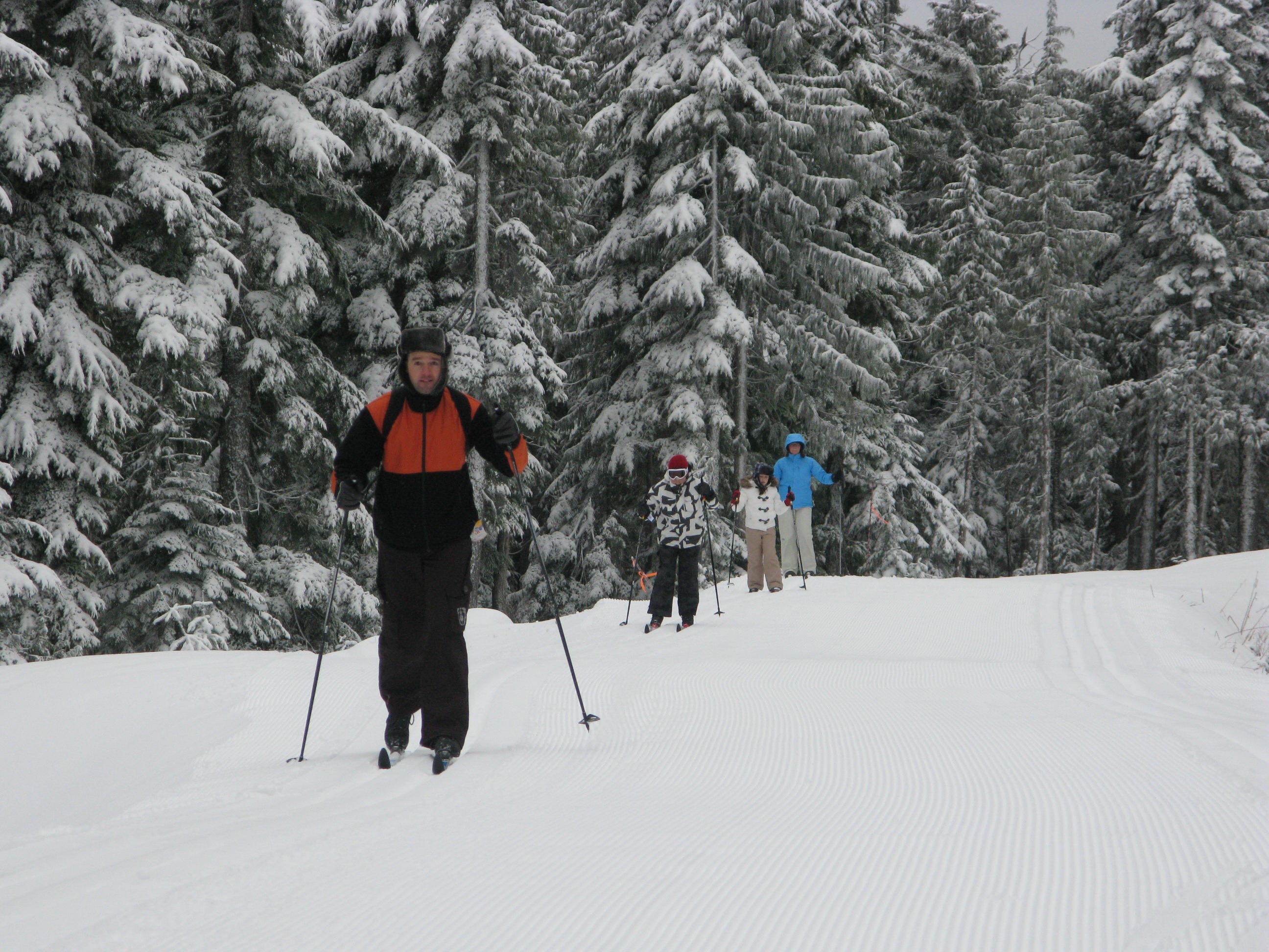
There's cross-country skiing for all ages on Dakota Ridge.
Poking through the clouds about 1,200 metres above the beaches and pretty parks is Dakota Ridge, one of the best cross-country ski destinations in the last place you’d expect to find it. Between November and March, if it’s raining at sea level, there’s a good chance it’s snowing up there.
And it’s only a 20-minute drive from sea level.
“You can come up for a couple of hours and be in a completely different world,” says Craig Moore, a cross-country skier and long-time member of the Dakota Ridge Winter Recreation Society, a non-profit group working to promote the area. “For cross-country skiing it beats anywhere on the west coast.”
It’s pretty good for tobogganing and snowshoeing, too.
A 620-hectare (1,532 acres) plateau atop a working watershed, Dakota Ridge offers a rolling landscape of stunted old growth hemlock and yellow cedar. On a clear day you can see the North Shore mountains, the Gulf Islands and Vancouver Island beyond – even Mount Baker down in Washington State.
There are 13 kilometres of groomed trails for cross-country skiers on Dakota Ridge.
Cross-country skiers will find 13 kilometres of groomed Nordic trails, all of them signposted and colour-coded according to degree of difficulty. Professional engineer Reidar Zapf-Gilje, who prepared Callaghan Valley’s 2010 Nordic Olympic course, designed Dakota Ridge’s trail network.
“In many cross-country skiing areas you’re skiing through woods and you don’t see too much,” says Zapf-Gilje.
“Dakota Ridge is way up there in terms of esthetics. Its real strength is its potential for recreation and citizen [cross-country] races.”
Jamie Mani hopes that potential will be realized. Mani owns Alpha Adventures, a Wilson Creek outdoor-adventure store specializing in guided snowshoe and cross-country ski touring on the Ridge.

When it's not snowing, the views from Dakota Ridge can be spectacular.
“One of the great things about this place is its proximity to so many other activities,” says Mani. “Someone can literally be out snowshoeing in the morning up in the mountains and then golfing or kayaking in the afternoon.
“And for Nordic skiing we have excellent potential because of great snowfall and a blend of flat and rolling trails. We have been skiing on the Ridge as late as May in previous years.”
Snowshoers will find their own trails and there’s plenty of room for hiking and tobogganing. You’ll find a parking lot, warming hunt and toilet at the trailhead.
The turnoff for Dakota Ridge is at the top of Field Road in Wilson Creek, about half way between Gibsons and Sechelt, and 20 kilometres drive from BC Ferries’ Langdale terminal. For many years, the unplowed access road to Dakota’s trailhead made it a ridge too far for some. In recent years the 11-kilometre road has been upgraded to allow for regular plowing, but four-wheel drive vehicles equipped with chains are still the way to go.
Or take advantage of Alpha Adventure’s shuttle service.
- To learn more about Dakota Ridge, visit http://www.scrd.ca/Dakota-Ridge
- For road updates and snow conditions on the Ridge, visit www.suncoastcentral.com/outdoor-reports.asp.
- To book cross-country ski lessons, a guided tour, equipment rentals or shuttle service up to Dakota Ridge, call Alpha Adventures at 1 604 885-8838 or visit www.outdooradventurestore.ca

