Archive for the ‘Snowshoeing’ Category
Cold play
The Tetrahedron Outdoor Club ensures a warm welcome for visitors
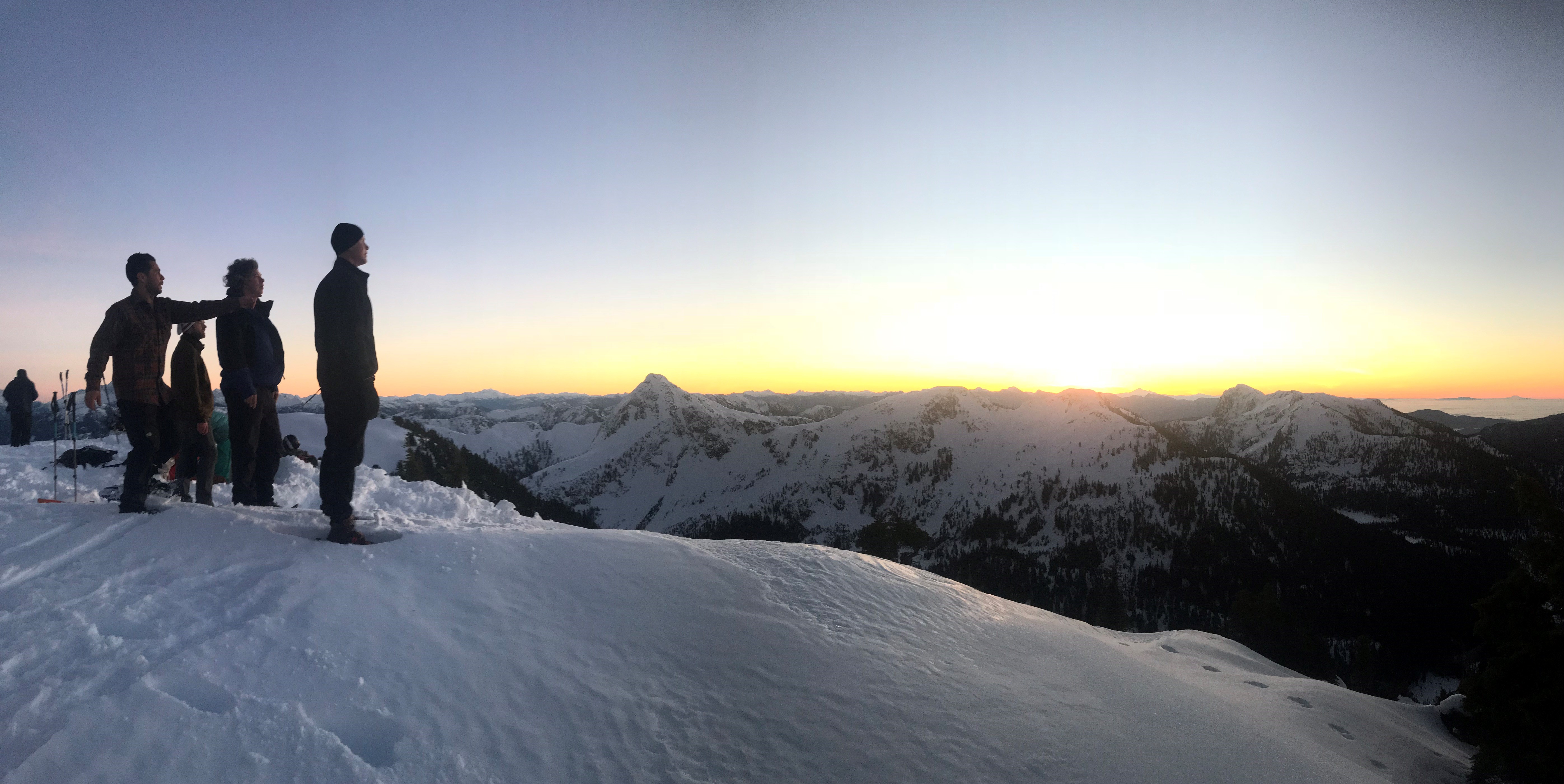
Reached by ferry or floatplane, the Sunshine Coast, north by northwest from Vancouver on Canada’s west coast, is the kind of place people visit to get away from it all. The Tetrahedron is the kind of place Sunshine Coasters go to get away from it all.
As backyards go, the Tetrahedron tends to be on the large side. Six thousand hectares of mountains, lakes, streams, wetlands and forest make this Class A provincial park the perfect place for backcountry enthusiasts to explore.
It also makes the Tet, as it’s fondly known, an immensely challenging place to maintain for visitors. Charged with that formidable task is the Tetrahedron Outdoor Club, a hugely dedicated volunteer organization committed to maintaining the park’s four rustic cabins and the 25-kilometre trail network connecting those cabins.
“B.C. Parks owns the cabins and it’s their provincial park,” explains club president, Gerry Marcotte. “We are the stewards of the park and a have great working relationship with B.C. Parks, which goes a long way to keeping these cabins and trails up to date.”
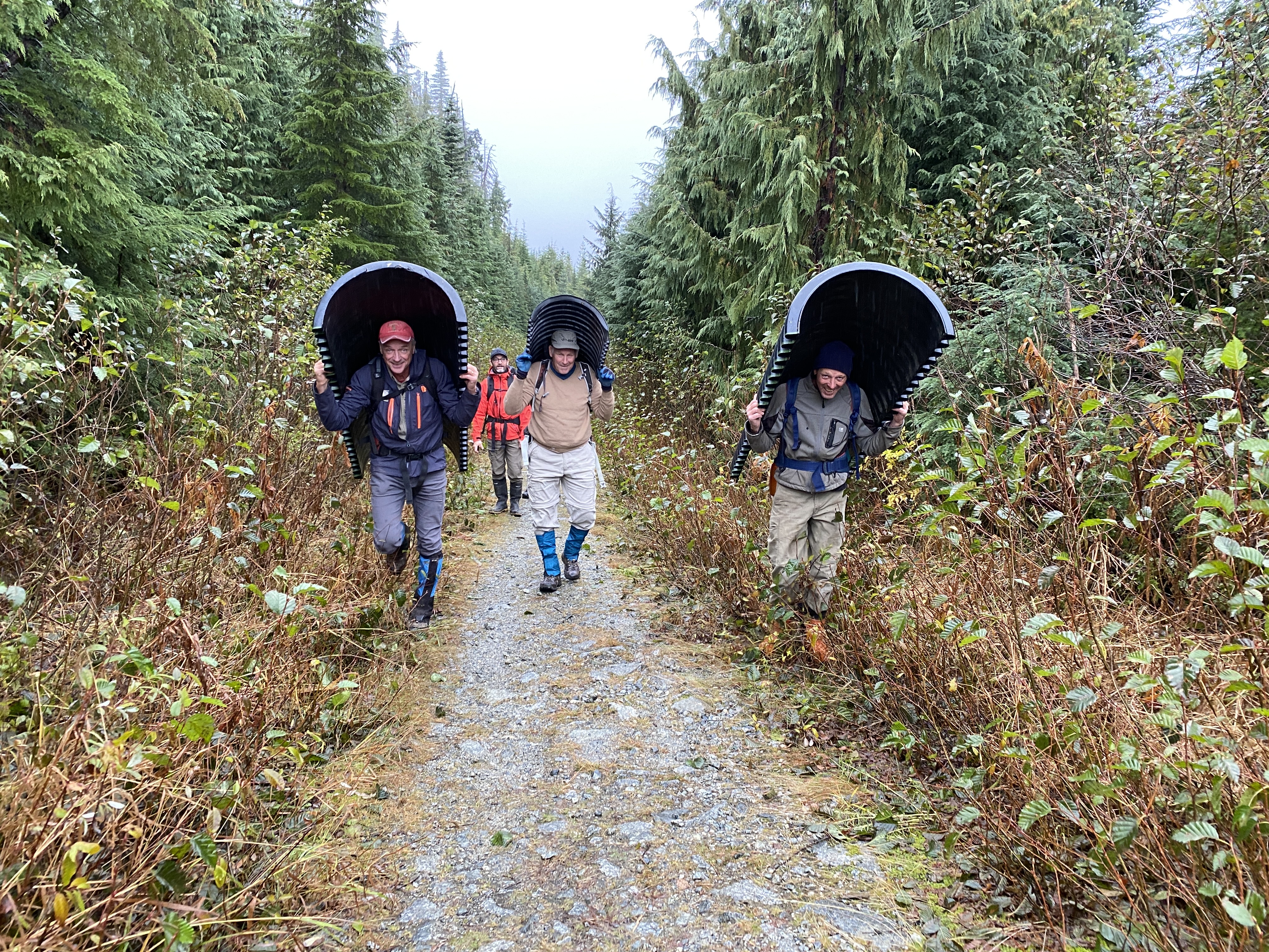
The latest major project keeping the club’s volunteers busy has been the installation of a three-ton bridge spanning Steele Creek. Lowered by helicopter and installed by club members last month, the bridge cost about $20,000 – $12,000 of which was partially funded by a grant from the Sunshine Coast Community Forest Legacy Fund.
It would have cost more but for the donations of businesses – structural engineering, welders and lumber milling. The mix of grants, donations, partnerships and resourceful volunteers continues from a blueprint established more than 35 years ago.
In the mid-1980s, amid an economic depression, a group of backcountry enthusiasts united to mobilize more than 200 volunteers, 45 businesses, schools, community groups and several levels of government: their goal, to build cabins linked by a trail network.
The Tetrahedron Ski Club, as it was then known, secured more than $150,000 in federal funding and another $20,000 from the province, to build the cabins at Sechelt airport. The cabins would then be disassembled and flown by helicopter to be reassembled on site.
Forestry company, Canfor, and the Sunshine Coast Regional District donated timber, Sechelt Creek Contracting provided logging service, Airspan donated some airtime, Gibsons Building Supplies provided crane trucks and the Outdoor Recreation Council pitched in with chainsaws.
An army of volunteers mobilized to clear trails while 18 people worked on the cabins, gaining valuable carpentry skills and learning about surveying and wilderness first aid. By the time the cabins opened to the public in 1987, the club had raised more than $300,000 for the project. Perhaps more remarkably, a single great idea had united governments, businesses and local volunteers.
So, what motivated such efforts back then and what continues to drive the club’s volunteers now?
“There are a lot of people in the Tet for pure recreation,” says long-time club member, Melissa Rayfield. “I think the difference with volunteering is that it becomes purposeful recreation. I think any volunteer would feel the same way, it’s part of their social life, part of pleasure and the fulfilment of getting something done.”
Melissa’s husband, Danny Fleischhacker, agrees, adding that the solitude and the elements amid the Tet’s wide-open spaces are hard to resist, especially in winter.
“Getting out into the backyard, being out in nature there’s a sense of throttling back, tapping the brakes and going slow, but looking around,” says Danny, who admits that he also likes to go fast. “I really love skinning in a blizzard with the wind blowing at me. (Skinning is the practice of sticking synthetic skins to skis, climbing a trail, then skiing down. Danny and fellow club-member, Sam Preston, are particularly fond of exploring ski terrain deep in the park and immortalizing perfect runs with names like “Heaven is a Halfpipe”.)
Melissa and Danny are stewards of McNair cabin, visiting about once a month for maintenance and monitoring. (Visitors are asked to clean up after themselves but that doesn’t always mean that they do.) Gerry and his wife Ellen steward Bachelor cabin. In between are Edwards and Steele cabins, each with their own stewards and the latter cabin being the highest, situated at the base of 5,114-foot Mount Steele.
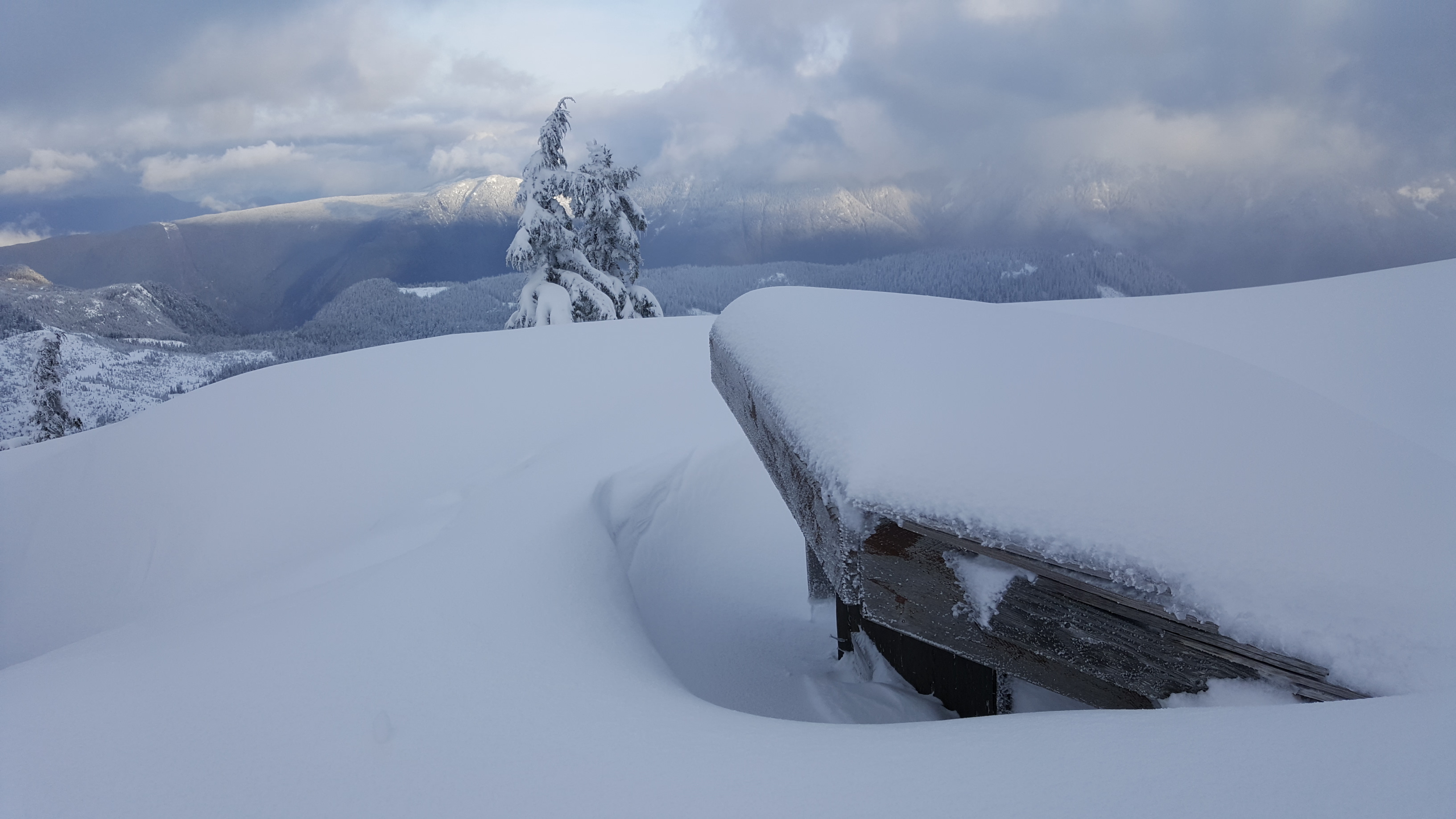

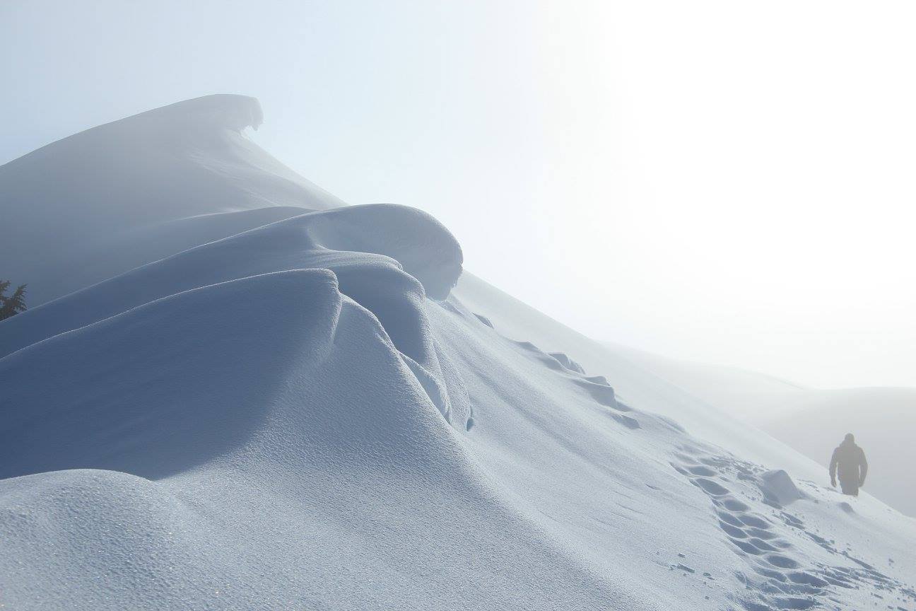
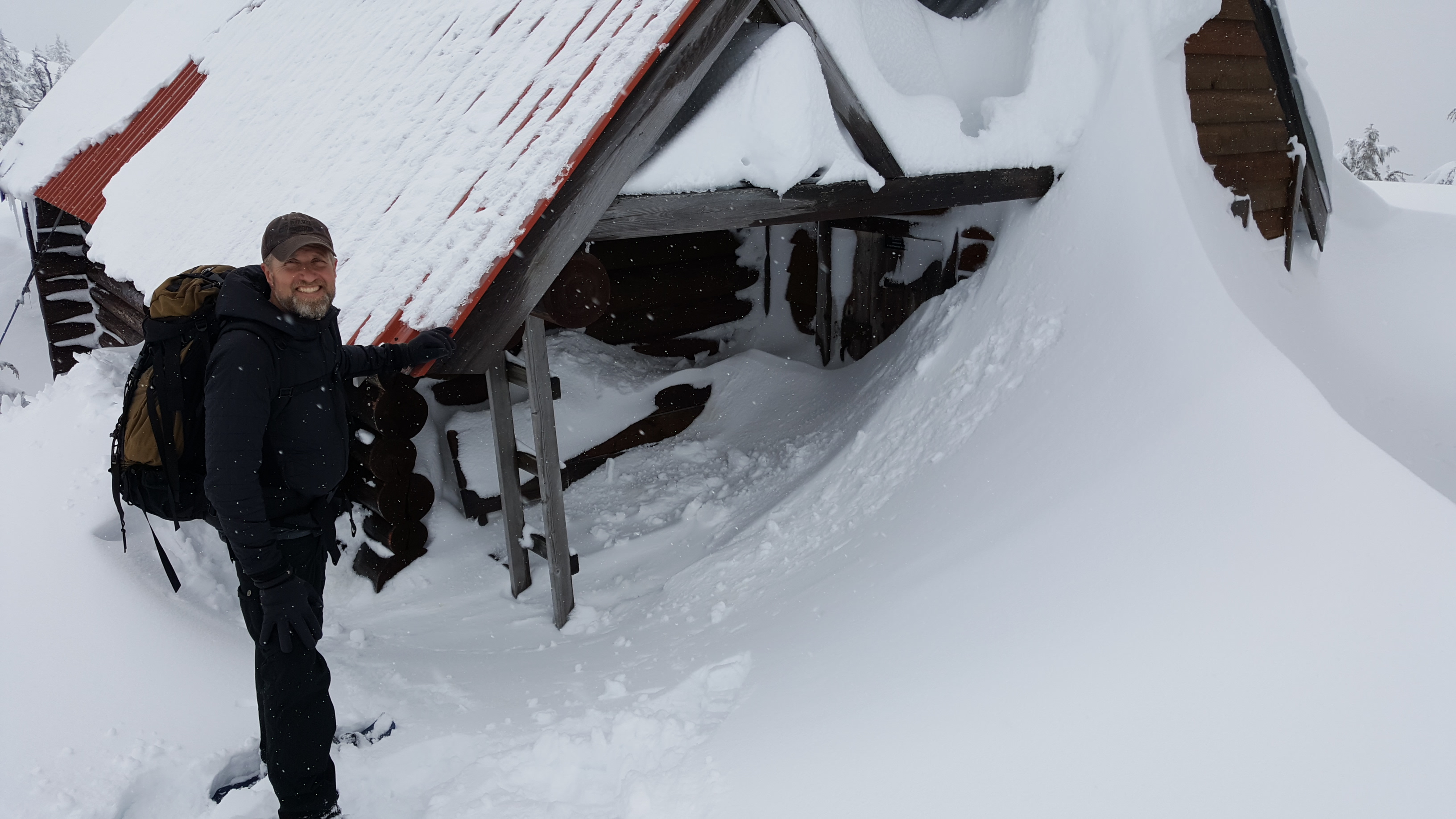
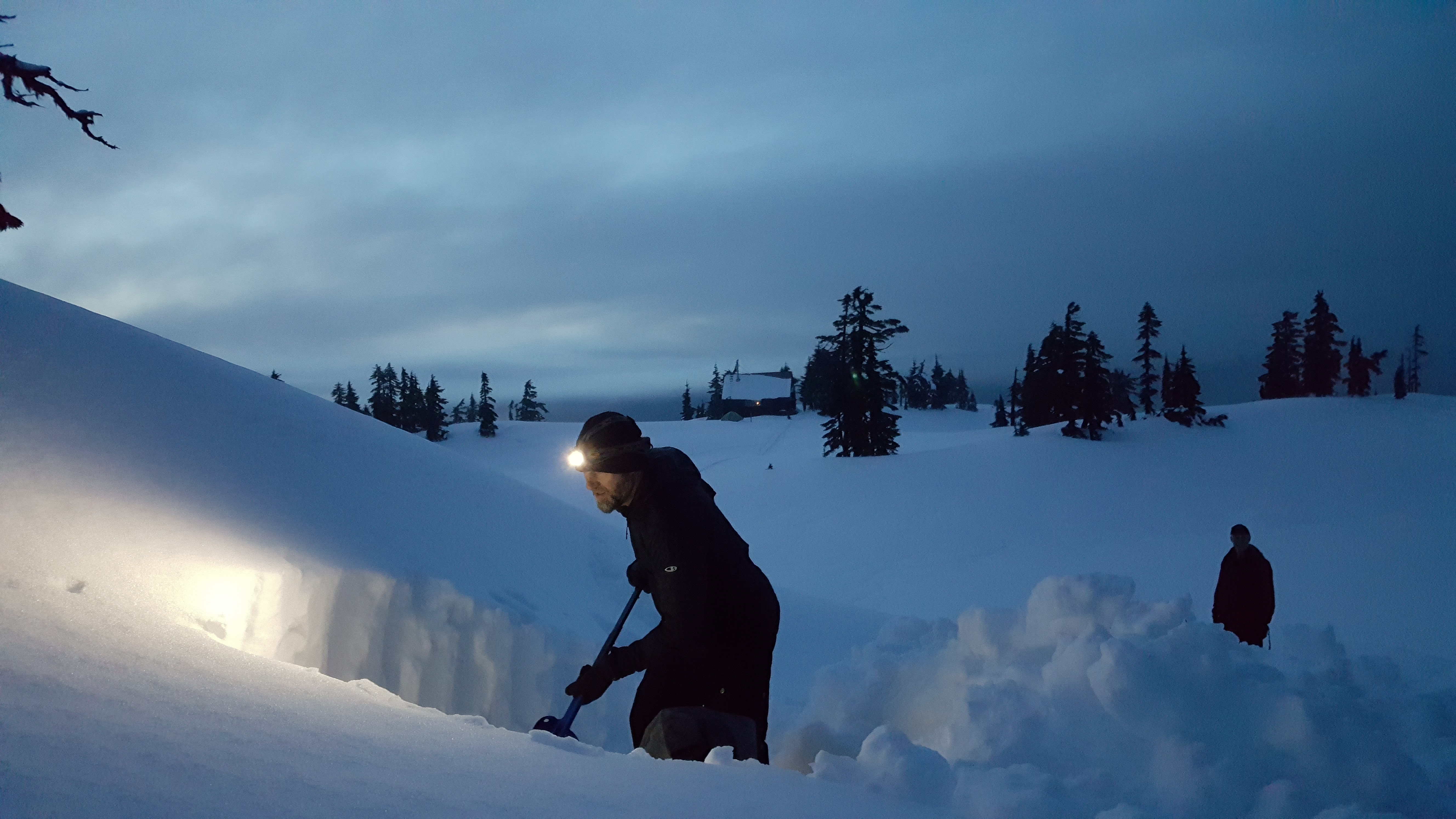
It’s not uncommon to have to dig your way into the Tetrahedron’s cabins and outhouses, especially on Mt. Steele.
The cabins accommodate 12 to 16 people, are first come, first serve, and are well equipped with mattresses in the attic, firewood in the basement, a kitchen counter and a sink. The wood stove usually has the place toasty warm within an hour.
Panther, Steele and Tetrahedron peaks loom over the park’s 10 lakes and some of the oldest trees in the country. Amabilis fir, mountain and western hemlock, yellow cedar and white pine can all be found here.
For Melissa and Danny, winter in the Tet means fun; summer means work. “It can take a herculean effort by a small number of people to accomplish some of the projects,” says Melissa. “Trail-clearing is never ending.”
(Veteran club member, George Smith, recently spearheaded a new trail to provide day-trippers with a beautiful new winter-touring option past Mayne Lake.)
Nor are the volunteers getting any younger.

“When you look at the group photos from the Steele Creek bridge project, you realize the average age of the volunteers is low-60s,” says Danny. “We need to bring down that average age, not that our volunteers aren’t uniquely capable – there are some extremely hard-working 70+ people. We all love the Tet and are very supportive of each other. There’s never a shortage of camaraderie.”
Funding is also a perennial concern for the club. Snow removal costs between $6,000 and $12,000 a year. Firewood is airlifted to the cabins at a cost of $18,000. Community members donate the wood, which is cut and split by club volunteers. (Visitors building winter bonfires outside of the cabins are a particular source of frustration for the club.) Then there’s cabin maintenance and major projects like the Steele Creek bridge. A bridge will soon be needed across Chapman Creek.

Cabin revenues of $10 to $15 a night help but the club’s major source of income is from the annual Banff Mountain Film Festival held at Elphinstone Secondary School in Gibsons. Tickets are on sale for the February 3 event, (see below for details) which is also a good opportunity to learn more about the club and consider volunteering. Otherwise, the best way to join is online at tetoutdoor.ca.
“We welcome everyone with open arms,” says Gerry. “We moved here in 2016 and were warmly welcomed and encouraged by the club and it still holds true today. The people we have come to know, the friends we’ve made – it’s absolutely awesome!”
Visiting the Tetrahedron
- Four-wheel drive and chains are essential for visiting the Tetrahedron during winter. For more information about conditions, visit the club’s Facebook page.
- For information about the park, visit bcparks.ca/explore/parkpgs/tetrahedron/
- There can be a significant avalanche risk in the park. Before heading out, visit www.avalanche.ca
Banff Mountain Film Festival tickets
Tickets for the Banff Mountain Film Festival, (February 3, 2023 at Elphinstone Secondary School) are available at:
- Alpha Adventures, Wilson Creek
- Elphi Cycles Gibsons and Sechelt outlets
- High Beam Dreams, Gibsons
- Trail Bay Source for Sports, Sechelt
Related stories: Men of Steele and Cabin Fever


Going downhill. Fast!
“Tobogganing, which has sprung into such sudden popularity, is only a form of coasting. There is no more exciting and exhilarating sport for ladies and gentlemen than this on a clear, cold winter evening.”
- Modern Manners and Social Forms: A Manual of the Manners and Customs of the Best Modern Society, James Bethuel Smiley, 1890

On the eastern slopes of Dakota Ridge, Emma Judd prepares for takeoff!
Even down at sea level and despite its name, the Sunshine Coast is no stranger to snow. Anyone who has grown up here can attest to cold snaps and snow days. Despite claiming to be 29, my mum-in-law Mary Vandeberg recalls the winter of 1954 vividly.
“We spent a lot time tobogganing down Davis Bay hill that winter,” says Mary. “We had spotters, but there really wasn’t much traffic to speak of in those days. And if there was, it wasn’t getting up that hill.”

Trouble with a capital T, Mary Vandeberg with her sister Gail somewhere on a road near Davis Bay, circa 1954.
For Mary’s daughter, my wife Leah, tobogganing the road down from Chatelech Secondary, was the ultimate way to celebrate a snow day.
Even in the snowiest winters of recent years, it’s difficult to image tobogganing Highway 101 from Selma Park down to Davis Bay, as Mary describes. But that doesn’t mean there aren’t plenty of other popular places to slide.
Located 14-km up the forest service road at the end of Field Road in Wilson Creek, Dakota Ridge is one of the few, if not the only sanctioned sliding area on the Sunshine Coast. Created in 2013, the sliding area has become a popular addition to the winter recreation venue, accounting for 30 percent of total traffic, according to the Sunshine Coast Regional District.
Especially popular with young families, the groomed hill is right behind a Quonset warming hut, which is equipped with a wood stove and picnic tables. If you’re craving some off-piste thrills, there’s a long, gentle clearing off Balsam Loop on Dakota Ridge’s eastern slope that’s perfect for building bumps and jumps.

We have liftoff! Ariana Harder takes to the skies above Dakota Ridge.
Local Cavin Crawford, who’s helped plow access roads to Dakota Ridge and the Tetrahedron for years, recommends a 200-metre slope at the eight-kilometre mark of the forestry road, near the turnoff for Dakota Bowl.
“You can drive up around the corner, let the kids out and drive down and pick them up,” says Cavin. “But please, do not toboggan on the road.”
Winter tires and chains are essential, if you’re planning to drive to Dakota Ridge; or catch the scheduled shuttle with Wilson Creek-based Alpha Adventures.
Closer to sea level, school fields are popular with the younger crowd. “The slope behind Gibsons elementary is good for younger kids and pretty good for building jumps,” says 12-year-old Kaishan Nonacowie. There’s also a gentle slope behind Elphinstone Secondary.
Flume Beach Park at the junction of Flume Road and Beach Avenue in Roberts Creek might be the closest you’ll get to sledding on the shoreline. It was a favourite spot when my kids were growing up and offers the added advantage of a scenic picnic area, plus the option of building a beach fire to warm up by.

In their element, Ariana Harder and Emma Judd on Dakota Ridge.
A poll of friends and family on Facebook elicited numerous favourite spots and a theme quickly developed: roads seem to be where it’s at. Some short, some steep, and most dead-ends. (My son suggested School Road in Gibsons, which might have been feasible in 1917-18, but not 2017-18.) While there’s room for discretion on secluded roads in particularly heavy snowfalls, as a rule, cars and toboggans don’t mix, especially for emergency services, highway maintenance contractors, and stranded residents.
Back in the 1970s, it was a different story, according to life-long Coast resident, Warren Hansen.
“My favourite hill was Benner Road, in Selma Park,” recalls Warren. “Back then, there was no such things as immediate plowing. People had to park on the highway in Selma Park and walk up to their homes. For at least a couple of days, kids could slide down Benner Road, or the top of Snodgrass and Chartwell, or the top of Radcliffe Road. Every kid from miles around would converge on this location.
“I remember a bunch of us piled on a toboggan racing other toboggans down the hill. We knew that once we passed a certain driveway it was time to bail otherwise we would blow the corner and get hurt. And most kids did get hurt from getting run into, going into the ditch, or bailing off the sled sliding at breakneck speeds.”
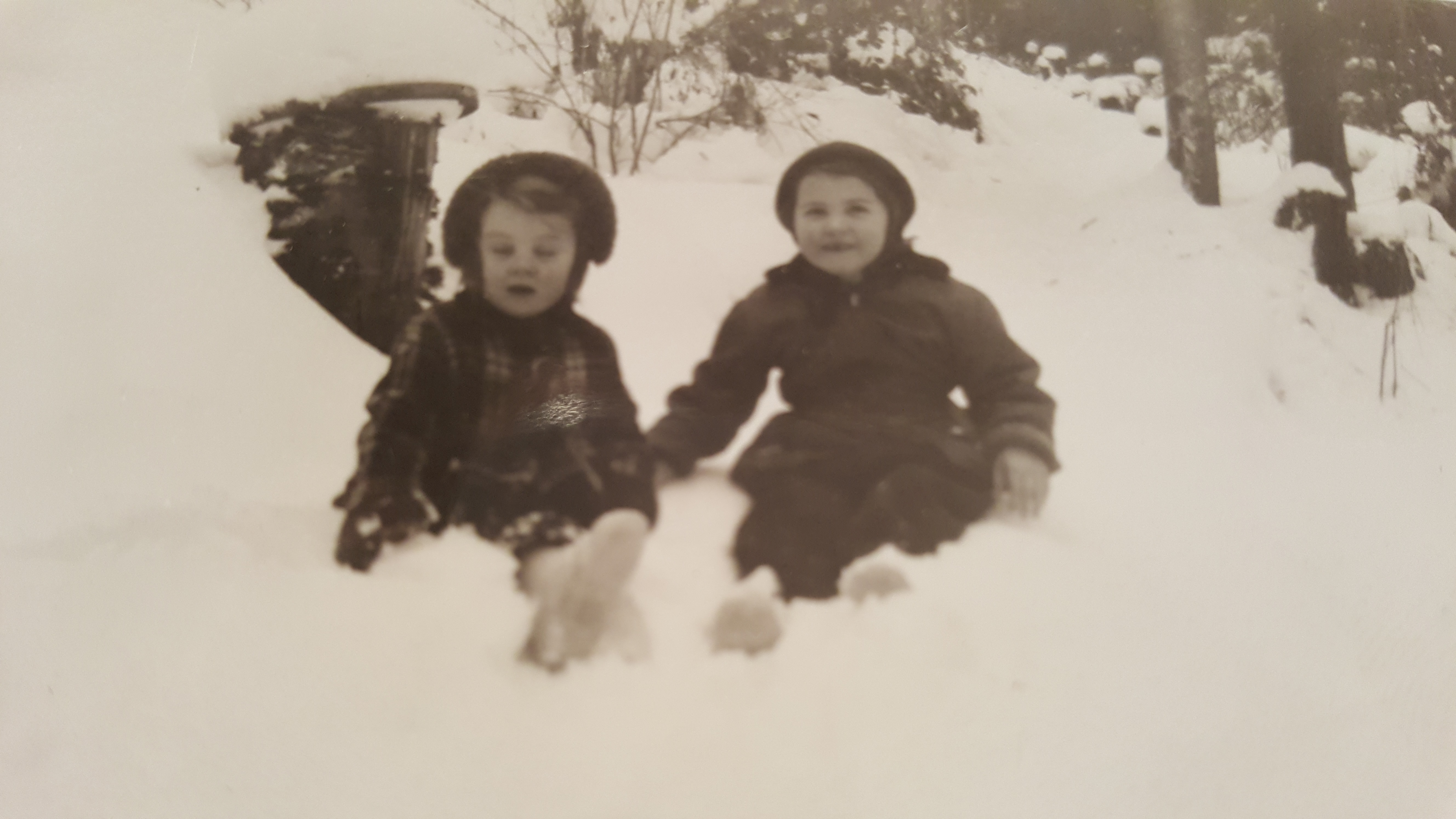
Mary Vandeberg and her sister Gail in the snowy Sunshine Coast winter of 1954.
Hansen acknowledges those days are over, but has mixed feelings.
“The plows, climate change and over-sensitive parents ruined the great sliding opportunities on Benner Road, which hasn’t been the same since those days. Then again, it could be because I grew up and know now that I would never let my kids slide on Benner Road.”
Wherever you end up sliding this winter, keep a few precautions in mind. BC Children’s Hospital recommends that young ones wear a ski, hockey, or bike helmet for tobogganing. Make sure your kids know how to control their speed and stop properly. Choose a slope away from roads and free from obstacles, such as rocks, trees, and fences. Never ride on a sled that is being pulled by anything motorized.
Bundle up, stay safe, and enjoy the snow!
The Missing Link: Connecting the Coast to Squamish
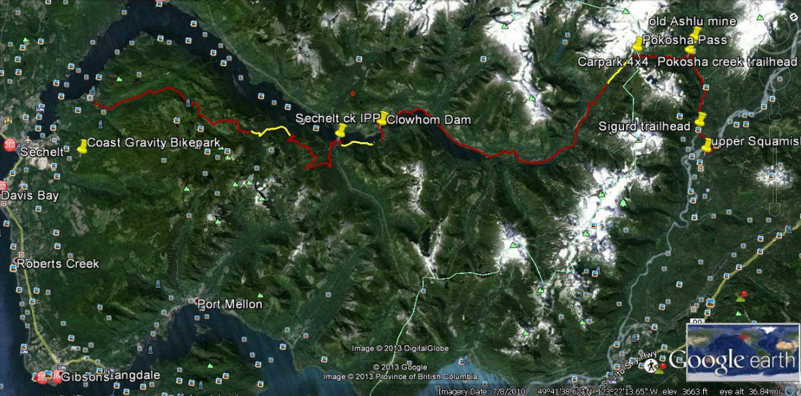
Yellow sections on this Google Earth map indicate about 10 kilometres of work needed to complete a trail connecting Sechelt with Squamish.
The map looks straightforward at first. As the crow flies, little more than 50 kilometres separate Sechelt and Squamish. Then you notice contour lines, crammed together like intense low-pressure systems, numerous splashes of white, indicating icy peaks, and deep blue streaks showing alpine lakes and ocean inlets. In between are green valleys that never seem to quite connect. Old logging roads, new hydroelectric projects, powerlines and pipelines present an extra layer of complexity revealed by Google Earth.
A cursory Internet search turns up more than 100 years of failed attempts to build a road system between the Sunshine Coast and “the mainland”.
So when Geoff Breckner tells me he’s about 10 kilometres away from completing a 75-kilometre trail connector, I’m interested.
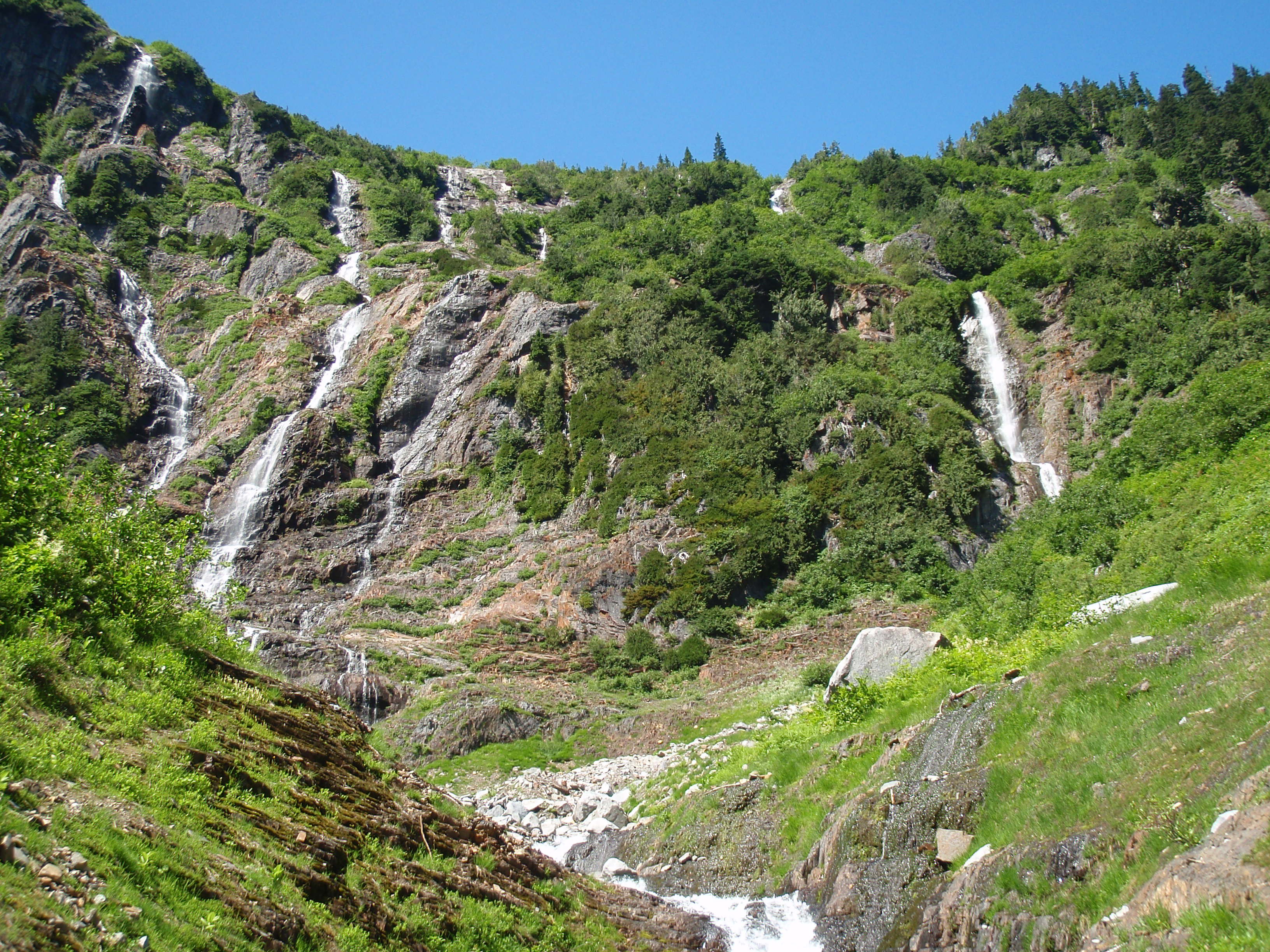
If successful, the trail would reveal a side of the Sunshine Coast unfamiliar to most residents, including a series of spectacular waterfalls between Pokosha Pass and Clowhom Valley. All photos courtesy Geoff Breckner
“With 10 capable guys and permission it could be finished in a week or two,” Breckner tells me by phone from Squamish. “But there are channels to go through, rules to be followed … funding.”
Breckner is recovering from major back surgery. When his doctor advised him to exercise he began hiking into the backcountry near his home in Squamish. The 53-year-old estimates he spent 200 hours during the last two summers working on the Squamish end of the trail.
A self-described “mountainbiking nut,” and “bush rat,” Breckner grew up in Deep Cove when the sport was still a novelty. He opened Pemberton’s first bike store, High Line Cycles, in 1994. A trail connecting Squamish with the Sunshine Coast makes a lot of sense, he says.
“I thought this was a great place for a bike trail. I knew there were logging roads up there and I researched as much as I could, checking out the feasibility of a route to Sechelt.”

Geoff Breckner’s tent at the south side of Pokosha Pass, near Mount Jimmy Jimmy.
Visit Breckner’s Facebook site ‘Squamish to Sechelt Trail’ and you’ll see a Google Earth image of the proposed route. From Upper Squamish and the Ashlu River Road, the route first heads north over existing trail through 4,000-foot Pokosha Pass before heading south, then due west following Clowhom Lake to Salmon Inlet, skirting the Tetrahedron Provincial Park, and on towards Sechelt via the Coast Gravity Bike Park.
About 55 kilometres of double track roads, and 20 kilometres of single track trails make up the route, says Breckner. The 10 kilometres still to be cleared comprise three sections of one kilometer, four kilometres and five kilometres.
“Once complete, it would be a long ride – two days for most people, but I hope to have a hut or shelter so people don’t need a tent and can travel light,” says Breckner. “The main problem would be lack of use, rather than overuse. The more use the better, to keep trail maintained and established.”
Breckner has received numerous offers of help from this side of the divide. Doug Feniak of Tillicum Bay is among those pledging assistance.

A self-described mountainbiking nut, Geoff Breckner rarely goes anywhere without his ride.
Feniak grew up riding with Breckner in Deep Cove. “It was a dream of ours when we were young, to be able to ride from Squamish to the Coast,” says Feniak. “We hiked into the Tetrahedron in August, looking for the best way. It’s super steep into Thornhill Creek but it shouldn’t be too bad after that because it’s old roads covered with Alders.”
Trails are in the Feniak family’s blood. Wife Jessica Huntington and son Linden both build trails, the latter professionally. Daughter, Holly, was 2012 downhill mountainbike Junior World Champion.
Doug says he expects to have a group working on this end of the trail in the fall.
“It would certainly be good for tourism here and I could see the B.C. Bike Race using it,” says Feniak.
Long-time local trailbuilder, Richard Culbert, says a trail to Squamish is “common sense”.
Culbert built the trail to the summit of Mt. Elphinstone, opening it on his 70th birthday. Now at 75, he’s busy clearing a trail up 4,700-foot Polytope Peak, which connects with Rainy River Road and Port Mellon due south. He believes that a trail from Squamish stands a better chance of completion if it veers south to Port Mellon, rather than to Sechelt.

Salmon Inlet from the top of Gray Creek Forest Service Road, looking north across Thornhill towards Clowhom valley. It’s about 60km from here to upper Squamish.
“The trail I’m working on is about a kilometer from a logging road, which appears to connect with this route,” says Culbert pointing at a printed version of Breckner’s route. “It also avoids Thornhill Creek [near Salmon Inlet] where the road is covered in alders.”
Warren Hansen concurs. “That gap after Salmon Inlet is some of the most rugged terrain I’ve ever walked in,” says Hansen, forester/area manager for Chartwell Consultants and an avid trailbuilder. “A lot of that area was logged in the 60s and 70s, so we’re talking about logging roads half a century old – many of which have been heavily deactivated and are covered in alder.
“I admire following an idea, but I worry about the sustainability of it,” adds Hansen. “The skeptical side of me thinks that there won’t be enough people using it. It will need to be on a lot of people’s bucket lists to make it sustainable.”
Hansen identifies with Breckner on one level.
“I believe in unfettered access to crown land. You live in the city, you can’t do this and that, but you have spoon-fed amenities. In a rural environment you don’t have those amenities, but you do have unfettered access to crown land. You can hike it, bike it, pick mushrooms in it, build trails. So you use it as you see fit, knowing that one day, it might be logged.”
Perhaps the person most excited about a possible connection is Bjorn Enga. The Granthams Landing-based filmmaker is the founder of Kranked, an online store for electric-assisted mountainbikes. They may upset purists, but bikes capable of climbing mountains in minutes, as opposed to hours, are catching on, says Enga.
“I’ve been riding on the Coast since 2000, and it’s an amazing coastline,” he says. “Suddenly, I’m thinking how much more I can see up there riding an e-bike. Imagine how phenomenal it would be to offer overnight tours with a fully charged battery for the next day.
“The Sea-to-Sky Corridor could become the e-bike capital of the world.”
Enga is helping Breckner with route planning and believes that trail completion is a matter of when, not if.
“Geoff goes way back to the start of mountainbike culture, before the glamour of the parks,” says Enga. “He’s done the hard part and one way or another, the trail will happen.”
In the meantime, some adventurers will continue to blaze their own trails. It seems as though everyone on the Sunshine Coast knows “a guy” who knows a route to Squamish. But their identity can be as elusive as the route.

More falls in the backcountry between Squamish and the Sunshine Coast.
Not so, Todd Lawson and friends, whose epic three-day trek from Lake Lovely Water, Squamish, to Sechelt via Clowhom Lake and Salmon Inlet, was featured in a 2014 issue of Mountain Life magazine. The trio packed inflatable stand-up paddleboards for the trip, which featured untold hours of bushwhacking through endless alder roots and Devil’s Club – an experience Lawson described in the story as “torture”. (He also wrote of the route, “It looked good on a laptop.”)
A different hazard awaited Denis Rogers of Sechelt, and fellow Coasters Mark Guignard and Al Jenkins, who hiked to Squamish in 2004 after being dropped by boat at the head of Narrows Inlet.
“It took us five days,” says Rogers, whose group followed a route from the head of Tzoonie Valley to a 4,800-foot pass, and then down to Falk Creek and a logging road leading to the Ashlu River and Squamish beyond.
“The third day was an interesting one,” recalls Rogers. “I fell in a lake and broke my watch, and Mark, the only one of us who didn’t bring bear spray, had an encounter with a black bear. Mark was about 20 yards ahead of us, picking his way through the boulders, when we shouted to him that a bear was taking an interest in him.
“The bear started down towards him, but then turned back. We suggested that perhaps the bear had been deterred by an offensive smell.”
Some hazards you won’t find on any map.
- To contact Geoff Breckner, email capnbreak@yahoo.ca or visit his Facebook site, Squamish to Sechelt Trail.
Summer in Whistler begins at the lake
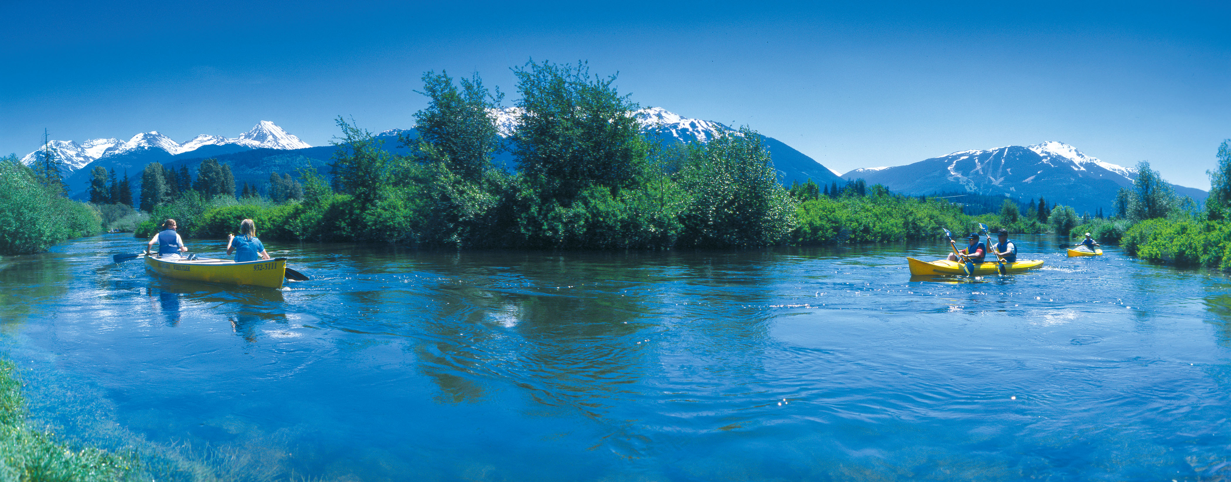
The River of Golden Dreams is an idyllic waterway for a quiet paddle … unless you find yourself in the middle of Whistler’s annual Go Fest and the Great Snow-Earth-Water Race. riverofgoldendreams.com photo
A quiet meander down the River of Golden Dreams, I’d promised my wife. After 36 hours of skiing, cycling, trail running, stand-up paddle boarding, dancing, eating and drinking, this would be a relaxing canoe cruise in the sunshine, a chance to mellow ourselves from weekend warriors to weekend wanderers.
It didn’t work out that way.
We’d come for Whistler’s Great Outdoors Festival, aka GO Fest. Held on the Victoria Day long weekend, GO Fest was the chance to cram an entire Whistler summer of activities into four days. A packed schedule had offered everything from fly-fishing to disc golf, river rafting to yoga, and much in between that involved wearing a silly costume.
By Sunday, my legs were aching from Saturday-night’s AlpenGlow Fun Run, a six-kilometre jog around Lost Lake, while wearing glow sticks. Or they might have ached from skiing Blackcomb’s Seventh Heaven all day; or from jumping up and down to The Sheepdogs during Friday night’s concert in the village.

The River of Golden Dreams connects Alta Lake and Green Lake. riverofgoldendreams.com photo
Cycling Whistler’s Valley Trail on Sunday morning, we stopped at Lakeside Park where we met Eric White of Backroads Whistler. When he told us about paddling the River of Golden Dreams, the timing seemed perfect: No pressure to perform; tranquility now. Backroads Whistler even picks you up at the end of the two- to three-hour paddle.
“People were coming here for the lakes long before the skiing,” Eric pointed out. “I think you’ll really enjoy it.”
To get our sea legs we warmed up with a stand-up paddle boarding session. Stand-up paddle boarding, or SUP, has taken off in recent years and it’s easy to see why. Not unlike snowshoeing, SUP offers a short learning curve and gets you closer to the elements. It can be as relaxing or as strenuous as you want. Eric gave us a quick tutorial on the dock and we were off.

Pasty Englishman attempts balance feat on stand-up paddle board!
The Kahuna boards designed by Whistler local, Steve Legge, were exceptionally stable, despite my initial fears of falling. (The lake ice broke just a month before!) It only took a couple of lengths between Lakeside’s docks for it to begin to feel like a core workout.
Now acclimatized to the occasional gusts picking up on Alta Lake, we paddled to shore for a new vessel.
Backroads offers kayaks and double kayaks but we opted for a two-person canoe. The canoe requires smooth communication between paddlers to navigate the notoriously tight corners of the River of Golden Dreams.
It’s also known as “The Divorce Boat,” according to Eric.
“We’ve only been married 23 years, what could possibly go wrong?” I asked my wife.
The River of Golden Dreams connects Alta Lake with Green Lake about three kilometres north. Because of its stubborn refusal to follow a straight line, the river’s full length is closer to five kilometres. In places, the river is barely wider than a canoe and portaging is sometimes necessary, depending on water levels, which can fluctuate rapidly depending on rain and snow melt.
After a quick paddling tutorial, we donned our lifejackets and set sail. Within 15 minutes we’d crossed Alta Lake and were nearing the mouth of the river. That’s when I noticed people waving at us from a bridge. Seconds later we heard a siren – the kind that’s normally accompanied by a loud voice shouting “release the hounds”.
“Why are those people waving at us?” asked my wife from the bow.

riverofgoldendreams.com photo
The answer appeared over our left shoulders: canoeists, two to a boat and wearing helmets and numbered pinnies, launching from a nearby beach and paddling straight for us. Unsure whether the people on the bridge were waving us in or away, we opted to paddle for the river, full steam ahead.
At the bridge we made two discoveries. The first was that we’d need to portage a few yards because we’d arrived at a weir. The second was that we’d unwittingly joined a pivotal leg in GO Fest’s Great Snow-Earth-Water Race – a grueling six-stage competition involving skiing, biking, running and canoeing.
“We’re expecting two dozen canoes through here,” a young man with a radio told us. “You might want to sit out and let them through.”
It occurred to me that on a narrow, winding river with few passing lanes and a head start, we could actually try and win the race. Then my wife reminded me that this was supposed to be a cruise. She also said something about ethics.
So for 20 minutes we perched at a picnic table and watched contestants portage their canoes around the weir and back into the river, cheered on by locals. When everyone had passed us, we re-launched and quickly learned to adapt to the river’s ever-changing moods: turn too tightly and fast eddies would pull us into the reeds; lose concentration and we’d find ourselves turning sideways to the current.
But the lush wetlands and snowy peaks beyond the banks made up for the occasional brushes with low branches. Better yet, during the course of our 90-minute paddle we became minor celebrities to those who had turned out to cheer on the racers. Everyone loves plucky losers and despite not wearing race pinnies, we were assumed by many to be the last-place finishers in the canoe stage of the Great Snow-Earth-Water Race.
I still think we probably could have won it!
The River of Golden of Golden Dreams (Backroads Whistler – riverofgoldendreams.com or 604 932-3111) is just one of a multitude of adventures awaiting visitors to Whistler this summer. Here are five more.

Several runs atop Blackcomb and the Horstman Glacier are open for skiing and boarding until late July.
Hit the Valley Trail: For a better perspective on Whistler’s surroundings get out of the village and onto the Whistler Valley Trail. More than 40 kilometres of paved trail and boardwalks connect Whistler’s lakes, parks and neighbourhoods. The trail is suitable for bikes, rollerbladers, joggers, walkers and well-behaved pets. Whistler.com offers more information on making the most of the Valley Trail, including a blog on the trail’s “six perfect spots”.
Shred the Park: Valley Trail offers a benign cycling experience and cross-country cyclists will find more than 500 kilometres miles of single track around Whistler. The Whistler Bike Park though condenses the best of Whistler’s downhill for all levels of mountain biker. Ride the lift up and take your pick of alpine view trails, banked cruisers through the forest, tight, winding single track and – for the experts – steep rock faces. Whistler Bike Park offers numerous ticket deals, including some with rentals, and accommodation packages. More information is at whistlerblackcomb.com.

Buckle up and ride the Elaho! Eric Beckstead photo
Ride the river(s): If paddling the River of Golden Dreams is too tame for you, consider whitewater rafting either of the Green, Lower Cheakamus, Elaho or Squamish rivers. A range of half-day and full-day tours are available from Whistler, (whistler.com/rafting) or from the Sunwolf Centre in Brackendale near Squamish (sunwolf.net/rafting).
Fly by the seat of your pants! The most exciting thing I’ve ever done in Whistler is ziplining at Cougar Mountain, just north of Whistler. Superfly Ziplines (superflyziplines.com) runs Canada’s longest, fastest, highest ziplines where speeds of more than 100 km/h are made possible by runs well over a kilometer long, 200 metres off the ground. Strap into a paragliding-style harness, attach to half an inch of galvanized steel with a trolley rig and prepare to fly! Ziptrek Ecotours (ziptrek.com) combines similar thrills above Fitzsimmons Creek with a strong environmental ethos.

Ziplining at Cougar Mountain, just north of Whistler.
Ski in a T-shirt: For all the great winter skiing at Whistler, the novelty of descending Horstman Glacier while wearing a T-shirt in July is hard to beat. Until late July, two or three runs, plus the terrain park remain open atop Blackcomb where lunch on the deck of the Horstman Hut is a must.
* For details of summer accommodation packages, visit fourseasonswhistler.com

Men of Steele

Next time we’ll bring snowboards and deckchairs.
My friend Tom and I had been planning a trip to the Tetrahedron for about 10 years. This weekend we finally did it. In hindsight, hiking to Mount Steele cabin would have been easier when I was 36, not 46.
At the base of 5,114-foot Mount Steele, the cabin is one of four two-storey cabins in Tetrahedron Provincial Park, each built to accommodate 16 people – first come, first serve. The others are at Bachelor Lake, above Edwards Lake, and between McNair and Chapman Lakes. The cabins are connected via a 25-kilometre trail network and are maintained by the Tetrahedron Outdoor Club.
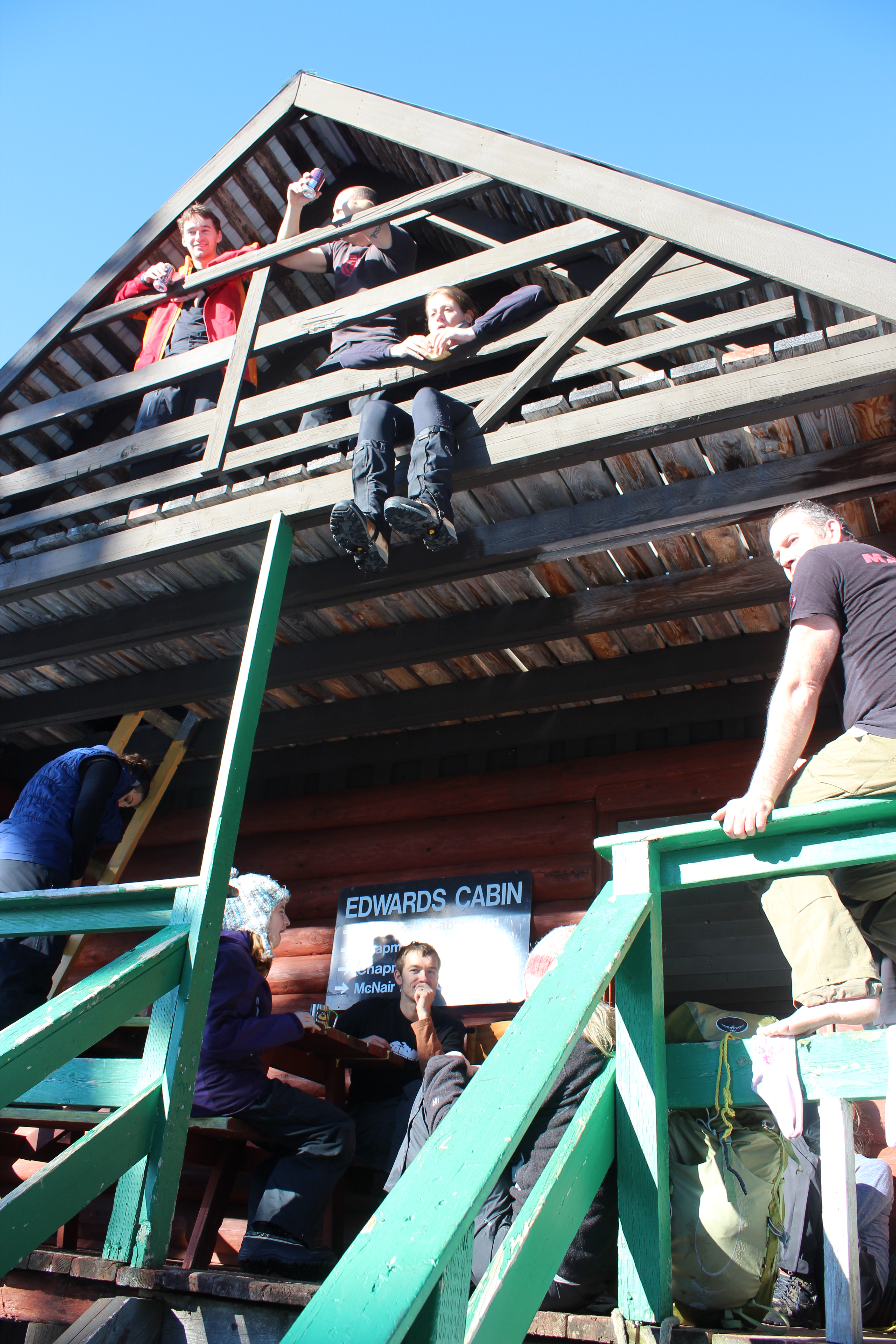
Lower Mainlanders enjoying lunch at Edwards Cabin.
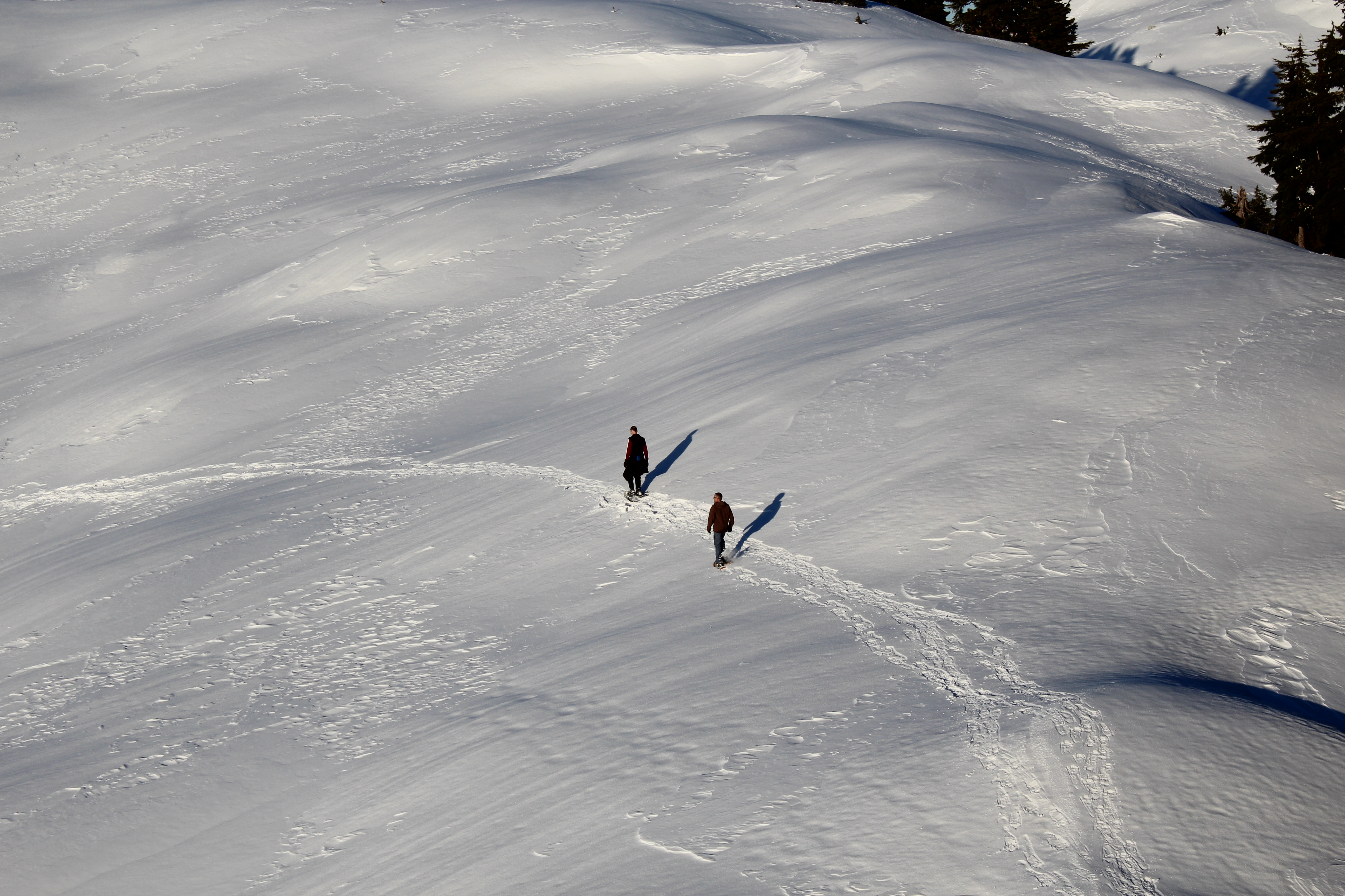
We set off on snowshoes from the trailhead up Grey Creek Forest Service Road. In true Sunshine Coast fashion, the Tetrahedron is not signposted from the road, despite being a Class A provincial park. That might explain why there are only three other cars in the parking lot on a sunny January weekend.
Six thousand hectares of mountains, lakes, streams, wetlands and forest, the Tet, as it’s fondly known, has long been cherished by the backcountry enthusiasts who can actually find it. We finally meet some of those enthusiasts about two hours into our hike at Edwards Lake. They’re a group of 12 skiers and snowshoers from the Lower Mainland who are planning to stay at Edwards Cabin. We stop for lunch with them there before pushing on at 1 p.m.
So far we’ve been hiking for about two hours. There’s been no new snow for a week, temperatures are above freezing and the sun’s out. The sign at Edwards Cabin says it’s just three more kilometres to Mount Steele Cabin. It doesn’t mention the elevation gain of 1,300 feet, but that much is obvious from the contour lines on Tom’s map, which look like an intense low pressure system; that and our occasional glimpses of Mount Steele – white, jagged and way up there beneath the bright blue sky.

Downtime at Edwards Lake. We opted not to test the ice.
The climb begins almost immediately, as does the sweat, pouring off me and soaking me from head to toe. The steeper it gets the happier Tom becomes. He shouts encouragement and I try to ignore the chafing of 20-year-old longjohns and the borrowed 40-pound rucksack on my back. Following tree markers, we zig-zag our way through amabilis fir, mountain and western hemlock, yellow cedar and white pine while Tom yells to me about his merino wool base layers. “Not a drop of sweat,” he shouts. “This material wicks all the sweat away!”
I don’t say anything. I’ve stopped talking to Tom.
After an hour of this I’m resting every 10 steps. I’m eating snow to try and and conserve my water. We appear to have cleared the forested section but that brings its own problems. We can’t see any more tree markers. So Tom checks his map and his compass and we decide to climb one of Steele’s lower open slopes, figuring the cabin will surely become visible as we ascend. But with no more markers in sight, we get cold feet – actually, mine are soaking wet. (Tom’s aren’t. He has merino wool socks … or something.)
So we descend, covering the same distance in 10 minutes that took us 30 minutes to climb. It’s 3:30 p.m. and for the first time all day, I have one eye on the time. The sweat is freezing on my back and it will be dark in 90 minutes. After some searching though, Tom spots a marker and we’re off again, climbing in a different direction toward a ridge that he swears will take us to the cabin. From the ridge we’re treated to views of the Tantalus Range and the markers continue to guide our way.

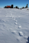
Mount Steele cabin, as seen from the top of Mount Steele.
Just before 4, I hear Tom from up ahead. “I can see the cabin!”
Thank God he’s not lying, I think as I catch up a few minutes later.
There it is, its red roof standing out against so much white. We savour the last few steps. I don’t think I’ve ever seen a location quite so beautiful. We have the place to ourselves. According to the guest book, we’re only the second visitors this year. An hour later at the metal kitchen table, we’re eating curry and naam bread cooked on the wood stove, washed down with a couple of beers. The cabin is well equipped, with mattresses in the attic, firewood in the basement, a kitchen counter with utensils and a couple of sinks. We melt snow for water and turn the stove down to a slow burn. Pretty soon the entire cabin is toasty warm.
It would seem impossible to put a price on such an amazing place, but the Tetrahedron Outdoor Club came up with $10 a night, which seems more than reasonable. More than a quarter of a century ago, the club used to be known as the Tetrahedron Ski Club. Back in 1987, the club mobilized more than 200 volunteers, 45 businesses, schools, community groups and several levels of government to build the Tetrahedron’s cabins and trail network.

Beer, curry, mates – just another Saturday night.
The cabins were built at Sechelt airport before being disassembled and flown by helicopter to be reassembled on site. Forestry company, Canfor, and the Sunshine Coast Regional District donated timber, Sechelt Creek Contracting provided logging service, Airspan donated some air time, Gibsons Building Supplies provided crane trucks and the Outdoor Recreation Council pitched in with chainsaws. For one of the few times in Sunshine Coast history, one great idea united governments, businesses, and local volunteers – in the midst of a recession, no less.
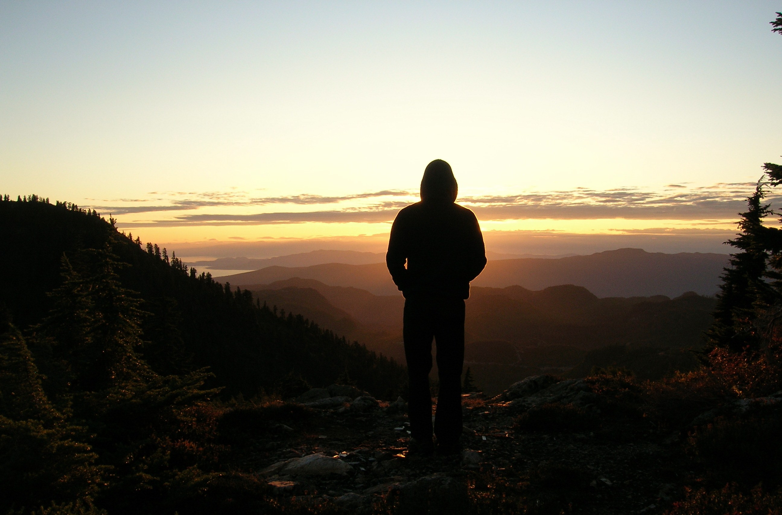
For all the day’s exertions, I can’t sleep. After midnight I set up my tripod outside and try and capture Mount Steele by moonlight with varying results. Fog covers Georgia Strait but I can see lights twinkling on Vancouver Island. There’s no bite to the breeze blowing and I feel like the last person on Earth. I may be delusional. I go back to bed.

The moon over Mount Steele. Sometimes not sleeping isn’t so bad.
In the morning under clear skies we hike to the top of Mount Steele. It’s difficult to reconcile this rugged terrain and such epic landscapes with the place I call home. For me, the Sunshine Coast typically conjures images of rainforest and beaches, not jagged peaks and frozen lakes. But then visiting this place would surely alter anyone’s perceptions.
Tom vows to bring his snowboard next time. I’m thinking a deck chair. We pack up, sweep up, and head out for the descent to civilization. Yesterday, it took us six hours to get here. Today we’re back at the car in just over two hours.
I relish every step of our tracks with a smile.
- For more information about the Tetrahedron Outdoor Club, visit www.tetoutdoor.ca
- Four-wheel drive and chains are essential for visiting the Tetrahedron. For more information about the park, visit www.env.gov.bc.ca/bcparks
- There can be a significant avalanche risk on Mount Steele. Before heading out, check with www.avalanche.ca/cac/bulletins/latest
- For more on the history of the Tetrahedron Outdoor Club, visit my earlier blog post here.
- If your fitness is kind of sketchy and you’re inexperienced in the backcountry, consider taking Tom with you. I couldn’t have done it without him.


The Icemen Cometh

Unlike Amundsen, who used dogs exclusively, Scott’s exploration and scientific teams usually man-hauled their heavily-laden sledges, often over great distances. Courtesy RBCM © Bettmann/CORBIS
With the benefit of a century’s hindsight, it’s clear only one man could have reached the South Pole first and made it back alive. In 1911-12, Norwegian explorer Roald Amundsen made his 1,660-mile roundtrip with 52 dogs, four sledges, five men and a single-minded focus on being first.
British Navy Captain Robert F. Scott made his final push for the Pole with 10 ponies, 22 dogs, 12 sledges, two motorized sledges, 16 men and a determination to log as much scientific data as possible. The Brits wore cotton; the Norwegians fur. The Brits brought 35,000 cigars and a pianola. The Norwegians did not.
Hindsight doesn’t diminish the enormity of what both men set out to accomplish, or the sacrifices they made. Their decisions drive the compelling tale of ‘Race to the End of the Earth,’ the feature exhibition at Victoria’s Royal B.C. Museum.
The noise of howling winds greets visitors to the exhibit, which recreates an epic story of triumph and tragedy through original artifacts, photographs, letters and authentic re-creations.
Scott’s Terra Nova Expedition had set out to be the first to reach the South Pole, a feat Scott and four companions thought they had achieved Jan. 17, 1912, only to discover that Amundsen’s team had beaten them by 33 days. Trapped in a nine-day blizzard without food or fuel, Scott and his party died on their return. The Norwegians made it back to their ship and a heroes’ welcome in Hobart, Tasmania, where their triumph was made public in March 7, 1912.

Roald Amundsen. Courtesy RBCM © AMNH Library
The exhibit is divided into seven sections, which chronologically tell the story of the men and their shared goal. Amundsen’s binoculars, chronometer, shotgun and sledge are on display, complemented with letters and photographs. A sledge pennant owned by Cecil H. Meares, Scott’s dog handler, is also among the original artifacts. True to the British tradition of Arctic exploration, sledges featured colourful silk flags to be spotted during blizzards. Meares’ pennant is one of only a few that has survived from the era and is locally significant because Meares moved to Victoria in the late 1920s.
Meares isn’t the only connection to Victoria. Scott himself visited the city in 1889/1890 as a Royal Navy Lieutenant. He developed a friendship with a local family and corresponded with them during the next 20 years. And a Canadian member of Scott’s team, decorated scientist Charles S. Wright, worked at the Pacific Naval Laboratory in Esquimalt, and at UBC and Royal Roads before retiring to Salt Spring Island. He died in Victoria in 1975.
The life-sized reconstructions of Scott’s living quarters and Amundsen’s underground workrooms are impressive. So, too, is an Emperor penguin diorama, vividly recreating ‘the worst journey in the world,’ an apt description of a five-week scientific expedition undertaken in winter by three of Scott’s men to collect Emperor penguins eggs. The three barely made it back alive.
And another of the savvy Norwegians’ decisions, that of building underground quarters out of the extreme wind and cold, is dramatically realized in a life-size re-creation
But it’s the smaller details that are memorable; the sepia photos of both men in their living quarters, on their skis and hauling sleds (the Brits felt hauling their own sleds showed strength of character); and the farewell letters written by Scott, in which he urges, “for God’s sake, take care of our people”. The British public was inspired to raise more than $75,000 ($7 million today) for those widowed and orphaned by the expedition. In 1913, King George V attended a standing-room-only memorial service for Scott’s team in St. Paul’s Cathedral.
The Royal B.C. Museum includes interactive and hands-on educational activities, allowing visitors to see how scientists live and work in Antarctica today. “Touch-this” stations are a nice addition, too, encouraging visitors to feel Reindeer fur and an Emperor penguin’s egg, among other items.
RBCM’s conservator Jana Stefan recently returned from her second visit to Antarctica, where she’s been helping to restore Scott’s expedition base camp – still standing after more than a century! Her work preserving more than 10,000 of the camp’s artifacts is presented on video. And for film on a more epic scale, IMAX Victoria in the RBCM is screening Shackleton’s Antarctic Adventure. British explorer Sir Ernest Shackleton’s 1914-1916 Antarctica Expedition is an extraordinary story of survival – beautifully filmed, and narrated by actor Kevin Spacey.
The RBCM is the only Canadian stop for Race to the End of the Earth, which runs until Oct. 14. Children’s summer camps and a lecture series featuring B.C. adventurers who have explored Antarctica are scheduled. For details, visit www.royalbcmuseum.bc.ca or call 1-888-447-7977.
During the winter, Amundsen’s men dug an extensive network of tunnels and rooms, including a bathroom and even a sauna. This life-sized re-creation shows an underground workroom in which his crew was able to work on their expedition gear away from the extreme wind and cold outside. Courtesy RBCM © AMNH/D. Finnin
If you go:
Victoria’s Parkside Hotel and Spa is a short walk from the Royal B.C. Museum. It offers a family package from $179 a night, including family admission to the museum, two-hour rental of the hotel’s private movie theatre, plus a snack basket with pop, popcorn and candy. Call 1-866-941-4175 or visit http://www.parksidevictoria.com/.
B.C. Ferries offers numerous summer package deals to Vancouver Island, including a Victoria Getaway from $109 per person, based on double occupancy. The package comprises one night at the Chateau Victoria Hotel, round-trip ferry from Vancouver for two adults and a car, plus complimentary parking. For more information on this and other deals, visit http://www.bcferriesvacations.com/ or call 1-888-BC FERRY.
For all other matters-Victoria, visit http://www.tourismvictoria.com/.
Heart of green
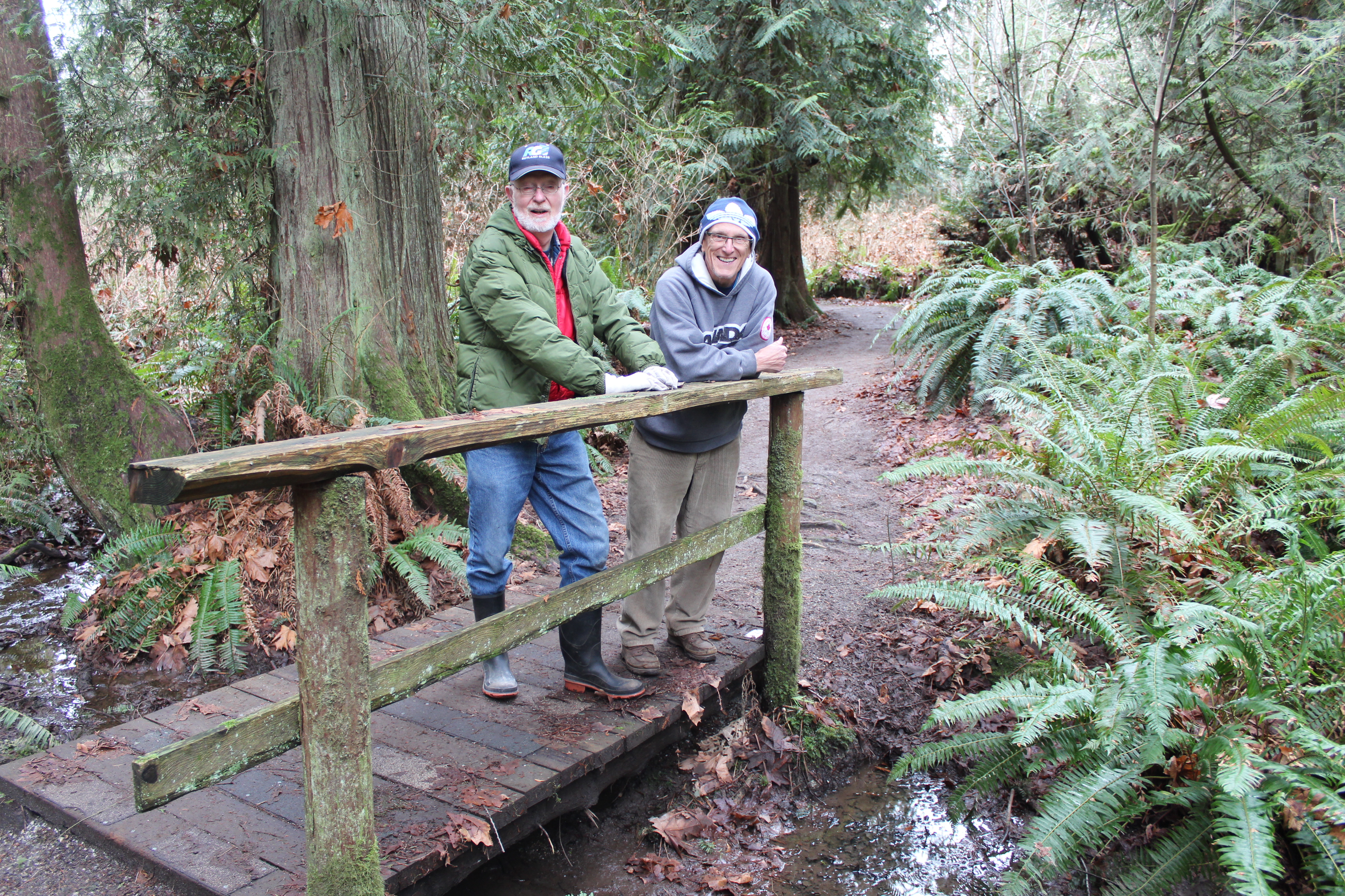
Sechelt Rotarians, Tom Pinfold (right) and Mick van Zandt on the trails of Kinnikinnick.
Shirley Macey didn’t have time to waste. When she wasn’t coaching kids, she was raising a family, working as a Gibsons RCMP dispatcher, and lobbying local government for more recreational space.
Somehow she found time every week to climb Soames Hill with a garbage bag to pick up other people’s litter.
“She was pretty amazing,” remembers her son Darin. “I didn’t think much of it growing up; now I don’t know how she did it.”
At the southern end of the Coast, 14 hectares of Soames Hill Regional Park are named after Shirley Macey. No doubt she would be proud of the soccer fields, the wheelchair-accessible playground and Frisbee golf course. Shirley – or Sam (an acronym of her full name, Shirley Amelia Macey) to her friends – was a dedicated volunteer whose legacy is by no means unique.
Shirley Macey, Maryanne West, Ted Dixon, Cliff Gilker and Hackett are – to name a few – venues so familiar to most of us that it’s easy to forget that they were also people. Ted Dixon, for example, worked tirelessly for self-government for the Sechelt Indian Band before dying in a car crash in 1981. Maryanne West was the backbone of community TV and so many volunteer projects before dying at age 90 in 2008.
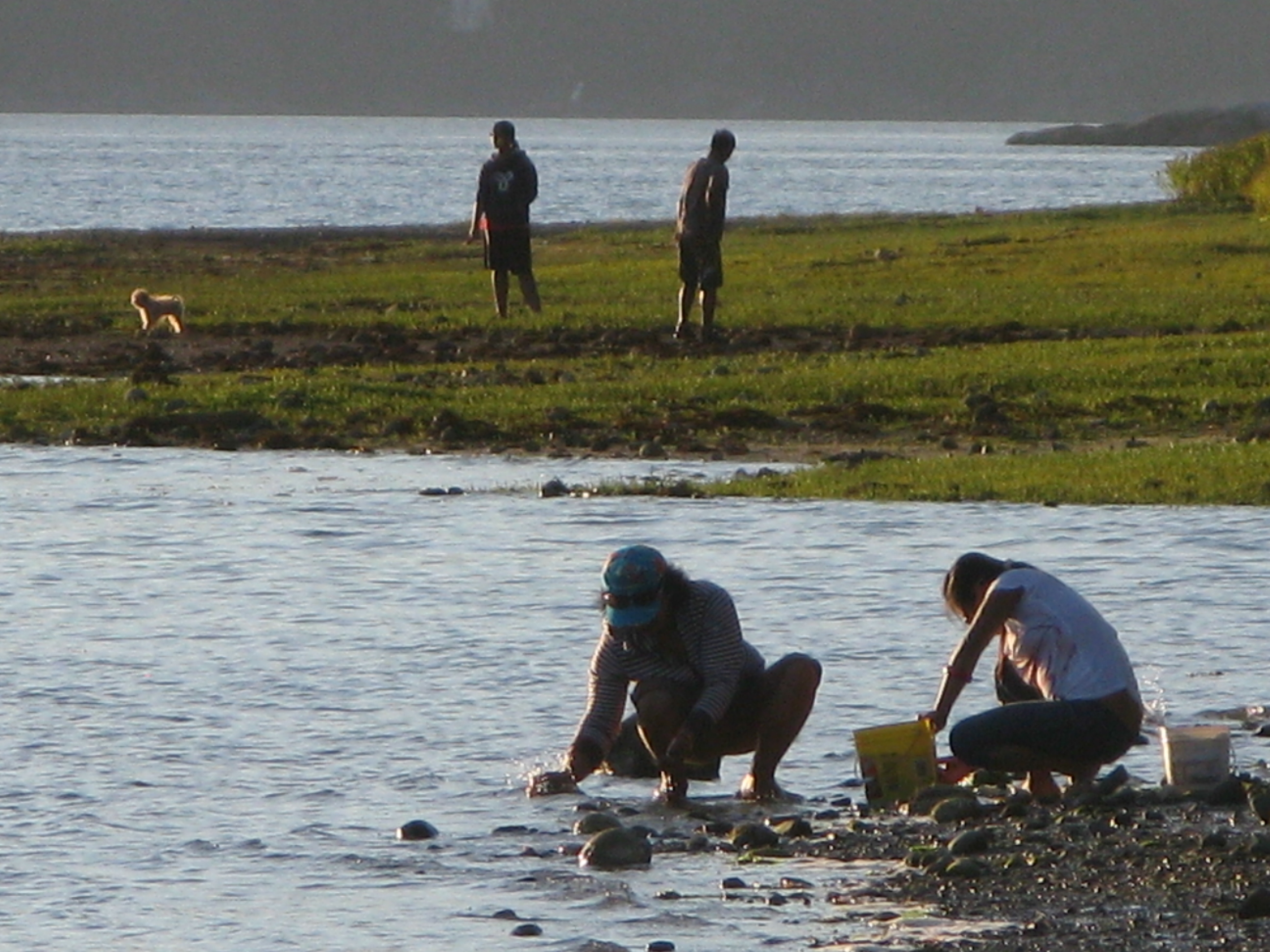
Scavenging the shoreline at Porpoise Bay. For parks and beaches, Sunshine Coasters are spoiled for choice.
And not all parks bear a family name. Brothers Memorial Park in Gibsons was named for logging contractors, Al and George Jackson who donated the land.
Today, volunteers continue to be the lifeblood of the Sunshine Coast’s parks and trails. In fact, the parks system wouldn’t work without them.
“We totally rely on volunteerism,” says Sunshine Coast Regional District parks planning coordinator, Sam Adams. “We wouldn’t be able to do what we do without it.”
For the SCRD that means mobilizing volunteer help in bigger parks like Dakota Ridge, where members of the Dakota Ridge Advisory Committee have been particularly helpful. Volunteers also help the SCRD maintain trails at Soames Hill, most recently working to improve the wooden stairs. Now the regional district is hoping to cultivate more volunteer assistance with an adopt-a-trail program.
“Part of our work plan for 2013 is to develop a more robust volunteer program,” says SCRD parks planning coordinator, Susan Mason. “We have kilometres and kilometres of trails to maintain, so people willing to document changes on a regular basis are helpful to us.”
The government-volunteer relationship is similar elsewhere on the Coast. District of Sechelt parks supervisor Perry Schmitt is grateful for the work of several trail building groups, as well as established service clubs.

Sunshine Coast Lions Club president Len Schollen at the site of the Lions’ next project, an accessible viewing deck in the corner of Mission Point Park where the beach and Chapman Creek meet.
“The Lions Club has been instrumental in making improvements to Mission Point park and the Sechelt Rotary Club has been assisting in rebuilding decks throughout Kinnikinnick forest trails,” says Schmitt. He also cites the work of the Sechelt Groves Society at the Heritage Forest trails, and the Sunshine Coast Natural History Society, which tends to Sechelt Marsh.
On a cold blustery day, Sunshine Coast Lions Club president Len Schollen shows me work completed on the Mission House deck and the next project – an accessible viewing deck in the corner of Mission Point Park where the beach and Chapman Creek meet.
“We’re basically waiting for some decent spring weather to build the viewing platform and a hard-surface ramp leading up to it,” says Schollen, surveying the footings already in place. “There’ll be a railing around it and hopefully some signs with information about the salmon run and pointing out places like Mount Arrowsmith.”
Why are Schollen and other Lions members involved in the project? “We serve, is the Lions’ motto,” says Schollen simply. “We try to make this a better place to live.”
It’s a sentiment shared by Sechelt Rotarians, Tom Pinfold and Mick van Zandt, when I meet them on the trails of Kinnikinnick park.
“We wanted to work on small projects where a few people could work for a few hours on something with lasting benefit,” says Pinfold. “We’d much prefer to let the District allocate their resources to new things instead of maintenance.”
With other Rotarians, the pair has replaced and built cedar bridges and decks throughout Kinnikinnick’s trails during the last three years. Topped with roofing tiles, the decks are essential given the drainage issues on multi-use trails in a popular park. The new bridges should be good for at least 10 years, reckons Pinfold. (Elsewhere in Kinnikinnick park and at Sprockids park in Langdale, Capilano University students hone their trail-building skills as part of the Mountain Bike Operations Certificate curriculum.)
There are 13 kms of groomed trails for cross-country skiers on Dakota Ridge, yet another Coast playground.
Pinfold and van Zandt have also worked on a wheelchair accessible deck at Halfmoon Bay’s Trout Lake and a viewing platform and trail in Roberts Creek’s Cliff Gilker park.
Elsewhere, volunteers continue to make the Sunshine Coast a great place to play. If you’re searching for the heart of the Sunshine Coast you’ll find it in any park or trail. From Pender Harbour’s Lions Park (the best soccer field on the Coast) to the mountain bike trails of Sprockids Park in Langdale, outdoor recreation thrives because people care enough to make it happen.
People like Shirley Macey.
Shirley didn’t live to see the park she’d fought for named in her honour. Just months after retiring from the RCMP and paying off her mortgage, she died of cancer in 1998.
“I didn’t realize until I was older that quite a few people called her mom,” recalls Darin, who has four kids of his own now. “I met all these people I knew at her service who thought of her as a surrogate mother.
“My kids are certainly proud of the park’s name. It’s too bad she died so young.”
Trail Mix
There are numerous opportunities to get involved in outdoor volunteering. Here are a few websites where you’ll find more information.
http://secheltlionsbc.lionwap.org/
email tony@whiskeyjacknaturetours.com for the Sunshine Coast Natural History Society
Thanks to the Sechelt Community Archives and the Sunshine Coast Museum and Archives for their help in researching this feature.
Cabin fever
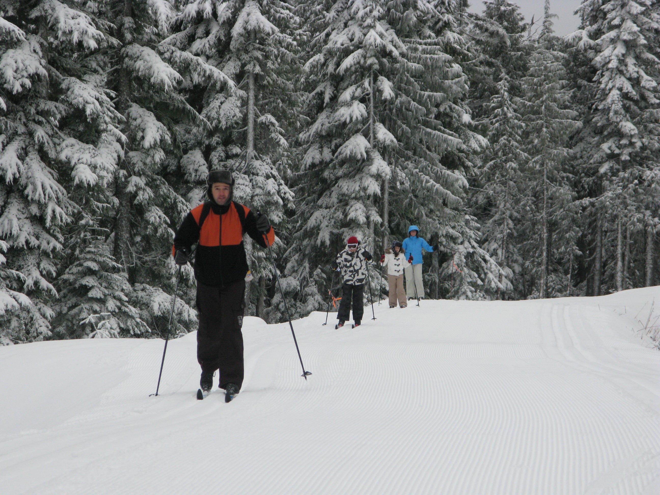
Snowshoers make their way to Mount Steele Cabin, one of four cabins built by the Tetrahdron Outdoor Club in 1987. Reynold Schmidt photo

“We came in by the light of the benevolent and gibbous moon waxing to near fullness. The skies were clear and the spirits were high, peeling laughter for 48 hours and sleeping for six.”
– An entry in the Bachelor Lake Cabin, Tetrahedron Provincial Park
Some people move to the Sunshine Coast to get away from it all. The Tetrahedron is where Sunshine Coasters go to get away from it all. Six thousand hectares of mountains, lakes, streams, wetlands and forest, the Tet, as it’s fondly known, has long been cherished by backcountry enthusiasts.
In 1987, a group of those enthusiasts banded together to mobilize more than 200 volunteers, 45 businesses, schools, community groups and several levels of government: their mission, to build cabins linked by a trail network.
Back then, they called themselves the Tetrahedron Ski Club. A quarter of a century later, they’re the Tetrahedron Outdoor Club, a group justifiably proud of the legacy created northeast of Sechelt. Last summer, club members marked the 25-year milestone with dances, parties, pancake breakfasts and numerous trips down memory lane.

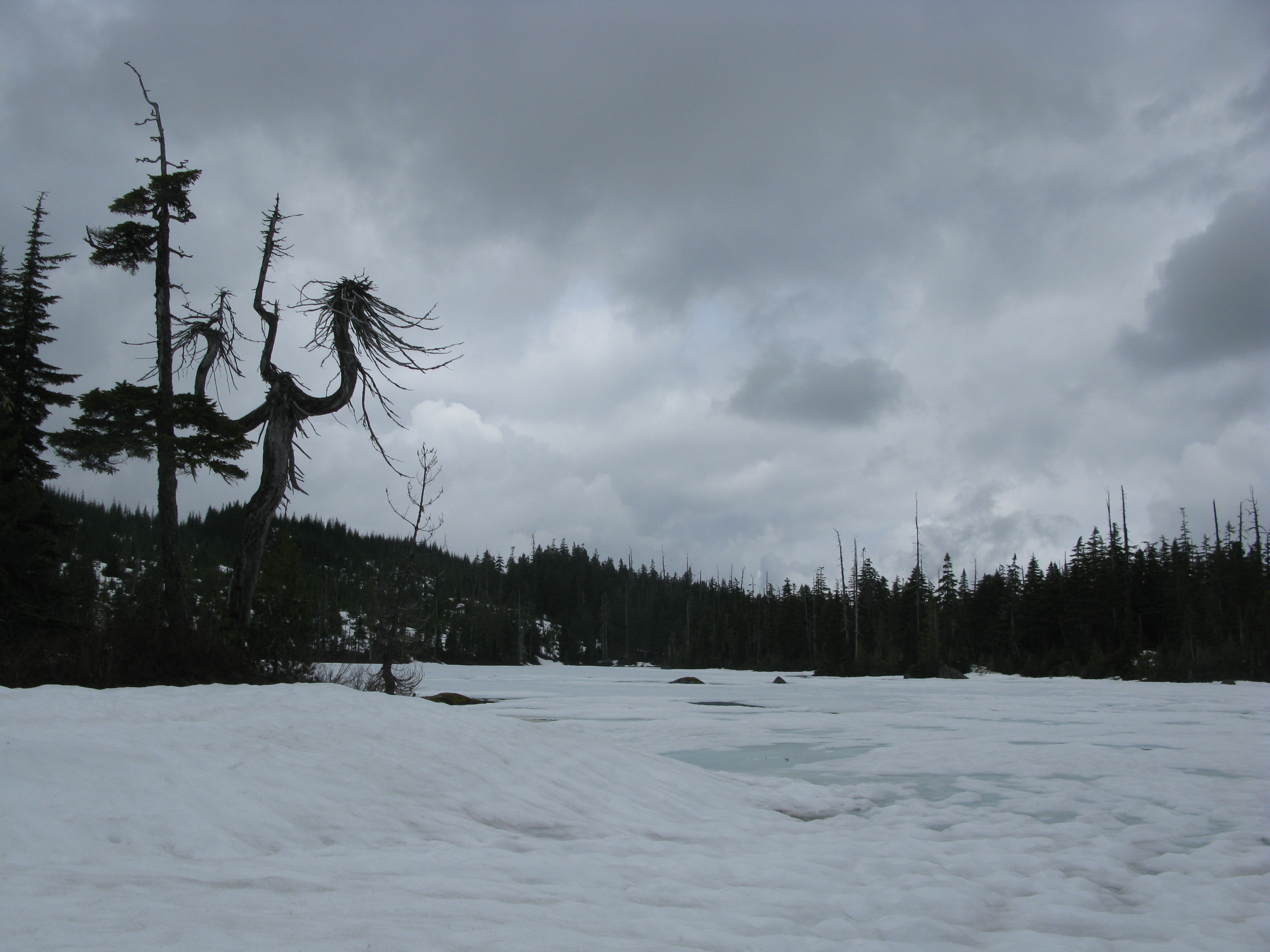
Tannis is one of 10 beautiful lakes in Tetrahedron Provincial Park. In June, the lake was still partially frozen.
Now they’re enjoying the snow.
“Early December, after that first big dump of snow; that’s my favourite time to go,” says club president, Reynold Schmidt. “I usually go with club members, friends – before the crowds.”
It’s June when Reynold and I visit Bachelor Lake Cabin, a one-hour hike from the trailhead up Grey Creek Forest Service Road. With snow more than a metre deep in places, I’m grateful for snowshoes. Partially frozen Tannis Lake is a testament to the cold, wet spring endured down at sea level, 1,100 metres below. At least the mosquitoes are still asleep.
Tannis is one of 10 beautiful lakes in Tetrahedron Provincial Park. There are three mountain peaks – Panther, Steele and Tetrahedron – and some of the oldest trees in the country. Amabilis fir, mountain and western hemlock, yellow cedar and white pine can all be found here. So, too, can the club’s four rustic, two-storey cabins each built to accommodate 16 people – first-come, first serve. They can be reached via a 25-kilometre trail network and are located at Bachelor Lake, above Edwards Lake, between McNair and Chapman Lakes, and below the summit of Mt. Steele.
A 25-kilometre trail network links the cabins in Tetrahedron Provincial Park. BC Parks photo
Inside Bachelor Cabin, we stop for lunch, seated on a long wooden bench at a metal table. There’s a wood stove and firewood. Above us is a sleeping loft with foam mattresses. From the kitchen window, looking across frozen Bachelor Lake, it’s hard to imagine “crowds”. We haven’t seen a soul all day. But weekend and holidays during the winter can be busy at the cabins, confirms Reynold, a natural resource officer with B.C. Ministry of Forests, Lands and Natural Resource Operations.
“We’ve had our problems with vandalism over the years, people coming just to party and not cleaning up after themselves,” he says. “There has been a lot of debate within the club to create a reservation system, but some members are adamant the cabins remain for everyone’s use.”
This year, the club has appointed stewards, two people per cabin, responsible for maintenance and regular monitoring. “They’re regular backcountry users who get to use the lockboxes to store their gear, so they don’t have to carry stuff in each time,” says Reynold.
“It helps dispel the sense that these are party cabins,” he adds.
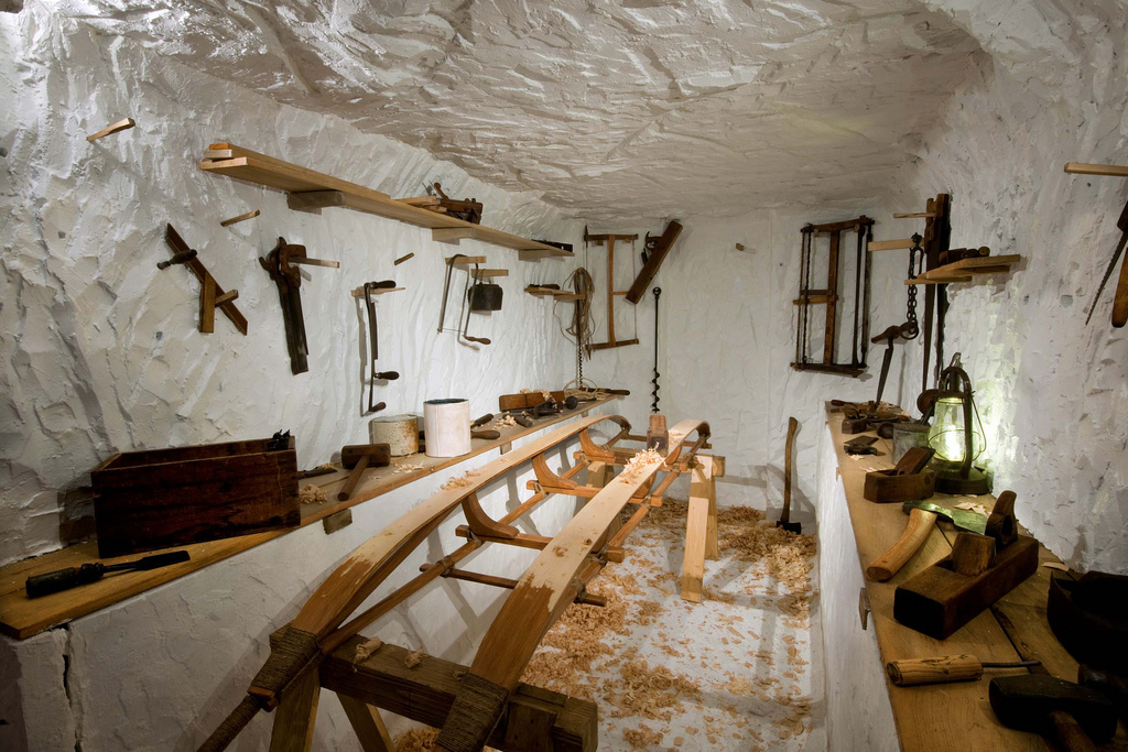
Naturally, the cabins are there to be enjoyed. How they came to be there is a different story, far removed from pristine mountain air – below sea level in fact!
A basement in Franklin Road, Gibsons, is where George Smith pitched his idea for a cabin and trail network. In 1985, George had skied Mount Steele with his friend Ian McConnell on June 1 weekend. He was struck by the quality of the snow and the potential of backcountry recreation in the area.

Bachelor Cabin, the closest of the four cabins to the trail head.
“The Sunshine Coast was in the midst of an economic depression,” recalls George. “People weren’t exactly light and breezy, but I thought this idea made sense.”
George approached his Franklin Road neighbor, Wayne Greggain, the titular head of the Tetrahedron Ski Club. After a heyday in the late 1960s and 70s, mostly skiing Mount Elphinstone courtesy of a Tucker Snow Cat and 600-foot lift purchased from Hollyburn Mountain, the ski club was all-but defunct by 1985. Wayne agreed to host a meeting of ski enthusiasts in his basement where George explained his vision.
The prevailing mood, recalls George, was: “We don’t know how good an idea this is, but if we don’t do it, someone else might and they won’t do it right.”
The group agreed that if George could secure funding for the project, the ski club would run it as a non-profit. By the fall of 1986, George – then a sometimes reporter with the former Coast News – had secured more than $150,000 in federal funding and another $20,000 from the province.
Yet another Franklin Road resident, Paul Anslow, was contracted to build the cabins at Sechelt airport. The cabins would then be disassembled and flown by helicopter to be reassembled on site. Forestry company, Canfor, and the Sunshine Coast Regional District donated timber, Sechelt Creek Contracting provided logging service, Airspan donated some air time, Gibsons Building Supplies provided crane trucks and the Outdoor Recreation Council pitched in with chainsaws.
A small army of volunteers mobilized to clear trails while 18 people during the course of the project worked on the cabins.
George describes former club president and long-time member, Victor Bonaguro, “a force of nature” who could “build anything”.
“Part of the reason we were able to get funding was because we created an 11-point education plan for the workers, so they would have the tools to go out and find work afterwards,” says George. Aside from cabin-building, workers learned valuable lessons in surveying and industrial and wilderness first aid, thanks to time donated by local experts.
By the time the cabins opened to the public in 1987, the club had raised more than $300,000 for the project. But perhaps more importantly, one great idea had united governments, businesses, and local volunteers in the midst of a recession, no less.
The Tetrahedron was declared a Class A provincial park in 1995. And in 2004, recognizing the year-round activities of its members, the ski club changed its name to the Tetrahedron Outdoor Club.”
“This resource is at least as good today as when it was first built,” says George, who’s still in love with the Tetrahedron.
“I feel lucky. When you walk in a forest that’s never been logged, it just feels different. It’s wonderful to be there.”
- For more information about the Tetrahedron Outdoor Club, visit www.tetoutdoor.ca
- Four-wheel drive and chains are essential for visiting the Tetrahedron. For more information about the park, visit www.env.gov.bc.ca/bcparks
- For an armchair view of the Tetrahedron, visit Coast adventurer Quinn Barabash’s website at captainquinn.com and see his video at captainquinn.com/adventure-video-blog/
Summer comes late to Bachelor Lake, pictured here in June.
White and wild on Dakota Ridge

If cross-country skiing is a little slow for you, tobogganing should get your adrenaline racing on Dakota Ridge.
Forty minutes ferry-ride from West Vancouver, the Sunshine Coast is better known for The Beachcombers, scout camps and verdant shorelines. People don’t typically associate this 140-kilometre peninsula with snow. But there it is, several feet of the stuff, just waiting to be played in.
You just have to look up.

There's cross-country skiing for all ages on Dakota Ridge.
Poking through the clouds about 1,200 metres above the beaches and pretty parks is Dakota Ridge, one of the best cross-country ski destinations in the last place you’d expect to find it. Between November and March, if it’s raining at sea level, there’s a good chance it’s snowing up there.
And it’s only a 20-minute drive from sea level.
“You can come up for a couple of hours and be in a completely different world,” says Craig Moore, a cross-country skier and long-time member of the Dakota Ridge Winter Recreation Society, a non-profit group working to promote the area. “For cross-country skiing it beats anywhere on the west coast.”
It’s pretty good for tobogganing and snowshoeing, too.
A 620-hectare (1,532 acres) plateau atop a working watershed, Dakota Ridge offers a rolling landscape of stunted old growth hemlock and yellow cedar. On a clear day you can see the North Shore mountains, the Gulf Islands and Vancouver Island beyond – even Mount Baker down in Washington State.
There are 13 kilometres of groomed trails for cross-country skiers on Dakota Ridge.
Cross-country skiers will find 13 kilometres of groomed Nordic trails, all of them signposted and colour-coded according to degree of difficulty. Professional engineer Reidar Zapf-Gilje, who prepared Callaghan Valley’s 2010 Nordic Olympic course, designed Dakota Ridge’s trail network.
“In many cross-country skiing areas you’re skiing through woods and you don’t see too much,” says Zapf-Gilje.
“Dakota Ridge is way up there in terms of esthetics. Its real strength is its potential for recreation and citizen [cross-country] races.”
Jamie Mani hopes that potential will be realized. Mani owns Alpha Adventures, a Wilson Creek outdoor-adventure store specializing in guided snowshoe and cross-country ski touring on the Ridge.

When it's not snowing, the views from Dakota Ridge can be spectacular.
“One of the great things about this place is its proximity to so many other activities,” says Mani. “Someone can literally be out snowshoeing in the morning up in the mountains and then golfing or kayaking in the afternoon.
“And for Nordic skiing we have excellent potential because of great snowfall and a blend of flat and rolling trails. We have been skiing on the Ridge as late as May in previous years.”
Snowshoers will find their own trails and there’s plenty of room for hiking and tobogganing. You’ll find a parking lot, warming hunt and toilet at the trailhead.
The turnoff for Dakota Ridge is at the top of Field Road in Wilson Creek, about half way between Gibsons and Sechelt, and 20 kilometres drive from BC Ferries’ Langdale terminal. For many years, the unplowed access road to Dakota’s trailhead made it a ridge too far for some. In recent years the 11-kilometre road has been upgraded to allow for regular plowing, but four-wheel drive vehicles equipped with chains are still the way to go.
Or take advantage of Alpha Adventure’s shuttle service.
- To learn more about Dakota Ridge, visit http://www.scrd.ca/Dakota-Ridge
- For road updates and snow conditions on the Ridge, visit www.suncoastcentral.com/outdoor-reports.asp.
- To book cross-country ski lessons, a guided tour, equipment rentals or shuttle service up to Dakota Ridge, call Alpha Adventures at 1 604 885-8838 or visit www.outdooradventurestore.ca

