Archive for the ‘BC Parks’ Category
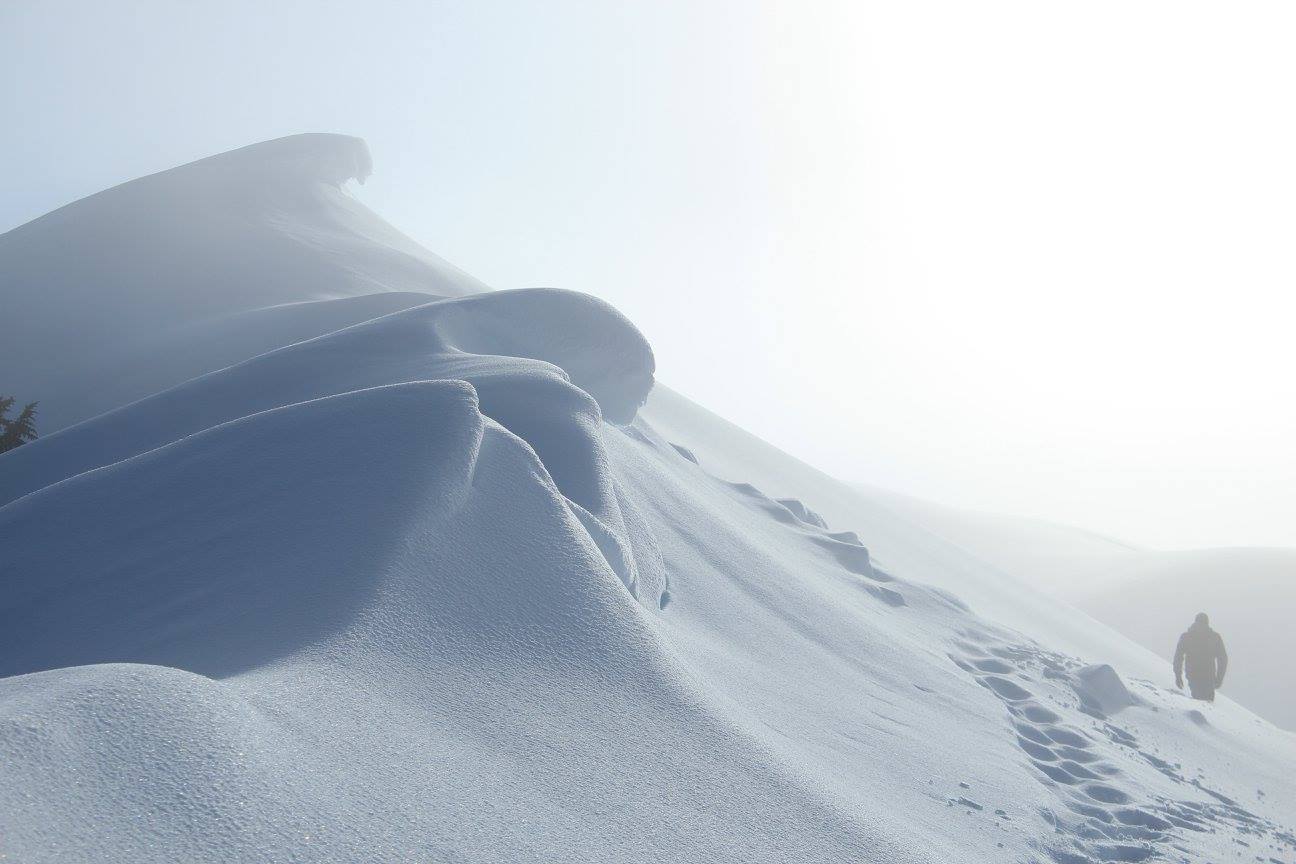
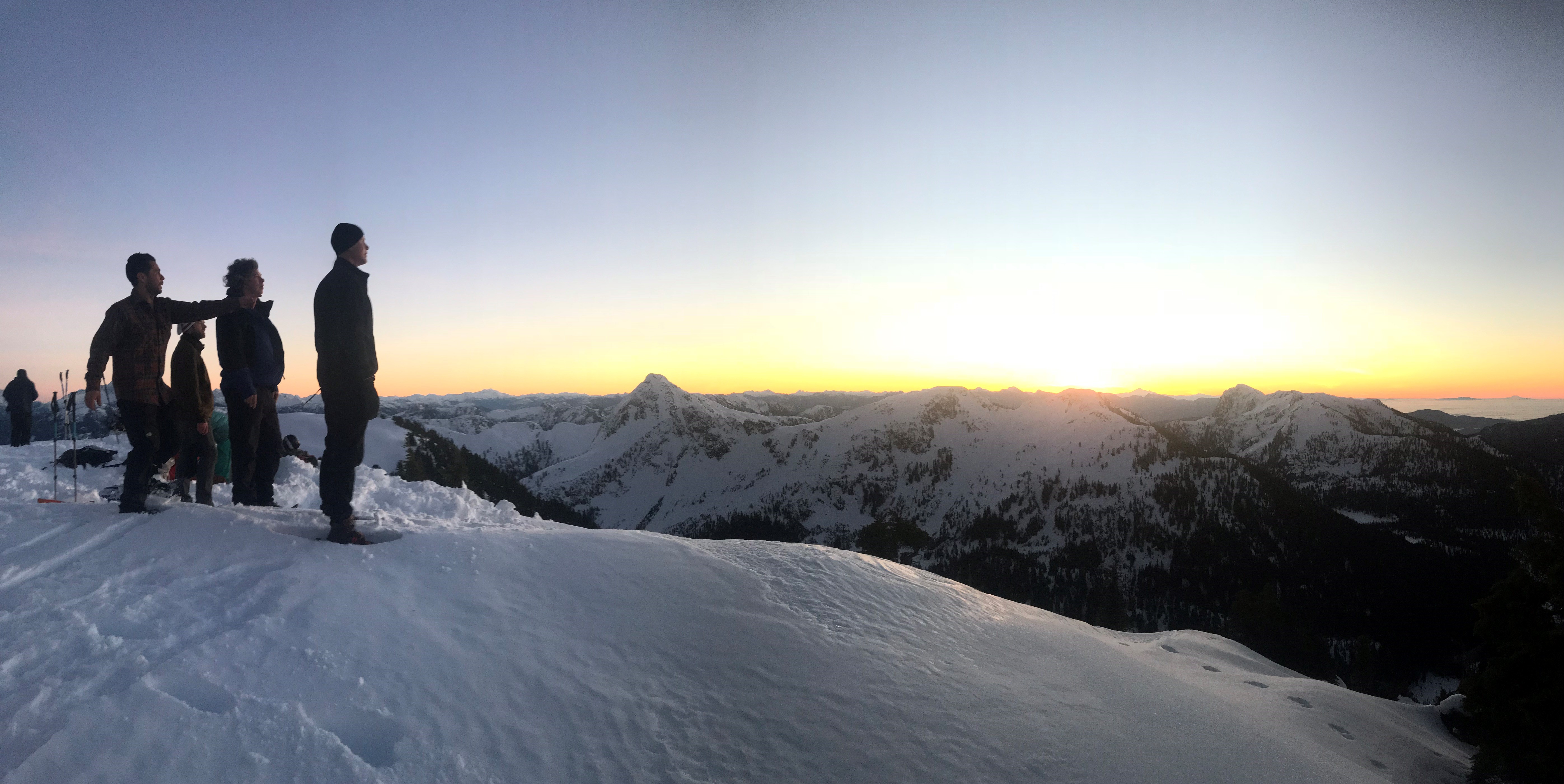
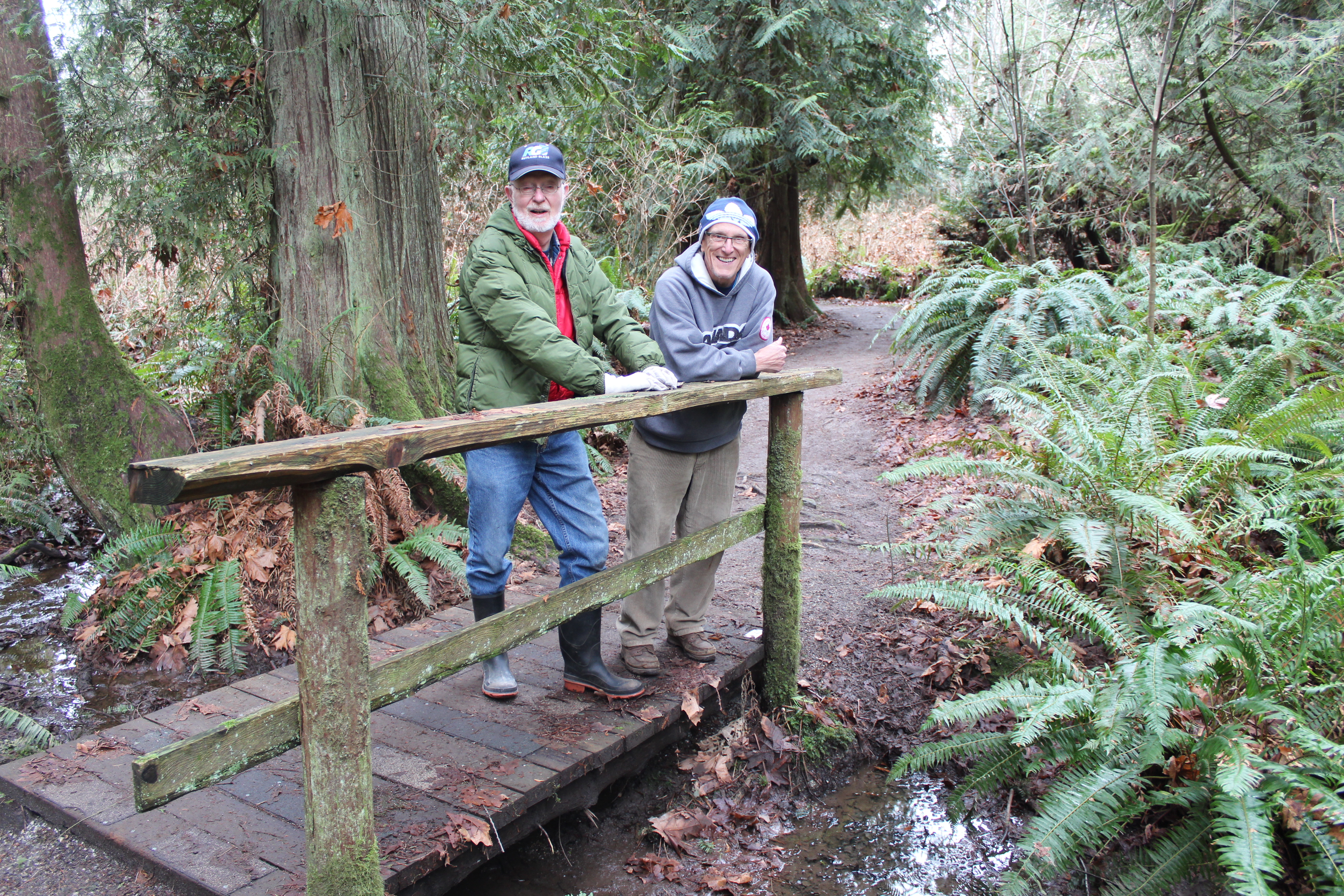
Cold play
The Tetrahedron Outdoor Club ensures a warm welcome for visitors
Reached by ferry or floatplane, the Sunshine Coast, north by northwest from Vancouver on Canada’s west coast, is the kind of place people visit to get away from it all. The Tetrahedron is the kind of place Sunshine Coasters go to get away from it all.
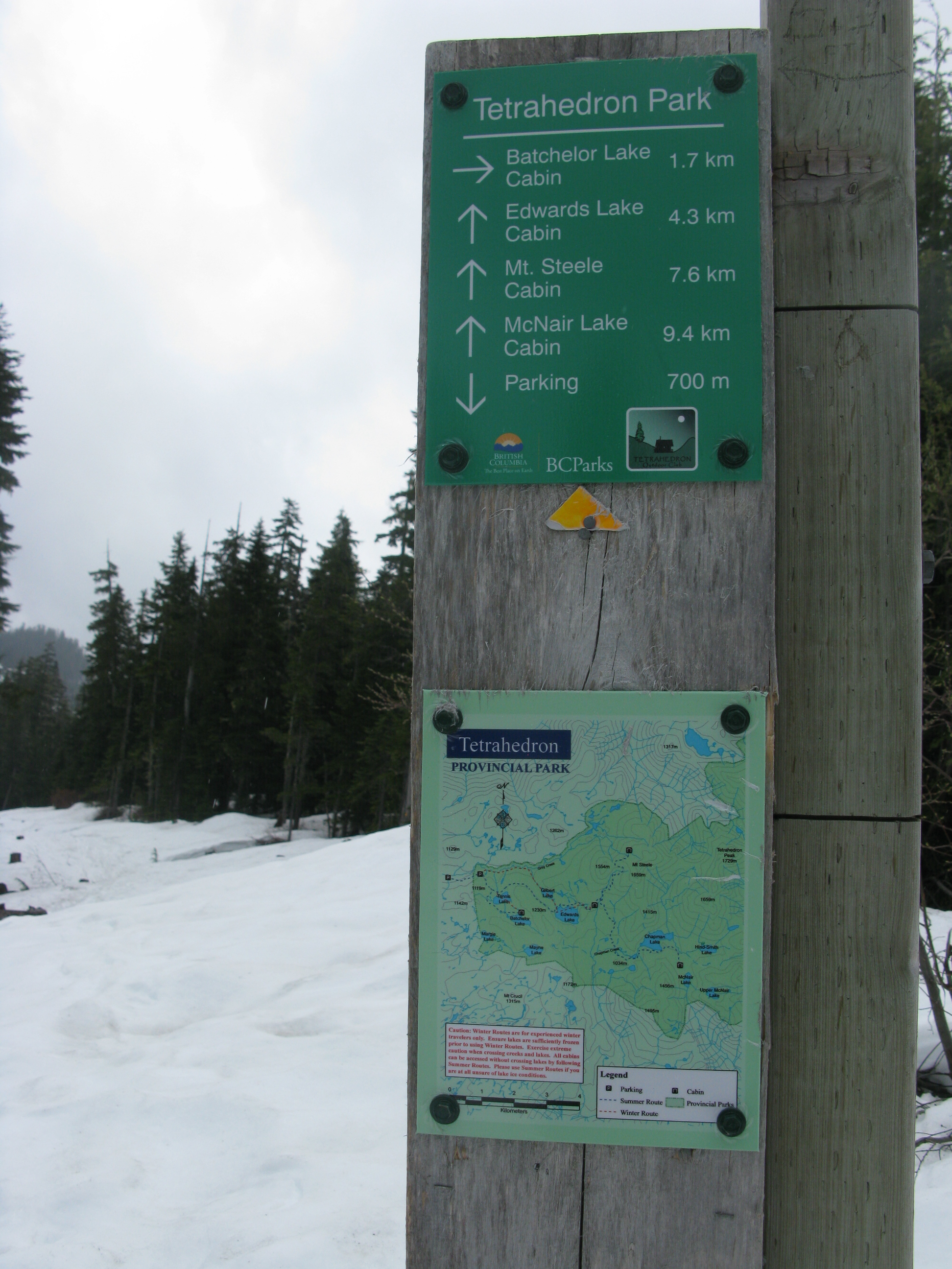
As backyards go, the Tetrahedron tends to be on the large side. Six thousand hectares of mountains, lakes, streams, wetlands and forest make this Class A provincial park the perfect place for backcountry enthusiasts to explore.
It also makes the Tet, as it’s fondly known, an immensely challenging place to maintain for visitors. Charged with that formidable task is the Tetrahedron Outdoor Club, a hugely dedicated volunteer organization committed to maintaining the park’s four rustic cabins and the 25-kilometre trail network connecting those cabins.
“B.C. Parks owns the cabins and it’s their provincial park,” explains club president, Gerry Marcotte. “We are the stewards of the park and a have great working relationship with B.C. Parks, which goes a long way to keeping these cabins and trails up to date.”
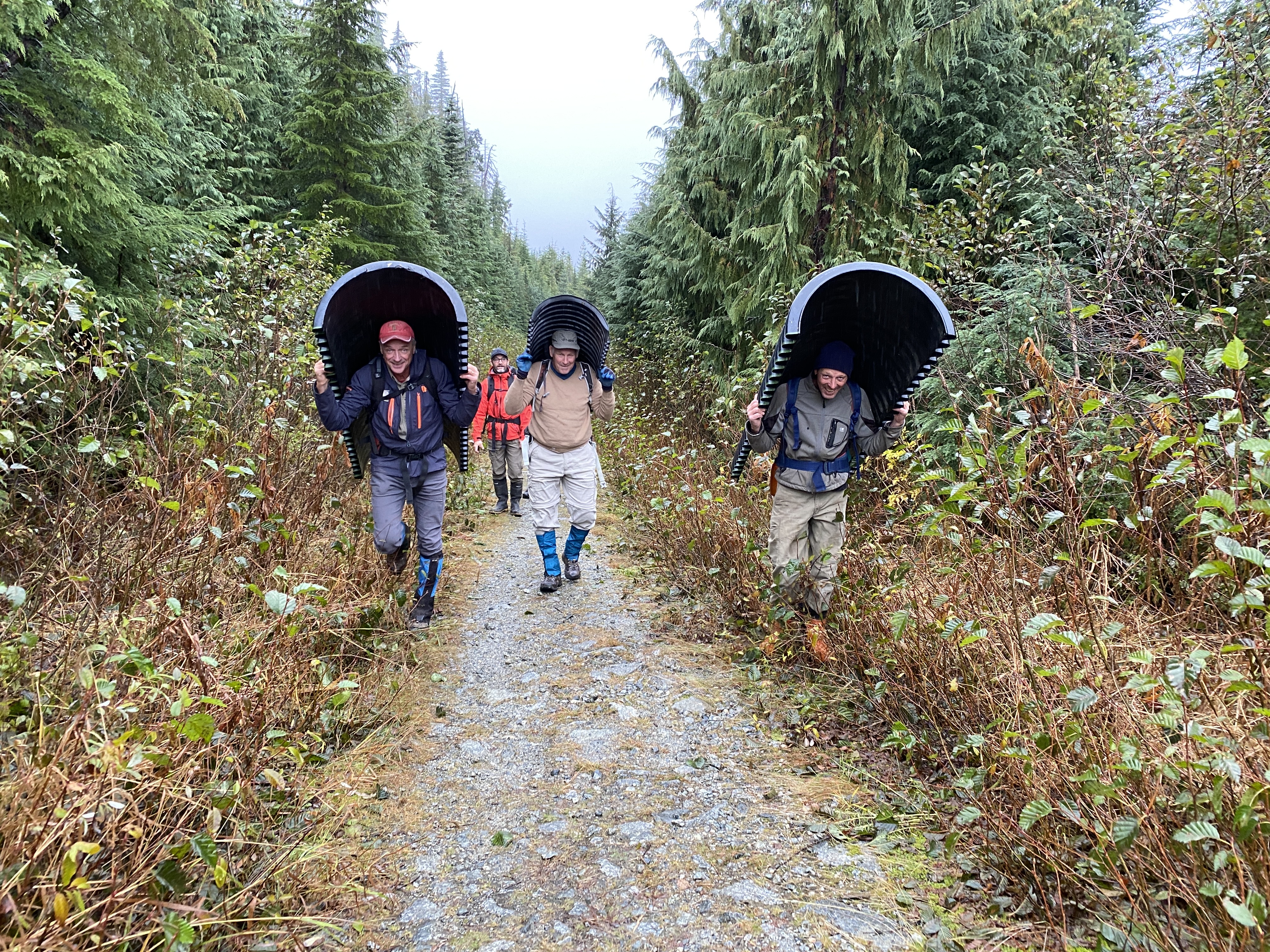
The latest major project keeping the club’s volunteers busy has been the installation of a three-ton bridge spanning Steele Creek. Lowered by helicopter and installed by club members last month, the bridge cost about $20,000 – $12,000 of which was partially funded by a grant from the Sunshine Coast Community Forest Legacy Fund.
It would have cost more but for the donations of businesses – structural engineering, welders and lumber milling. The mix of grants, donations, partnerships and resourceful volunteers continues from a blueprint established more than 35 years ago.
In the mid-1980s, amid an economic depression, a group of backcountry enthusiasts united to mobilize more than 200 volunteers, 45 businesses, schools, community groups and several levels of government: their goal, to build cabins linked by a trail network.
The Tetrahedron Ski Club, as it was then known, secured more than $150,000 in federal funding and another $20,000 from the province, to build the cabins at Sechelt airport. The cabins would then be disassembled and flown by helicopter to be reassembled on site.
Forestry company, Canfor, and the Sunshine Coast Regional District donated timber, Sechelt Creek Contracting provided logging service, Airspan donated some airtime, Gibsons Building Supplies provided crane trucks and the Outdoor Recreation Council pitched in with chainsaws.
An army of volunteers mobilized to clear trails while 18 people worked on the cabins, gaining valuable carpentry skills and learning about surveying and wilderness first aid. By the time the cabins opened to the public in 1987, the club had raised more than $300,000 for the project. Perhaps more remarkably, a single great idea had united governments, businesses and local volunteers.
So, what motivated such efforts back then and what continues to drive the club’s volunteers now?
“There are a lot of people in the Tet for pure recreation,” says long-time club member, Melissa Rayfield. “I think the difference with volunteering is that it becomes purposeful recreation. I think any volunteer would feel the same way, it’s part of their social life, part of pleasure and the fulfilment of getting something done.”
Melissa’s husband, Danny Fleischhacker, agrees, adding that the solitude and the elements amid the Tet’s wide-open spaces are hard to resist, especially in winter.
“Getting out into the backyard, being out in nature there’s a sense of throttling back, tapping the brakes and going slow, but looking around,” says Danny, who admits that he also likes to go fast. “I really love skinning in a blizzard with the wind blowing at me. (Skinning is the practice of sticking synthetic skins to skis, climbing a trail, then skiing down. Danny and fellow club-member, Sam Preston, are particularly fond of exploring ski terrain deep in the park and immortalizing perfect runs with names like “Heaven is a Halfpipe”.)
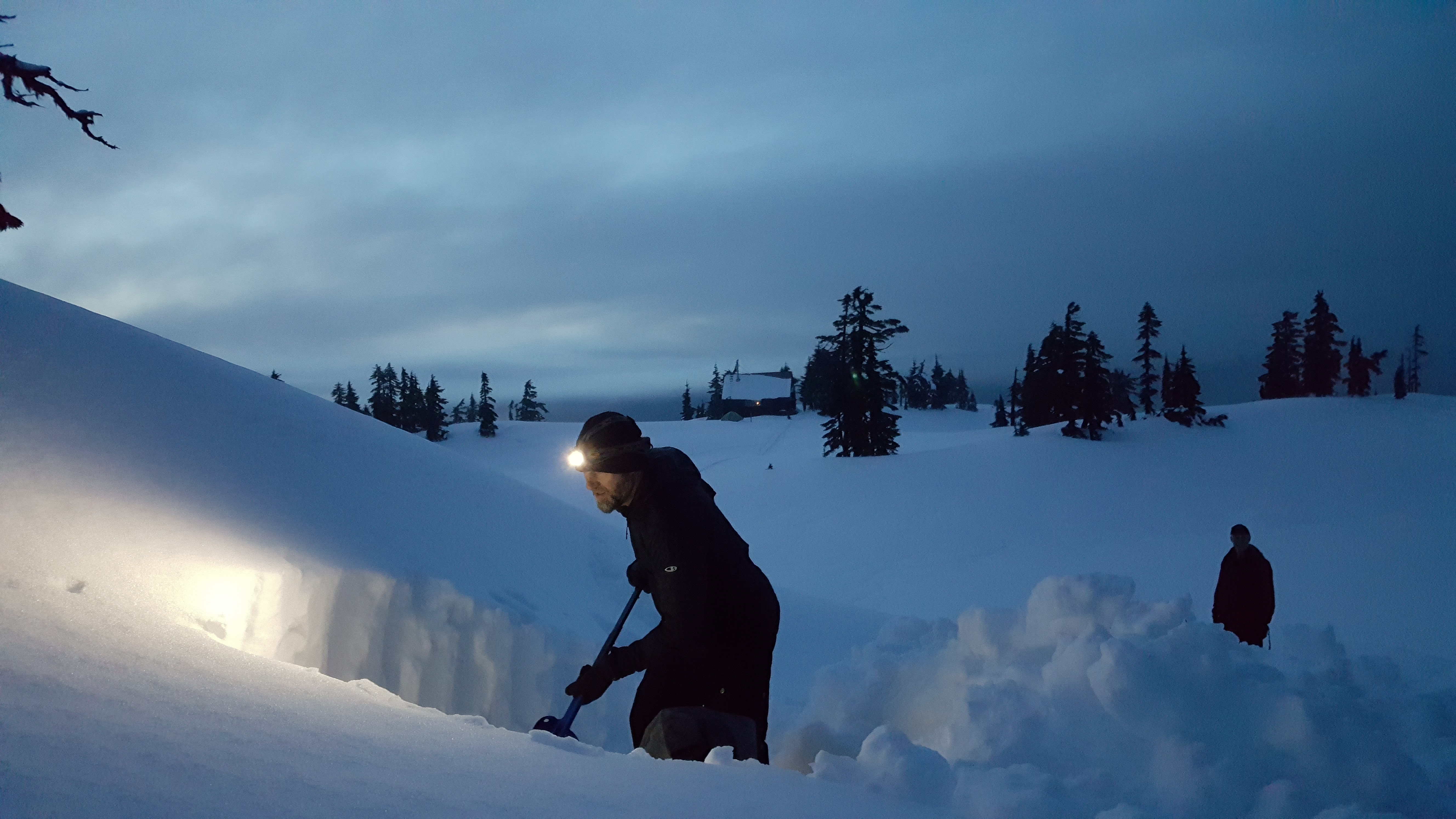
Melissa and Danny are stewards of McNair cabin, visiting about once a month for maintenance and monitoring. (Visitors are asked to clean up after themselves but that doesn’t always mean that they do.) Gerry and his wife Ellen steward Bachelor cabin. In between are Edwards and Steele cabins, each with their own stewards and the latter cabin being the highest, situated at the base of 5,114-foot Mount Steele.
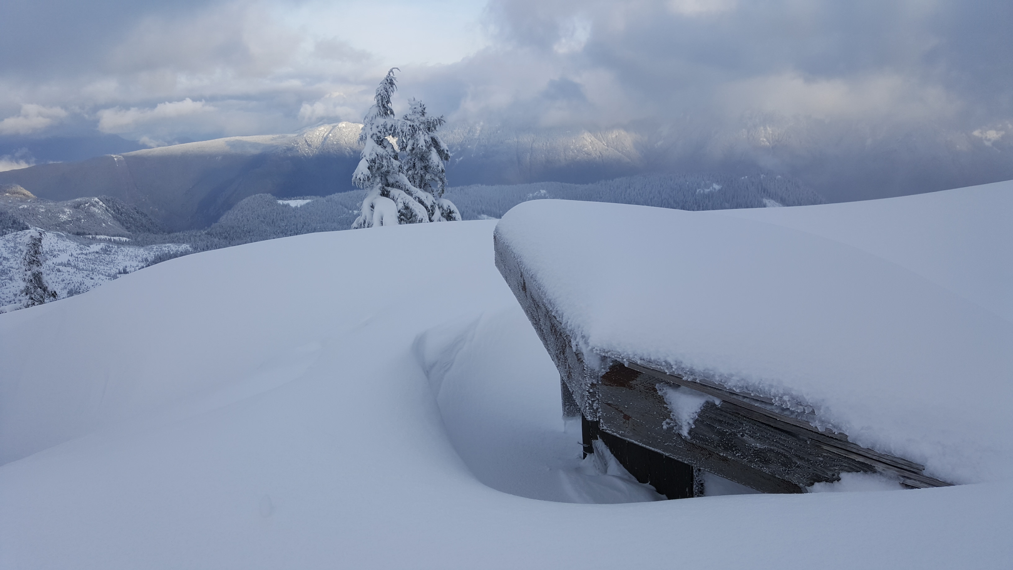

It’s not uncommon to have to dig your way into the Tetrahedron’s cabins and outhouses, especially on Mt. Steele.
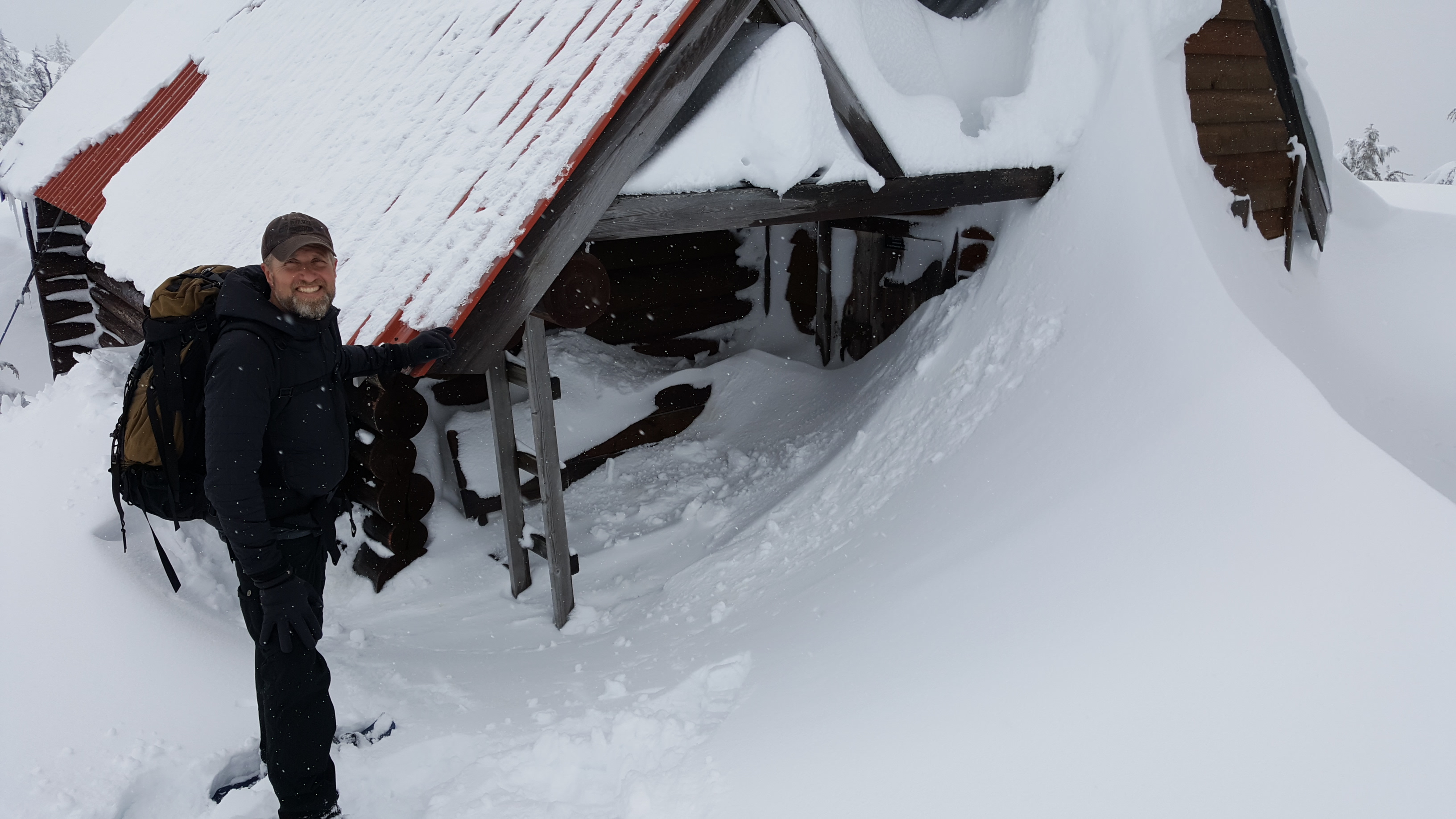
The cabins accommodate 12 to 16 people, are first come, first serve, and are well equipped with mattresses in the attic, firewood in the basement, a kitchen counter and a sink. The wood stove usually has the place toasty warm within an hour.
Panther, Steele and Tetrahedron peaks loom over the park’s 10 lakes and some of the oldest trees in the country. Amabilis fir, mountain and western hemlock, yellow cedar and white pine can all be found here.
For Melissa and Danny, winter in the Tet means fun; summer means work. “It can take a herculean effort by a small number of people to accomplish some of the projects,” says Melissa. “Trail-clearing is never ending.”
(Veteran club member, George Smith, recently spearheaded a new trail to provide day-trippers with a beautiful new winter-touring option past Mayne Lake.)
Nor are the volunteers getting any younger.

“When you look at the group photos from the Steele Creek bridge project, you realize the average age of the volunteers is low-60s,” says Danny. “We need to bring down that average age, not that our volunteers aren’t uniquely capable – there are some extremely hard-working 70+ people. We all love the Tet and are very supportive of each other. There’s never a shortage of camaraderie.”
Funding is also a perennial concern for the club. Snow removal costs between $6,000 and $12,000 a year. Firewood is airlifted to the cabins at a cost of $18,000. Community members donate the wood, which is cut and split by club volunteers. (Visitors building winter bonfires outside of the cabins are a particular source of frustration for the club.) Then there’s cabin maintenance and major projects like the Steele Creek bridge. A bridge will soon be needed across Chapman Creek.

Cabin revenues of $10 to $15 a night help but the club’s major source of income is from the annual Banff Mountain Film Festival held at Elphinstone Secondary School in Gibsons. Tickets are on sale for the February 3 event, (see below for details) which is also a good opportunity to learn more about the club and consider volunteering. Otherwise, the best way to join is online at tetoutdoor.ca.
“We welcome everyone with open arms,” says Gerry. “We moved here in 2016 and were warmly welcomed and encouraged by the club and it still holds true today. The people we have come to know, the friends we’ve made – it’s absolutely awesome!”
Visiting the Tetrahedron
- Four-wheel drive and chains are essential for visiting the Tetrahedron during winter. For more information about conditions, visit the club’s Facebook page.
- For information about the park, visit bcparks.ca/explore/parkpgs/tetrahedron/
- There can be a significant avalanche risk in the park. Before heading out, visit www.avalanche.ca
Banff Mountain Film Festival tickets
Tickets for the Banff Mountain Film Festival, (February 3, 2023 at Elphinstone Secondary School) are available at:
- Alpha Adventures, Wilson Creek
- Elphi Cycles Gibsons and Sechelt outlets
- High Beam Dreams, Gibsons
- Trail Bay Source for Sports, Sechelt
Related stories: Men of Steele and Cabin Fever


Slow train to Winnipeg

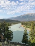
There is no fast train to Winnipeg. VIA Rail’s meandering service from Vancouver to Winnipeg fits a country that’s meant to be savoured. Yes, you could fly in under three hours, but if you’re looking for a more immersive experience and can spare three days, take the train. It’s not meant to be fast.
Leah and I checked in at Pacific Central Station in Vancouver on a sunny, Friday morning in late July. The forest fires that shrouded most of western Canada were still two weeks away and clear skies beckoned. Friends had been surprised to learn of a rail connection. Almost as surprised as by our destination. True, Winnipeg’s not the first place you think of for a summer holiday, but we live on the Sunshine Coast. A break from tourists would be good for the soul.
Our noon departure left 15 minutes late, but few passengers seemed to notice. Most people were busy exploring their new home for the next two nights; four nights for Toronto-bound passengers.

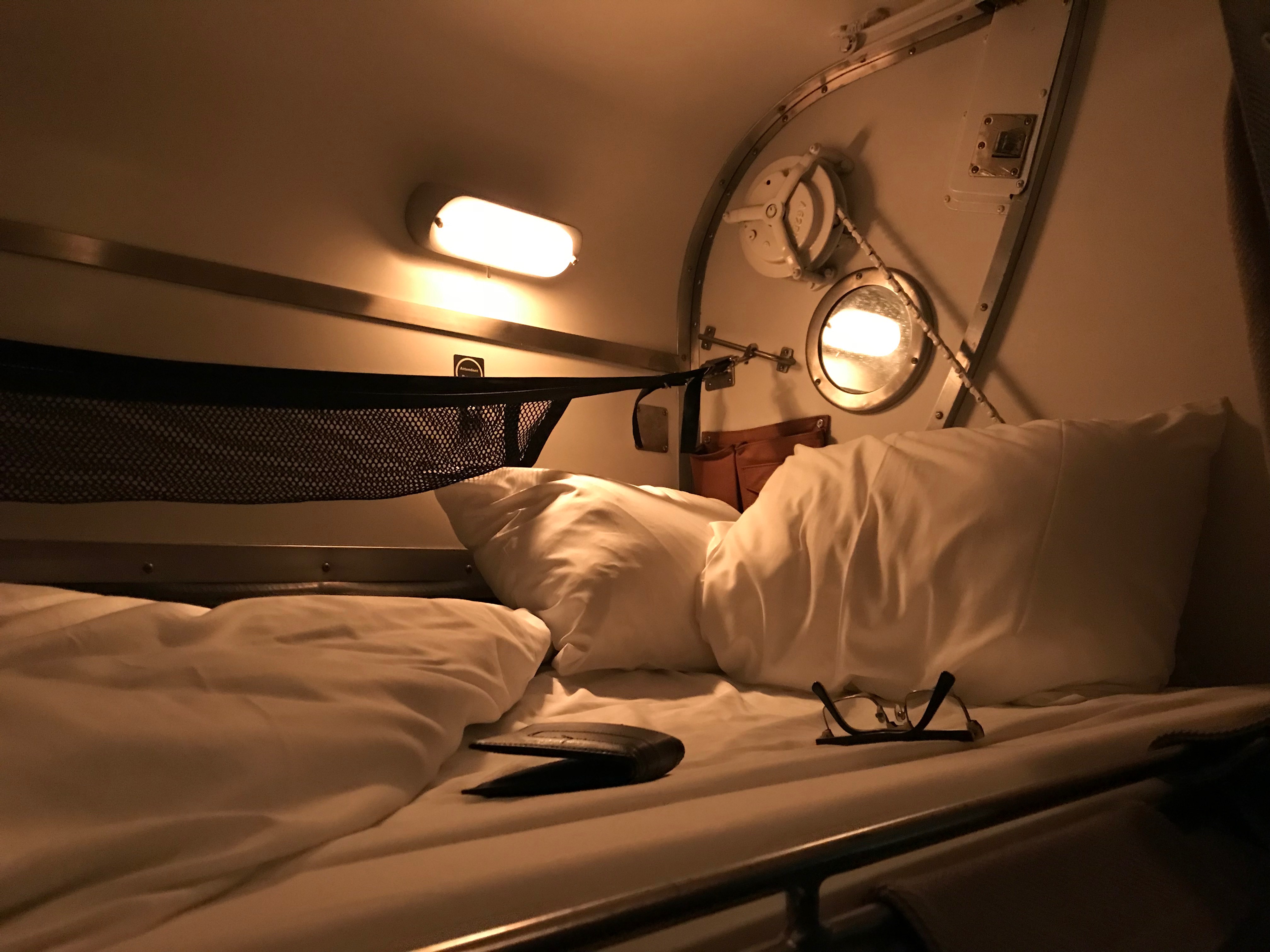
Private sleeping quarters in Prestige class come with your own concierge.
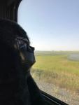
A large American tour party, each traveller wearing a name badge, patrolled the corridors for the first hour, marvelling at the cleverly concealed shower closets, the premium-class cabins and the viewing cars. With 72 hours ahead of us, we decided to pace ourselves, watching East Vancouver, Burnaby, and New Westminster pass us by before venturing from our seats.
VIA Rail trains come in three classes and various carriage designations. The best views are to be had in the Skyline cars with their scenic dome sections, and the Panorama car, which features windows to the ceiling. The Park car in the caboose is an elegant throwback to bygone lounge luxury and is limited to the train’s Prestige passengers at certain times of the day.
Prestige is the priciest of VIA’s three travelling classes, offering private sleeping quarters and a personal concierge. We travelled in Sleeper Plus, which saw our seats being transformed by a carriage attendant at night into comfy bunk beds shrouded behind a thick curtain. (The attendant reverses the process in the morning while you’re at breakfast.) For Economy Class, picture your seat becoming a La-Z-Boy with pillow and blanket. All meals are included in the price for Prestige and Sleeper Plus.
An excellent three-course lunch, including a sautéed prawn and scallop salad, set the tone for our meals ahead. Duck, rack of lamb, and beef wellington were among the hot, fresh dinners somehow served from a tiny kitchen, which also offered vegetarian options for every dining course. Canadian wines and craft beer choices from Toronto, Winnipeg and Vancouver, were a nice surprise too. We soon got to know our Winnipeg-based crew, who were proud of their hometown and quick with recommendations.
Seats by day transform into bunk beds by night in Sleeper Plus.
Meal times presented a chance to meet fellow passengers – mostly American visitors, including one woman from San Francisco who had been suffering Trump-induced anxiety attacks. “Two days with no news has done me the world of good,” she confided.
There were other little surprises along the way. Complimentary mimosas went down well on Saturday morning while stuck for an hour outside of Jasper. Informal wine tasting with one of the crew in the dome car eased us through the Saskatchewan-Manitoba border. Lounge car patrons were entertained by a classical guitarist in an afternoon performance.
The real star of the show though was the view, otherwise known as Canada. First criss-crossing the Fraser River and then the Thompson, the train follows a route largely uncharted by the highway. At dinner on Friday night, heads swivelled to see a series of attractions appearing on or by the Thompson: a solitary eagle, a herd of elk, an abandoned church and a forgotten Chevy truck, circa 1960, all punctuated the dry beige canvas of thirsty cottonwoods and parched underbrush.
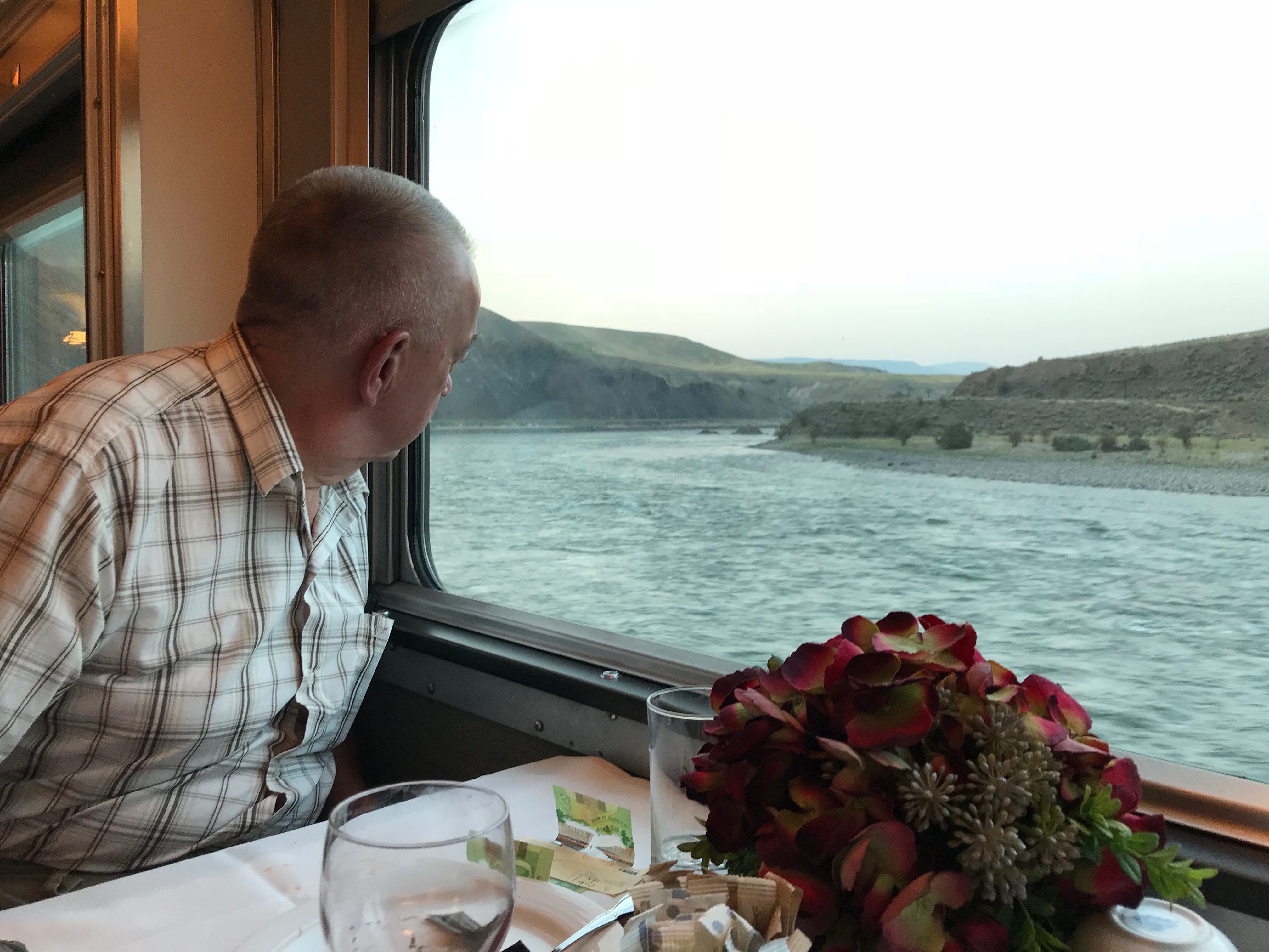
Dinner-time distractions as we skirt the Thompson River near Kamloops, BC.
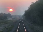
Sun set to be replaced by a full, blood moon. It cast its spell on us as we settled into our bunks and watched it rise, glowing red and irresistible over Kamloops Lake. I fell asleep realizing that after almost 12 hours on the train, I had yet to crack a book or suggest a game of Yahtzee with Leah.
VIA Rail’s not quiet. There were times during the night that I thought a crash was imminent, such was the screeching on the rails. “You’ve got all day to nap,” I told myself as I opened the blind to see daybreak in the Rockies. Our attendant told us we’d made good time overnight, getting up to 80 kilometres an hour, which might have explained the noise.

After a night on the train it was good to stretch our legs in Jasper on the Discovery Trail.
The American tour party alighted at Jasper where the remaining passengers had a couple of hours to explore. In minutes we were walking Jasper’s Discovery Trail, heading towards Old Fort Point. At the first viewpoint overlooking the city, a menacing gang of Bighorn Sheep blocked our path. We hesitated for 10 minutes, taking photos from a distance. The sheep looked less menacing when a jogger breezed right by them.
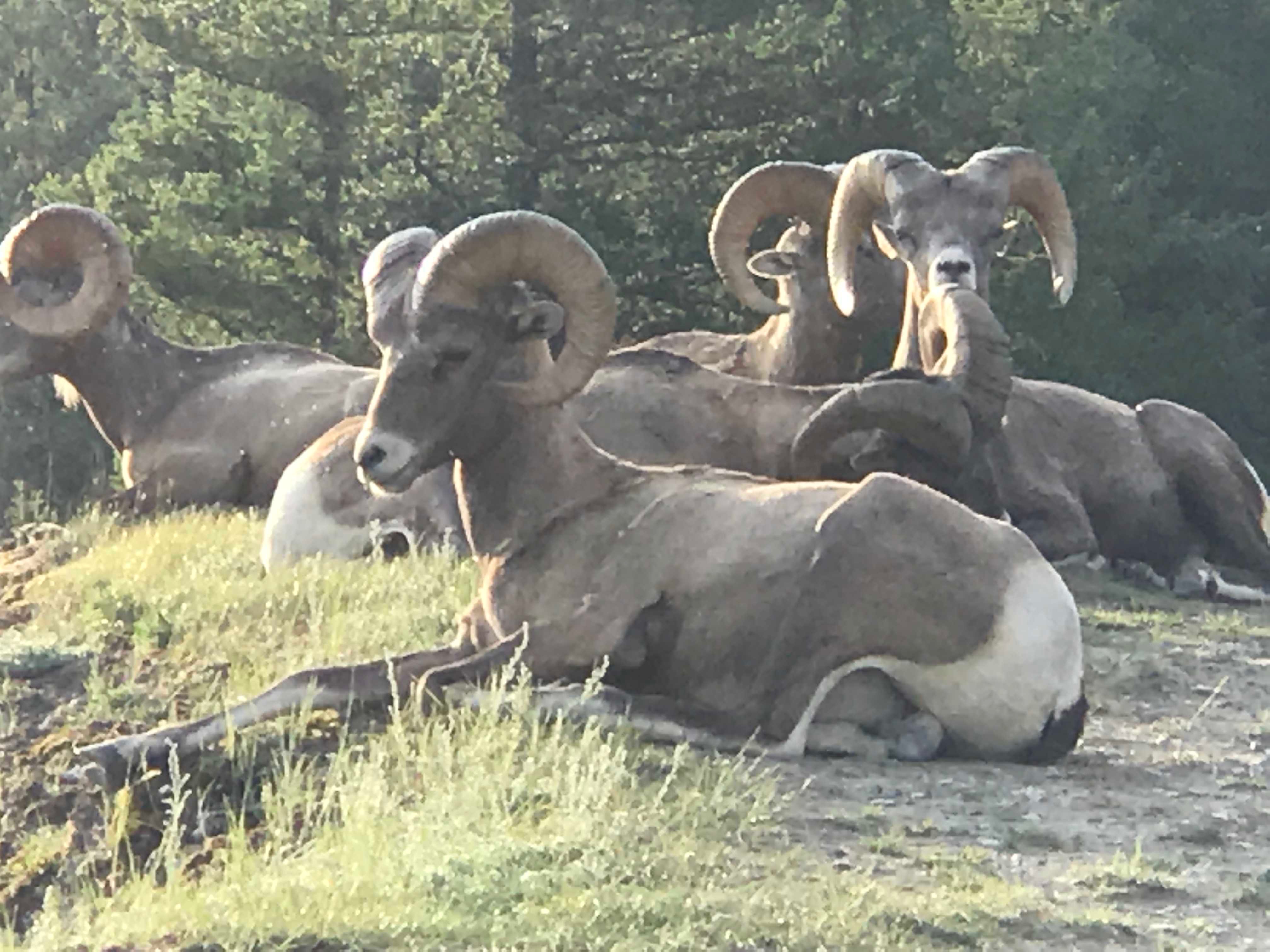
Bighorn Sheep – not so menacing in hindsight.
It took all day to reach Edmonton. Numerous stops for freight traffic, (which have priority) including a two-hour standstill, put us in at 7 p.m., a few hours behind schedule. We disembarked to skip rope a while on the platform (three solid meals a day and a sedentary lifestyle take their toll) and take photos of the City of Champions in the distance. By 8 a.m. the next morning after a better night’s sleep, we’d caught up an hour or two and were in Saskatoon for another 20-minute stroll on the platform.
Our final day of gazing out of the window introduced us to place names that seemed to herald a story: Punnichy, Ituna, Spy Hill and Atwater – population 30. Potash mines are the only hills on the Prairies, looming on the horizon occasionally like elongated pyramids. The old, wooden grain silos, so iconic to this region, seemed harder to find. Kelliher, Saskatchewan produced a nice one though.
Our last stop before Winnipeg was Melville, Sask., home of the Melville Millionaires junior hockey team and named after Grand Trunk Railway president, Charles Melville Hays, who died on the Titanic. We rolled into Winnipeg at 8.40 p.m., 90 minutes late but still warm and sunny outside.
We never did play Yahtzee!

-
- Classy caboose
-

- Bunk with a view
-
- Athabasca River, Jasper
-

- Grain silos
-

- Saskatoon baby!
-
- Derek missing the rains down in Africa
-

- Derek – first gorilla in Melville, Sask.
-
- Sunset near Edmonton
-
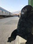
- Derek reflects on his time in Jasper
Going downhill. Fast!
“Tobogganing, which has sprung into such sudden popularity, is only a form of coasting. There is no more exciting and exhilarating sport for ladies and gentlemen than this on a clear, cold winter evening.”
- Modern Manners and Social Forms: A Manual of the Manners and Customs of the Best Modern Society, James Bethuel Smiley, 1890

On the eastern slopes of Dakota Ridge, Emma Judd prepares for takeoff!
Even down at sea level and despite its name, the Sunshine Coast is no stranger to snow. Anyone who has grown up here can attest to cold snaps and snow days. Despite claiming to be 29, my mum-in-law Mary Vandeberg recalls the winter of 1954 vividly.
“We spent a lot time tobogganing down Davis Bay hill that winter,” says Mary. “We had spotters, but there really wasn’t much traffic to speak of in those days. And if there was, it wasn’t getting up that hill.”

Trouble with a capital T, Mary Vandeberg with her sister Gail somewhere on a road near Davis Bay, circa 1954.
For Mary’s daughter, my wife Leah, tobogganing the road down from Chatelech Secondary, was the ultimate way to celebrate a snow day.
Even in the snowiest winters of recent years, it’s difficult to image tobogganing Highway 101 from Selma Park down to Davis Bay, as Mary describes. But that doesn’t mean there aren’t plenty of other popular places to slide.
Located 14-km up the forest service road at the end of Field Road in Wilson Creek, Dakota Ridge is one of the few, if not the only sanctioned sliding area on the Sunshine Coast. Created in 2013, the sliding area has become a popular addition to the winter recreation venue, accounting for 30 percent of total traffic, according to the Sunshine Coast Regional District.
Especially popular with young families, the groomed hill is right behind a Quonset warming hut, which is equipped with a wood stove and picnic tables. If you’re craving some off-piste thrills, there’s a long, gentle clearing off Balsam Loop on Dakota Ridge’s eastern slope that’s perfect for building bumps and jumps.

We have liftoff! Ariana Harder takes to the skies above Dakota Ridge.
Local Cavin Crawford, who’s helped plow access roads to Dakota Ridge and the Tetrahedron for years, recommends a 200-metre slope at the eight-kilometre mark of the forestry road, near the turnoff for Dakota Bowl.
“You can drive up around the corner, let the kids out and drive down and pick them up,” says Cavin. “But please, do not toboggan on the road.”
Winter tires and chains are essential, if you’re planning to drive to Dakota Ridge; or catch the scheduled shuttle with Wilson Creek-based Alpha Adventures.
Closer to sea level, school fields are popular with the younger crowd. “The slope behind Gibsons elementary is good for younger kids and pretty good for building jumps,” says 12-year-old Kaishan Nonacowie. There’s also a gentle slope behind Elphinstone Secondary.
Flume Beach Park at the junction of Flume Road and Beach Avenue in Roberts Creek might be the closest you’ll get to sledding on the shoreline. It was a favourite spot when my kids were growing up and offers the added advantage of a scenic picnic area, plus the option of building a beach fire to warm up by.

In their element, Ariana Harder and Emma Judd on Dakota Ridge.
A poll of friends and family on Facebook elicited numerous favourite spots and a theme quickly developed: roads seem to be where it’s at. Some short, some steep, and most dead-ends. (My son suggested School Road in Gibsons, which might have been feasible in 1917-18, but not 2017-18.) While there’s room for discretion on secluded roads in particularly heavy snowfalls, as a rule, cars and toboggans don’t mix, especially for emergency services, highway maintenance contractors, and stranded residents.
Back in the 1970s, it was a different story, according to life-long Coast resident, Warren Hansen.
“My favourite hill was Benner Road, in Selma Park,” recalls Warren. “Back then, there was no such things as immediate plowing. People had to park on the highway in Selma Park and walk up to their homes. For at least a couple of days, kids could slide down Benner Road, or the top of Snodgrass and Chartwell, or the top of Radcliffe Road. Every kid from miles around would converge on this location.
“I remember a bunch of us piled on a toboggan racing other toboggans down the hill. We knew that once we passed a certain driveway it was time to bail otherwise we would blow the corner and get hurt. And most kids did get hurt from getting run into, going into the ditch, or bailing off the sled sliding at breakneck speeds.”
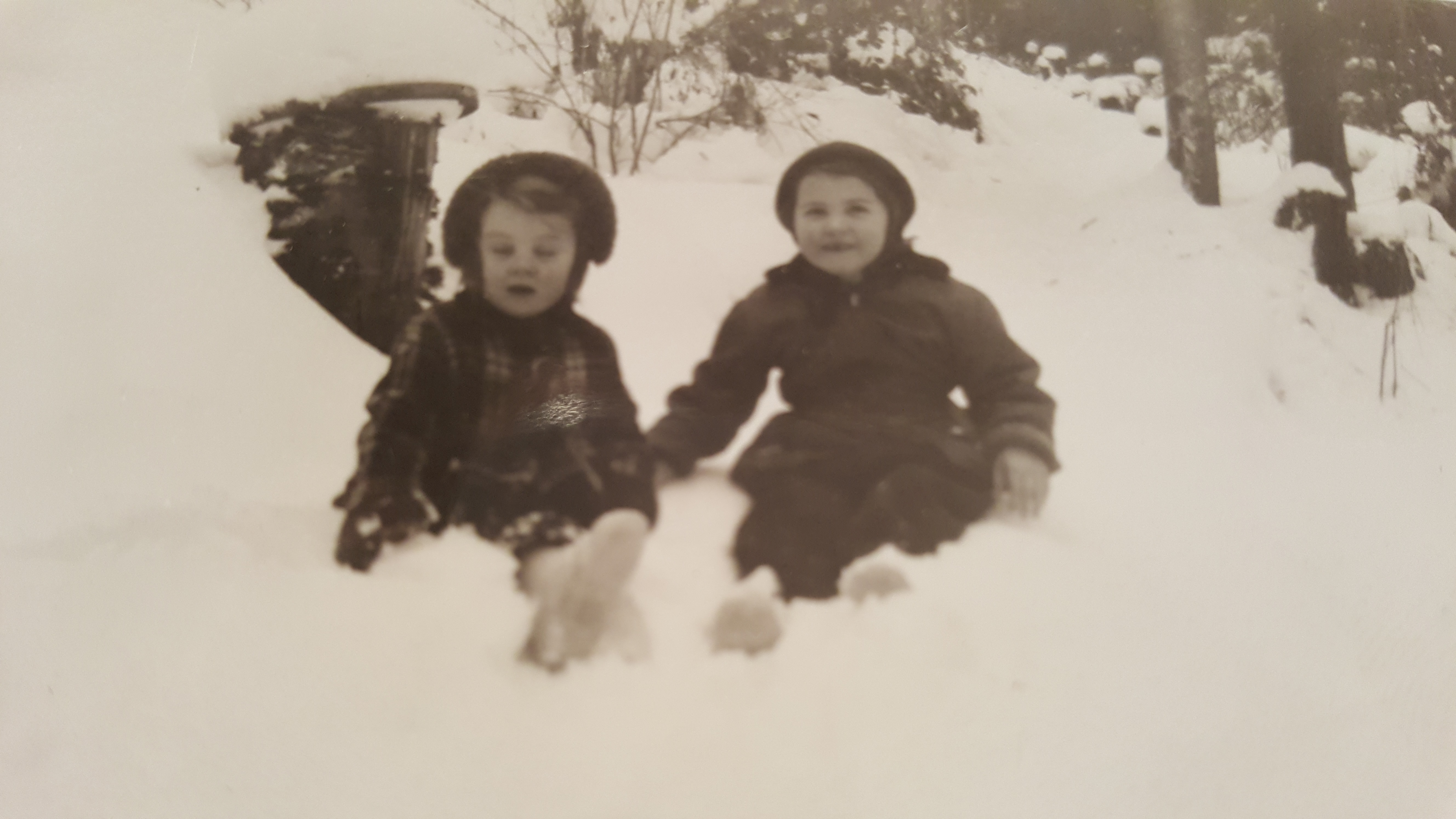
Mary Vandeberg and her sister Gail in the snowy Sunshine Coast winter of 1954.
Hansen acknowledges those days are over, but has mixed feelings.
“The plows, climate change and over-sensitive parents ruined the great sliding opportunities on Benner Road, which hasn’t been the same since those days. Then again, it could be because I grew up and know now that I would never let my kids slide on Benner Road.”
Wherever you end up sliding this winter, keep a few precautions in mind. BC Children’s Hospital recommends that young ones wear a ski, hockey, or bike helmet for tobogganing. Make sure your kids know how to control their speed and stop properly. Choose a slope away from roads and free from obstacles, such as rocks, trees, and fences. Never ride on a sled that is being pulled by anything motorized.
Bundle up, stay safe, and enjoy the snow!
The one that didn’t get away
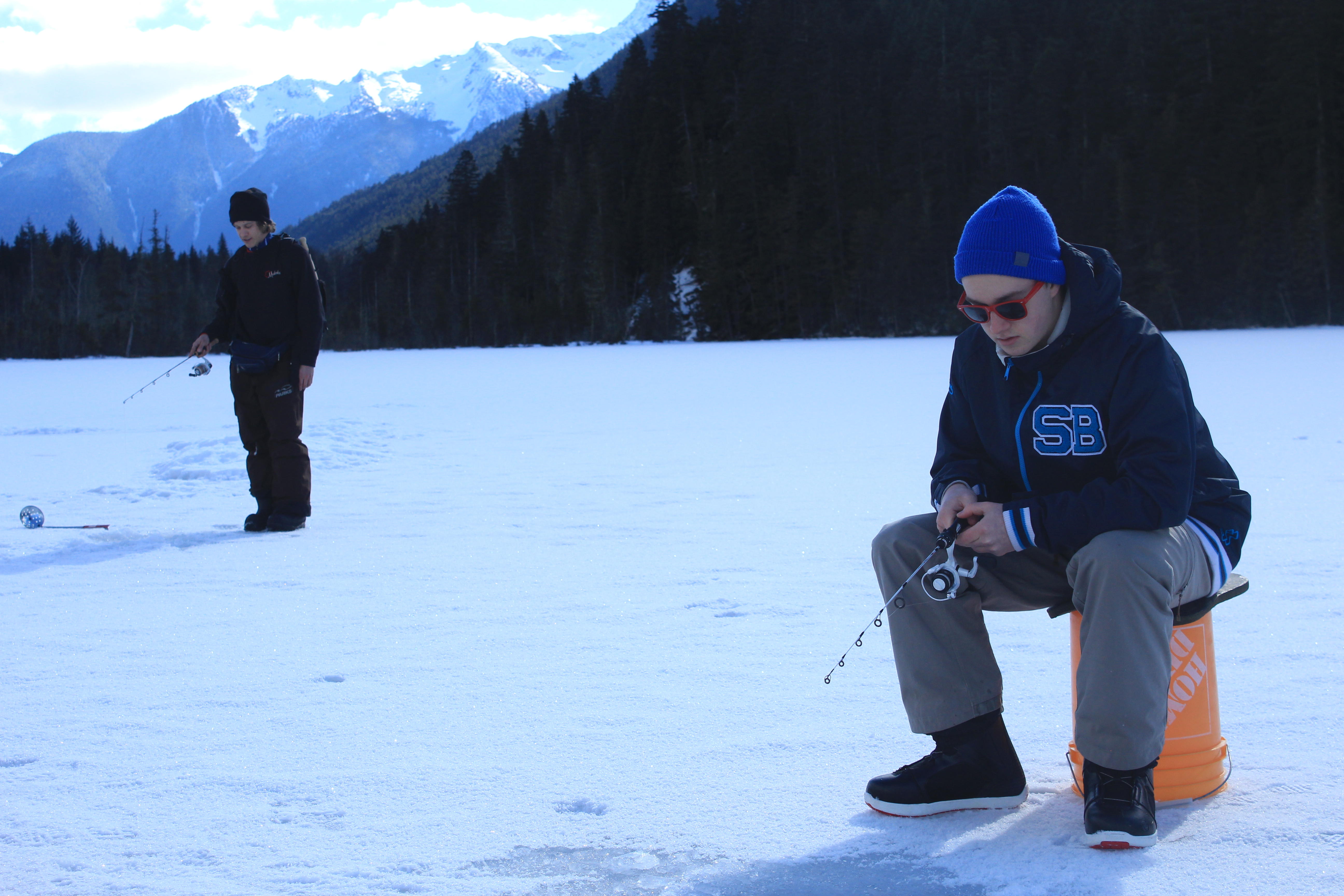
Ryan Judd consoles himself with the thought that it’s a dry cold, as he patiently waits for a bite.
Brad Knowles doesn’t care much for bananas. Not when he’s fishing, at least.
“Did you bring bananas?” he asks from the driver’s seat.
I check with my son Ryan, sitting across from me in the back of Brad’s truck. No, we didn’t bring bananas. We check our packed lunch. No bananas, although the hot chocolate seems to have spilled.
Bananas will jinx fishing every time,” says Brad, who double checks that his assistant guide, Matt, has not brought bananas. Matt, a bass fisherman from Mississauga – where he’s known to some as “The Bassassassin” – knows better than to bring bananas.
We’re on our way to Blackwater Lake, about an hour out of Whistler, east of Pemberton. From mid-November to late-March, give or take, the 6.5-kilometre lake near D’Arcy is ice fishing country.
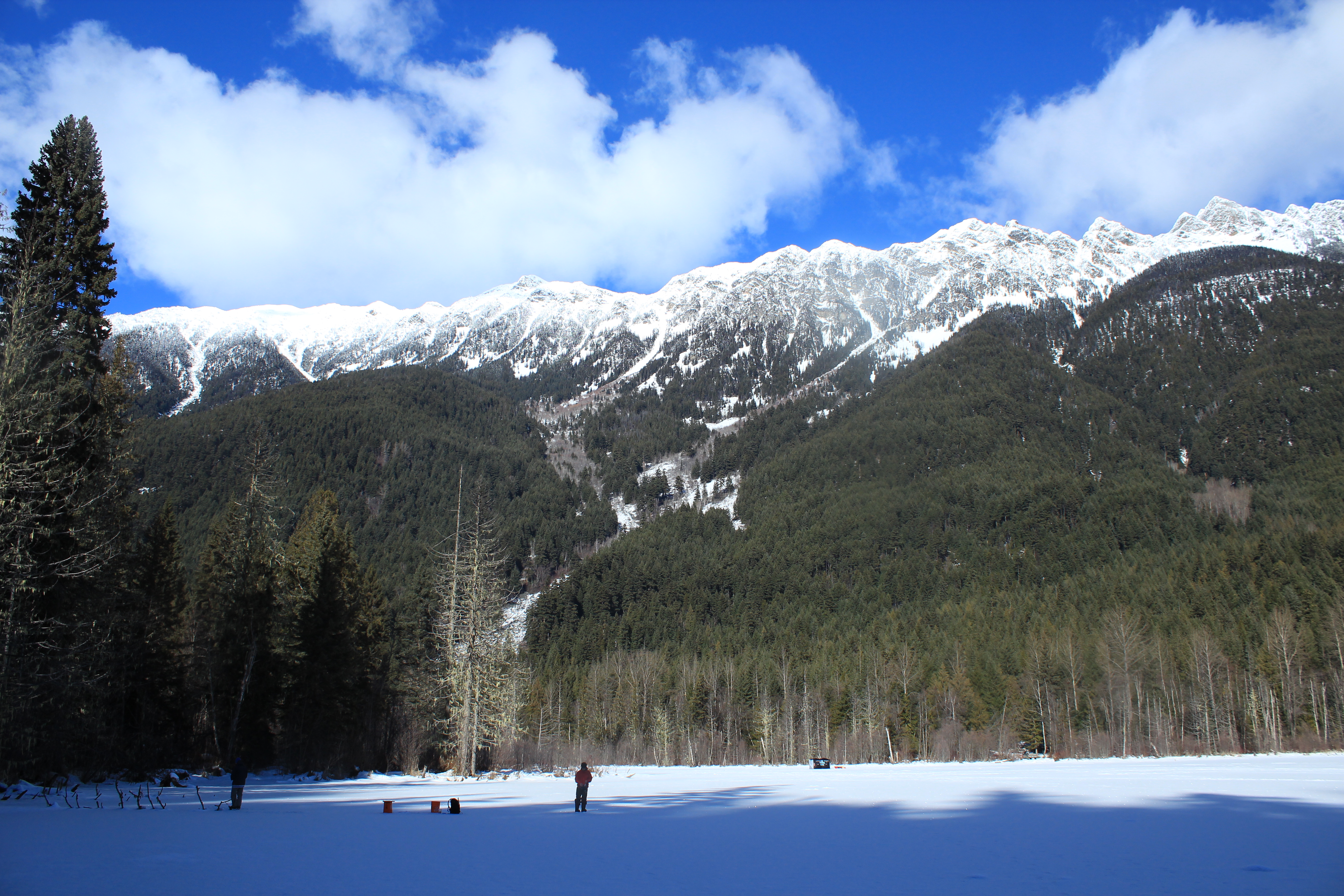
6.5-kilometre Blackwater Lake, about an hour out of Whistler, east of Pemberton.
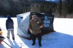
At this time of year, Brad’s company, Pemberton Fish Finder, runs ice fishing tours. “It’s for people who want to escape the Whistler bubble and experience the lakes, wildlife, catch some fish and listen to some stories,” says Brad.
Brad has lots of stories. He grew up in Pemberton and is something of a local celebrity, starring in his own fishing show on Whistler Cable for a while. Together with running a fishing store, Pemberton Fish Finder keeps him busy year round.
My only adult fishing story involves a crab trap and a capsized canoe. I had always assumed ice fishing would involve a flight to Prince George or Edmonton.
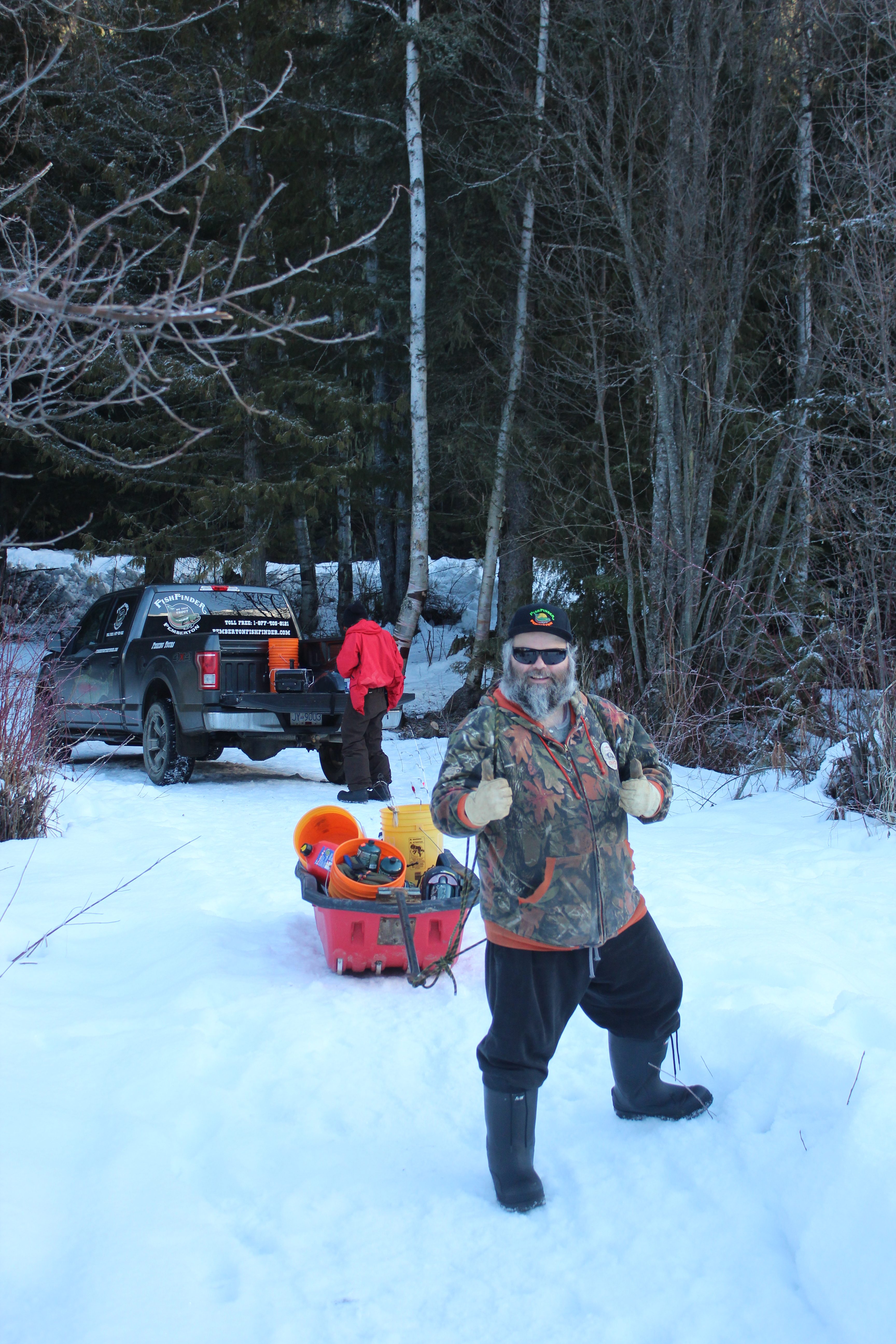
Brad Knowles, owner-operator of Pemberton Fish Finder.
Blackwater Lake is idyllic. Serrated peaks loom all around us and under blue sky, the ice is blinding. The air temperature is just below freezing, there’s no wind, and the sun is flirting with the clouds. But for a creek in the distance, the only thing I can hear is my heart beating.
“Australians lose their marbles when they see this,” says Brad. “They ask me, ‘You’re sure we can stand on this?’ I’m like, ‘Dude, I’m 300 pounds, you can stand on this.’”
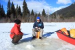
Brad sets about cutting holes in the ice with a gas-powered auger. He and Matt set us up with rods and we bait the hooks with freshwater shrimp, which are native to the lake. Everyone gets an upturned bright orange bucket and a thermal pad to sit on.
And that’s it, we’re ice fishing.
We immediately get bites. Brad and Matt coach us on setting the hook, otherwise known as the hook-set – a quick upward thrust of the rod before reeling in. One by one though, we lose the bites and rue our bad luck.
“Well there’s a reason it’s called fishing and not catching,” says Brad.
After about an hour, Brad carves out new holes and we spread out. Under his guidance, I switch bait from shrimp to trout roe. Ryan and Matt are several hundred yards away but the air is so still, it’s easy to talk without raising our voices.
A lone whisky jack keeps us company, occasionally stealing a shrimp from the bait bucket, and otherwise mocking us.
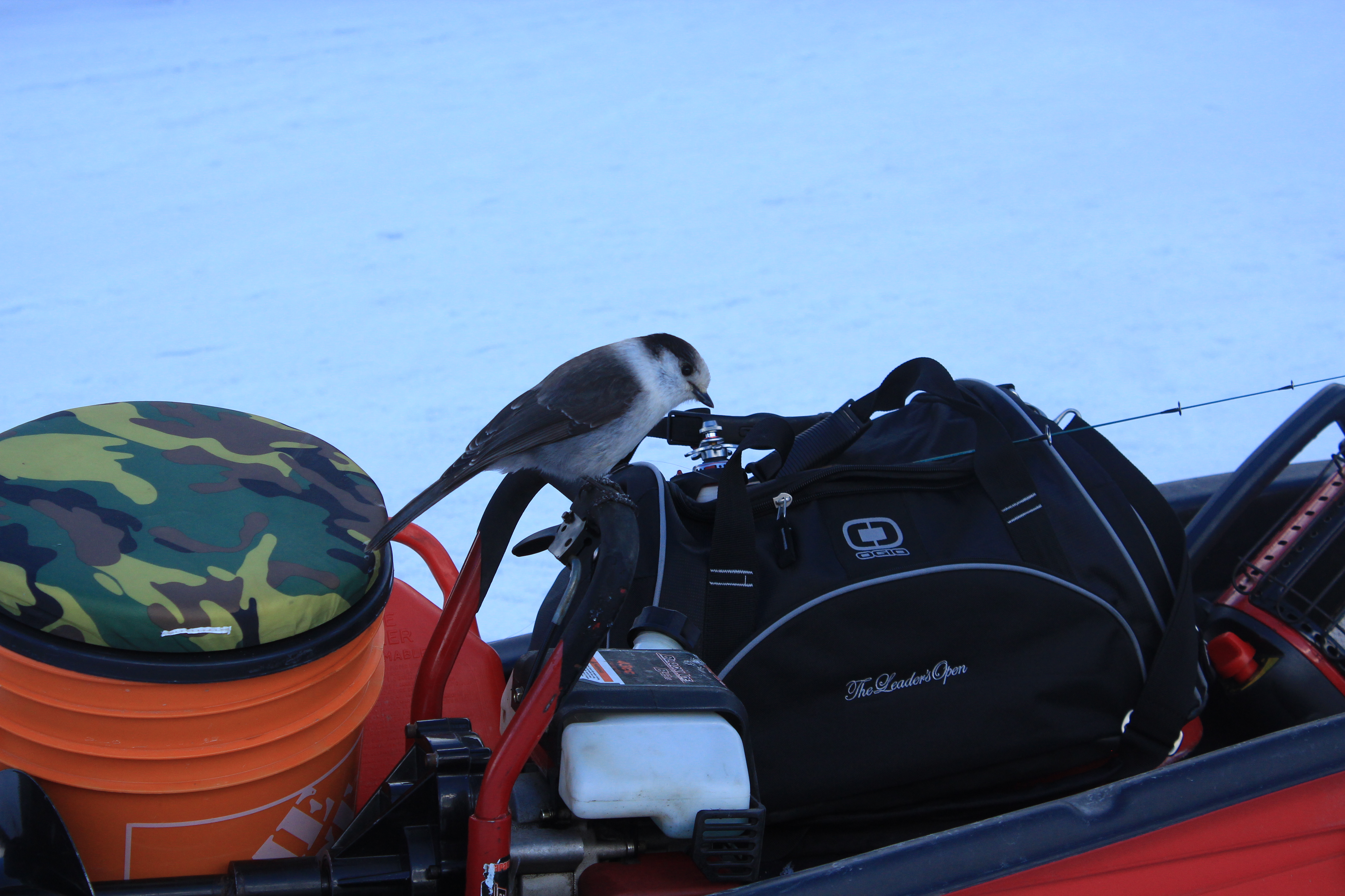
A lone whisky jack steals bait and taunts us.
Brad’s been fishing in this region for about 35 years, chasing all five salmon species, plus pike minnows, steelhead, cutthroat, bull, brook, lake and rainbow trout. Together with his dad, Ivan, and his brother, Sheridan, Brad has carved out a living here and now employs his wife in the guiding business while raising three kids.
“There’s not a day I don’t wake up and look at the mountains, excited to go to work,” he says. I can see why. Fish or no fish, Blackwater Lake is quite an office. There’s a small forestry campground nearby with a dozen sites and in summer, lily pads and extensive weed beds flourish here. And somewhere beneath our boots and buckets today are rainbow trout ranging from 10 to 25 inches and weighing as much as six pounds.
Just as I’m beginning to think the shrimp bait looks tasty we decide that it’s lunchtime.
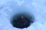
Brad carves pairs of holes a few inches apart and sets up a shelter in seconds. We’re not cold but from inside the shelter the water appears even clearer through holes that take on a luminous quality. “Sometimes you can see the fish before you catch them,” says Brad. For now, we watch our bait descend beyond sight and remain ever hopeful.
No bites but the sandwiches help.
As 2 o’clock nears, Brad suggests we concentrate on a shaded corner of the lake. We exit the shelter and set up one last time, trying to ignore the creeping cold. I start to wonder whether one of us is actually carrying a concealed banana. Then I think back to growing up in the UK. As a schoolboy, I used to accompany friends on night-fishing trips in the Kent countryside. In two years of those fishing trips, I never caught anything but a cider hangover. It occurs to me that not only have I never caught a fish, I’ve never actually seen anyone else catch a fish.
Perhaps I’m cursed?

One rainbow trout, about 10 inches long and just in time for dinner!
I decide not to share this thought with Ryan, and instead concentrate on the hole, which I realize is freezing before my very eyes. Then I’m shaken from my thoughts.
“YEAH!” shouts Brad. I turn just in time to see the rod bend for a moment and a plump rainbow trout flop into Brad’s palm. “No way we were going before we got one,” says Brad as we celebrate the catch. It’s closer to the 10-inch end of the scale and a beautiful looking fish.
Hopeful of more to come we continue fishing for another half an hour, but to no avail. “That’s fishing,” says Brad philosophically as he drops us back in Whistler. Ryan and I both warm up while a friend cooks our catch. It’s more than worth the wait: fresh, flavorful and not even a hint of banana.
nevjudd.com
If you go
For more information about guided ice fishing trips with Pemberton Fish Finder, visit pembertonfishfinder.com.
Do not bring bananas.


Trail and tribulation in Powell River
Make it to the top of Tin Hat Mountain and you will be rewarded with 360-degree views of more than two-dozen lakes. Plus you’re half way to finishing the trail! Photos courtesy Eagle Walz
Connecting Sarah Point, near Lund, to the ferry terminal at Saltery Bay, the 180-kilometre Sunshine Coast Trail now ranks among the greatest hiking trails in the world, according to Explore Magazine’s Top-50 list. Not only is it more than twice the length of the West Coast Trail on Vancouver Island, it’s Canada’s longest hut-to-hut hiking trail, and it’s free!
The trail’s mix of old growth forest, mountain peaks and sandy shoreline, attract thousands of visitors from around the world each year. Fifteen beautifully constructed huts en route provide overnight accommodation on a first-come, first-serve basis.
“It’s beginning to be seen as an economic driver in Powell River,” says Eagle Walz. “It’s the biggest recreational tourism resource we have.”
Walz is a trailblazer, one of a handful of outdoor enthusiasts who in 1992 realized that accessible old growth on the Upper Sunshine Coast was fast disappearing. They formed the Powell River Parks and Wilderness Society (PRPAWS), a non-profit committed to setting aside protected areas on a trail sufficiently unique to lure locals and tourists alike.
Eagle Walz in his element, hiking the Sunshine Coast Trail. Walz is a co-founder of the Powell River Parks and Wilderness Society, the non-profit behind the trail’s creation and upkeep.
PRPAWS mobilized volunteer work parties and began connecting the bushwhacked paths, deactivated roads, and disused railway grades left behind by a century of logging. In some places that meant constructing bridges – some 120 feet long – to ford creeks and rivers. They found enduring allies in a group of bloody old men, otherwise known as the BOMB (Bloody Old Men’s Brigade) squad. Comprising mostly retirees, many of whom practiced their trades at Powell River’s paper mill, the BOMB squad helped build bridges and huts, and are still counted upon for help in the trail’s never-ending maintenance.
The first time I interviewed Eagle for a story back in 2000, he was fending off criticism from a variety of sources over liability issues and the environmental concerns about sensitive wildlife areas. Walz and his cohorts had run into a host of jurisdictional challenges, too. Crown forest land, private land owned by logging companies, and Tla’amin Nation land are among the eight jurisdictions through which the trail crosses.
Seventeen years ago, he addressed those questions with a question of his own: “Would the trail have been built if we’d settled all these issues first?”
When I caught up with Eagle earlier this year, that question at least, appeared to have been answered. “You couldn’t start this trail now and try and make this happen,” says Eagle. “But that doesn’t mean the logging companies won’t stop logging. Western Forest Products, with their tree farm licence, they are the biggest interest. We manage to work together and eke out considerations. I only wish it would be a bigger buffer along the trail than we get most of the time.”
That buffer can be from 10 to 30 metres, sometimes more. Occasionally, the trail must be relocated in places. Overall, says Eagle, compromise and varying levels of protection ensure the trail’s viability.
“Our vision is that in 100 years, we’ll have no more logging near the trail,” he says. “It will be designated an old growth trail to be enjoyed by future generations. It needs someone to be the champion for it. We’re hopeful the younger generation will take over and certainly a lot of younger people are using it. People of all ages.”
Perhaps more challenging to PRPAWS is pressure on the trail from non-hikers.
“Mountain biking is very popular here, as it is everywhere else. The pressure is always to turn something into something else. But a multi-use trail wouldn’t have the same appeal as a single-use trail. We’re struggling to remain a hiking trail only because that’s what’s given us the edge in the market place. That’s what is bringing people by the thousands from all over the world to Powell River.”
In the meantime, trail maintenance keeps Eagle busier than ever. Ten years retired as a teacher, Eagle says he has time to enjoy the trail, but it’s usually when he’s part of a work party. The day I call him, he’s about to leave on just such a mission – a five-night trip to Confederation Lake, a steep section of the trail in Inland Lake Park, north of Powell River.

Eagle Walz takes in the view from the hut atop Tin Hat Mountain.
It’s a favourite spot, he says, before adding: “I think usually where I’m working, I like that part the best.” Eagle’s other cherished locations include Tin Hat Mountain with its 360-degree views of more than two-dozen lakes; and Mount Troubridge, popular for its magnificent stands of Douglas fir and yellow-cedar old growth.
When Eagle’s not on the trail, he’s writing about it – though not in the way he might have envisaged in 1972, when he moved to Powell River to write poetry: “I write hundreds and hundreds of emails,” he says in a deadpan voice. “That’s basically the extent of my writing.”
- Visit http://sunshinecoast-trail.com/ for everything you need to know about planning a trip, including the definitive guide to the trail, written by – who else? – Eagle Walz.
The Missing Link: Connecting the Coast to Squamish
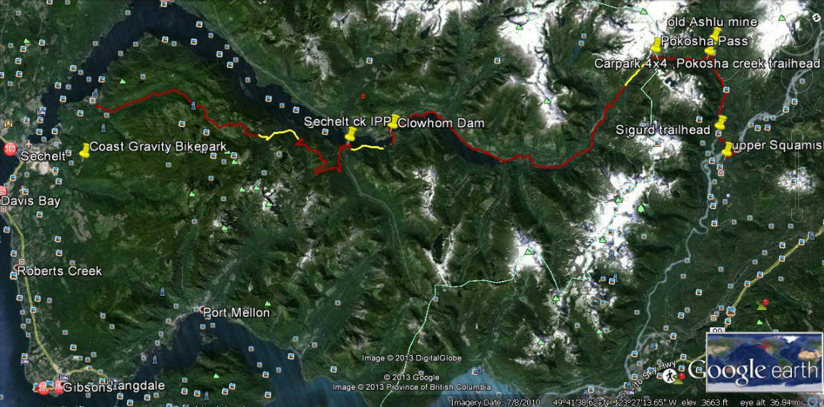
Yellow sections on this Google Earth map indicate about 10 kilometres of work needed to complete a trail connecting Sechelt with Squamish.
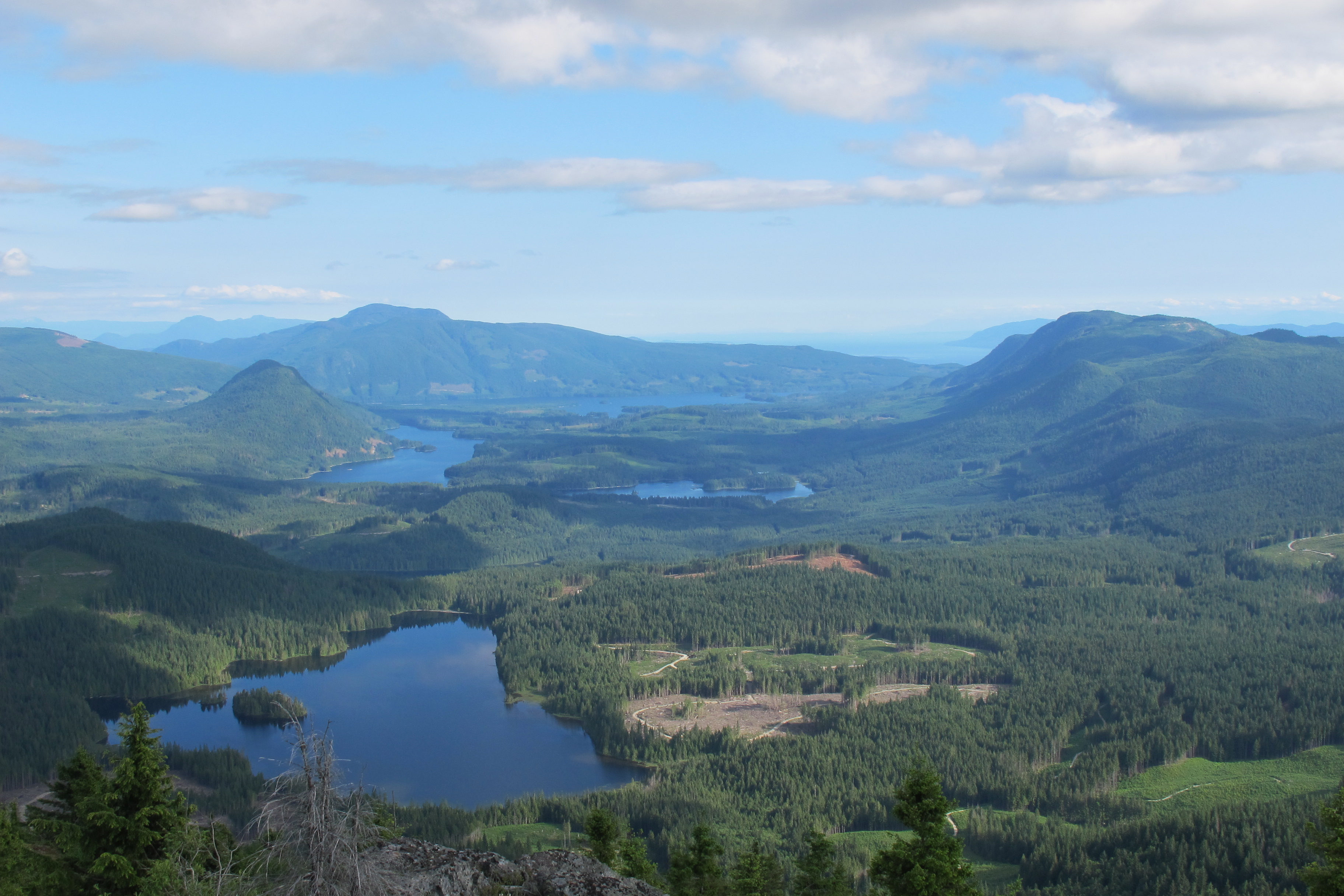
The map looks straightforward at first. As the crow flies, little more than 50 kilometres separate Sechelt and Squamish. Then you notice contour lines, crammed together like intense low-pressure systems, numerous splashes of white, indicating icy peaks, and deep blue streaks showing alpine lakes and ocean inlets. In between are green valleys that never seem to quite connect. Old logging roads, new hydroelectric projects, powerlines and pipelines present an extra layer of complexity revealed by Google Earth.
A cursory Internet search turns up more than 100 years of failed attempts to build a road system between the Sunshine Coast and “the mainland”.
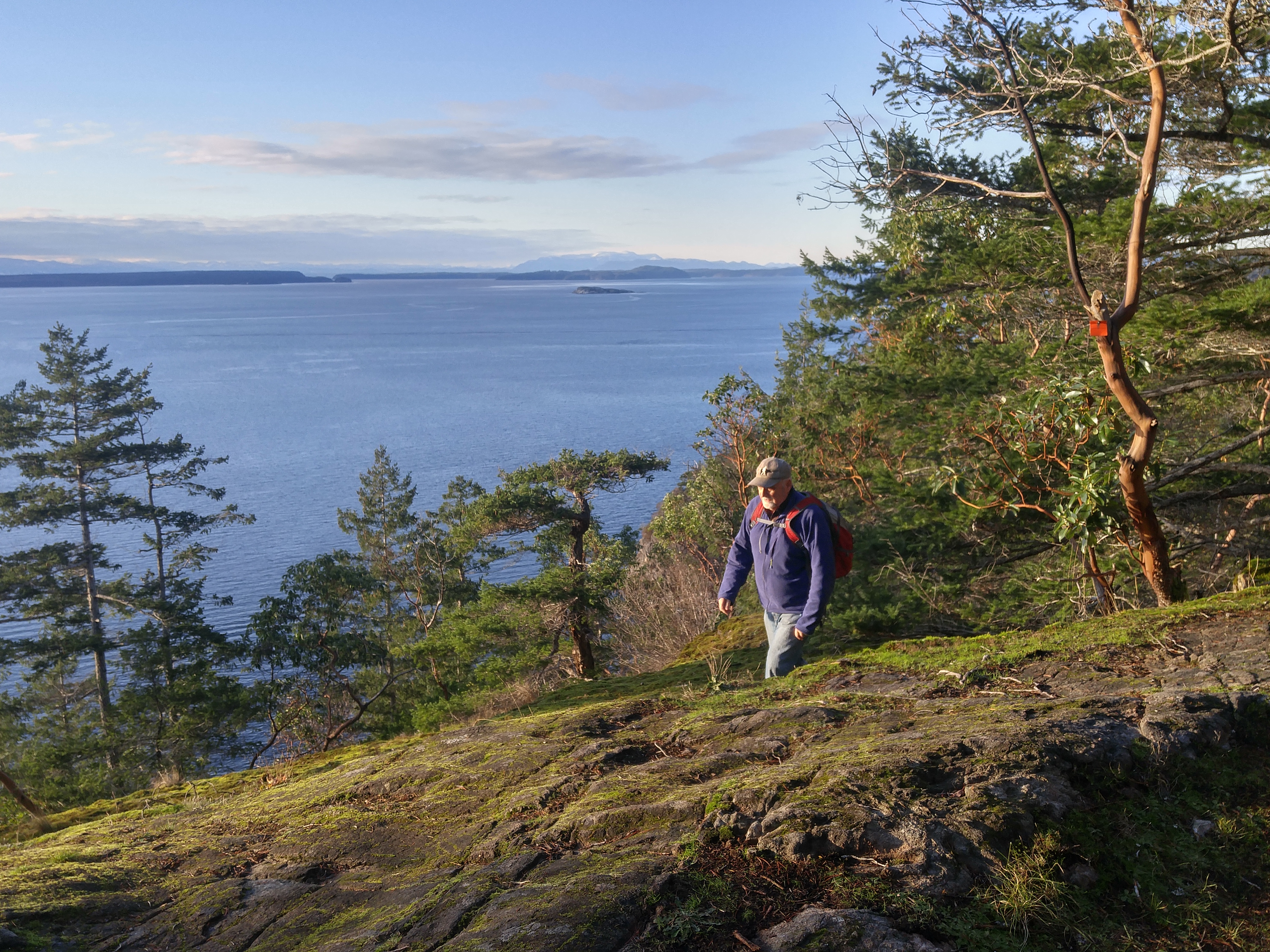
So when Geoff Breckner tells me he’s about 10 kilometres away from completing a 75-kilometre trail connector, I’m interested.
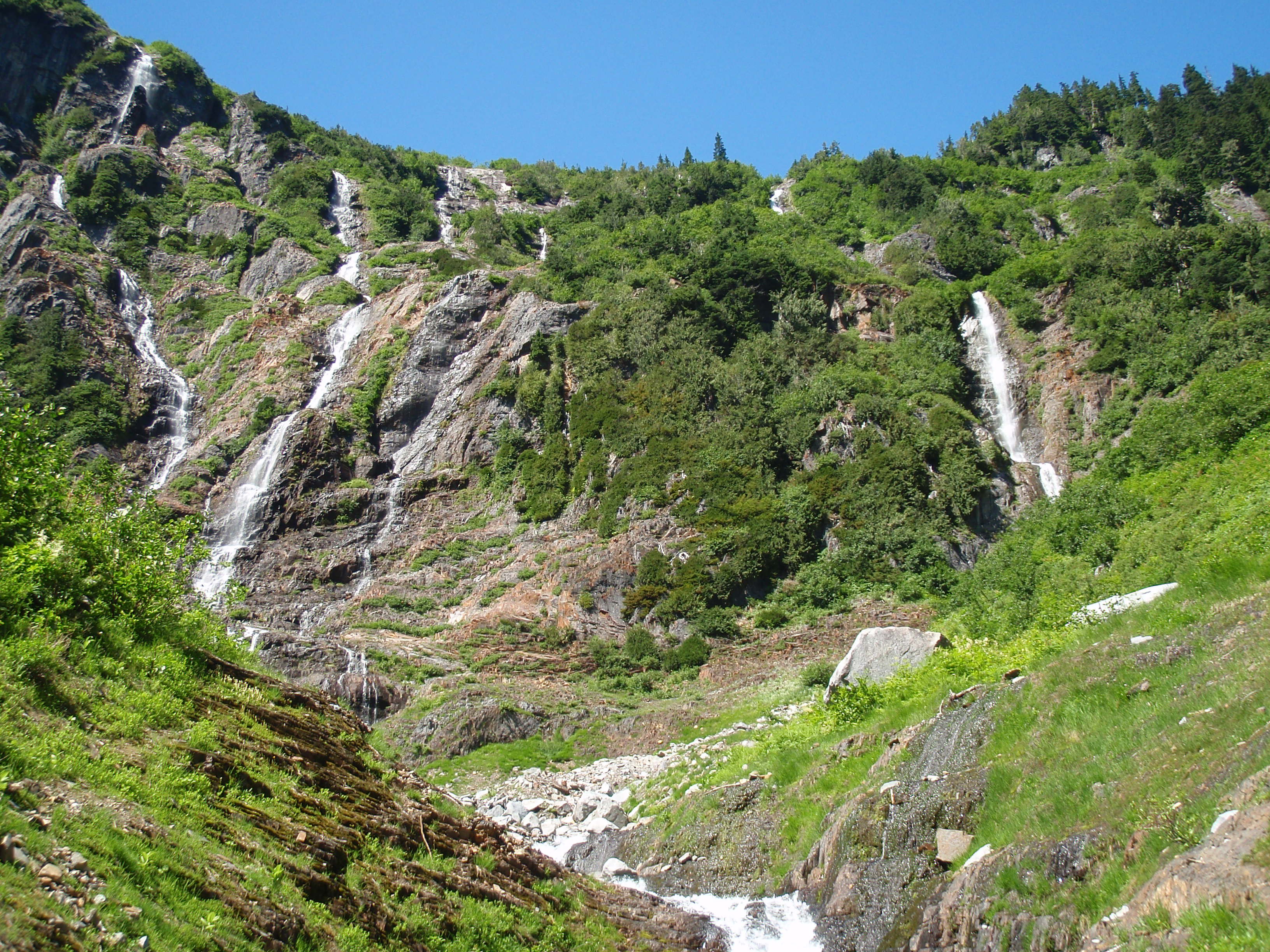
If successful, the trail would reveal a side of the Sunshine Coast unfamiliar to most residents, including a series of spectacular waterfalls between Pokosha Pass and Clowhom Valley. All photos courtesy Geoff Breckner
“With 10 capable guys and permission it could be finished in a week or two,” Breckner tells me by phone from Squamish. “But there are channels to go through, rules to be followed … funding.”
Breckner is recovering from major back surgery. When his doctor advised him to exercise he began hiking into the backcountry near his home in Squamish. The 53-year-old estimates he spent 200 hours during the last two summers working on the Squamish end of the trail.
A self-described “mountainbiking nut,” and “bush rat,” Breckner grew up in Deep Cove when the sport was still a novelty. He opened Pemberton’s first bike store, High Line Cycles, in 1994. A trail connecting Squamish with the Sunshine Coast makes a lot of sense, he says.
“I thought this was a great place for a bike trail. I knew there were logging roads up there and I researched as much as I could, checking out the feasibility of a route to Sechelt.”

Geoff Breckner’s tent at the south side of Pokosha Pass, near Mount Jimmy Jimmy.
Visit Breckner’s Facebook site ‘Squamish to Sechelt Trail’ and you’ll see a Google Earth image of the proposed route. From Upper Squamish and the Ashlu River Road, the route first heads north over existing trail through 4,000-foot Pokosha Pass before heading south, then due west following Clowhom Lake to Salmon Inlet, skirting the Tetrahedron Provincial Park, and on towards Sechelt via the Coast Gravity Bike Park.
About 55 kilometres of double track roads, and 20 kilometres of single track trails make up the route, says Breckner. The 10 kilometres still to be cleared comprise three sections of one kilometer, four kilometres and five kilometres.
“Once complete, it would be a long ride – two days for most people, but I hope to have a hut or shelter so people don’t need a tent and can travel light,” says Breckner. “The main problem would be lack of use, rather than overuse. The more use the better, to keep trail maintained and established.”
Breckner has received numerous offers of help from this side of the divide. Doug Feniak of Tillicum Bay is among those pledging assistance.

A self-described mountainbiking nut, Geoff Breckner rarely goes anywhere without his ride.
Feniak grew up riding with Breckner in Deep Cove. “It was a dream of ours when we were young, to be able to ride from Squamish to the Coast,” says Feniak. “We hiked into the Tetrahedron in August, looking for the best way. It’s super steep into Thornhill Creek but it shouldn’t be too bad after that because it’s old roads covered with Alders.”
Trails are in the Feniak family’s blood. Wife Jessica Huntington and son Linden both build trails, the latter professionally. Daughter, Holly, was 2012 downhill mountainbike Junior World Champion.
Doug says he expects to have a group working on this end of the trail in the fall.
“It would certainly be good for tourism here and I could see the B.C. Bike Race using it,” says Feniak.
Long-time local trailbuilder, Richard Culbert, says a trail to Squamish is “common sense”.
Culbert built the trail to the summit of Mt. Elphinstone, opening it on his 70th birthday. Now at 75, he’s busy clearing a trail up 4,700-foot Polytope Peak, which connects with Rainy River Road and Port Mellon due south. He believes that a trail from Squamish stands a better chance of completion if it veers south to Port Mellon, rather than to Sechelt.

Salmon Inlet from the top of Gray Creek Forest Service Road, looking north across Thornhill towards Clowhom valley. It’s about 60km from here to upper Squamish.
“The trail I’m working on is about a kilometer from a logging road, which appears to connect with this route,” says Culbert pointing at a printed version of Breckner’s route. “It also avoids Thornhill Creek [near Salmon Inlet] where the road is covered in alders.”
Warren Hansen concurs. “That gap after Salmon Inlet is some of the most rugged terrain I’ve ever walked in,” says Hansen, forester/area manager for Chartwell Consultants and an avid trailbuilder. “A lot of that area was logged in the 60s and 70s, so we’re talking about logging roads half a century old – many of which have been heavily deactivated and are covered in alder.
“I admire following an idea, but I worry about the sustainability of it,” adds Hansen. “The skeptical side of me thinks that there won’t be enough people using it. It will need to be on a lot of people’s bucket lists to make it sustainable.”
Hansen identifies with Breckner on one level.
“I believe in unfettered access to crown land. You live in the city, you can’t do this and that, but you have spoon-fed amenities. In a rural environment you don’t have those amenities, but you do have unfettered access to crown land. You can hike it, bike it, pick mushrooms in it, build trails. So you use it as you see fit, knowing that one day, it might be logged.”
Perhaps the person most excited about a possible connection is Bjorn Enga. The Granthams Landing-based filmmaker is the founder of Kranked, an online store for electric-assisted mountainbikes. They may upset purists, but bikes capable of climbing mountains in minutes, as opposed to hours, are catching on, says Enga.
“I’ve been riding on the Coast since 2000, and it’s an amazing coastline,” he says. “Suddenly, I’m thinking how much more I can see up there riding an e-bike. Imagine how phenomenal it would be to offer overnight tours with a fully charged battery for the next day.
“The Sea-to-Sky Corridor could become the e-bike capital of the world.”
Enga is helping Breckner with route planning and believes that trail completion is a matter of when, not if.
“Geoff goes way back to the start of mountainbike culture, before the glamour of the parks,” says Enga. “He’s done the hard part and one way or another, the trail will happen.”
In the meantime, some adventurers will continue to blaze their own trails. It seems as though everyone on the Sunshine Coast knows “a guy” who knows a route to Squamish. But their identity can be as elusive as the route.

More falls in the backcountry between Squamish and the Sunshine Coast.
Not so, Todd Lawson and friends, whose epic three-day trek from Lake Lovely Water, Squamish, to Sechelt via Clowhom Lake and Salmon Inlet, was featured in a 2014 issue of Mountain Life magazine. The trio packed inflatable stand-up paddleboards for the trip, which featured untold hours of bushwhacking through endless alder roots and Devil’s Club – an experience Lawson described in the story as “torture”. (He also wrote of the route, “It looked good on a laptop.”)
A different hazard awaited Denis Rogers of Sechelt, and fellow Coasters Mark Guignard and Al Jenkins, who hiked to Squamish in 2004 after being dropped by boat at the head of Narrows Inlet.
“It took us five days,” says Rogers, whose group followed a route from the head of Tzoonie Valley to a 4,800-foot pass, and then down to Falk Creek and a logging road leading to the Ashlu River and Squamish beyond.
“The third day was an interesting one,” recalls Rogers. “I fell in a lake and broke my watch, and Mark, the only one of us who didn’t bring bear spray, had an encounter with a black bear. Mark was about 20 yards ahead of us, picking his way through the boulders, when we shouted to him that a bear was taking an interest in him.
“The bear started down towards him, but then turned back. We suggested that perhaps the bear had been deterred by an offensive smell.”
Some hazards you won’t find on any map.
- To contact Geoff Breckner, email capnbreak@yahoo.ca or visit his Facebook site, Squamish to Sechelt Trail.
Men of Steele

Next time we’ll bring snowboards and deckchairs.
My friend Tom and I had been planning a trip to the Tetrahedron for about 10 years. This weekend we finally did it. In hindsight, hiking to Mount Steele cabin would have been easier when I was 36, not 46.
At the base of 5,114-foot Mount Steele, the cabin is one of four two-storey cabins in Tetrahedron Provincial Park, each built to accommodate 16 people – first come, first serve. The others are at Bachelor Lake, above Edwards Lake, and between McNair and Chapman Lakes. The cabins are connected via a 25-kilometre trail network and are maintained by the Tetrahedron Outdoor Club.
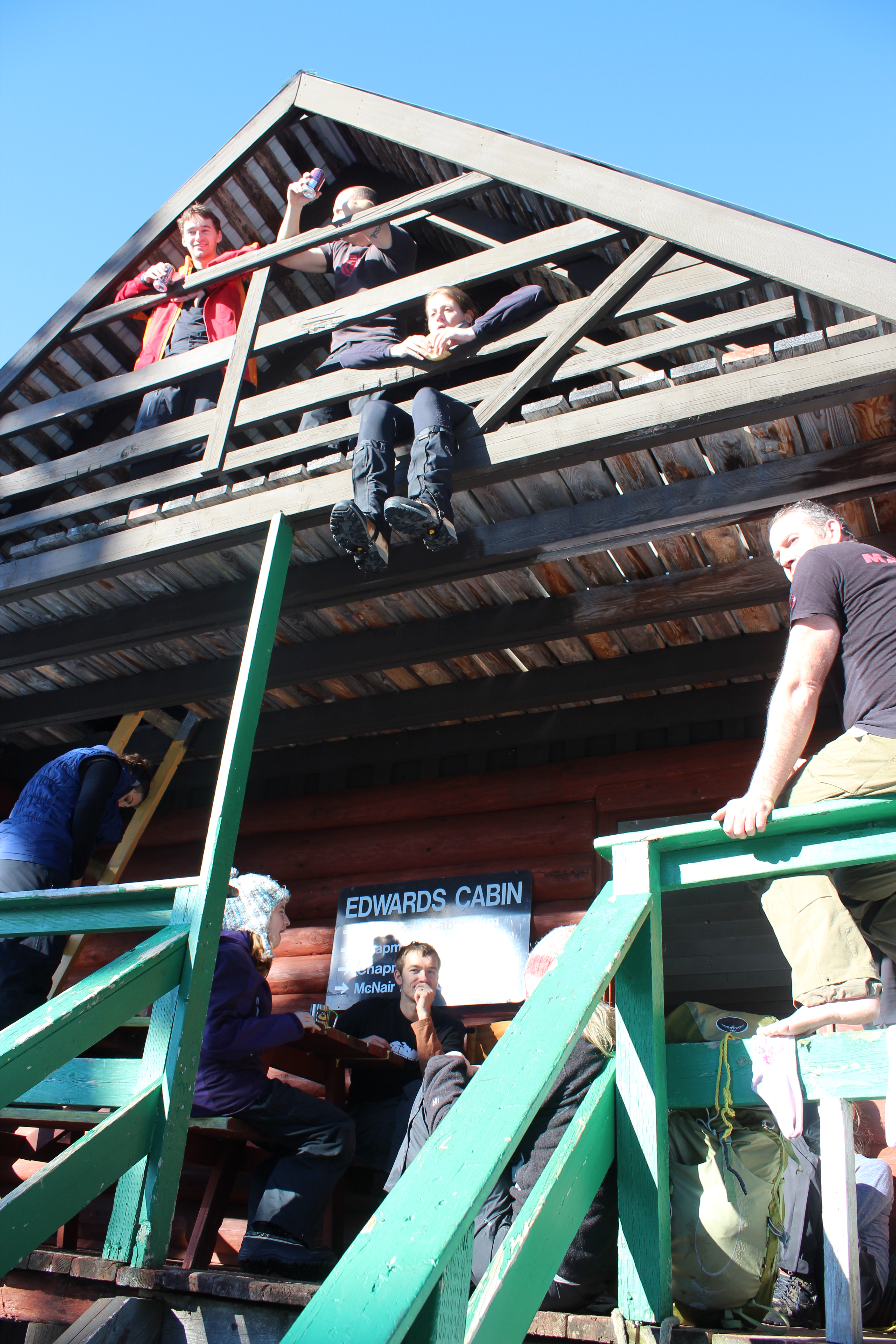
Lower Mainlanders enjoying lunch at Edwards Cabin.
We set off on snowshoes from the trailhead up Grey Creek Forest Service Road. In true Sunshine Coast fashion, the Tetrahedron is not signposted from the road, despite being a Class A provincial park. That might explain why there are only three other cars in the parking lot on a sunny January weekend.
Six thousand hectares of mountains, lakes, streams, wetlands and forest, the Tet, as it’s fondly known, has long been cherished by the backcountry enthusiasts who can actually find it. We finally meet some of those enthusiasts about two hours into our hike at Edwards Lake. They’re a group of 12 skiers and snowshoers from the Lower Mainland who are planning to stay at Edwards Cabin. We stop for lunch with them there before pushing on at 1 p.m.
So far we’ve been hiking for about two hours. There’s been no new snow for a week, temperatures are above freezing and the sun’s out. The sign at Edwards Cabin says it’s just three more kilometres to Mount Steele Cabin. It doesn’t mention the elevation gain of 1,300 feet, but that much is obvious from the contour lines on Tom’s map, which look like an intense low pressure system; that and our occasional glimpses of Mount Steele – white, jagged and way up there beneath the bright blue sky.

Downtime at Edwards Lake. We opted not to test the ice.
The climb begins almost immediately, as does the sweat, pouring off me and soaking me from head to toe. The steeper it gets the happier Tom becomes. He shouts encouragement and I try to ignore the chafing of 20-year-old longjohns and the borrowed 40-pound rucksack on my back. Following tree markers, we zig-zag our way through amabilis fir, mountain and western hemlock, yellow cedar and white pine while Tom yells to me about his merino wool base layers. “Not a drop of sweat,” he shouts. “This material wicks all the sweat away!”
I don’t say anything. I’ve stopped talking to Tom.
After an hour of this I’m resting every 10 steps. I’m eating snow to try and and conserve my water. We appear to have cleared the forested section but that brings its own problems. We can’t see any more tree markers. So Tom checks his map and his compass and we decide to climb one of Steele’s lower open slopes, figuring the cabin will surely become visible as we ascend. But with no more markers in sight, we get cold feet – actually, mine are soaking wet. (Tom’s aren’t. He has merino wool socks … or something.)
So we descend, covering the same distance in 10 minutes that took us 30 minutes to climb. It’s 3:30 p.m. and for the first time all day, I have one eye on the time. The sweat is freezing on my back and it will be dark in 90 minutes. After some searching though, Tom spots a marker and we’re off again, climbing in a different direction toward a ridge that he swears will take us to the cabin. From the ridge we’re treated to views of the Tantalus Range and the markers continue to guide our way.

Mount Steele cabin, as seen from the top of Mount Steele.
Just before 4, I hear Tom from up ahead. “I can see the cabin!”
Thank God he’s not lying, I think as I catch up a few minutes later.
There it is, its red roof standing out against so much white. We savour the last few steps. I don’t think I’ve ever seen a location quite so beautiful. We have the place to ourselves. According to the guest book, we’re only the second visitors this year. An hour later at the metal kitchen table, we’re eating curry and naam bread cooked on the wood stove, washed down with a couple of beers. The cabin is well equipped, with mattresses in the attic, firewood in the basement, a kitchen counter with utensils and a couple of sinks. We melt snow for water and turn the stove down to a slow burn. Pretty soon the entire cabin is toasty warm.
It would seem impossible to put a price on such an amazing place, but the Tetrahedron Outdoor Club came up with $10 a night, which seems more than reasonable. More than a quarter of a century ago, the club used to be known as the Tetrahedron Ski Club. Back in 1987, the club mobilized more than 200 volunteers, 45 businesses, schools, community groups and several levels of government to build the Tetrahedron’s cabins and trail network.

Beer, curry, mates – just another Saturday night.
The cabins were built at Sechelt airport before being disassembled and flown by helicopter to be reassembled on site. Forestry company, Canfor, and the Sunshine Coast Regional District donated timber, Sechelt Creek Contracting provided logging service, Airspan donated some air time, Gibsons Building Supplies provided crane trucks and the Outdoor Recreation Council pitched in with chainsaws. For one of the few times in Sunshine Coast history, one great idea united governments, businesses, and local volunteers – in the midst of a recession, no less.
For all the day’s exertions, I can’t sleep. After midnight I set up my tripod outside and try and capture Mount Steele by moonlight with varying results. Fog covers Georgia Strait but I can see lights twinkling on Vancouver Island. There’s no bite to the breeze blowing and I feel like the last person on Earth. I may be delusional. I go back to bed.

The moon over Mount Steele. Sometimes not sleeping isn’t so bad.
In the morning under clear skies we hike to the top of Mount Steele. It’s difficult to reconcile this rugged terrain and such epic landscapes with the place I call home. For me, the Sunshine Coast typically conjures images of rainforest and beaches, not jagged peaks and frozen lakes. But then visiting this place would surely alter anyone’s perceptions.
Tom vows to bring his snowboard next time. I’m thinking a deck chair. We pack up, sweep up, and head out for the descent to civilization. Yesterday, it took us six hours to get here. Today we’re back at the car in just over two hours.
I relish every step of our tracks with a smile.
- For more information about the Tetrahedron Outdoor Club, visit www.tetoutdoor.ca
- Four-wheel drive and chains are essential for visiting the Tetrahedron. For more information about the park, visit www.env.gov.bc.ca/bcparks
- There can be a significant avalanche risk on Mount Steele. Before heading out, check with www.avalanche.ca/cac/bulletins/latest
- For more on the history of the Tetrahedron Outdoor Club, visit my earlier blog post here.
- If your fitness is kind of sketchy and you’re inexperienced in the backcountry, consider taking Tom with you. I couldn’t have done it without him.


The Trail Collector

Creator of sunshine-coast-trails.com Becky Wayte is probably the Sunshine Coast’s most avid nature bather.
You might call Becky Wayte a wanderer. Almost every day for the last 20 years, Becky has hiked or biked a trail somewhere on the Sunshine Coast. It wasn’t until a couple of years ago though, that she became a collector.
Some people collect stamps; others baseball cards. Becky collects trails, maps them with a GPS, and documents them on sunshine-coast-trails.com, a website she created for outdoor enthusiasts. The site lists hundreds of trails, from Langdale to Earl’s Cove, with descriptions, maps, difficulty ratings and useful links. She has her favourites – three of which she describes in her own words in a sidebar to this story.
In 2011, hiking three to four hours a day, almost every day, Becky managed to map almost all of the Sunshine Coast’s trails in six months. She’s been updating her collection ever since. The Coast is home to some prolific trail builders, it seems.
“I actually thought it would take me a couple of years,” she tells me. “But I quickly realized that I’m a little obsessive. When I start something, I need to see it through to the end.”
But the truth is, collecting trails never ends. New trails are always springing up and some remain well-guarded secrets. In a recent interview with pinkbike.com, local mountain-bike phenom, Holly Feniak, describes the Coast’s trails as: “Dreamy. Loamy, mossy, bouncy, incredibly green, and in the secret spots … all that and steep.”
Cliff Gilker Park, Roberts Creek.
She might have added ‘never-ending’!
“For heaven’s sake, stop building trails,” Becky laughs, when I ask her about the Coast’s trail builders. “I actually love finding new trails and I admit, there might be the odd one I don’t know about. I’m always trying to keep up!”
For a moment, we think we may have found a new one. It’s an unusually hot day in May and we’re walking through a dusty trail off Field Road in Wilson Creek. We’re accompanied by Cody, a large, lovable dog from the nearby SPCA where Becky volunteers each week as a dog-walker. The path veers past someone’s back yard and into the forest.
“Let’s take a look,” says Becky, in her element. A few minutes later we come to a dead-end. Cody looks at us expectantly and we return the way we came. So what inspired Becky to take on this labour of love?
“I have three dogs and one has issues with other dogs, so I wanted to find new trails to hike where there weren’t so many people,” she says. “There were few websites, but they only featured the most popular hikes, places like Mount Daniel, so I decided I’d do it myself.”
Becky’s well qualified. Not only does she love the outdoors, but she learned to build websites through her work teaching computer courses in the Adult Basic Education Program at Capilano University in Sechelt. With the website established, Ryan Robertson, a Squamish-based app developer, who specializes in creating trail applications for iPhones and Androids, contacted Becky. Becky provided the GPS (Global Positioning System – the satellite navigation application) data and Ryan created the app. Trailmapps: Sunshine Coast costs $10 and is available at the Apple Store and Google Play.
For old-school trail lovers, she’s also created waterproof trail maps that are available in Gibsons at Spin Cycles, and in Sechelt at Source for Sports, the Sechelt Visitors’ Centre, and Off The Edge Adventure Sports.
Outdoors, technology couldn’t be further from Becky’s mind. While she’s always hiked to combat weight gain, she’s also convinced of nature’s therapeutic benefits. The Japanese have a name for it: shinrin-yoku, or forest bathing. Becky cites Japanese research, which points to the many benefits of simply being in nature – lower blood pressure, higher creative aptitude and boosted immune systems.
“I prefer the term ‘nature-bathing’ because I find just being out in nature makes me feel better. I always come home feeling better than when I left.”
Well, almost always.
Becky sheepishly recalls one particular hike that went awry, much to her husband’s despair. “I was hiking up Elphinstone and I’d let people know where I was going and what time I’d return. It took a lot longer than I’d expected though and my phone died.
“I got back around 7:45 p.m. – not the 5 p.m. I’d told my husband. He was pretty mad.”
The experience didn’t sour Becky’s love of Mount Elphinstone. In fact, the Mount Elphinstone Summit Trail ranks in her three favourite hikes and bikes. (See below.)

Kinnikinnick Park, West Sechelt.
Sidebar
My Three Favourite Hikes & Bikes, by Becky Wayte
Mount Elphinstone Summit Trail (hike only)
This is a long, fairly difficult climb, but the view at the very top is worth it. The trail to the top can be accessed from the top of Sprockids or via some feeder trails off B & K logging road in Roberts Creek. If you take your time and enjoy a picnic and rest at the top, this hike will likely take you five or six hours. Make lots of noise or wear a bell so the bears hear you coming.
Ruby Klein Traverse – Suncoaster Trail (hike or bike)
Beautiful views of Ruby Lake and a hand carved bench greet you at the highest point along the trail. Easy to make a whole day trip out of this even though the hike itself will probably only take you a couple of hours. You can visit the Iris Griffiths Centre, take a swim in Klein Lake and there is even a feeder trail down to the Ruby Lake restaurant (Trattoria Italiano).
McNeill Lake Circle Route (hike or bike)
This is one of my favourite destinations in the summer months because I always combine a bike ride with a swim. The lake itself is not that well known so often no one else is there, especially on weekdays. There are several trails that connect to create a loop around the lake, with access to the lake from a couple of spots. I park on Middlepoint Forest Service Road and take Copper Head, Dry Feet, a logging road, Old Pole Road and back to Copper Head. There is a short trail off the logging road just north of Dry Feet that takes you into the lake. This is an excellent place to ride your mountain bike if you have pre-teen kids or you just want a fairly flat ride (we don’t have many flat rides on the Coast). Hiking it probably takes about 1.5 hours and by bike about an hour, unless you stop to enjoy a swim.
For the definitive web guide to the Sunshine Coast’s trails, visit http://www.sunshine-coast-trails.com.
Heart of green
Sechelt Rotarians, Tom Pinfold (right) and Mick van Zandt on the trails of Kinnikinnick.
Shirley Macey didn’t have time to waste. When she wasn’t coaching kids, she was raising a family, working as a Gibsons RCMP dispatcher, and lobbying local government for more recreational space.
Somehow she found time every week to climb Soames Hill with a garbage bag to pick up other people’s litter.
“She was pretty amazing,” remembers her son Darin. “I didn’t think much of it growing up; now I don’t know how she did it.”
At the southern end of the Coast, 14 hectares of Soames Hill Regional Park are named after Shirley Macey. No doubt she would be proud of the soccer fields, the wheelchair-accessible playground and Frisbee golf course. Shirley – or Sam (an acronym of her full name, Shirley Amelia Macey) to her friends – was a dedicated volunteer whose legacy is by no means unique.
Shirley Macey, Maryanne West, Ted Dixon, Cliff Gilker and Hackett are – to name a few – venues so familiar to most of us that it’s easy to forget that they were also people. Ted Dixon, for example, worked tirelessly for self-government for the Sechelt Indian Band before dying in a car crash in 1981. Maryanne West was the backbone of community TV and so many volunteer projects before dying at age 90 in 2008.
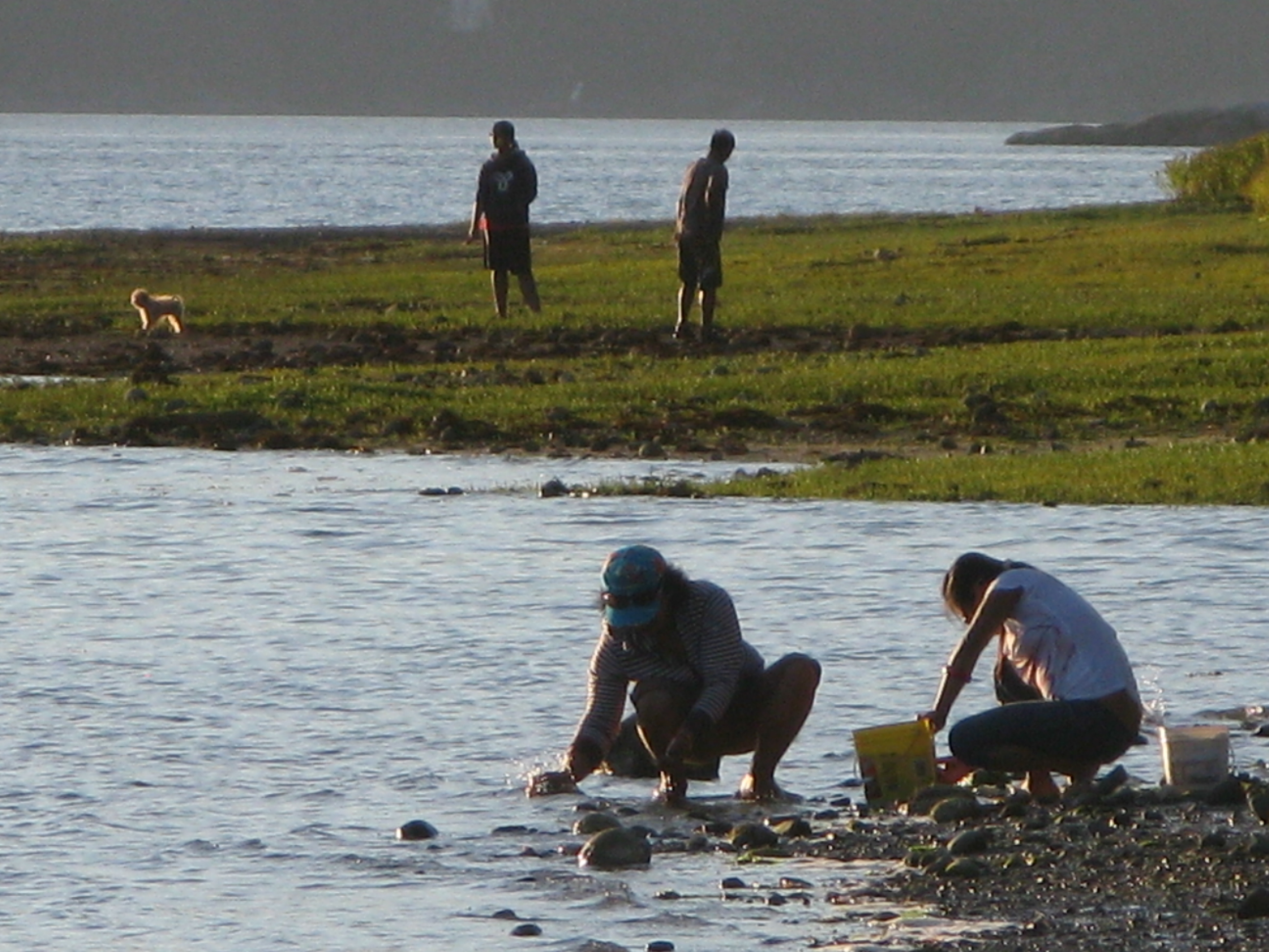
Scavenging the shoreline at Porpoise Bay. For parks and beaches, Sunshine Coasters are spoiled for choice.
And not all parks bear a family name. Brothers Memorial Park in Gibsons was named for logging contractors, Al and George Jackson who donated the land.
Today, volunteers continue to be the lifeblood of the Sunshine Coast’s parks and trails. In fact, the parks system wouldn’t work without them.
“We totally rely on volunteerism,” says Sunshine Coast Regional District parks planning coordinator, Sam Adams. “We wouldn’t be able to do what we do without it.”
For the SCRD that means mobilizing volunteer help in bigger parks like Dakota Ridge, where members of the Dakota Ridge Advisory Committee have been particularly helpful. Volunteers also help the SCRD maintain trails at Soames Hill, most recently working to improve the wooden stairs. Now the regional district is hoping to cultivate more volunteer assistance with an adopt-a-trail program.
“Part of our work plan for 2013 is to develop a more robust volunteer program,” says SCRD parks planning coordinator, Susan Mason. “We have kilometres and kilometres of trails to maintain, so people willing to document changes on a regular basis are helpful to us.”
The government-volunteer relationship is similar elsewhere on the Coast. District of Sechelt parks supervisor Perry Schmitt is grateful for the work of several trail building groups, as well as established service clubs.

Sunshine Coast Lions Club president Len Schollen at the site of the Lions’ next project, an accessible viewing deck in the corner of Mission Point Park where the beach and Chapman Creek meet.
“The Lions Club has been instrumental in making improvements to Mission Point park and the Sechelt Rotary Club has been assisting in rebuilding decks throughout Kinnikinnick forest trails,” says Schmitt. He also cites the work of the Sechelt Groves Society at the Heritage Forest trails, and the Sunshine Coast Natural History Society, which tends to Sechelt Marsh.
On a cold blustery day, Sunshine Coast Lions Club president Len Schollen shows me work completed on the Mission House deck and the next project – an accessible viewing deck in the corner of Mission Point Park where the beach and Chapman Creek meet.
“We’re basically waiting for some decent spring weather to build the viewing platform and a hard-surface ramp leading up to it,” says Schollen, surveying the footings already in place. “There’ll be a railing around it and hopefully some signs with information about the salmon run and pointing out places like Mount Arrowsmith.”
Why are Schollen and other Lions members involved in the project? “We serve, is the Lions’ motto,” says Schollen simply. “We try to make this a better place to live.”
It’s a sentiment shared by Sechelt Rotarians, Tom Pinfold and Mick van Zandt, when I meet them on the trails of Kinnikinnick park.
“We wanted to work on small projects where a few people could work for a few hours on something with lasting benefit,” says Pinfold. “We’d much prefer to let the District allocate their resources to new things instead of maintenance.”
With other Rotarians, the pair has replaced and built cedar bridges and decks throughout Kinnikinnick’s trails during the last three years. Topped with roofing tiles, the decks are essential given the drainage issues on multi-use trails in a popular park. The new bridges should be good for at least 10 years, reckons Pinfold. (Elsewhere in Kinnikinnick park and at Sprockids park in Langdale, Capilano University students hone their trail-building skills as part of the Mountain Bike Operations Certificate curriculum.)
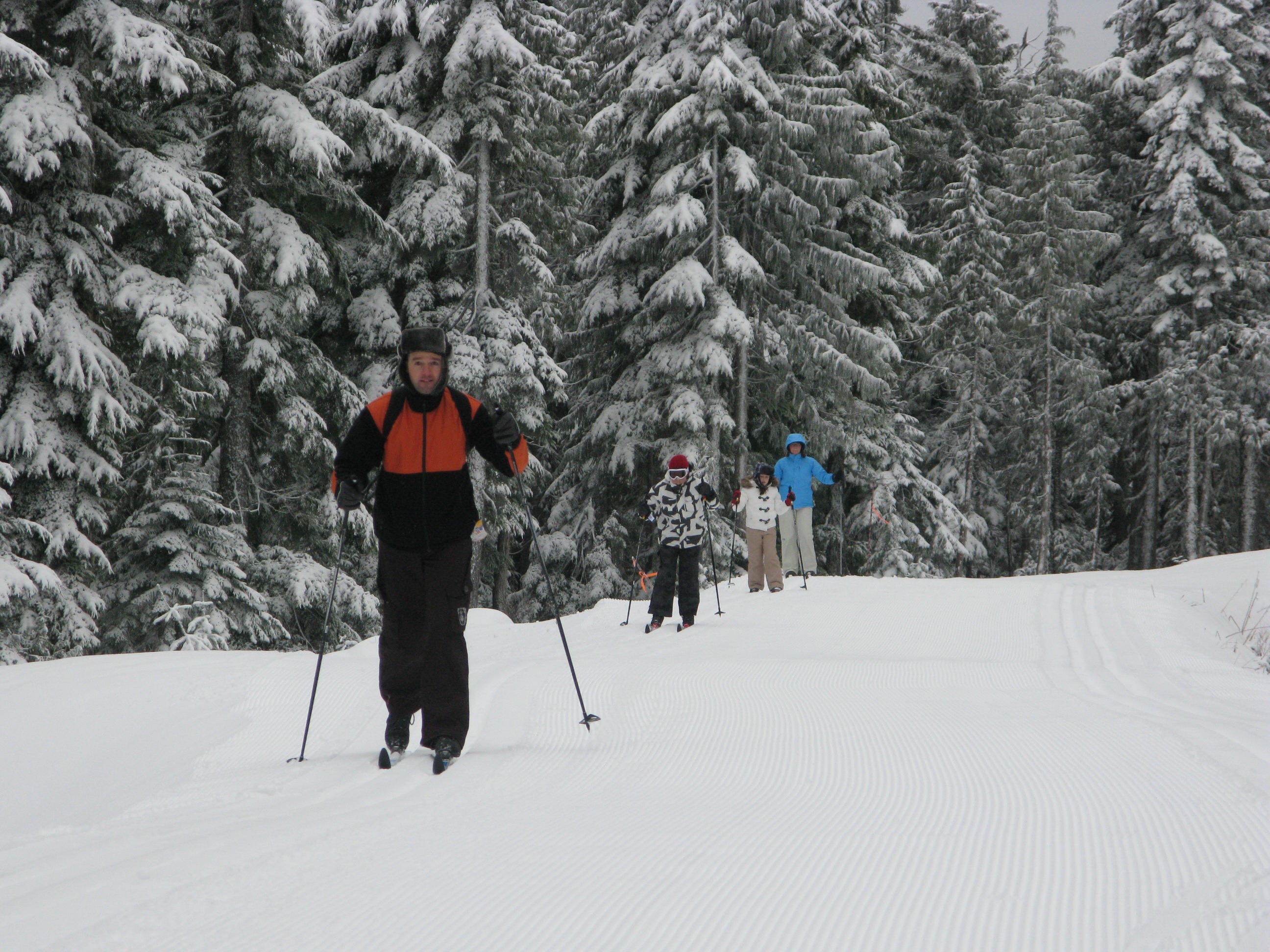
There are 13 kms of groomed trails for cross-country skiers on Dakota Ridge, yet another Coast playground.
Pinfold and van Zandt have also worked on a wheelchair accessible deck at Halfmoon Bay’s Trout Lake and a viewing platform and trail in Roberts Creek’s Cliff Gilker park.
Elsewhere, volunteers continue to make the Sunshine Coast a great place to play. If you’re searching for the heart of the Sunshine Coast you’ll find it in any park or trail. From Pender Harbour’s Lions Park (the best soccer field on the Coast) to the mountain bike trails of Sprockids Park in Langdale, outdoor recreation thrives because people care enough to make it happen.
People like Shirley Macey.
Shirley didn’t live to see the park she’d fought for named in her honour. Just months after retiring from the RCMP and paying off her mortgage, she died of cancer in 1998.
“I didn’t realize until I was older that quite a few people called her mom,” recalls Darin, who has four kids of his own now. “I met all these people I knew at her service who thought of her as a surrogate mother.
“My kids are certainly proud of the park’s name. It’s too bad she died so young.”
Trail Mix
There are numerous opportunities to get involved in outdoor volunteering. Here are a few websites where you’ll find more information.
http://secheltlionsbc.lionwap.org/
email tony@whiskeyjacknaturetours.com for the Sunshine Coast Natural History Society
Thanks to the Sechelt Community Archives and the Sunshine Coast Museum and Archives for their help in researching this feature.
Cabin fever
Snowshoers make their way to Mount Steele Cabin, one of four cabins built by the Tetrahdron Outdoor Club in 1987. Reynold Schmidt photo

“We came in by the light of the benevolent and gibbous moon waxing to near fullness. The skies were clear and the spirits were high, peeling laughter for 48 hours and sleeping for six.”
– An entry in the Bachelor Lake Cabin, Tetrahedron Provincial Park
Some people move to the Sunshine Coast to get away from it all. The Tetrahedron is where Sunshine Coasters go to get away from it all. Six thousand hectares of mountains, lakes, streams, wetlands and forest, the Tet, as it’s fondly known, has long been cherished by backcountry enthusiasts.
In 1987, a group of those enthusiasts banded together to mobilize more than 200 volunteers, 45 businesses, schools, community groups and several levels of government: their mission, to build cabins linked by a trail network.
Back then, they called themselves the Tetrahedron Ski Club. A quarter of a century later, they’re the Tetrahedron Outdoor Club, a group justifiably proud of the legacy created northeast of Sechelt. Last summer, club members marked the 25-year milestone with dances, parties, pancake breakfasts and numerous trips down memory lane.

Tannis is one of 10 beautiful lakes in Tetrahedron Provincial Park. In June, the lake was still partially frozen.
Now they’re enjoying the snow.
“Early December, after that first big dump of snow; that’s my favourite time to go,” says club president, Reynold Schmidt. “I usually go with club members, friends – before the crowds.”
It’s June when Reynold and I visit Bachelor Lake Cabin, a one-hour hike from the trailhead up Grey Creek Forest Service Road. With snow more than a metre deep in places, I’m grateful for snowshoes. Partially frozen Tannis Lake is a testament to the cold, wet spring endured down at sea level, 1,100 metres below. At least the mosquitoes are still asleep.
Tannis is one of 10 beautiful lakes in Tetrahedron Provincial Park. There are three mountain peaks – Panther, Steele and Tetrahedron – and some of the oldest trees in the country. Amabilis fir, mountain and western hemlock, yellow cedar and white pine can all be found here. So, too, can the club’s four rustic, two-storey cabins each built to accommodate 16 people – first-come, first serve. They can be reached via a 25-kilometre trail network and are located at Bachelor Lake, above Edwards Lake, between McNair and Chapman Lakes, and below the summit of Mt. Steele.
A 25-kilometre trail network links the cabins in Tetrahedron Provincial Park. BC Parks photo
Inside Bachelor Cabin, we stop for lunch, seated on a long wooden bench at a metal table. There’s a wood stove and firewood. Above us is a sleeping loft with foam mattresses. From the kitchen window, looking across frozen Bachelor Lake, it’s hard to imagine “crowds”. We haven’t seen a soul all day. But weekend and holidays during the winter can be busy at the cabins, confirms Reynold, a natural resource officer with B.C. Ministry of Forests, Lands and Natural Resource Operations.
“We’ve had our problems with vandalism over the years, people coming just to party and not cleaning up after themselves,” he says. “There has been a lot of debate within the club to create a reservation system, but some members are adamant the cabins remain for everyone’s use.”
This year, the club has appointed stewards, two people per cabin, responsible for maintenance and regular monitoring. “They’re regular backcountry users who get to use the lockboxes to store their gear, so they don’t have to carry stuff in each time,” says Reynold.
“It helps dispel the sense that these are party cabins,” he adds.
Naturally, the cabins are there to be enjoyed. How they came to be there is a different story, far removed from pristine mountain air – below sea level in fact!
A basement in Franklin Road, Gibsons, is where George Smith pitched his idea for a cabin and trail network. In 1985, George had skied Mount Steele with his friend Ian McConnell on June 1 weekend. He was struck by the quality of the snow and the potential of backcountry recreation in the area.

Bachelor Cabin, the closest of the four cabins to the trail head.
“The Sunshine Coast was in the midst of an economic depression,” recalls George. “People weren’t exactly light and breezy, but I thought this idea made sense.”
George approached his Franklin Road neighbor, Wayne Greggain, the titular head of the Tetrahedron Ski Club. After a heyday in the late 1960s and 70s, mostly skiing Mount Elphinstone courtesy of a Tucker Snow Cat and 600-foot lift purchased from Hollyburn Mountain, the ski club was all-but defunct by 1985. Wayne agreed to host a meeting of ski enthusiasts in his basement where George explained his vision.
The prevailing mood, recalls George, was: “We don’t know how good an idea this is, but if we don’t do it, someone else might and they won’t do it right.”
The group agreed that if George could secure funding for the project, the ski club would run it as a non-profit. By the fall of 1986, George – then a sometimes reporter with the former Coast News – had secured more than $150,000 in federal funding and another $20,000 from the province.
Yet another Franklin Road resident, Paul Anslow, was contracted to build the cabins at Sechelt airport. The cabins would then be disassembled and flown by helicopter to be reassembled on site. Forestry company, Canfor, and the Sunshine Coast Regional District donated timber, Sechelt Creek Contracting provided logging service, Airspan donated some air time, Gibsons Building Supplies provided crane trucks and the Outdoor Recreation Council pitched in with chainsaws.
A small army of volunteers mobilized to clear trails while 18 people during the course of the project worked on the cabins.
George describes former club president and long-time member, Victor Bonaguro, “a force of nature” who could “build anything”.
“Part of the reason we were able to get funding was because we created an 11-point education plan for the workers, so they would have the tools to go out and find work afterwards,” says George. Aside from cabin-building, workers learned valuable lessons in surveying and industrial and wilderness first aid, thanks to time donated by local experts.
By the time the cabins opened to the public in 1987, the club had raised more than $300,000 for the project. But perhaps more importantly, one great idea had united governments, businesses, and local volunteers in the midst of a recession, no less.
The Tetrahedron was declared a Class A provincial park in 1995. And in 2004, recognizing the year-round activities of its members, the ski club changed its name to the Tetrahedron Outdoor Club.”
“This resource is at least as good today as when it was first built,” says George, who’s still in love with the Tetrahedron.
“I feel lucky. When you walk in a forest that’s never been logged, it just feels different. It’s wonderful to be there.”
- For more information about the Tetrahedron Outdoor Club, visit www.tetoutdoor.ca
- Four-wheel drive and chains are essential for visiting the Tetrahedron. For more information about the park, visit www.env.gov.bc.ca/bcparks
- For an armchair view of the Tetrahedron, visit Coast adventurer Quinn Barabash’s website at captainquinn.com and see his video at captainquinn.com/adventure-video-blog/
Summer comes late to Bachelor Lake, pictured here in June.
